EPISODE · Aug 29, 2019 · 20 MIN
Extracting cloud free images in an area of interest from a remote sensing archive (foss4g2019)
from Chaos Computer Club - archive feed · host Jesko Zimmermann
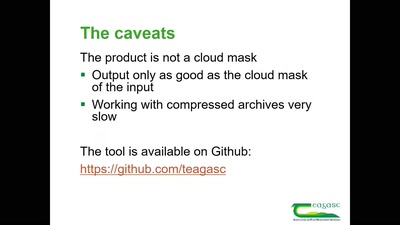
Open source satellite imagery becomes increasingly important in many areas of research and business. In the case of agriculture, it is being used to assess land use, support subsidies, and to help farmers to manage their land more efficiently. Many of these applications require regular revisits to best catch temporal the variety that defines many land uses. Cloud cover can be a serious issue, often obscuring the majority of images acquired from passive sensors. Filtering an area of interest for cloud free images, can be labour intensive or lead to loss of valuable input data. Here we introduce a Python tool developed using open-source packages that will assess user defined areas of interest against supplied cloud masks for three satellite platforms: ESA’s Sentinel-2 (Level 1C products), NASA’s Landsat-8 (Level 1C and SR products) and the joint CNES and ISA platform Venµs. We present a case study from County Meath, Ireland to assess the number of cloud free Sentinel-2 images identified for fields surveyed in the EU Land Use/Cover Area Frame Survey (LUCAS) and compare it to the number of images that would have been obtained by threshold filtering images. None about this event: https://talks.2019.foss4g.org/bucharest/talk/RQFEJA/
NOW PLAYING
Extracting cloud free images in an area of interest from a remote sensing archive (foss4g2019)
No transcript for this episode yet
Similar Episodes
May 17, 2026 ·37m
May 8, 2026 ·39m
Apr 28, 2026 ·25m
Apr 25, 2026 ·9m
Apr 24, 2026 ·5m
Apr 24, 2026 ·9m