
EPISODE · Oct 17, 2024 · 4 MIN
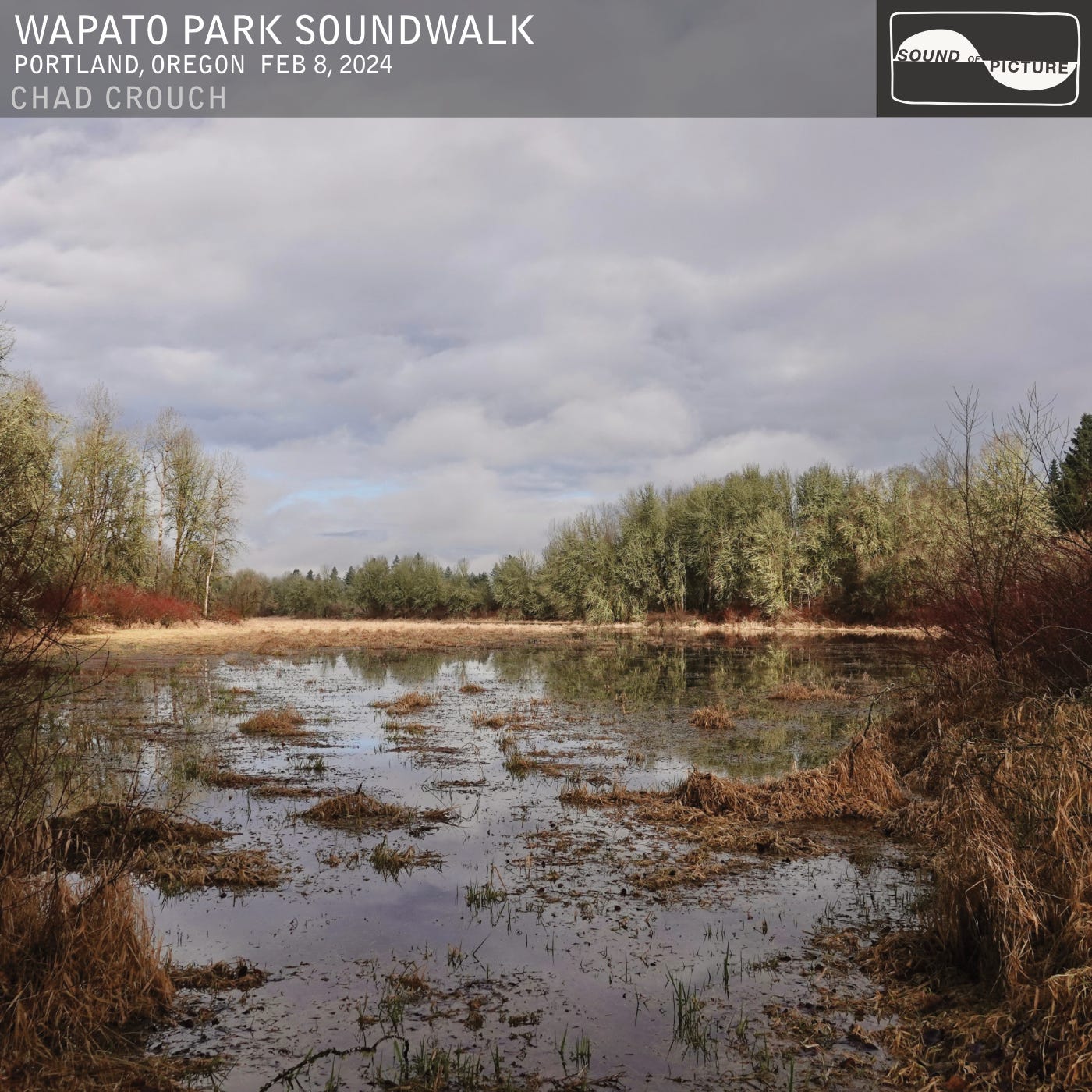
Wapato Park Soundwalk
from Soundwalk · host Chad Crouch
This is a free preview of a paid episode. To hear more, visit chadcrouch.substack.comWapato Park is pretty great, partially because it’s easily overlooked and therefore never crowded. Its full name is Wapato Access Greenway State Park. It’s a sleeper park, the kind you stumble on if you like studying maps. The small gravel parking lot trailhead is on a dead end road, and easy to miss. Interestingly, it’s the only trailhead on Sauvie Island that you don’t have to pay $10 ($30/yr) to park at. In the winter the trail can be quite muddy, in the late spring and summer it can get buggy, and if you’re really unlucky, your car can get busted into. Still, it’s worth a visit.On a mild February day earlier this year I strolled around its shores, and down to the dock on the river. This soundscape records the wildlife and ambience of winter. You’ll hear Common Raven, spirited and unusual vocalizations from Stellar’s Jays, a Pileated Woodpecker, Ruby-crowned and Golden-crowned Kinglets, and all kinds of water birds. Sometimes you even see Tundra Swans in small numbers here.Reminiscences of Louis Labonte (1900) recalls life on Scappoose Creek near Sauvie's Island, as a teenage boy, from about 1833 to 1836. Labonte [Jr.] was the son of Astor expedition member Louis Labonte [Sr.] and his native wife, daughter of Clatsop Chief Coboway.Game on the ponds of the island was very abundant, consisting of deer, bear, and panthers and wildcats; and beaver were still plentiful; but the waterfowl of the most magnificent kind, at their season of passage, and, indeed much of the year, almost forbade the hunter to sleep.Indeed, the lake was so covered by the flock as almost to conceal the water.So we can forgive Capt. William Clark for his 1805 journal remark referring to the swans, geese and cranes: “they were emensely numerous and their noise horrid.” Here we have another recollection of wildlife din riotous enough to make sleeping difficult.And, here I am thinking about this place prior to Euro-American settlement again, prior to industrialization and the inescapable anthropogenic noise coming from the commercial aircraft corridor above, the highway to the west, and the motorboats in the channel.Now, you might be thinking to yourself, boy Chad sure brings up indigenous people a lot, for being a field recording and music guy. It’s true. I think it’s because I get so tuned into natural soundscape, that I’m curious to imagine all the details of what life was like two hundred-plus years ago. When I’m editing my field recordings with splices and EQ filters and cut & paste techniques to approximate a pre-industrial quietude, I can’t help but think people used to be much more in tune with wildlife and weather. In the vicinity of Wapato Park, human history goes deeper than is often discussed. According to amateur archeologist Emory Strong, there are three archeological points of interest nearby:MU 6. Cath-la-nah-qui-ah. six houses and 400 inhabitants. Nathaniel Wyeth built Fort William near this town but the residents had all died in the pestilence by then. Dr. Mclaughlin had all the houses burned. Excavations reveal everything covered with a film of cedar charcoal.MU 7. The site of Wyeth’s Fort WilliamMU 8. One of the prehistoric sites that appears to be very old. There are no game or fish bones, and the midden has a different character from the more recent sites. (Stone Age on the Columbia River, 1958)[“MU” here is just an archeological prefix indicating Multnomah County. The modern trinomial standard now includes a code for Oregon as a prefix: 35 MU 6 and so on.] Each is an interesting story. Let’s discuss. (35 MU 6) Cath-la-nah-qui-ah (or Gat-la-na-koa-iq), was a Multnomah tribe village on Multnomah Channel. The size estimate of 400 inhabitants belongs to Lewis and Clark. This would have been about half the size of the main Multnomah village on the other side of the island, in that time period. This is what that milieu looked like on the day I visited.This is what the plank houses looked like 200 years ago. They varied in size from 15’ x 30’ all the way up to 30’ x 400’:This is what the inside of a plankhouse looked like:Today, if not obliterated by erosion, or dike building, one would only expect to see slight depression in the soil on the site where one of these plankhouses stood. In the early 1800’s there were hundreds of them on the lower Columbia. The pestilence of the 1830’s is now widely regarded to have been a malaria epidemic. Sauvie Island tribes—perhaps owing to the marshy landscape— were particularly devastated. The Indians believed it had been introduced by an American ship involved in the salmon trade, the Owyhee, commanded by John Dominis. They may have been right, as the ship had visited malarial ports before sailing to the Columbia. The impact of fever and ague on Native people in Oregon was earthshaking. In the 1820s, they had been by far the majority population in the region; by the early 1840s, they were in the minority. (Disease Epidemics among Indians, 1770s-1850s)Dr. McLoughlin was the Chief Factor of Fort Vancouver, upriver about 10 miles. This was the center of operations and trade for the entire Pacific Northwest, on behalf of French-Canadian Hudson’s Bay Co (HBC). In addition to the to the Cath-la-nah-qui-ah village, HBC men also burned the larger Multnomah village (35 MU 2, 800 inhabitants, originally much larger) on the east side of the island, presumably in an effort to curb the epidemic.In an 1895 article for The Oregonian, pioneer John Minto reminisced about the “old Multnomah nation” and its appearance fifty years before, in 1845. We landed and camped for the night at the site of the last Multnomah village, but at which that time there were no Indians nor sign of recent Indian life. There was however an extensive city of the dead, a cemetery laid out in streets as wide as the plat of Riverview Cemetery at Portland. The dead were deposited on structures of wide split cedar boards three or more inches thick, set upright; sometimes three tiers of horizontal boards one above the other, mortised into and secured by twisted inner bark of cedar. On these the dead were laid wrapped in cedar bark. He included this remark about what he heard:It was rare that a traveller should pass a village at night without hearing at the same time the women wailing for the dead and the monotonous beat of a tom-tom. Now, I know that maybe this all seems like a tangent. But, these are testimonials both to the look and sound of that time that I think is not just interesting, but worth sharing, particularly on public lands where these events happened. And for my part, why not include them with narratives about my soundscape recordings also bearing witness to the land?Just 8 years after Minto’s observations of the Multnomah village site, in 1853, Simon Morgan Reeder settled the donation land claim (originally belonging to one N. D. Miller) on which once stood the largest village of the island. Today the main road on the east side of the island, Reeder Road, bears his name. Now let us turn to (35 MU 7) Fort William, the abandoned effort to set up a trading post on Sauvie Island by Nathaniel J. Wyeth, rivaling HBC, on behalf of American investors in 1834. Two roadside monuments have been erected nearby. Let’s be clear: these are monuments to a failed business venture. Upon arrival, Wyeth saw opportunity in the Natives’ misfortune, writing in his journals "providence has made room for me and with doing them [Natives] more injury than I should if I had made room for myself viz Killing them off."[3]Wyeth had many setbacks in his attempt to establish Fort William. In 1835 one of his men was killed at the hands of another. Reading a correspondence from his investors, one might surmise Wyatt was a poor communicator, if not lacking the temperament of a leader.Finally there is (35 MU 8) “a prehistoric site that appears to be very old. There are no game or fish bones…” Here we are to understand the bones decomposed in the intervening time span. These weren’t the original vegans of the Portland basin. My best attempts to research this further yielded nothing. Were these the ancestors of the Multnomahs, the Chinookan peoples? The landscape holds a lot of mysteries. I think about them when I listen to it. Thank you for reading and listening. I hope you enjoy Wapato Park Soundwalk. Wapato Park Soundwalk is available on all streaming platforms (Spotify, Apple, Tidal, Amazon, YouTube…) tomorrow, Friday, October 18th.
NOW PLAYING
Wapato Park Soundwalk
No transcript for this episode yet
Similar Episodes
Mar 27, 2026 ·46m
Nov 28, 2025 ·25m
Nov 28, 2025 ·20m
Nov 28, 2025 ·23m
Nov 28, 2025 ·22m
Sep 9, 2025 ·28m