PODCAST · news
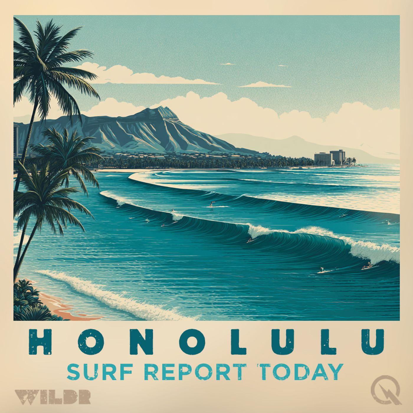
Surf Report for Honolulu Hawaii
by Inception Point Ai
Honolulu Hawaii Surf ReportScore the best waves on Oahu's South Shore with your AI surf advisor!The "Honolulu Hawaii Surf Report" is your inside track to legendary surf spots like Waikiki, Ala Moana, and Diamond Head. Harnessing the power of AI to analyze National Weather Service data, this podcast gives you everything you need to know about the wave conditions in Honolulu.What's inside each episode:Essential Wave Info: Wave height, swell direction and period, wind speed and direction, and water temperature reports.Focus on Oahu's South Shore: We'll highlight the impact on iconic breaks with recommendations for different skill levels.The North Shore Watch (Seasonal): Get updates on when the big winter swells hit Oahu's North Shore, including insights about when it might be manageable for experienced surfers.Island Vibes: Stay connected to the Hawaiian surf culture with potential updates on local events, surf contests, and
-
537
Hawaii Surf Forecast Through Thursday: East Facing Shores Fire Up to Eight Feet, Trade Winds Strengthen
Good afternoon from the National Weather Service in Honolulu. Here's your surf zone forecast for Hawaii through Thursday. We're looking at a transitional pattern across the islands as we head into the latter part of the week. Currently, that small north-northwest swell is on its way out, so expect it to keep declining through Thursday. The good news? A fresh batch of north-northwest swell is already in the pipeline and should arrive by Saturday, bringing us some nice action along the north and west-facing shores come the weekend. For the next several days, don't sleep on the south-facing beaches. A series of small, long-period south swells will keep things interesting with near-average conditions. But here's where it gets exciting—the trades are strengthening, and they're going to keep pushing solid surf along our east-facing shores well into next week. Let's break down what you're looking at tonight and Thursday by region. Across Kauai, north-facing shores will see one to three feet tonight dropping to nothing to two feet by Thursday afternoon. West-facing breaks stay tiny at zero to two feet throughout. South-facing shores are the play with consistent three to five-foot faces, while east-facing exposures are firing at five to seven feet tonight and ramping up to six to eight feet by Thursday afternoon. Winds will be out of the east around fifteen miles per hour with mostly sunny skies until six, then clouds move in with some scattered showers. Lows in the lower seventies. Oahu's looking similar with the same surf heights across the board. East-facing breaks are handling five to seven feet tonight and six to eight feet Thursday, so get out there if you've got a spot on that side. North and west faces are small, while south-facing beaches maintain that three to five-foot range. Expect mostly sunny skies Thursday with isolated showers. Winds will be stronger from the east at around twenty miles per hour. One heads up—we're talking extreme UV conditions Thursday, so slather on that sunscreen. Highs in the lower eighties. Maui's following the same swell pattern. East-facing shores are your best bet at five to seven feet tonight building to six to eight feet Thursday afternoon. Winds will be out of the east at fifteen to twenty miles per hour. Mostly sunny Thursday with scattered showers possible. Highs in the lower eighties. On the Big Island windward and southeast side, north-facing shores will be small while east-facing spots are solid at five to seven feet tonight and six to eight feet Thursday. South-facing breaks maintain three to five feet. Expect mostly cloudy skies with showers likely tonight and Thursday morning. Winds northeast around ten to fifteen miles per hour with highs around eighty. The leeward side of the Big Island stays quiet with west-facing shores minimal at zero to two feet and south-facing beaches offering three to five feet both nights. Mostly sunny Thursday with scattered showers. Light winds shifting from west in the evening to south early Thursday then back to west in the afternoon. Highs in the mid-eighties. Remember, swimmers and surfers should always use caution in the surf zone. Rip currents will be present and their strength increases with surf size. Head to hawaiibeachsafety.com for the latest hazard information at specific beaches across the islands. Stay safe out there and enjoy the waves. For more http://www.quietplease.ai Get the best deals https://amzn.to/3ODvOta
-
536
Hawaii Surf Forecast Tuesday May 19 North Shore Swell Building East Facing Shores Fire
Good afternoon, this is your Hawaii surf zone forecast for Tuesday, May 19th. Let's dive into what's shaping up in the waters around the islands. We're looking at some interesting swell patterns developing over the next few days. A small, short to medium period swell from the north-northwest is filling in today, and that's just the warm-up act. Later this week, expect a more significant north-northwest swell to arrive, courtesy of a strong low-pressure system brewing near the Aleutian Islands. That should really get things moving on the north-facing shores. Down south, a consistent series of long-period south-southwest swells is keeping conditions near average along our southern coastlines. Meanwhile, strengthening trade winds are the real story here, maintaining elevated surf and fresh short-period swell along all east-facing shores heading into next week. Let's break down conditions by island, starting with Kauai. Tonight, expect mostly sunny skies until around six o'clock, then things turn mostly cloudy with scattered showers. It'll be warm, with lows in the lower seventies and light east winds at five to ten miles per hour. North and west-facing shores are running small, at two to four feet, while south-facing breaks are a bit more substantial at three to five feet. The east-facing shores are your go-to spot, firing at three to five feet tonight and building to four to six feet Wednesday afternoon. Wednesday brings partly sunny skies with scattered showers persisting, highs in the mid-eighties, and east winds picking up to ten to fifteen miles per hour. Over on Oahu, tonight looks partly cloudy with scattered showers and a low in the lower seventies. East winds will run around fifteen miles per hour. The surf picture mirrors Kauai with north and west facing shores at two to four feet, south-facing at three to five feet, and east-facing shores at three to five feet tonight, climbing to four to six feet by Wednesday afternoon. Wednesday's looking mostly sunny with scattered showers, highs in the lower eighties, and east winds ramping up to fifteen to twenty miles per hour. Fair warning: the UV index Wednesday is hitting extreme levels, so sunscreen is absolutely essential if you're heading out. Maui conditions tonight show partly cloudy skies with scattered showers and lows in the lower seventies. East winds around fifteen miles per hour. North-facing shores are one to three feet, west-facing is minimal at zero to two feet, but south and east-facing shores both sit at three to five feet, bumping to four to six feet Wednesday afternoon. Wednesday stays mostly sunny with scattered showers, highs in the lower eighties, and east winds at fifteen to twenty miles per hour. The Big Island's windward and southeast side tonight will be mostly cloudy with numerous showers, lows in the lower seventies, and light northeast winds at five to ten miles per hour. North-facing shores are one to three feet, east-facing is three to five feet, and south-facing is the strongest at four to six feet, holding steady through Wednesday afternoon. Expect partly sunny skies Wednesday with scattered showers, highs around eighty, and northeast winds at ten to fifteen miles per hour. On the leeward side of the Big Island, tonight brings partly sunny conditions until six o'clock, then partly cloudy with scattered showers and lows in the lower seventies. Winds are light and variable. West-facing shores are running three to five feet, while south-facing is stronger at four to six feet. Wednesday looks mostly sunny with scattered showers, highs in the mid-eighties, and light winds from the southwest in the morning, shifting northwest by afternoon. One final reminder: rip currents will be present in and near the surf zone, and their strength increases with surf size. Swimmers should exercise caution at all times and enter the water near a lifeguard. For the latest beach hazard and safety information at individual beaches, visit hawaiibeachsafety.com. Stay safe out there and enjoy the waves. For more http://www.quietplease.ai Get the best deals https://amzn.to/3ODvOta
-
535
Hawaii Surf Forecast Monday May 4 2026 Northwest Swell Peak Tonight Tuesday Morning Waves Above Average
Good afternoon, this is your Hawaii Surf Zone Forecast for Monday, May fourth, twenty twenty-six. A moderate northwest swell continues building this evening and will peak tonight into early Tuesday, delivering surf well above seasonal averages along north and west facing shores. This swell gradually declines through Wednesday, but here's the exciting part: a larger northwest swell is expected to arrive Wednesday and could produce surf near High Surf Advisory levels by Thursday before dropping off Friday into the weekend. Meanwhile, a south swell slowly decreases tonight into Tuesday, with small pulses preventing the waves from completely flattening out for the rest of the week. Trade wind swell remains below average, keeping east facing shores on the quieter side. Let's break down what you can expect around the islands: On Kauai, north facing shores will see seven to ten feet tonight through early morning, dropping to five through seven feet by Tuesday afternoon. West facing beaches offer five to seven feet tonight, fading to three to five Tuesday. The south and east shores stay small and manageable. Oahu's north facing breaks show four to six feet tonight, jumping to six through eight feet Tuesday morning before easing back slightly. West facing shores peek at four to six feet Tuesday morning, while south and east faces remain small. Conditions look partly sunny early, then cloudy with scattered showers and east winds diminishing after midnight. Maui's north facing shores deliver three to five feet tonight, building to five through seven feet Tuesday morning. West facing breaks stay minimal around one to three feet. East faces hold steady in the two to four foot range tonight. Big Island windward and southeast shores feature one to three feet on the north, three to five on the east side, with conditions remaining relatively consistent. The leeward side stays small, with west facing beaches one to three feet and south shores two to four feet. Tuesday brings partly sunny skies across all islands with scattered showers and lighter winds. Temperatures reach the lower eighties. High UV index expected, so bring your sunscreen. This is your Hawaii Surf Zone Forecast. Check hawaiibeachsafety.com for the latest beach hazard information, and always exercise caution near the water. For more http://www.quietplease.ai Get the best deals https://amzn.to/3ODvOta This content was created in partnership and with the help of Artificial Intelligence AI.
-
534
Kauai Surf Forecast Sunday to Monday: 7 to 10 Foot Waves Expected on North Shores
# KAUAI SURF FORECAST REPORT Good afternoon, this is your Kauai surf forecast for Sunday evening through Monday, brought to you by the National Weather Service Honolulu. We're looking at an interesting shift in our surf pattern over the next 24 hours. Right now, we've got small northwest swell dominating the scene with a moderate northwest swell on the way that's going to pump things up considerably. Tonight, expect mostly cloudy skies with scattered showers and temperatures dropping into the upper 60s. Winds will be light from the east at 10 to 15 miles per hour. On the north facing shores, you're looking at 4 to 6 foot surf both this evening and heading into the morning. West facing beaches will stay smaller at 2 to 4 feet, while south and east facing shores see 3 to 5 feet through tonight. The tidal picture shows a high of 2.0 feet at Hanalei Bay around 4:18 this afternoon, dropping to a low of just 0.3 feet later tonight. Now here's where it gets interesting. Monday is going to bring noticeably larger surf, especially on the north facing shores. We're looking at a significant jump from this morning's 6 to 8 feet building to 7 to 10 feet by Monday afternoon. That's above seasonal average for this time of year, so surfers should definitely take note. West facing shores will see 4 to 6 feet in the morning bumping up to 5 to 7 feet by afternoon. South and east facing beaches will see a slight decrease to 2 to 4 feet and 2 to 4 feet respectively. Monday itself looks partly sunny with scattered showers and highs in the lower 80s. Northeast winds will be light around 10 miles per hour. Sunrise is at 6:03 AM and sunset at 7:05 PM. Looking ahead, this northwest swell will gradually decline late Tuesday and Wednesday before potentially building again Thursday with larger swell that could approach High Surf Advisory levels. A south-southwest swell will produce seasonal average conditions tonight but gradually decrease through the week, while trade wind swell drops below seasonal average. Stay hydrated, wear sunscreen, and as always, swim near lifeguards and exercise caution in the surf zone. For more http://www.quietplease.ai Get the best deals https://amzn.to/3ODvOta This content was created in partnership and with the help of Artificial Intelligence AI.
-
533
Hawaii Surf Forecast Saturday to Sunday: North Swell Fading, South Swell Peak Late Sunday
Good afternoon, this is your Hawaii surf forecast for Saturday, May 2nd through Sunday evening. We're looking at some interesting transitions this weekend across the islands. An existing small west-northwest swell is gradually fading, but don't worry, there's plenty of action to come. North and west facing shores will maintain some elevated surf as a slightly smaller northwest swell arrives early next week. And if you're patient, a longer period northwest swell is on the way late next week, generated by a developing low pressure system near Japan that's forecast to lift toward the Kuril Islands. For those chasing the southern exposure, this is your weekend to get excited. A long period south-southwest pulse is arriving, and it's going to peak late Sunday into Monday. So if you're thinking about checking out the south-facing breaks, timing is everything over the next day or so. There's one less exciting note though. As the trade winds steadily weaken, wind waves and trade wind swell will diminish, so expect to see surf dropping along east-facing shores over the next several days. Let's break down what's happening island by island, starting with Kauai. North-facing breaks are looking at four to six feet tonight and Sunday morning, then dropping to three to five feet Sunday afternoon. West-facing shores are more modest at three to five feet tonight, fading to two to four tomorrow morning and staying there through afternoon. South and east-facing breaks are running three to five and four to six feet respectively, with the east side dropping back to three to five feet by Sunday afternoon. Tonight expect mostly sunny skies until six, then mostly cloudy with scattered showers. Winds are light out of the east at five to ten miles per hour, and lows will be in the upper sixties. Sunday brings partly sunny skies with more scattered showers, northeast winds around ten miles per hour, and highs in the lower eighties. The high tide at Hanalei Bay comes in at two point zero feet at four eighteen in the afternoon. Moving to Oahu, the pattern is similar with north-facing shores at four to six feet tonight and morning, dropping to three to five feet Sunday afternoon. West-facing breaks are one to three feet, south-facing is three to five feet, and east-facing peaks at four to six feet tonight before dropping to three to five tomorrow. Tonight will be partly cloudy until midnight then mostly cloudy with scattered showers. East winds are a bit stronger here at ten to fifteen miles per hour. Lows in the lower seventies. Sunday looks partly sunny with scattered showers, temperatures in the lower eighties, and northeast winds at ten to fifteen miles per hour. Fair warning: the UV index on Sunday is extreme, so get that sunscreen on. Over on Maui, north-facing shores are three to five feet tonight and morning, dropping to two to four feet Sunday afternoon. West-facing breaks are small at one to three feet both nights. South-facing is three to five feet, and east This content was created in partnership and with the help of Artificial Intelligence AI.
-
532
Hawaii Surf Forecast: Northwest Swell Building to Advisory Levels, Best Waves Friday Through Weekend
Good afternoon, this is your surf zone forecast for Hawaii, issued Friday at three forty-four PM HST. An incoming northwesterly swell is building in and will bring rising surf to north and west facing shores overnight. We're looking at surf peaking near advisory levels before gradually easing through the weekend. Another slightly smaller northwest swell is expected early next week, with another long-period northwest swell potentially arriving late next week. If you're heading south, things are looking up too. South facing shores will trend upward over the weekend with the arrival of a long-period south-southwest swell. East facing shores, however, will trend downward as the trade winds weaken. Let's break it down by island, starting with Kauai. Tonight, expect north facing shores to reach seven to ten feet, climbing to eight to twelve feet by morning. West facing shores will see five to seven feet tonight, increasing to six to eight feet. South and east shores will stay mellow at two to four feet and four to six feet respectively. Saturday looks similar with north shores at eight to twelve feet in the morning, easing back to seven to ten feet in the afternoon. Tonight's low will be in the upper sixties with mostly cloudy skies and scattered showers. East winds at ten to fifteen miles per hour. Moving to Oahu, the north facing shores mirror Kauai's pattern with seven to ten feet tonight pumping up to eight to twelve feet by morning, then easing to seven to ten feet Saturday afternoon. West shores staying consistent at five to seven feet tonight and six to eight feet Saturday. The slightly stronger winds here, fifteen to twenty miles per hour diminishing after midnight, will ease to around fifteen miles per hour Saturday. Low tonight in the lower seventies, mostly sunny Saturday with that very high UV index, so grab your sunscreen. Over on Maui, north facing shores are slightly smaller at six to eight feet tonight, building to seven to ten feet by morning. West shores are essentially flat at zero to two feet, while south shores hold steady at two to four feet. East shores at four to six feet. Saturday brings mostly sunny skies and a low around seventy degrees. The Big Island's windward and southeast shores show minimal north shore activity with one to three feet throughout. East facing shores getting the most action at four to six feet, and south shores at two to four feet. Tonight expect mostly cloudy conditions with numerous showers and northeast winds at ten to fifteen miles per hour. On the leeward side, conditions are calmer still. West facing shores at one to three feet and south shores at two to four feet tonight and Saturday. Mostly clear to sunny skies with isolated showers, light southwest winds becoming northeast after midnight. Saturday brings those lighter winds from the south becoming west in the afternoon. Overall, this weekend shapes up nicely for north and west shore enthusiasts while south facing breaks wake up as we progre This content was created in partnership and with the help of Artificial Intelligence AI.
-
531
Honolulu Surf Forecast: North Shore Swell Expected Late Friday, East Shores Fire Up Thursday
Good afternoon, this is your Honolulu National Weather Service Surf Zone Forecast for Thursday, April 30th through Friday, May 1st. We're tracking some interesting swell activity heading into the islands over the next couple of days. Let's break down what's happening across each region. Starting with our north facing shores, we're expecting near average conditions today and tonight with surf in the five to seven foot range. That small northwest swell currently in place will gradually decline through Friday, but here's the exciting part. A storm system that developed near the Kuril Islands earlier this week is now tracking toward the Aleutians and will send a moderate, long-period northwest swell our way late Friday into Saturday. This should kick up above average surf along north and west facing shores by Saturday, so plan accordingly if you're chasing those swells. On the west side, tonight looks modest with three to five feet, dropping to two to four feet Friday morning before bumping back up to four to six feet in the afternoon. Similar story across most islands, though Maui's west shore will stay relatively quiet through the period. For those hunting waves on south facing beaches, expect minimal activity through the work week with just background swell. However, a small long-period south-southwest pulse arrives late Friday and should give everything a little boost through the weekend. South shores will see one to three feet tonight and Friday morning, rising to two to four feet Friday afternoon. Now if you're an east side enthusiast, pay attention. Trade winds are about to briefly strengthen to fresh to strong levels tonight into Friday, and that's going to fire up the east facing shores. We're looking at two to four feet tonight, jumping to four to six feet Friday morning and afternoon. Come the weekend though, those trades will weaken and the east shore surf will fade below average by early next week. Weather wise, expect mostly cloudy skies tonight with scattered showers and low temperatures around seventy. Friday brings partly to mostly sunny conditions with numerous showers continuing. High temperatures will reach the lower eighties across most islands with east winds around fifteen to twenty miles per hour. For those planning beach time, sunrise Friday is around six o'clock in the morning, sunset at roughly seven o'clock in the evening depending on your island. UV index will be very high Friday, so bring the sunscreen. A quick reminder to all water users, rip currents will be present in and near the surf zone, with strength increasing as swell size increases. Always swim near a lifeguard and exercise caution at all times. For detailed beach hazard information, head over to hawaiibeachsafety.com. That's your forecast. Get out there and enjoy these islands. For more http://www.quietplease.ai Get the best deals https://amzn.to/3ODvOta This content was created in partnership and with the help of Artificial Intelligence AI.
-
530
Hawaii Surf Forecast April 29 2026: Five to Seven Foot Waves Peak Thursday on Kauai and Oahu North Shores
Good afternoon, this is your Hawaii Surf Zone Forecast for Wednesday, April 29th, 2026. A new northwest swell is filling in as we speak and will peak tonight into Thursday morning before gradually declining into Friday. If you're chasing those north and west-facing breaks, tonight through Thursday is definitely your window. We're looking at solid five to seven foot faces on north shores across the islands, with the best action concentrated on Kauai and Oahu. Looking further down the line, Mother Nature has another gift coming our way. A storm-force low currently spinning in the North Pacific will send a moderate, longer-period northwest swell toward the islands late Friday into Saturday. This one should bring above-average surf to north and west-facing shores, so if this week's swell leaves you wanting more, just hold tight. South-facing beaches will remain pretty mellow through most of the week with just background south to southwest swell. However, a small south-southwest pulse is expected to arrive this weekend from recent activity near New Zealand. This should bump up the surf, especially by Sunday, so those south shore spots will have something to work with by the end of the week. East-facing shores will stay small and choppy through midweek, though we might see a slight rise Thursday and Friday as the trades pick up. For Kauai specifically, expect five to seven foot surf on the north shore tonight and Thursday, with three to five feet on the west side. South and east shores will stay quiet. Oahu's looking similar with four to six foot waves on the north shore, building to five to seven by Thursday morning. West-facing breaks will see three to five feet, while south and east shores stay in the zero to two foot range. Maui will see three to five foot swells on the north shore tonight, building to four to six feet by Thursday. The west side will be pretty small, and south shores will see that slight uptick late in the week. On the Big Island, conditions will vary by location. Windward and southeast shores will see modest two to four foot swells on the east side, while leeward areas will remain small through the forecast period. Winds will be generally northeast to east across the islands, with speeds ranging from ten to twenty miles per hour. Expect mostly sunny to partly cloudy skies with scattered showers, and temperatures in the upper seventies to lower eighties. So here's the bottom line, surfers. Tonight and Thursday are prime for north and west-facing breaks. If you're eyeing the south side, wait until the weekend. And if another strong swell is what you're hoping for, Friday and Saturday are coming in hot. Get out there and enjoy what these islands have to offer. For more http://www.quietplease.ai Get the best deals https://amzn.to/3ODvOta This content was created in partnership and with the help of Artificial Intelligence AI.
-
529
Hawaii Surf Forecast Tuesday April 28 Northwest Swell Arrives Wednesday Strong Surf Expected Friday Saturday
Good evening surfers, this is your Hawaii surf forecast brought to you by the National Weather Service in Honolulu for Tuesday, April 28th, 2026. Let's break down what's happening across the islands right now and what's coming your way over the next few days. Starting with the north and west facing shores, we're looking at small surf tonight before conditions improve. A small bump is possible on Wednesday, but here's where it gets interesting. An upward trend is expected during the second half of the week as a northwest swell arrives as early as Wednesday night. This swell is originating from a storm-force low that tracked into the Bering Sea over the weekend, and it's been confirmed by satellite data, so we're fairly confident it's going to materialize. Looking further ahead to Friday and Saturday, another storm-force low positioned east of Japan will send a moderate, longer-period northwest swell our direction. This one has the potential to push surf heights toward advisory levels along exposed north and west facing shores, so definitely keep an eye on that development. Now, for those of you eyeing the south facing beaches, expect small conditions through much of the week with mainly background south to southwest swell. However, another south-southwest pulse may arrive by this weekend from some recent activity east of New Zealand, which should provide a small bump in surf. East facing shores will remain relatively small and choppy through midweek, but a slight rise is possible Thursday and Friday as the trade winds strengthen. Let's get specific with the islands. Across Kauai tonight, expect north facing shores at 2 to 4 feet, west facing at 1 to 3, south facing at 1 to 3, and east facing at 2 to 4 feet. These conditions hold through the morning. By Wednesday, north facing shores bump up to 3 to 5 feet and west facing reaches 2 to 4 feet, while south and east facing remain relatively unchanged. It'll be mostly sunny with scattered showers, lows around 70, and east winds around 10 miles per hour. Over on Oahu, tonight brings 2 to 4 feet on north facing shores with 1 to 3 foot surf on the west side. Wednesday sees north facing shores reaching 3 to 5 feet with west facing at 2 to 4. Expect mostly sunny skies with scattered showers, lows in the lower 70s, and northeast winds around 15 miles per hour Wednesday. The UV index will be very high, so grab that sunscreen. Maui is looking a bit smaller tonight with 1 to 3 feet on north facing shores and 2 to 4 feet on the east side. West facing shores are holding at 0 to 2 feet. Wednesday brings modest improvement with north facing reaching 2 to 4 feet while west facing stays in that 0 to 2 foot range. Conditions will be mostly sunny with scattered showers and east winds 10 to 15 miles per hour. The Big Island windward and southeast side tonight shows 1 to 3 feet on north and south facing shores with 2 to 4 feet on the east side. Wednesday stays consistent with these numbers. Expect mostly cloudy This content was created in partnership and with the help of Artificial Intelligence AI.
-
528
Hawaii Surf Forecast Sunday Monday April 26 27 North Facing Shores Six to Eight Feet Declining Through Week
Good evening, this is your Hawaii surf zone forecast for Sunday, April 26th through Monday, April 27th. Let's start with conditions heading into tonight across the islands. North facing shores will see six to eight foot surf this evening, easing to five to seven feet by morning. This gradual decline continues through Monday as we transition into the first half of the week. For those checking out west facing breaks, expect four to six feet tonight, dropping to three to five feet by morning, and further diminishing Monday as the current swell continues to lose steam. South facing shores will experience a somewhat inconsistent pattern. A southwest swell peaks this evening and tonight at two to four feet, followed by a gradual downward trend through Monday. However, keep an eye out for another small south-southwest pulse potentially arriving next weekend. East facing shores will remain relatively small and choppy at two to four feet, though a brief strengthening of trade winds tomorrow could produce a small bump in surf. Looking ahead to the extended outlook, north and west facing shores will see an upward trend during the second half of the week as a new northwest swell arrives. This could be followed by a larger northwest swell system Friday into Saturday, with surf heights potentially approaching advisory levels for exposed north and west facing shores. So mark your calendars for what could be an exciting weekend ahead. Current weather conditions across the islands show partly cloudy skies tonight with scattered showers. Temperatures will dip to the upper 60s to lower 70s depending on your location, with east winds generally five to fifteen miles per hour. Monday will bring mostly sunny skies with scattered showers lingering, highs in the lower 80s, and similar wind conditions. Tidal activity tonight includes lows ranging from point three to point five feet with highs between one point two and two point zero feet, depending on your specific location around the islands. Monday's tides will see lows from negative point one to point two feet with highs between one point one and one point eight feet. As always, remember that surf heights can vary significantly from beach to beach along any given coastline, and larger surf than the upper end of our forecast ranges will occur periodically. Rip currents will be present in and near the surf zone, with strength increasing as surf size increases. Swimmers should exercise caution at all times and enter the water near a lifeguard whenever possible. For the latest beach hazard and safety information at individual beaches throughout Hawaii, visit hawaiibeachsafety.com. Get out there and enjoy the waves responsibly. For more http://www.quietplease.ai Get the best deals https://amzn.to/3ODvOta This content was created in partnership and with the help of Artificial Intelligence AI.
-
527
Hawaii Surf Forecast Saturday April 25 26 2026 North Shore Waves Peak Sunday Small Moderate Surf
Good afternoon, this is your Hawaii surf zone forecast for Saturday, April 25th through Sunday, April 26th, 2026. A medium-period northwest swell is peaking tonight into Sunday, bringing small to moderate surf to north and west-facing shores before gradually declining through early next week. Meanwhile, that hurricane-force low spinning across the Aleutian Islands should send us a moderate northwest swell around mid-week that we'll definitely want to keep our eyes on. Short-period northeasterly energy is fading fast this afternoon, which means eastern exposures will stay below average for the first half of next week with weak trade winds. However, locally strong trade winds could make a comeback during the latter half of the week, potentially delivering rough and choppy conditions with near normal wave heights. Small background swells from the west will linger through today and disappear by Sunday. A minor southwest bump from the Tasman Sea is expected to fill in tonight and peak Sunday. Don't expect significant southern exposure swell through the first half of next week, though a gale fetch east of New Zealand could produce a small south-southwest swell by next weekend. Let's break down what each island can expect. Kauai's north-facing shores will see seven to ten foot waves tonight and tomorrow, with west-facing beaches in the five to seven foot range. Oahu will experience five to seven foot waves on north-facing shores tonight, maintaining six to eight feet through Sunday. Maui's north-facing shores will see four to six feet tonight, building to five to seven feet by Sunday. The Big Island's windward and southeast shores will stay modest at three to five feet tonight, dropping to two to four feet Sunday. Tonight expect mostly sunny conditions until six o'clock, then mostly cloudy skies with scattered showers. Temperatures will dip to the upper sixties and lower seventies across the islands. East winds at ten to fifteen miles per hour will diminish after midnight. Sunday brings mostly sunny skies with scattered showers, highs in the lower eighties, and east winds continuing at ten to fifteen miles per hour. Remember, rip currents will be present in or near the surf zone, with strength increasing as surf size increases. Always exercise caution and swim near lifeguards. Check hawaiibeachsafety.com for the latest beach hazard information at your favorite spots. Enjoy the waves responsibly out there. For more http://www.quietplease.ai Get the best deals https://amzn.to/3ODvOta This content was created in partnership and with the help of Artificial Intelligence AI.
-
526
Hawaii Surf Forecast Thursday April 23 Head High Waves North Shores New Swells Arriving Friday
Good morning, this is your Hawaii Surf Zone Forecast for Thursday, April 23rd, 2026. We're tracking a transitional pattern across the islands as we head into the weekend. A small northwest swell that peaked yesterday is gradually leveling out, but don't worry—a couple of North Pacific gales are sending a series of new north to northwest swells our way starting Friday night through the first half of next week. These incoming swells should maintain waist to head high surf along north-facing shores into early next week. Now, here's the good news for our east-facing beaches. That north-northeast swell that brought advisory-level conditions yesterday afternoon has finally run its course. We're canceling the High Surf Advisory for east-facing shores as that swell has fallen below advisory thresholds. However, moderate to fresh trades will continue to support near seasonal average wind wave surf along these exposures. For today across Kauai, expect five to seven foot waves along the north and east-facing shores this morning, dropping to four to six feet by afternoon. The west and south shores stay mellow at two to four and one to three feet respectively. Oahu follows a similar pattern with five to seven foot waves on the north and east shores today, easing tomorrow as that northwest swell continues its decline. Maui's east-facing shores are showing the most impressive action at six to eight feet this morning, dropping to five to seven feet by afternoon, so if you're chasing some swell there, get out early. The Big Island windward and southeast coasts are lighting up too, with six to eight foot waves on east-facing shores this morning. Friday brings a noticeable drop across most exposures as we transition between swells. Looking at the bigger picture, small background energy from the west will linger through today and fade out this weekend. We're also watching a small southwest swell bump from Tasman Sea gale activity that should arrive this weekend, but nothing significant from the south is expected through the first half of next week. Weather-wise, we're looking at mostly sunny skies with only scattered to isolated showers. Expect temperatures in the lower eighties and light northeast winds around ten miles per hour, though some windward areas may see winds ten to fifteen miles per hour. For everyone heading to the water, remember that rip currents are present and their strength increases with surf size, so exercise caution and always try to swim near a lifeguard. Stay safe out there, and we'll have another update for you tomorrow. For more http://www.quietplease.ai Get the best deals https://amzn.to/3ODvOta This content was created in partnership and with the help of Artificial Intelligence AI.
-
525
Hawaii Surf Forecast: Waist to Head High Waves Continue Through Next Week on North Shores
Good morning, this is your surf zone forecast for Hawaii, issued Thursday morning at eight fifty-nine. A small northwest swell that peaked yesterday continues to gradually level out over the next few days. However, don't expect the lineup to go completely flat. A pair of North Pacific gale lows are sending a series of small north to northwest swells our way from Friday night through the first half of next week. These swells will keep waist to head high surf rolling into north-facing shores all the way through next week. Yesterday afternoon brought some advisory level surf along northeast and eastern exposures, with above-average heights hitting select Maui and Big Island western shores. That north-northeast swell has now leveled out and dropped below advisory thresholds, so we've cancelled the High Surf Advisory for east-facing shores. But here's the good news for east-facing beaches: an enhanced northeast fetch near a weak low northeast of the islands will push in a secondary swell tomorrow. Combined with moderate to fresh trade winds, you'll see near seasonal average conditions on east-facing shores. Small background energy from the west will continue lingering for the next few days, fading out by this weekend. Also arriving this weekend is a small southwest bump from Tasman Sea gale energy. No significant south swells are expected through the first half of next week. Looking at the individual islands, Kauai will see north-facing shores at five to seven feet this morning, dropping to four to six feet by afternoon. East-facing shores are similarly elevated at five to seven feet. Friday, expect that north-facing surf to drop to three to five feet as the day progresses. Oahu's north shores are also running five to seven feet today with four to six in the afternoon. East-facing shores match that action. Friday sees similar decreases, with north-facing surf dropping to three to five feet in the morning and two to four by evening. Maui is seeing six to eight feet on east-facing shores today, dropping to five to seven this afternoon. That's some of the best action around right now. North-facing shores are five to seven feet this morning, four to six this afternoon. By Friday, expect three to five feet on north shores, declining to two to four by evening. The Big Island windward and southeast side is also showing strong east-facing surf at six to eight feet today, five to seven this afternoon. North-facing shores are five to seven feet today, dropping to four to six this evening. Friday brings that north shore down to three to five feet. Leeward sides across the islands will see smaller, more subdued conditions. West-facing shores on the Big Island are currently three to five feet this morning, two to four this afternoon, with Friday looking at two to four throughout the day. Weather looks mostly sunny across all islands today with isolated to scattered showers and highs in the lower eighties. Northeast winds will stay light around ten mph, th This content was created in partnership and with the help of Artificial Intelligence AI.
-
524
Hawaii Surf Forecast Tuesday April 14th 2026 North and South Shores Four to Six Feet
Good afternoon, this is your Hawaii Surf Zone Forecast for Tuesday, April 14th, 2026. A small northwest swell is slowly diminishing into the weekend, while a small to medium period south swell will keep conditions boosted along the south shores through late week before fading away. Meanwhile, surf along the east shores remains below the seasonal average as trade winds stay light, though increasing trades by week's end should bring a slight bump to those exposures. Let's break it down by island. KAUAI is looking pretty solid right now. Tonight you're looking at four to six foot surf on the north and south facing shores, with three to five foot conditions on the west side and two to four feet on the east. Expect cloudy skies with showers likely and lows in the lower seventies. Winds will start out of the south around five miles per hour, then shift west in the evening before turning northeast after midnight. Wednesday brings a slight bump down on the north shore to three to five feet in the afternoon, while south facing shores hold steady at four to six feet. Conditions stay mostly the same on the west and east, with highs in the lower eighties and east winds around five miles per hour. Moving to OAHU, tonight north and south facing shores are running four to six feet with three to five on the west and two to four on the east. We've got a chance of showers with lows in the lower seventies and light east winds around five miles per hour. Wednesday sees the north shore back off to three to five feet during the afternoon while the south remains consistent at four to six. West side drops to two to four feet while east facing stays at two to four. Expect highs in the lower eighties with east winds picking up to around ten miles per hour. The UV index will be very high, so grab that sunscreen. MAUI tonight shows three to five foot surf on the north and south shores with two to four on the east and just one to three on the west. Cloudy skies with a slight chance of showers and lows in the lower seventies. East winds are running five to ten miles per hour. Wednesday brings minimal changes across all exposures, holding steady through the afternoon with highs in the lower eighties and similar east wind speeds. On the BIG ISLAND, let's talk leeward and windward separately. The windward and southeast side tonight has two to four foot conditions on the north and east facing shores with four to six feet on the south. Mostly cloudy with a slight chance of showers, lows around seventy, and east winds five to ten miles per hour becoming northwest after midnight. Wednesday stays consistent across the board with similar surf heights, cloudy skies and a chance of showers, highs in the lower eighties. On the leeward side, tonight brings two to four feet on the west facing shores and four to six on the south. Mostly cloudy with a slight chance of showers and lows in the lower seventies. West winds around five miles per hour shift to north after midnight. Wednesda This content was created in partnership and with the help of Artificial Intelligence AI.
-
523
Hawaii Surf Forecast Tuesday Through Midweek: South Swell Arrives With 4 to 6 Foot Waves
Good afternoon! Here's your Hawaii surf forecast for tonight through Tuesday. A small, medium-period northwest swell is winding down, but don't worry, it's leaving behind some solid small surf along the north and west shores. We're expecting a reinforcing pulse to arrive on Tuesday that'll keep things playful before northwest energy takes a step back for the rest of the week. The real news? A brand new south swell is rolling in Tuesday, and it's bringing some serious stoke to the south-facing shores through mid-week before gradually fading into the weekend. Meanwhile, east-facing breaks are staying below their usual seasonal average, with lighter than normal trade winds in the forecast near and upstream of the islands all week long. Let's break this down by island, starting with Kauai. Tonight, expect four to six feet on the north shore with three to five foot waves on the west side. South-facing beaches will see three to five, while the east shore stays modest at two to four. Temperatures dip to the lower seventies under cloudy skies with a chance of showers and light southwest winds around five to ten miles per hour. Tuesday brings similar conditions on the north shore at four to six feet in the morning, dropping to three to five by evening. The south side comes alive though, jumping to four to six feet as that new swell arrives. East shores remain two to four. Expect showers to be likely with highs in the lower eighties and calm southerly winds. Moving to Oahu, tonight's forecast mirrors Kauai with north shores at four to six, west at three to five, and south at three to five. The east side sits at two to four feet. It'll be cloudy with a chance of showers and temps in the lower seventies with light southeast winds. Tuesday on Oahu sees the north shore holding four to six in the morning before backing off to three to five by evening. Here's where it gets good: the south-facing shores light up with four to six feet as that new swell takes charge. East shores stay mellow at two to four. Expect a moderate UV index, a chance of showers, highs around eighty, and light east winds. Over on Maui, tonight offers three to five feet on the north shore, two to four on the west, three to five on the south, and two to four on the east, all under cloudy skies with a chance of showers and temps in the lower seventies. Tuesday's a game-changer for Maui's south shore, which bumps up to four to six feet. The north shore actually backs off to two to four. West and east shores stay two to four feet. Skies clear slightly to mostly cloudy with just a slight chance of showers, highs in the lower eighties, and light east winds at five to ten miles per hour. The Big Island windward and southeast side tonight shows two to four feet on the north and east shores with three to five on the south. Low temperatures hover around seventy degrees under cloudy skies with slight shower chances and southeast winds at five to ten miles per hour. Tuesday brings that south s This content was created in partnership and with the help of Artificial Intelligence AI.
-
522
Hawaii Surf Forecast Sunday April 12th North Swell Fills In Moderate Conditions Expected Through Monday
Good afternoon, this is your surf zone forecast for Hawaii, issued Sunday April 12th at 3 o'clock. A moderate north-northwest swell is filling in along the islands this afternoon, generated by a formerly gale force low positioned north-northwest of the main Hawaiian islands. This swell will keep conditions small to moderate through Monday before declining for the rest of the week. Meanwhile, a medium-period south swell continues its decline through Monday, but don't worry—a new south swell arrives Tuesday, bringing another boost to south facing shores through mid-week before gradually subsiding into the weekend. If you're thinking about heading out to east facing beaches, keep expectations low. Surf along eastern shores will remain below seasonal average with lighter than normal trade winds forecast through next week. Let's break down what to expect across the islands. On Kauai, tonight you're looking at seven to ten foot faces on north facing shores, with five to seven foot faces on the west side. South and east facing shores are smaller at two to four feet. Monday, expect those north facing breaks to ease slightly to six to eight feet in the morning, then drop to five to seven by evening. West facing shores will see four to six in the morning dropping to three to five by afternoon. South and east shores hold steady in the two to four foot range. Conditions tonight will be cloudy with occasional showers and southeast winds around five miles per hour. Monday stays cloudy with scattered showers and light south winds. Over on Oahu, north facing shores are pumping six to eight feet tonight and holding that through Monday morning before easing to five to seven by afternoon. West facing breaks are four to six tonight and Monday morning, dropping to three to five by evening. South and east facing shores are in the two to four foot range. Tonight expect cloudy skies with occasional showers and northeast winds becoming east after midnight. Monday brings scattered showers with light southeast winds and a low UV index. Maui is seeing smaller conditions overall. North facing shores offer four to six feet tonight, easing to three to five Monday morning and two to four by afternoon. West, south, and east shores are all two to four feet. Tonight will be mostly cloudy with occasional showers and northeast winds around ten miles per hour. Monday turns mostly cloudy with isolated showers and light southeast winds. The Big Island's windward and southeast shores show three to five feet on north facing breaks tonight, dropping to two to four Monday. East and south shores are two to four feet tonight, with south shores bumping up to three to five Monday afternoon. Expect mostly cloudy skies tonight with isolated showers and southeast winds five to ten miles per hour. Monday becomes cloudy with southeast winds around ten miles per hour. On the leeward Big Island, west and south facing shores are two to four feet tonight through most of Monday, though south sh This content was created in partnership and with the help of Artificial Intelligence AI.
-
521
Kauai Surf Report Saturday Sunday Six to Ten Foot Waves North Shore Northwest Swell
# Kauai Surf Report for Saturday and Sunday Alright, keiki, here's what's cooking in the waters around Kauai this weekend. Tonight we're looking at some decent swell action on the north facing shores with waves running six to eight feet. Your west facing breaks will be a bit more mellow at four to six feet, while south and east facing beaches are going to be smaller, sitting in the two to four foot range. The weather will be cloudy with scattered showers and a chance of isolated thunderstorms, so keep an eye on the sky. Low temperatures will dip into the upper sixties with light northwest winds around five miles per hour. If you're planning a moonlit paddle, just be aware of those scattered showers moving through. By Sunday, things are going to get a little more interesting. The north facing shores will pick up slightly, reaching six to eight feet in the morning and jumping to seven to ten feet by afternoon. That's some solid swell for the adventurous crew. West facing breaks will maintain four to six feet through the morning before bumping up to five to seven feet come afternoon. South and east facing shores will stay pretty consistent in the two to four foot range. Sunday's weather looks similar with more clouds, showers, and the possibility of isolated thunderstorms. Winds will shift to the southeast at around five miles per hour, and temperatures will climb into the upper seventies. We'll have sunrise at six twenty in the morning and sunset at six fifty-six in the evening. Here's the bigger picture: we've got a moderate, short to medium period northwest swell that filled in early Saturday morning, and another reinforcement is on tap for Sunday that should keep the energy up through the weekend. The south swell that's been delivering some fun waves will gradually decline through Monday, but don't worry, a new south swell is expected to arrive by Tuesday to keep things firing through midweek before it slowly fades into the following weekend. So grab your board, check those tides, and get out there. Just remember to respect the ocean and stay aware of your surroundings. For more http://www.quietplease.ai Get the best deals https://amzn.to/3ODvOta This content was created in partnership and with the help of Artificial Intelligence AI.
-
520
Hawaii Surf Forecast Friday to Saturday: Best Waves Expected Saturday With Moderate Swell Across Islands
Good morning and welcome to your Hawaii surf forecast for Friday evening through Saturday. Let's break down what the ocean has in store across the islands. Starting with Kauai, we're looking at decreasing southern winds tonight, which means declining surf along the southern shores and much smoother conditions overall. Tonight's north-facing beaches will see two to four foot waves in the evening, building to four to six feet by morning. The real action happens on Saturday when a moderate short-period northwest swell moves in, bringing north-facing shores up to seven to ten feet in the morning before settling to six to eight feet by afternoon. West and south-facing shores will stay in the four to six foot range, while east-facing spots remain smaller at two to four feet. Weather-wise, expect mostly sunny skies tonight with a slight chance of thunderstorms, then sunny conditions Saturday with isolated showers. Temperatures in the upper sixties to around eighty degrees. Over on Oahu, tonight brings mostly cloudy skies with numerous showers and southwest winds fifteen to twenty miles per hour, easing after midnight. North-facing beaches will jump from one to three feet tonight to six to eight feet Saturday morning, which is solid surf. South-facing shores hold steady at five to seven feet tonight and four to six feet Saturday. The swell pattern here shows moderate activity with good waves expected across most exposures. Saturday brings partly sunny skies with scattered showers, north winds around five miles per hour, and highs near eighty. The UV index will be very high, so bring that sunscreen. Maui's looking good for south-facing action. Tonight you'll see five to seven foot waves on southern exposures with mostly cloudy skies and showers. Saturday maintains that four to six foot range on south-facing shores while north-facing beaches pick up energy, jumping from one to three feet tonight to three to five feet Saturday morning, then building to five to seven feet by afternoon. West and east-facing shores remain smaller. Conditions Saturday turn partly sunny with scattered showers and temperatures in the lower eighties. The Big Island's windward and southeastern shores experience frequent showers tonight with south winds around ten miles per hour. North and east-facing beaches stay in the smaller range at one to three feet, while south-facing shores offer better waves at four to six feet both tonight and Saturday. Saturday brings mostly cloudy skies until mid-morning, then partly sunny with numerous showers and southeast winds around ten miles per hour. On the leeward side of the Big Island, west-facing shores stay modest at two to four feet while south-facing beaches maintain four to six foot waves both tonight and Saturday. You'll have mostly cloudy skies with showers tonight and partly sunny conditions Saturday with scattered showers and south winds five to ten miles per hour. The bigger picture shows that continued pulses of southerly swell This content was created in partnership and with the help of Artificial Intelligence AI.
-
519
Oahu Surf Forecast April 9 2026 Eight to Twelve Foot South Swell High Surf Advisory
# Oahu Surf Forecast Report Thursday, April 9, 2026, 9:03 PM HST Good evening, this is your Oahu surf forecast for tonight and Friday. A High Surf Advisory remains in effect for all south facing shores. If you're heading out tonight, expect some interesting conditions across the island. The current south swell that peaked yesterday is slowly declining, but here's where it gets good: strong southeasterly winds are expected to develop tonight and will generate some large, disorganized surf along our south facing beaches. We're looking at eight to twelve foot waves with eight to twelve foot morning conditions as well, so if you've got access to a south facing break, tonight is definitely worth checking out. North and west facing shores will see more modest four to six foot waves, while east facing beaches should expect three to five foot surf. The winds tonight will be noticeably breezy with southeast winds around twenty five miles per hour, so dress in layers and be prepared for some wind chop. Moving into Friday, things will shift a bit. South facing shores will see a slight decline to seven to ten foot waves, so we're still looking at solid conditions for anyone chasing that swell. The north facing beaches will drop off to two to four feet, and the east facing shores will hold steady at three to five feet. Friday's weather will be cloudy with frequent showers and the possibility of thunderstorms, so keep an eye on that if you're planning an early morning session. As for the bigger picture, a smaller short period northwest swell is expected to fill in Friday night through early next week, so even as the current swell fades, there's more action on the way. The winds will shift lighter on Friday with southwest winds five to ten miles per hour, making for cleaner conditions overall. Remember to exercise caution in the water, respect rip currents which will be strengthened with these larger surf conditions, and always swim near a lifeguard. Have a great session out there. For more http://www.quietplease.ai Get the best deals https://amzn.to/3ODvOta This content was created in partnership and with the help of Artificial Intelligence AI.
-
518
Hawaii Surf Forecast: High Surf Advisory Through Thursday Morning, South Swell Declining With Strengthening Winds
Good afternoon, this is your surf zone forecast for Hawaii, issued at 3:02 PM on Wednesday, April 8th, 2026. We're watching a south-southwest swell that's been peaking and will gradually decline tonight through the rest of the week. A High Surf Advisory remains in effect for all south facing shores throughout the Hawaiian Islands through 6 AM Thursday morning. On the north facing shores, a moderate long-period northwest swell has also peaked, but don't worry—a smaller short-period northwest swell is expected to arrive over the weekend into early next week, so there's more action coming. Here's where things get interesting. As the long-period south swell continues to drop on Thursday, strong to gale force southerly winds are expected to develop and really strengthen through Thursday night into Friday. This wind increase will bring a rapid buildup of short-period energy, and we'll see surf heights climb right back above advisory thresholds for south facing shores. Get ready for some large, disorganized surf along many south facing shores Thursday into Friday. East facing shores will also see an increase later this week thanks to those strengthening southeasterly winds, particularly at southeast exposures. Let's break down what to expect by region. For Kauai, tonight brings 8 to 12 foot surf on the north facing shores, dropping to 7 to 10 feet by morning. South facing shores will hold steady at 7 to 10 feet both tonight and through the morning. Expect cloudy skies with showers and a slight chance of thunderstorms, with lows in the upper 60s and southeast winds becoming east after midnight. Thursday on Kauai shows north facing shores at 7 to 10 feet in the morning, dropping to 6 to 8 feet by afternoon. South facing shores maintain 7 to 10 feet throughout the day. Conditions remain cloudy with showers, highs in the upper 70s, and southeast winds around 15 miles per hour. Low tide at Nawiliwili hits at 1:08 PM with just 0.2 feet. Moving to Oahu, tonight's forecast shows similar patterns with 8 to 12 foot surf on north facing shores, dropping to 7 to 10 feet by morning. South facing shores sit at 7 to 10 feet both tonight and through the morning. Expect cloudy skies, lows around 70, and southeast winds becoming northeast after midnight. Thursday on Oahu brings 7 to 10 foot morning swells on north facing shores, declining to 6 to 8 feet by afternoon. South facing shores hold their 7 to 10 foot range throughout the day. It'll be cloudy with showers, highs in the upper 70s, and southeast winds around 15 miles per hour. For Maui, tonight features 7 to 10 foot surf on north facing shores and south facing shores, with showers likely and lows in the lower 70s. Thursday shows north facing shores dropping from 6 to 8 feet morning to 5 to 7 feet afternoon, while south facing shores remain solid at 7 to 10 feet. Expect cloudy skies with showers, highs in the lower 80s, and light east winds around 10 miles per hour. On the Big Island windward and southeas This content was created in partnership and with the help of Artificial Intelligence AI.
-
517
Hawaii High Surf Advisory Update South Facing Shores 7 to 10 Feet Wednesday April 8th
Good evening, this is your Hawaii Surf Zone Forecast for Tuesday, April 7th through Wednesday, April 8th, 2026. A High Surf Advisory remains in effect for all south-facing shores of the Hawaiian Islands through Wednesday night. Here's what's happening out there on the water. Offshore and near-shore buoys are painting a picture of steadily rising energy this evening, particularly in those longer 18 to 22 second period bands. This swell will continue climbing through the night and peak Wednesday above advisory thresholds. We're looking at south-facing shores consistently in the 7 to 10 foot range both Wednesday morning and afternoon across all islands. Meanwhile, up north, a moderate long-period northwest swell is filling in nicely this evening and will peak Wednesday, though it'll stay just below advisory levels. A smaller short-period north-northeast swell will also work in before peaking tomorrow and dropping off as we head into Thursday. Looking ahead to later in the week, as that long-period south swell starts to decline Thursday, strong to near gale force southerly winds are expected to develop and really intensify Thursday night into Friday. Those increasing southerly winds will trigger a rapid buildup of short-period energy, bringing surf heights right back above advisory thresholds with large, disorganized surf expected along many south-facing shores Thursday into Friday. Let's break down conditions by island. On Kauai, tonight expect 6 to 8 foot surf on south-facing shores, ramping up to 7 to 10 feet Wednesday. North-facing shores will see 5 to 7 tonight and climb to 7 to 10 Wednesday. West and east-facing shores will remain smaller. Over on Oahu, south-facing shores are currently 6 to 8 feet and will rise to 7 to 10 feet Wednesday. North-facing shores start at 4 to 6 tonight and build to 6 to 8 Wednesday morning, with some peaking at 7 to 10 Wednesday afternoon. Expect numerous showers and southeast winds around 5 miles per hour. Maui will see similar trends with south-facing shores at 6 to 8 feet tonight, pushing to 7 to 10 Wednesday. North-facing shores are smaller at 2 to 4 tonight, building to 4 to 6 Wednesday. There's a slight chance of thunderstorms tonight with scattered showers Wednesday. The Big Island's windward and southeast shores will experience 6 to 8 foot surf on the south-facing side tonight, ramping up to 7 to 10 feet Wednesday. North and east-facing shores remain small. Expect showers and a slight chance of thunderstorms tonight with more showers Wednesday. On the leeward side of the Big Island, south-facing shores are 6 to 8 feet tonight, climbing to 7 to 10 feet Wednesday, while west-facing shores stay in the 4 to 6 foot range. Overall, tonight brings mostly cloudy to cloudy skies with scattered showers across the islands. Lows will range from the upper 60s to around 70 degrees. Wednesday features cloudy conditions with showers, highs in the upper 70s to mid 80s, and light southeast winds of 5 to 10 miles pe This content was created in partnership and with the help of Artificial Intelligence AI.
-
516
Oahu Surf Forecast Monday Evening Tuesday North Shore Waves Four to Six Feet
# Oahu Surf Forecast - Monday Evening into Tuesday Well folks, if you're looking to get some waves on the North Shore, you're in luck. A moderate long-period northwest swell is filling in tonight and will really crank up the action late Tuesday through Wednesday. We're talking four to six feet on north-facing shores by Tuesday, which should make for some fun sessions, though the conditions will get a bit choppy as multiple swells overlap. On top of that, a smaller, short-period north-northeast swell is moving in during the day Tuesday and will peak Wednesday before fading Thursday. So yes, you'll have some competing energy in the water, but that's what happens when multiple swells converge. Just expect it to get a little rougher and choppier along those north-facing breaks. If you're more of a south shore kind of surfer, don't worry. A slightly larger long-period south swell will fill in tonight and give you a noticeably better boost Tuesday. By Wednesday, surf could actually reach advisory levels along the south-facing shores, so keep an eye on that. Things will slowly ease back down Thursday into the weekend, but strengthening southerly winds could make conditions pretty rough and choppy by late next week. East shore breaks will remain small and below the seasonal average. We're talking just one to three feet through the period due to a lack of strong trade winds, though you might get some wrap from those northerly swells. For tonight on Oahu, expect mostly cloudy skies with scattered showers. Highs in the upper 60s. East winds at ten to fifteen mph will shift to southeast around five mph after midnight. North-facing shores are looking at three to five feet, west-facing at one to three feet, and south-facing holding at two to four feet. Tuesday looks mostly cloudy with scattered showers and highs in the upper 70s. Winds will shift to east around five mph. Surf picks up to four to six feet on north-facing shores and two to four feet on west-facing breaks, while south and east shores stay at two to four feet and one to three feet respectively. The UV index Tuesday will be extreme, so lather up that sunscreen before paddling out. High tide in Honolulu is at seven twenty-three tonight, with a low at three oh-eight in the morning. Tuesday's low comes at eleven fifty-three in the morning. Stay safe out there, watch out for rip currents, and remember to swim near a lifeguard. For more http://www.quietplease.ai Get the best deals https://amzn.to/3ODvOta This content was created in partnership and with the help of Artificial Intelligence AI.
-
515
Hawaii Surf Forecast April 5-6 2026: Small Swells Build to Moderate Conditions Midweek
Welcome to your Hawaii Surf Zone Forecast for Sunday evening through Monday, April fifth through sixth, twenty twenty-six. Let's start with the North Shore action. Small northwest swells will keep conditions modest along north facing shores through Monday, with waves ranging from two to four feet. The real story unfolds Monday night and Tuesday when a moderate, long-period northwest swell fills in, giving north shore surf a noticeable boost by late Tuesday into Wednesday. If you're chasing north shore peaks, patience through Monday will pay dividends midweek. Moving to the south shores, a small southerly swell keeps things gentle through Monday with one to three foot surf. But here's where it gets interesting. A larger, long-period south swell moves in Monday night and will deliver noticeably better conditions Tuesday through the weekend ahead. So south shore enthusiasts, get ready for an upgrade in the coming days. The east facing shores are looking flat and below seasonal averages for the next week. We're lacking strong trade winds both over and upstream of the islands, so don't expect much action on the windward side. Looking more specifically at Kauai, tonight brings three to five foot surf on north shores with east shores picking up two to four feet. South and west facing beaches stay small at one to three feet. Monday follows a similar pattern with north shores steady and other exposures staying small. Over on Oahu, comparable conditions with two to four foot waves on north and east shores tonight, while south and west faces remain one to three feet. Monday looks nearly identical, though scattered showers and very high UV make sunscreen mandatory. Maui mirrors these trends with two to four foot surf on north and east shores, one to three elsewhere. The forecast calls for mostly sunny skies Monday with just isolated showers. The Big Island windward and southeast shores show one to three foot waves on north and south faces, two to four feet on east exposures. Leeward shores on the Big Island remain small at one to three feet across both south and west facing beaches. Overall, we're looking at a pattern shift building through midweek with better swell arriving for both north and south shores. Tonight and Monday will be transition days with modest conditions, so if you're in the water, stay near lifeguards and watch for rip currents, especially as waves build toward midweek. For more http://www.quietplease.ai Get the best deals https://amzn.to/3ODvOta This content was created in partnership and with the help of Artificial Intelligence AI.
-
514
Hawaii Surf Forecast Saturday April 4: North Shore Swells 2 to 5 Feet, South Swell Building Monday
Good afternoon, this is your Hawaii surf forecast for Saturday, April fourth. Let's break down what's happening across the islands. Starting with the North Shores, we're looking at small to medium period swells from the west-northwest filling in tonight. We're talking two to four foot faces this evening, holding steady through Sunday morning, then bumping up to three to five feet by Sunday afternoon. This pattern continues as northwest energy builds overnight into Sunday. It's a gradual increase, but nothing dramatic yet. The West Facing shores are staying pretty modest. One to three feet tonight, climbing to two to four feet by Sunday. These shores will remain the quietest of the bunch over the next couple days. South Facing beaches are in for a treat come Monday. Minor pulses from the South Pacific will keep things small through the weekend, but a larger long-period swell is moving in from that direction and will stick around all week. Fair warning though, strengthening southerly winds will make conditions choppy by midweek. East Facing shores are actually looking pretty decent right now. Two to four foot faces tonight and Sunday as trades begin to weaken. By midweek, a small to medium period swell will provide another bump to the action. Looking ahead to the extended period, Monday night through Wednesday will see moderate medium-period energy arrive from the west-northwest, bumping our north and west shores just below advisory thresholds. That swell will gradually decline through the latter half of the week. Conditions are mostly cloudy tonight with isolated showers and temperatures in the mid to upper sixties. Northeast winds around ten to fifteen miles per hour. Sunday shapes up partly sunny with the same isolated shower chances and highs near eighty. UV index will be very high, so grab that sunscreen. For the best beach safety information, head over to hawaiibeachsafety.com. Stay aware of rip currents, especially as surf sizes increase, and remember to always swim near a lifeguard. This has been your Hawaii surf forecast. For more http://www.quietplease.ai Get the best deals https://amzn.to/3ODvOta This content was created in partnership and with the help of Artificial Intelligence AI.
-
513
Hawaii Surf Forecast Friday April 3rd: Small Waves Today Big Swell Coming Monday
Good afternoon, this is your Hawaii surf zone forecast for Friday, April 3rd through Saturday, April 4th. Let's start with what's happening across the islands right now. A short-period northeast swell is on its way out, but don't worry, there's plenty of action coming down the pipeline. For those of you heading to north-facing shores, expect small surf tonight and Saturday, ranging from one to four feet. The action picks up significantly early next week when a moderate medium-period west-northwest swell rolls in Monday night through Wednesday, bringing conditions just below advisory levels. So if you're planning a trip, mid-week is shaping up to be your sweet spot. South-facing beaches are about to get some love from the South Pacific. You'll see minor pulses through the weekend, but the real show starts Monday when a larger long-period south swell moves in and sticks around through at least midweek. The bonus? Strengthening southerly winds mean increasingly choppy conditions by the middle of the week, which could add some character to your sessions if you're into that sort of thing. East-facing shores will gradually decline as that short-period northeast swell fades this evening. Moderate trade winds kicking in Monday will keep small surf going through early next week, so there's consistency there if you're looking for reliable conditions. Tonight across the islands, expect partly cloudy skies with isolated showers and lows in the upper 60s. East winds will be light around ten miles per hour. Saturday looks spectacular with mostly sunny skies, isolated showers, and highs in the upper 70s to low 80s depending on your location. Whether you're chasing waves on Kauai, Oahu, Maui, or the Big Island, these next few days offer something for everyone. Get out there and make some waves before that epic west-northwest swell arrives early next week. For more http://www.quietplease.ai Get the best deals https://amzn.to/3ODvOta This content was created in partnership and with the help of Artificial Intelligence AI.
-
512
Hawaii Surf Forecast Thursday April 2nd Northeast Swell Fading West Northwest Swell Arriving Friday Night
Good afternoon, this is your Hawaii Surf Zone Forecast for Thursday, April 2nd, 2026. We're looking at a transitional period across the islands as northeast trade wind swells continue their gradual fade through the weekend. The short period northeast swell that's been delivering some fun size to north and east-facing shores will slowly diminish as the moderate trades ease up, which means expect that northeastern exposure to progressively decline but still pack enough punch and chop to keep things interesting through the rest of the week. The real story developing is what's on the horizon for north and west-facing beaches. These exposures have been pretty modest, but that's about to change. A small to medium-period west-northwest swell is expected to arrive Friday night, followed by a second small northwest swell arriving late Saturday. Looking ahead to early next week, things get more intriguing with a small to moderate medium-period west-northwest swell expected to arrive and fill in nicely by midweek. South-facing shores will continue picking up small reinforcements through the weekend before a slightly larger long-period south swell arrives early next week to provide some welcome variety. Let's break down what you're looking at tonight and tomorrow for the major islands. Starting with Kauai, tonight expect north-facing beaches to see three to five feet in the evening dropping to two to four feet by morning. West-facing shores staying tiny at zero to two feet. South-facing beaches offering two to four feet tonight, while east-facing exposures deliver the best action at four to six feet. Friday brings a noticeable decline. North-facing breaks dropping to two to four feet in the morning, one to three by evening. East-facing still respectable at three to five in the morning fading to two to four. South-facing dropping to two to four morning, one to three afternoon. Conditions look mostly sunny with scattered showers and temperatures around eighty degrees. Light northeast winds around ten to fifteen miles per hour will keep things from getting too chappy. Oahu's looking similar with tonight's north-facing surf running three to five feet dropping to two to four by morning. East-facing delivering the best conditions at four to six feet tonight, three to five tomorrow morning. Friday brings lighter conditions across the board with northeast winds around fifteen miles per hour. The UV index tomorrow will be very high, so sunscreen is essential if you're heading out. West-facing shores remain small at zero to two feet both nights. Maui follows the same pattern with east and north-facing exposures seeing the bulk of tonight's activity at four to six and three to five feet respectively. West-facing shores showing one to three feet tonight, easing to zero to two tomorrow. Friday trends lighter across all exposures. Mostly cloudy conditions through midday then clearing up with scattered showers and light northeast winds around ten miles per hour. The This content was created in partnership and with the help of Artificial Intelligence AI.
-
511
Hawaii Surf Forecast April 1-2: 4-6 Foot Waves North East Shores Before Conditions Ease Thursday
Good afternoon, this is your Hawaii surf forecast for Wednesday, April first through Thursday, April second, twenty twenty-six. We're tracking moderate surf on north and east-facing shores as a short-period northeast swell continues to work its magic across the islands. This energy will gradually diminish tonight and into Thursday, so if you're thinking about paddling out, tonight might be your best window before conditions start to ease. Let's break down what's happening island by island. Starting with Kauai, you're looking at four to six foot surf on north and east-facing shores tonight and tomorrow morning, dropping to three to five feet by tomorrow afternoon. West-facing beaches will stay small at one to three feet, while south-facing shores hold two to four feet throughout the period. Winds are running east at ten to fifteen miles per hour, and you'll see scattered showers with temperatures dropping to the upper sixties overnight and climbing to the upper seventies tomorrow. Over on Oahu, the pattern is nearly identical with four to six foot conditions on north and east-facing breaks tonight and early tomorrow, easing to three to five feet as the afternoon arrives. West and south-facing shores remain small, running one to three and two to four feet respectively. Expect east winds around fifteen miles per hour, partly cloudy skies with isolated showers tonight, and scattered showers developing tomorrow. Here's something worth noting: the UV index tomorrow is going to be very high, so sunscreen is definitely your friend out there. Maui's looking at that same four to six foot swell on north and east-facing shores, with three to five foot conditions developing through Thursday afternoon. West-facing beaches are basically flat at zero to two feet, and south-facing shores will see two to four foot waves. East winds at ten to fifteen miles per hour, partly cloudy tonight with isolated showers, then mostly cloudy tomorrow with scattered showers moving in. Temperatures range from the mid-sixties overnight to the mid-seventies tomorrow. The Big Island's windward and southeast shores are in on the action too, with four to six foot surf on north and east-facing breaks tonight and early tomorrow, dropping to three to five feet by afternoon. South-facing shores are holding two to four feet. Winds are lighter here, running north around ten miles per hour, with scattered showers expected tomorrow. Over on the Big Island's leeward side, conditions are much quieter. West-facing shores show one to three feet and south-facing beaches hold two to four feet throughout the period. It's mostly clear tonight with west winds around five miles per hour that'll turn southeast after midnight. Tomorrow stays mostly cloudy with light southeast winds becoming westerly in the afternoon, and temperatures climbing near eighty degrees. Here's what's coming down the pike: a small to medium-period northwest swell arrives this weekend, bringing a modest increase in surf f This content was created in partnership and with the help of Artificial Intelligence AI.
-
510
Hawaii Surf Forecast Tuesday March 31st 2026 Moderate North Swell Kauai Oahu Maui Big Island Conditions
Good afternoon, this is your Hawaii surf zone forecast brought to you by the National Weather Service in Honolulu for Tuesday, March 31st, 2026. A short period north-northeast swell is currently generating moderate surf along north and east-facing shores across the islands. This swell will gradually diminish tonight and into Wednesday as it veers northeast. If you're on shores with good exposure to this NNE swell, you'll also notice some decent wind wave chop kicked up by our solid moderate trade winds. West-facing beaches will continue to see wrap around energy from this same northeasterly swell throughout the week, gradually getting smaller as we head forward. The silver lining? A small to medium period northwest and west-northwest swell is expected to arrive this weekend, bringing a nice little bump in surf for west-facing shores. Meanwhile, south-facing beaches should see continued small pulses of surf to keep things interesting through the week. Let's break down conditions across the islands starting with Kauai. Tonight, north and east-facing shores will see five to seven foot surf while west-facing beaches hold three to five feet. South-facing shores expect two to four feet. Expect mostly sunny conditions until six in the evening, then mostly cloudy skies with scattered showers moving in. Lows around the mid-sixties with east winds at fifteen to twenty miles per hour. Wednesday on Kauai sees that moderate swell continuing to ease down. North and east-facing shores drop to four to six feet while west-facing beaches settle to two to four feet. South-facing shores remain at two to four feet. It'll be mostly sunny with scattered showers, highs around eighty degrees, and lighter east winds at ten to fifteen miles per hour. Moving to Oahu, tonight's conditions mirror Kauai with north and east-facing shores at five to seven feet and west-facing beaches at three to five feet. South-facing shores at two to four feet. We'll have partly cloudy skies with scattered showers, upper sixties for lows, and northeast winds at fifteen to twenty miles per hour. Wednesday on Oahu brings mostly sunny skies with scattered showers. North and east-facing shores drop to four to six feet, west-facing at two to four feet, and south-facing remains two to four feet. Highs in the upper seventies with lighter northeast winds. The UV index will be extreme, so don't forget that sunscreen. On Maui, expect the same swell pattern. Tonight brings five to seven feet on north and east-facing shores with three to five feet on west-facing beaches and two to four feet on south-facing shores. Partly cloudy with scattered showers, mids sixties, and east winds ten to fifteen miles per hour. Wednesday sees mostly sunny conditions with scattered showers. North and east-facing shores at four to six feet, west-facing at two to four feet, and south-facing at two to four feet. Highs in the mid-seventies with east winds around ten to fifteen miles per hour. The Big Island's windward This content was created in partnership and with the help of Artificial Intelligence AI.
-
509
Hawaii Surf Forecast: Moderate Northeast Swell Tonight and Tomorrow, Small Waves Expected on South Shores
Good afternoon, here's your Hawaii surf forecast for tonight and tomorrow. A moderate short period northeasterly swell generated by a gale low northeast of the state will hold through tonight. The good news is we've dropped the High Surf Advisory, as spectral analysis shows most of the energy is contained in shorter period bins. In plain English, the longer period waves just aren't quite strong enough to warrant that advisory. Let's break down what's happening across the islands. On the north facing shores, expect consistent seven to ten foot surf tonight and tomorrow morning, dropping to six to eight feet by tomorrow afternoon. East facing beaches will be a bit smaller at six to eight feet due to the shorter period nature of this swell, though you'll still feel the effects of those strong northeast trade winds creating choppy conditions. West and south facing beaches are running small, with three to five foot surf on westerly exposures and just two to four feet on the southern shores. But don't expect this to stay quiet for long. A storm force low is developing southeast of New Zealand over the next few days, and models are tracking a moderate south-southwest swell that could arrive by next week and bring some life back to those southern exposures. For tonight's conditions, expect mostly cloudy skies across the islands with scattered showers. Temperatures will drop to the mid to upper sixties, with northeast winds running around fifteen to twenty miles per hour. Tomorrow looks partly sunny with the same scattered shower chances and slightly warmer highs in the mid to upper seventies, though the Big Island leeward side could push near eighty degrees. Tides will be relatively modest over the next twenty-four hours, with highs around one to two feet and lows near zero or slightly negative. If you're heading out, keep an eye out for rip currents in or near the surf zone, and remember to swim near a lifeguard whenever possible. More detailed beach hazard information is available at hawaiibeachsafety.com. Stay safe out there. For more http://www.quietplease.ai Get the best deals https://amzn.to/3ODvOta This content was created in partnership and with the help of Artificial Intelligence AI.
-
508
Hawaii Surf Zone Forecast: High Surf Advisory for North Facing Shores This Sunday Evening
# Surf Zone Forecast for Hawaii - Sunday Evening Hello and welcome to tonight's surf zone forecast for the Hawaiian Islands. A powerful gale low pressure system is currently directing a moderate to large short period swell from the north northeast, and this swell is expected to peak tonight, bringing significant surf to our north facing shores. Based on observations from NDBC Buoy 51000, surf along north facing beaches will reach high surf advisory thresholds tonight. These advisories are in effect for all north facing shores across the islands, select exposed east facing shorelines, and the west side of Maui. Expect these conditions to gradually decline throughout the week as the swell slowly weakens. Let's break down what's happening island by island, starting with Kauai. North facing shores will see impressive surf ranging from twelve to sixteen feet tonight, maintaining ten to fifteen feet into Monday. East facing shores will experience smaller six to eight foot waves, while west and south facing beaches remain modest with just four to seven feet and two to four feet respectively. Expect mostly cloudy skies with scattered showers, and northeast winds around ten to fifteen miles per hour. Temperatures will dip to the mid sixties tonight before warming to the upper seventies Monday afternoon. Moving to Oahu, north facing shores are experiencing a similar story with ten to fifteen foot surf developing tonight and persisting through Monday. East facing beaches will pick up six to eight foot waves while west and south shores stay smaller. Weather conditions look slightly better for Oahu with partly cloudy skies tonight and mostly sunny conditions expected Monday. Northeast winds will be a bit stronger here at fifteen to twenty miles per hour. High temperatures reach the mid seventies with a very high UV index, so sunscreen is essential if you're heading out. Maui's north facing shores are showing some of the largest potential tonight with twelve to sixteen foot surf, even maintaining those heights into Monday before dropping slightly to ten to fifteen feet by Monday evening. The west side is included in the high surf advisory. East facing shores will see six to eight foot waves while the calmer south and west facing beaches offer smaller waves. Expect mostly sunny conditions Monday with scattered showers, northeast winds around fifteen miles per hour, and temperatures in the mid seventies. The Big Island's windward and southeast shores are under the high surf advisory for north facing beaches, which will see ten to fifteen foot surf tonight and Monday. East facing shores will pick up six to eight foot waves. The leeward side experiences much calmer conditions with west facing shores offering four to seven foot waves and south shores remaining small at two to four feet. Conditions there look mostly sunny Monday with light south winds and temperatures reaching the lower eighties. Throughout the eastern shores, expect consistent choppy conditi This content was created in partnership and with the help of Artificial Intelligence AI.
-
507
Hawaii Surf Forecast March 28-29 2026 North East Facing Shores Build to Advisory Levels Sunday
Good afternoon everyone, this is your Hawaii Surf Forecast for Saturday evening through Sunday, March 28th and 29th, 2026. A northwest swell will be winding down tonight, but don't worry, the ocean has something fresh brewing. A new short-period north-northeast swell is moving in and will build significantly throughout Sunday, pushing surf heights along north and east-facing shores to near advisory levels by day's end. Both shorelines will likely see advisory conditions Sunday night into Monday before this swell gradually fades through the rest of the week. Let's break down what's happening island by island. On Kauai, north-facing shores will see five to seven feet tonight, building to an impressive nine to twelve feet Sunday morning, then ramping up to ten to fourteen feet by afternoon. East-facing shores will stay in the four to six foot range tonight and Sunday morning, then settle at six to eight feet. West and south-facing shores will remain small throughout, with two to four feet and two to four feet respectively. Oahu is looking similar with north-facing shores climbing from five to seven feet tonight to ten to fourteen feet by Sunday afternoon. East-facing breaks will hold steady at four to six feet tonight and six to eight feet Sunday. West-facing shores stay small at two to four feet, while south-facing breaks round out at two to four feet. The UV index on Oahu Sunday will be very high, so get that sunscreen on. Maui adds a twist with west-facing shores showing some real potential. After one to three feet tonight, west-facing breaks will jump to four to six feet Sunday morning and build to six to eight feet by afternoon. That's some genuine progression worth watching. North-facing shores follow the usual pattern, five to seven feet tonight to ten to fourteen feet Sunday, while east-facing stays consistent at four to six feet tonight and six to eight feet Sunday. The Big Island's windward and southeast shores will see excellent growth on north-facing breaks, jumping from two to four feet tonight to a solid ten to fourteen feet by Sunday afternoon. East-facing shores maintain their four to six feet tonight and six to eight feet Sunday. The leeward side stays quieter with west and south-facing shores remaining small. Weather-wise, expect mostly cloudy conditions tonight with isolated showers and temperatures in the mid to upper sixties. Northeast winds will range from fifteen to twenty miles per hour across most islands. Sunday turns mostly sunny to partly sunny with similar wind patterns continuing. Temperatures will climb to the mid-seventies on most islands, with the Big Island leeward reaching near eighty. Along south-facing shores across all islands, small background pulses will keep things above flat conditions through early next week, so there's something for everyone. West-facing shores remain mainly small throughout the week. Remember, rip currents will be present in and near the surf zone, with their strength increasing This content was created in partnership and with the help of Artificial Intelligence AI.
-
506
Hawaii Surf Forecast: Northwest Swell This Weekend, Large Northeast Swell Building for High Surf Advisory
Good afternoon, here's your Hawaii surf forecast brought to you by the National Weather Service in Honolulu. We're looking at some fun conditions developing across the islands over the next few days. Right now, a small to medium period northwest swell is moving in and combining with what's left of a short period northeast wind swell. This combo is keeping things interesting across the north facing shores, with waves running five to seven feet tonight and maintaining that same range into Saturday morning before dropping back to four to six feet in the afternoon. East facing shores are also getting some love from the northeast swell, sitting at three to five feet through Saturday morning and picking up to four to six feet in the afternoon as the trade winds strengthen. South and west facing beaches will stay smaller, with one to three foot waves, though we might see a slight bump to two to four feet on south shores Saturday afternoon. Now here's the exciting part. A large medium period northeast swell is on the approach and should arrive Sunday through early next week, bringing high surf advisory conditions across north and east facing shores. This is definitely something to keep an eye on if you're heading out over the weekend. Saturday's looking pretty nice across most of the islands. Expect mostly sunny skies with scattered showers, highs in the low to mid seventies depending on your location, and northeast winds ranging from fifteen to twenty five miles per hour, getting breezy on Oahu. It'll be a nice UV index day, so protect that skin. Tides are fairly typical for this time of year, with low tides generally in the early morning and evening, and highs running in the late night and midday hours. Stay safe out there, watch for rip currents, especially as surf sizes increase, and remember to swim near lifeguards whenever possible. For detailed beach safety information, check out hawaiibeachsafety dot com. For more http://www.quietplease.ai Get the best deals https://amzn.to/3ODvOta This content was created in partnership and with the help of Artificial Intelligence AI.
-
505
Hawaii Surf Forecast Thursday to Friday: Northwest Swells, Trade Winds, and Advisory Conditions This Weekend
Good afternoon, this is your Hawaii surf zone forecast for Thursday evening through Friday brought to you by the National Weather Service in Honolulu. We're tracking a pair of medium-period northwest swells moving through the islands right now. One's already peaking today with directions around 310 to 320 degrees, while another's on its way and should arrive Friday coming from 320 to 330 degrees. These swells will keep small surf rolling into north-facing shores through Saturday before gradually fading as we head into the weekend. For those eyeing the east-facing beaches, expect some wind wave action from the steady northeasterly trade winds. That energy will gradually decline through Friday, but then it's going to build right back up over the weekend, so there's more to come on that front. Here's where things get interesting. A larger north-northeast swell is brewing and will begin building into our region Saturday night, intensifying through Monday. This one's expected to bring advisory-level surf to both north and east-facing shores, especially late this weekend into early next week. If you're planning to get in the water, that's the window to watch. South-facing shores will experience small background pulses that should keep conditions above flat through early next week, so there's something for everyone regardless of which side of the islands you call home. Let's break this down by island, starting with Kauai. Tonight you're looking at five to seven feet on north-facing shores, three to five on the west side, and one to three on south-facing beaches. East-facing shores are showing four to six feet. Friday will maintain those north-facing heights at five to seven feet, while west and east-facing shores will see a slight dip. Expect mostly cloudy skies with numerous showers tonight, lows in the mid 60s, and northeast winds around 10 miles per hour. Friday looks mostly sunny with scattered showers, highs in the upper 70s, and northeast winds picking up to 10 to 15 miles per hour. Moving to Oahu, tonight's forecast shows four to six feet on the north shore and east-facing breaks, two to four on the west side, and one to three feet on the south. Friday stays relatively consistent with four to six feet on the north, three to five on the west, and three to five on the east. Weather-wise, tonight's mostly cloudy with scattered showers, lows in the upper 60s, and northeast winds at 10 to 15 miles per hour. Friday brings mostly sunny conditions with scattered showers, highs in the mid 70s, northeast winds around 15 miles per hour, and a very high UV index, so get that sunscreen ready. Over on Maui, north-facing and east-facing shores are showing four to six feet tonight, dropping slightly to four to six and three to five respectively on Friday. West and south-facing beaches will see one to three feet tonight, decreasing to one to three Friday evening. Tonight's partly cloudy with scattered showers and east winds at 10 to 15 miles per hour. Frid This content was created in partnership and with the help of Artificial Intelligence AI.
-
504
Hawaii Surf Forecast Wednesday March 25 Small Northwest Swell Building Thursday Before Major Swell Arrives Sunday
Good afternoon, this is your Hawaii Surf Zone Forecast for Wednesday, March 25th. A small northwest swell is already knocking on our door. The forerunners have reached the northwest buoys and will be arriving along the north shores tonight. Don't expect too much just yet though. This medium period swell should peak around three feet on Thursday before gradually declining as we head into the weekend. Here's the breakdown by island: Starting with Kauai, north facing shores will see four to six feet tonight, building to five to seven feet by Thursday morning and holding steady through the afternoon. East facing beaches are looking at similar heights, four to six feet tonight, dropping to three to five feet Thursday. West facing shores will pick up some energy too, ranging from two to four feet tonight and four to six by Thursday. South facing beaches will stay small for now, around one to three feet, but should rise to two to four feet Thursday evening. Over on Oahu, north facing shores are mirroring Kauai with four to six tonight and five to seven Thursday. East facing spots are four to six feet tonight, settling to three to five Thursday. West and south facing beaches will be smaller, one to three feet, though south shores could see two to four by Thursday afternoon. The UV index is going to be very high Thursday, so don't forget your sunscreen. Maui is looking very similar, with north shores at four to six feet tonight and five to seven Thursday. East facing beaches also tracking four to six tonight, three to five Thursday. South shores again staying small for now but potentially two to four by Thursday evening. The Big Island windward and southeast side will see north facing shores at four to six feet tonight, building to five to seven Thursday. East facing spots are four to six tonight, dropping to three to five Thursday. On the leeward side, expect minimal surf for now, with west and south facing shores at zero to two feet tonight, gradually building to two to four feet Thursday afternoon. Now, here's where it gets interesting. While we're dealing with a modest swell this week, there's something much bigger brewing northeast of the islands. A low pressure system about a thousand miles out is going to strengthen significantly this weekend. We're talking strengthening northeasterly winds and potential gales. This setup is likely to bring high surf advisories to our north and east facing shores from Sunday into early next week. So enjoy the moderate conditions Thursday and Friday, because things are about to get cranking. For the next few days, expect scattered showers island wide with northeast winds ranging from ten to twenty miles per hour depending on your location. Temperatures will be reaching the upper seventies to low eighties, and sunrise times are around six-twenty to six-thirty-five AM, with sunset around six-thirty to six-fifty-one PM. This is your Hawaii Surf Zone Forecast. Stay safe out there and check hawaiibeachsafety.co This content was created in partnership and with the help of Artificial Intelligence AI.
-
503
Hawaii Surf Forecast Tuesday Evening North and East Shores Peak Tonight Before Decline Wednesday
# Surf Zone Forecast for Hawaii - Tuesday Evening Good evening surfers. Here's your latest surf zone forecast from the National Weather Service in Honolulu. We're looking at some interesting swell dynamics developing over the next few days. A north-northwest swell is fading out, but don't worry because a reinforcing pulse of short to medium period north-northeast energy is moving in and will peak tonight before declining through Wednesday. Meanwhile, the forerunners of another small northwest swell are already arriving on Wednesday, with that medium period swell building to its peak on Thursday before gradually declining through the weekend. For those of you watching the east-facing shores, short period energy from rebuilding trades will increase to near seasonal averages tonight and Wednesday, and that activity will hold steady into the weekend. A small south-southwest swell will be declining tonight into Wednesday, and while we may see small pulses of southerly swell throughout the rest of the week, those south-facing shores will continue to see small but consistent activity. Let's break this down by island, starting with Kauai. North and east-facing shores are looking solid at six to eight feet tonight and Wednesday morning, with a slight decrease to five to seven feet Wednesday afternoon. West and south-facing shores will stay small, ranging from one to five feet throughout the period. Over on Oahu, north-facing shores are showing five to seven feet tonight and Wednesday morning, dropping to four to six feet Wednesday afternoon. East-facing shores are also nice at six to eight feet tonight and Wednesday morning before declining to five to seven feet in the afternoon. West and south-facing exposures remain small. Expect mostly sunny conditions Wednesday with very high UV, so bring your sunscreen. Maui's north and east-facing shores are displaying similar patterns to Oahu, with five to seven feet tonight and Wednesday morning, then four to six feet Wednesday afternoon. West-facing shores will drop to one to three feet Wednesday afternoon, so those spots will be fading through the day. The Big Island windward and southeast shores are showing four to six feet on north-facing breaks and five to seven feet on east-facing shores, both tapering slightly Wednesday afternoon. The leeward side remains quiet with one to three feet on west and south-facing shores, and conditions there will be even lighter Wednesday afternoon with mostly sunny skies and highs in the lower eighties. Overall, your best windows look to be tonight and early Wednesday morning on the northern and eastern exposures before the swell begins its decline. If you're heading out, watch for rip currents, especially as swell sizes increase, and always surf near a lifeguard. Get out there and enjoy the waves. For more http://www.quietplease.ai Get the best deals https://amzn.to/3ODvOta This content was created in partnership and with the help of Artificial Intelligence AI.
-
502
Hawaii Surf Forecast Monday March 23rd Medium North Swell Builds Tuesday Peak Waves 8 to 12 Feet
Good afternoon, this is your Hawaii surf zone forecast for Monday, March 23rd, 2026. A small north swell is gradually declining tonight while a persistent west-northwest swell holds steady across the islands. The real story though unfolds Tuesday when a reinforcing pulse of medium period north-northeast swell arrives and really starts to make waves. Peak action will hit Tuesday afternoon and night, with north and exposed east-facing shores getting close to High Surf Advisory territory before conditions ease Wednesday. Let's break down what's happening island by island. Starting with Kauai, north-facing breaks will build from 6 to 8 feet tonight to 7 to 10 feet Tuesday morning, then jump to 8 to 12 feet in the afternoon. East-facing shores will see 4 to 6 feet tonight, climbing to 5 to 7 feet Tuesday morning and peaking at 6 to 8 feet by afternoon. West and south-facing shores stay small at 2 to 4 feet. Weather Tuesday looks partly sunny with isolated showers and east winds around 15 miles per hour. On Oahu, the pattern is similar with north-facing shores ramping up to 8 to 12 feet at their Tuesday peak. East-facing breaks jump from 3 to 5 feet tonight to 6 to 8 feet Tuesday afternoon. Expect mostly sunny skies with a very high UV index and northeast winds gusting to around 20 miles per hour. High temperatures reaching the upper 70s. Maui sees slightly smaller peaks with north-facing beaches reaching 7 to 10 feet by Tuesday afternoon, up from 5 to 7 feet tonight. East-facing shores climb to 5 to 7 feet. Scattered showers and northeast winds between 10 and 15 miles per hour keep things mild in the mid 70s. The Big Island windward and southeast side picks up 5 to 7 feet on north-facing breaks Tuesday afternoon. East-facing beaches will see 4 to 6 feet building to 5 to 7 feet. Partly sunny skies with scattered showers and north winds at 10 to 15 miles per hour. Leeward Big Island stays quiet as expected with small 3 to 5 foot waves on west-facing breaks and 2 to 4 feet on south shores. Mostly sunny with highs in the lower 80s. Looking ahead, another west-northwest swell arrives Thursday and peaks Friday before declining through the weekend. Trade wind energy rebuilds to near seasonal average Tuesday night and Wednesday, holding strong into the weekend. A short-lived pulse of small south-southeast swell is possible Wednesday through Friday. Plan for rip currents, especially in larger surf zones, and remember to always swim near lifeguards. For detailed beach safety information, visit hawaiibeachsafety.com. For more http://www.quietplease.ai Get the best deals https://amzn.to/3ODvOta This content was created in partnership and with the help of Artificial Intelligence AI.
-
501
Hawaii Surf Forecast Sunday March 23 2026 North Swell Rising Best Waves Kauai Oahu Maui
Good evening! Here's your Hawaii surf zone forecast for Sunday night into Monday, March 23rd, 2026. A northeast swell that peaked yesterday is on its way out, but don't worry because relief is on the way. A fresh north swell is moving in and will team up with existing background swells to keep north-facing shores nicely elevated through the rest of the week. South-facing beaches will stay from going totally flat thanks to a small south-southwest swell, while east-facing shores will see slightly elevated conditions through Monday from the fading northeast swell plus a little northern wrap action. By midweek, trade winds are expected to strengthen, bringing a bump in short-period wind waves to east-facing shores. Let's break down what's happening around each island. On Kauai, north-facing shores are looking the best with eight to twelve feet tonight dropping to six to eight feet by morning and holding steady through Monday. West-facing beaches will see two to four feet, while south-facing spots will stay small at two to four feet. East-facing shores will be in the three to five foot range. Expect mostly cloudy skies tonight with scattered showers and northeast winds five to ten miles per hour. Monday brings partly sunny skies with isolated showers, northeast winds picking up to ten to fifteen miles per hour, and highs around eighty degrees. Over on Oahu, north-facing breaks are firing at seven to ten feet tonight, dropping to five to seven feet by Monday. West and south-facing shores are staying small in the two to five foot range, while east-facing spots hold three to five feet. Tonight looks cloudy with scattered showers and northeast winds around ten miles per hour. Monday will be partly sunny with scattered showers, northeast winds at ten to fifteen miles per hour, and highs in the upper seventies. The UV index will be very high, so bring that sunscreen. Maui's north-facing shores are solid at six to eight feet tonight, settling into five to seven feet through Monday. West-facing beaches stay small at two to four feet, south-facing spots hang around three to five feet, and east-facing shores sit at three to five feet. Tonight will be cloudy with occasional showers and isolated thunderstorms. Southeast winds around five miles per hour in the evening will become light and variable. Monday looks mostly cloudy with numerous showers and isolated thunderstorms, north winds five to ten miles per hour, and highs in the upper seventies. The Big Island's windward and southeast shores are seeing three to five feet on north and east-facing beaches, with south-facing spots at two to four feet. Tonight brings cloudy skies with occasional showers and isolated thunderstorms, north winds around five miles per hour becoming southwest after midnight. Monday stays cloudy with occasional showers and isolated thunderstorms, southwest winds around five miles per hour becoming east in the afternoon, and highs in the upper seventies. On the leeward side, west-fa This content was created in partnership and with the help of Artificial Intelligence AI.
-
500
Hawaii Surf Forecast March 21-22: 10-15 Foot Waves Hit North Shores, High Surf Advisory in Effect
Good afternoon everyone, this is your Hawaii surf forecast for Saturday, March 21st through Sunday, March 22nd. A powerful northerly swell is peaking across the islands right now, delivering some serious waves to north facing shores. Niihau, Kauai, and Oahu are all experiencing borderline advisory level surf this afternoon, which is why a High Surf Advisory remains in effect for those north facing coasts until 6 AM Sunday morning. Let's start with Kauai. North facing shores are cranking with 10 to 15 feet tonight, dropping to 9 to 12 feet by morning. That action will continue into Sunday with 9 to 12 feet in the morning, settling to 8 to 12 feet by afternoon. If you're heading out, watch out for that wrap action on the east facing shores, where you're looking at 6 to 8 feet tonight. West and south facing beaches will stay small and manageable with 4 to 7 feet and 3 to 5 feet respectively. Fair weather is expected with mostly cloudy skies and occasional showers, with lows around 70 degrees. Over on Oahu, the north shores are equally impressive with 10 to 15 feet this evening, easing to 8 to 12 feet overnight and 7 to 10 feet by Sunday afternoon. East facing shores will see some solid swell wrap as well, ranging from 6 to 8 feet tonight before dropping to 3 to 5 feet by tomorrow afternoon. West and south facing shores remain small at 3 to 6 feet and 3 to 5 feet respectively. Expect cloudy skies with occasional showers and a slight chance of thunderstorms, with temperatures hovering around 70 degrees tonight. Maui is seeing slightly smaller peaks but still respectable conditions. North facing shores are holding 8 to 12 feet tonight, gradually declining to 6 to 8 feet by Sunday afternoon. The wrap swell on east facing beaches is delivering 5 to 7 feet this evening. West and south facing shores remain modest at 2 to 6 feet and 3 to 5 feet. Weather wise, expect cloudy conditions with occasional showers and a chance of thunderstorms, with temperatures in the upper 60s to upper 70s. Big Island windward and southeast shores are catching some of that wrap swell too, with north and east facing beaches showing 5 to 7 feet tonight before settling to 3 to 5 feet Sunday afternoon. South facing shores are holding 5 to 7 feet this evening but dropping significantly to 3 to 5 feet by tomorrow. The leeward side stays quiet with consistent 3 to 5 foot waves on both west and south facing beaches. Looking ahead, a slight bump from a small west-northwest swell is expected to peak Sunday, while a declining south swell will continue trending down through the weekend. The current northerly swell will gradually diminish as we head into Sunday evening. One important reminder: with these surf conditions come strong rip currents, especially where the swell is largest. Exercise caution if you're entering the water, and always swim near a lifeguard when available. For the latest beach hazard information, visit hawaiibeachsafety.com. Stay safe out there and enjoy the swe This content was created in partnership and with the help of Artificial Intelligence AI.
-
499
Hawaii Surf Forecast Friday Weekend North Shores Peak Seven to Ten Feet Saturday
Good morning surfers! Let's break down what's happening in the lineup across the islands this Friday and into the weekend. A moderate medium period north swell is rebuilding today and will peak tomorrow as it shifts out of the north-northeast. This means the north shores are going to be firing through Saturday with waves reaching seven to ten feet. If you've got a board that handles some juice, north facing breaks are definitely your play. That said, if you're an east shore enthusiast, we've got some disappointment brewing. East facing shores are staying well below average through the weekend, so you'll be scraping by on two to four foot waves. But don't lose hope just yet. Early next week could bring something special as northeasterly trade winds develop, potentially sending a larger pulse of medium period north-northeast swell your way. We're talking rough surf that could approach High Surf Advisory levels. So patience might pay off for the east side crew. On the south side, a moderate south swell is slowly fading out today, but a small reinforcing south-southwest swell should arrive this weekend and stick around through Monday. Don't expect anything huge though. South facing shores will be on the smaller side for the rest of the week. Now let's zoom into specifics. Up on Kauai, north facing shores are looking solid at five to seven feet today, jumping to seven to ten feet on Saturday. West and south shores are smaller, but if you're flexible with your spot selection, there's something to ride. Sunrise is early at six forty, and sunset wraps up at six forty-nine. Over on Oahu, similar conditions are setting up. North shores are five to seven today, building to seven to ten on Saturday. The UV index is running very high, so slather on that sunscreen. Temperatures are hovering around eighty degrees with mostly cloudy skies and a chance of showers with isolated thunderstorms both days. Sunrise hits at six thirty-five and sunset is six forty-three. Maui's got a slightly different flavor. North facing shores start at four to six today and climb to six to ten feet on Saturday. Interesting development here is the west facing shores should see some action, starting at two to four feet and building to four to seven feet by Saturday. This is where that small west-northwest swell is making its presence known. It's actually a better setup for the Valley Isle this weekend. Down on the Big Island windward and southeast side, north facing shores are a four to six foot proposition today and Saturday. Pretty consistent but not explosive. Leeward side is smaller across the board, so if you're hunting waves on the Big Island, the windward side is your best bet. A few final notes. Expect rip currents in and near the surf zone, and they'll be stronger the bigger the waves get. Swimmers should exercise caution at all times and get in near a lifeguard if possible. Winds are light to moderate across the islands, mostly south to southwest, so unless you're hunt This content was created in partnership and with the help of Artificial Intelligence AI.
-
498
Massive East Shore Surf Alert Hawaii Braces for 8 to 12 Foot Swells with Upcoming North Swell Warning
Aloha, wave riders! Let's break down Hawaii's surf scene for the next couple days. East facing shores are keeping things exciting with a solid 8 to 12 foot swell that's holding steady through Thursday. These are some serious waves that'll have experienced surfers grinning and newbies staying safely on the beach. North and west facing shores are playing it cool with modest 3 to 5 foot waves - nothing to write home about, but still decent for a casual session. South facing shores are keeping things mellow with a consistent 2 to 4 foot range. But hold onto your board wax, because a game-changing north to north-northeast swell is brewing! Forerunners will start rolling in Sunday night, building to near warning levels by Monday and Tuesday. West Maui and west Big Island near Kua Bay are gonna see some serious elevation - we're talking potential advisory level surf heights. Winds are keeping things spicy with east breezes ranging 15 to 20 mph, occasionally gusting up to 25 mph. Expect scattered showers and mostly sunny to partly cloudy conditions across the islands. Temperature-wise, we're looking at upper 60s overnight and daytime highs around 80 degrees - classic Hawaiian paradise conditions. Pro tip for beach-goers: Check local beach safety resources and always respect the ocean. These waves demand respect, so stay alert and surf smart. Catch you on the waves, Hawaii! For more http://www.quietplease.ai Get the best deals https://amzn.to/3ODvOta This content was created in partnership and with the help of Artificial Intelligence AI.
-
497
Massive East Shore Waves Alert High Surf Advisory Hawaii Surfers Prepare for Epic 8-12 Foot Swells Through Wednesday
Aloha, wave riders! Get ready for an epic surf forecast that's gonna make your board quiver with anticipation. East-facing shores are absolutely pumping right now with a High Surf Advisory in full effect through Wednesday night. We're talking monster waves ranging 8 to 12 feet that'll challenge even the most seasoned surfers. Those strong upstream trades are creating a seriously radical playground for advanced wave hunters. If you're looking to catch some action on north, west, and south shores, temper your expectations. Surf's gonna be pretty mellow - we're talking modest 2-4 foot faces with minimal excitement. But hold onto your leashes, because a small medium-period northwest swell is sneaking in late Wednesday through Friday, offering a tiny bump in north-facing wave action. Now here's where it gets seriously exciting - we've got a heavyweight swell brewing for next week. Forerunners of a moderate to large long-period north swell are set to arrive late Sunday night. By Monday, we'll be looking at advisory-level waves that'll build quickly and then gradually decline through midweek. For tonight, expect breezy east winds around 20-25 mph, scattered showers, and temperatures hanging in the upper 60s. Wednesday looks mostly sunny with continued strong easterly winds and scattered tropical sprinkles. Pro tip: Always check local beach conditions, watch for rip currents, and never surf alone. Stay stoked and stay safe, Hawaii! Mahalo and catch you on the waves! For more http://www.quietplease.ai Get the best deals https://amzn.to/3ODvOta This content was created in partnership and with the help of Artificial Intelligence AI.
-
496
High Surf Advisory Hits Hawaiian Islands with Monster 7-12 Foot Waves Across East Facing Shores This Week
Aloha, wave riders! Get ready for an epic surf forecast that's about to drop some serious swell knowledge. East-facing shores are cranking up the excitement with a High Surf Advisory that's set to rock the Hawaiian islands through Wednesday. We're talking monster waves ranging from 7 to 12 feet - that's some serious playground for experienced surfers! These massive swells are being driven by powerful trade winds creating a relentless fetch upstream. Think of it like nature's own surf machine churning out epic conditions. Kauai, Oahu, Maui, and the Big Island's windward shores are all feeling the maritime magic. For those looking to catch some serious action, east-facing beaches are your go-to spot. Expect consistent wave heights between 7-10 feet tonight, ramping up to 8-12 feet tomorrow. North, west, and south facing shores? They're keeping things mellow with modest 1-3 foot swells. Wind conditions are looking spicy too - east winds hammering at 20-25 mph, which means choppy, dynamic conditions for advanced surfers. Temperatures will hover in the dreamy upper 60s to upper 70s, with mostly sunny skies and scattered tropical showers adding some dramatic flair to your surf session. Looking ahead, surf enthusiasts should mark their calendars. A promising north swell (010-020 degrees) is forecasted to arrive late Sunday night, potentially building to advisory levels by next week. Safety first, wave warriors! Check local beach conditions, watch for rip currents, and always respect the ocean's power. Aloha and catch those epic waves! For more http://www.quietplease.ai Get the best deals https://amzn.to/3ODvOta This content was created in partnership and with the help of Artificial Intelligence AI.
-
495
Hawaii High Surf Advisory Brings Massive 8 to 12 Foot Waves to East Facing Shores This Washington Weekend
Aloha surfers and ocean enthusiasts! Get ready for a wild ride across Hawaii's shores this Washington's Birthday weekend. Our east-facing coastlines are getting hammered with a serious high surf advisory that's pumping out waves between 8 to 12 feet - this is not your average day at the beach! Strong trade winds around 20 to 25 miles per hour are generating massive easterly swells that are lighting up our surf zones. Kauai, Oahu, Maui, and the Big Island's windward sides are all experiencing these epic conditions. If you're an experienced surfer looking for some adrenaline, these are your golden hours. For the North and West facing shores, expect more mellow vibes with surf ranges between 1 to 5 feet. The South facing shores are holding steady at 1 to 4 feet. A small northwest swell will peek in midweek, offering a slight bump for those northern exposures on Wednesday and Thursday. Weather-wise, we're looking at mostly cloudy to partly sunny conditions with scattered showers. Temperatures will hover in the upper 60s to low 80s, depending on your island location. Sunrise kicks off around 6:45 to 7:10 AM, with sunset painting the sky between 6:19 and 6:34 PM. Rip currents are a serious concern with these big waves, so swimmers and beach-goers should exercise extreme caution. Always swim near a lifeguard and check local beach safety resources before heading out. Catch these epic waves safely, and aloha! For more http://www.quietplease.ai Get the best deals https://amzn.to/3ODvOta This content was created in partnership and with the help of Artificial Intelligence AI.
-
494
Monster Waves Alert Hawaii East Shores High Surf Advisory 7-12 Feet Trade Winds Bring Epic Surfing Conditions This Weekend
Aloha, wave riders! Get ready for a wild weekend of surf action across the Hawaiian Islands. The east-facing shores are about to light up with some serious wave energy that'll have adrenaline junkies jumping for joy. We're looking at a high surf advisory that's pumping up the east-facing shores with some monster waves ranging from 7 to 12 feet. Kauai, Oahu, Maui, and the Big Island's windward side are all set to feel the power of these trade wind swells. If you're an experienced surfer, this is your moment - but newbies should definitely keep their feet on the sand. The trade winds are cranking up, blowing steady at 15 to 20 miles per hour and expected to increase to around 25 mph by Sunday afternoon. These winds are the driving force behind our epic surf conditions, creating a playground for wind swell enthusiasts. North-facing shores won't be left out of the fun, holding steady with 3-5 foot waves. South-facing beaches will see a slight bump, climbing from 1-3 feet to 2-4 feet by Sunday afternoon. Weather-wise, expect mostly cloudy skies with scattered to numerous showers. Temperatures will hover in the upper 70s to low 80s - perfect for catching waves and working on that tropical tan. Pro tip: Check local beach safety websites before heading out, and always respect the ocean's power. Rip currents are no joke, so stay alert and surf smart. Catch you on the waves, Hawaii! For more http://www.quietplease.ai Get the best deals https://amzn.to/3ODvOta This content was created in partnership and with the help of Artificial Intelligence AI.
-
493
Hawaii Weekend Surf Forecast: Northwest Swell Drops, East Shores Pumping with 6-8 Foot Waves and Windy Conditions
Aloha surfers and ocean enthusiasts! Get ready for an epic weekend of Hawaiian wave action. The northwest swell is holding steady tonight but will gradually decrease over the weekend. While minimal northwest energy is expected early next week, wind swell will keep things interesting for select spots. East facing shores are about to light up! Strong trade winds are cranking up the surf, with heights potentially reaching advisory levels by Sunday. Expect consistent 6-8 foot faces that will have longboarders and wave hunters stoked. North facing shores across all islands are delivering solid 6-8 foot waves this evening, dropping slightly to 5-7 feet on Saturday. West facing shores will see a mellow 3-5 foot range, perfect for intermediate riders looking for some clean lines. South shore conditions remain relatively small, offering gentle 1-3 foot rollers with some background trade wind swell. Not epic, but definitely rideable for those looking to get wet. Weather-wise, expect mostly cloudy skies with scattered showers across the islands. Temperatures will hover in the upper 70s to low 80s, with east winds blowing consistently at 15-20 mph, creating those classic Hawaiian wind conditions. Pro tip: Check local beach safety websites before heading out, and always respect the ocean's power. Rip currents can be tricky, so stay alert and surf smart. Catch you on the waves, Hawaii! For more http://www.quietplease.ai Get the best deals https://amzn.to/3ODvOta This content was created in partnership and with the help of Artificial Intelligence AI.
-
492
Hawaii Surf Forecast: Epic Trade Winds Spark Exciting 4-6 Foot Waves on East-Facing Shores This Weekend
Aloha, wave riders! Get ready for a swell weekend across the Hawaiian islands. A small northwest swell is building and will peak on Friday, bringing some fun bumps to the north and west-facing shores. Don't expect massive waves, but there's enough energy to keep things interesting. East-facing shores are where the real action is happening. Strong trade winds are creating some seriously spicy conditions. Oahu and Kauai could see advisory or even warning-level surf along their eastern coastlines. If you're an east-side surfer, you'll want to grab your board and catch these energetic waves. Kauai's looking at consistent 5-7 foot surf on north and east-facing shores tonight and tomorrow. Expect east winds howling at 15-20 mph, so be prepared for some gusty conditions. The island will see mostly sunny skies with scattered showers, keeping temperatures comfortably in the upper 60s to around 80. Oahu's surf scene mirrors Kauai's, with 4-6 foot waves on north and east-facing shores. The UV index is hitting very high, so don't forget your sunscreen. East winds will be cranking around 20 mph, creating some exciting conditions for wind and surf enthusiasts. Maui and the Big Island are joining the party with similar surf patterns. East-facing shores will see 4-6 foot waves, while north-facing shores offer a more modest 3-5 foot range. Temperatures will hover in the upper 70s with mostly sunny skies and the occasional refreshing shower. Bottom line: It's a classic Hawaiian surf forecast with trade winds driving the action. East-facing shores are the stars of the show, so grab your board, check the local conditions, and get ready to ride some sweet island waves! Stay stoked and stay safe out there, Hawaii! For more http://www.quietplease.ai Get the best deals https://amzn.to/3ODvOta This content was created in partnership and with the help of Artificial Intelligence AI.
-
491
High Surf Advisory Hits Hawaiian Islands: Monster Waves 7-10 Feet Pound East Facing Shores with Strong Trade Winds
Aloha wave riders and beach enthusiasts! Get ready for some serious swell action across the Hawaiian islands. The trade winds are cranking up a high surf advisory for east facing shores that's going to make your board bounce. We're looking at monster waves ranging 7-10 feet tonight and dropping slightly to 6-8 feet tomorrow. Kauai, Oahu, Maui, and the Big Island's windward regions are all under the gun for some serious surf. Tonight's forecast is packed with mostly cloudy skies and scattered showers, with temperatures hovering in the upper 60s. East winds are blowing strong at 15-20 mph, which is generating these epic wave conditions. Expect east facing shores to be the main attraction for hardcore surfers. The surf scene is dynamic - we're seeing a gradual downward trend in wave heights, but don't get too comfortable. Meteorologists are predicting trades will restrengthen over the weekend, potentially bringing another round of advisory and even warning level surf along east facing shores. For those seeking variety, small to medium northwest swells will continue through the weekend. A little something for everyone - north facing shores will see 3-5 foot waves tonight, ramping up to 4-6 feet tomorrow afternoon. Safety first, surf warriors! Rip currents are likely, so enter waters near lifeguards and stay alert. UV index is high, so slap on that sunscreen and stay hydrated. Catch these waves if you can, but always respect the ocean's power. Aloha and happy surfing! For more http://www.quietplease.ai Get the best deals https://amzn.to/3ODvOta This content was created in partnership and with the help of Artificial Intelligence AI.
-
490
High Surf Advisory Hits Hawaii: Massive 7-10 Foot Waves Pound East-Facing Shores with Intense Trade Winds
Aloha, wave riders and beach lovers! Get ready for a wild ride across Hawaii's shores as we dive into today's epic surf forecast. Hold onto your boards, because the trade winds are cranking up the intensity! East-facing shores are experiencing a High Surf Advisory with massive waves ranging from 7 to 10 feet tonight. These aren't your typical gentle rollers - we're talking serious ocean power that'll have even experienced surfers taking notice. Kauai, Oahu, Maui, and the Big Island are all feeling the maritime mood. Expect breezy east winds between 15 to 25 miles per hour creating those thundering waves. While east-facing shores are the star of the show, don't ignore the other coastlines. North-facing shores are holding steady with 3 to 5 foot swells, offering some reliable riding conditions. As we roll into Wednesday, the surf will gradually calm down. East-facing shores will see waves dropping to 6 to 8 feet - still impressive but less intense. Small northwest and background south swells will continue providing some additional action for adventurous wave hunters. Temperature-wise, we're looking at a comfortable range in the upper 60s to low 80s, with mostly cloudy skies and scattered showers adding some tropical drama to the scene. Pro tip: Always check local beach conditions and never underestimate the ocean's power. Rip currents are no joke, so swim near lifeguards and stay alert. Catch those waves safely, Hawaii! Aloha and mahalo! For more http://www.quietplease.ai Get the best deals https://amzn.to/3ODvOta This content was created in partnership and with the help of Artificial Intelligence AI.
-
489
High Surf Warning Hawaii: Monster 15 Foot Waves Slam East Shores with Powerful Winds and Dramatic Swell Conditions
Aloha surf enthusiasts! This is your Hawaii surf report coming in hot from the National Weather Service. Get ready for some seriously epic wave action hitting our islands right now. We've got a High Surf Warning blazing across all east facing shores with massive swells rolling in at a jaw-dropping 10 to 15 feet tonight and early Tuesday. If you're planning to catch some waves, listen up! The east shores are going absolutely wild with powerful winds generating monster surf. Expect breezy conditions with east winds hammering between 20 to 30 miles per hour, especially around Oahu and Kauai. As we roll into Tuesday, those monster waves will start to mellow out a bit, dropping to a still impressive 7 to 10 feet. North facing shores will see consistent 4 to 6 foot swells during tonight and early morning, gradually decreasing to 3 to 5 feet by Tuesday afternoon. Other island shores are looking pretty chill. West facing beaches will see modest 2 to 4 foot swells, while south facing shores will keep things mellow with 1 to 3 foot waves. Weather-wise, expect cloudy skies with occasional to numerous showers across the islands. Temperatures will hover in the upper 60s overnight and climb to the upper 70s during the day. Pro tip for water warriors: Keep an eye on those rip currents and always swim near a lifeguard. These waves are not for the faint of heart! Surf's up, Hawaii! Stay safe and enjoy the ride! For more http://www.quietplease.ai Get the best deals https://amzn.to/3ODvOta This content was created in partnership and with the help of Artificial Intelligence AI.
-
488
Massive High Surf Warning Hits Hawaiian Islands with 10-15 Foot Waves Challenging Surfers Across East-Facing Shores
Aloha, wave riders! Get ready for a wild ride across the Hawaiian islands as we break down the epic surf conditions heading our way. Hold onto your boards, because the east-facing shores are about to get hammered with a massive High Surf Warning. We're talking monster waves ranging from 10 to 15 feet that'll make even the most seasoned surfers think twice! These towering swells are courtesy of some seriously strong trade winds blowing through Monday night. Kauai, Oahu, Maui, and the Big Island's windward side are all under the gun with these intense conditions. Expect breezy northeast winds screaming between 20 to 30 miles per hour, creating a real challenge for ocean enthusiasts. The good news? Things will calm down slightly Tuesday and Wednesday, but don't get too comfortable. The surf will still remain elevated, potentially hanging around advisory levels. Trade winds will continue to flex their muscles, keeping things spicy throughout the week. For those seeking gentler waves, the north and west-facing shores will see more modest 5-7 foot swells. South-facing beaches are looking pretty mellow, with small 1-3 foot waves and some background south-southwest energy adding a little flavor. Pro tip: Check those local beach safety resources before paddling out. Rip currents are no joke, and these conditions are not for the faint of heart. Cloudy skies, scattered showers, and isolated thunderstorms are also on the menu, so keep your weather eye open. Bottom line: If you're an experienced big wave rider, this could be your moment. If not, maybe enjoy the show from the safety of the beach. Stay safe, stay stoked, and aloha! For more http://www.quietplease.ai Get the best deals https://amzn.to/3ODvOta This content was created in partnership and with the help of Artificial Intelligence AI.
We're indexing this podcast's transcripts for the first time — this can take a minute or two. We'll show results as soon as they're ready.
No matches for "" in this podcast's transcripts.
No topics indexed yet for this podcast.
Loading reviews...
ABOUT THIS SHOW
Honolulu Hawaii Surf ReportScore the best waves on Oahu's South Shore with your AI surf advisor!The "Honolulu Hawaii Surf Report" is your inside track to legendary surf spots like Waikiki, Ala Moana, and Diamond Head. Harnessing the power of AI to analyze National Weather Service data, this podcast gives you everything you need to know about the wave conditions in Honolulu.What's inside each episode:Essential Wave Info: Wave height, swell direction and period, wind speed and direction, and water temperature reports.Focus on Oahu's South Shore: We'll highlight the impact on iconic breaks with recommendations for different skill levels.The North Shore Watch (Seasonal): Get updates on when the big winter swells hit Oahu's North Shore, including insights about when it might be manageable for experienced surfers.Island Vibes: Stay connected to the Hawaiian surf culture with potential updates on local events, surf contests, and
HOSTED BY
Inception Point Ai
CATEGORIES
Loading similar podcasts...
URL copied to clipboard!