PODCAST · news
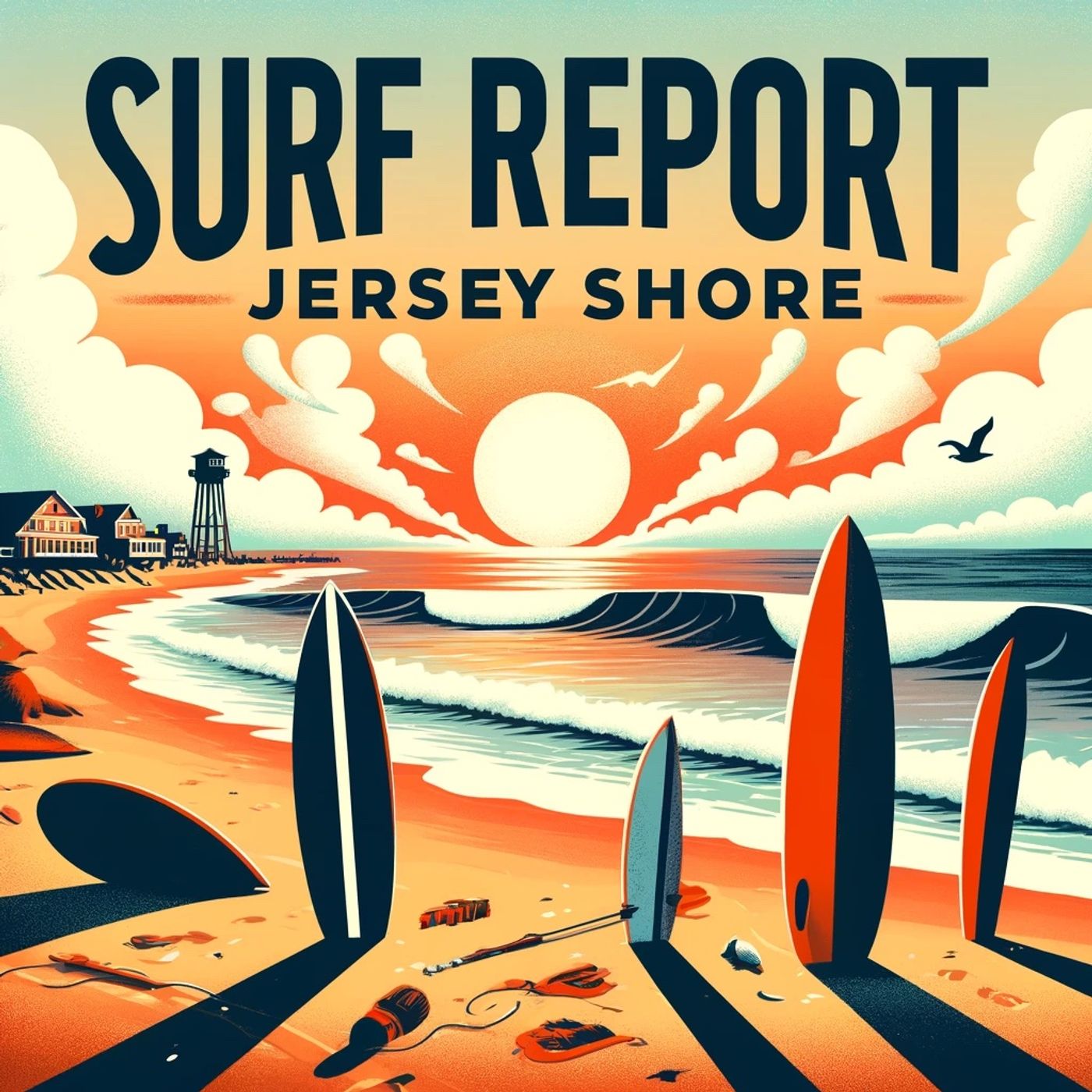
Surf Report - New Jersey Shore areas
by Inception Point Ai
Welcome to "Surf Report - Jersey Shore," your daily source for the latest surf updates along the stunning coastlines of the Jersey Shore and Monmouth area. Whether you're an experienced surfer or a beginner, our podcast provides real-time updates on wave heights, tides, wind conditions, and water temperatures to help you catch the best waves. Keywords: Jersey Shore surf report, daily surf conditions, Monmouth surf updates, NJ surf podcast, wave height report, surf gear reviews, surf safety tips, Jersey Shore surfers, New Jersey coastal surf, surf news and insightsfor more https://www.quietperiodplease.com/This show includes AI-generated content.
-
465
New Jersey Delaware Surf Forecast: Moderate Rip Currents Today, High Risk Friday With Three to Five Foot Waves
Good morning! Here's your surf zone forecast for New Jersey and Delaware. Today is shaping up to be a mixed bag across the region. We're looking at moderate rip current risk everywhere, with surf heights running two to three feet. Water temperatures are chilly, ranging from the lower fifty-two along the coast up to the upper fifty-eight near the Delaware beaches. Expect mostly cloudy skies with showers developing throughout the day. The high will hover in the mid-sixties, though the Delaware beaches could see upper-sixties near Ocean City and Rehoboth. Winds will be northeast, generally ten to twenty miles per hour, though they'll increase to around twenty this afternoon down south. Now here's where things get interesting. Friday is when the action really picks up. Rip current risk jumps to high across all beaches, so swimmers and waders need to be extra cautious. That's when life-threatening rip currents become likely in the surf zone. Surf heights will increase to three to five feet, giving surfers something to work with after today's small stuff. The winds will pick up notably, especially to the south. Down at Cape May and Rehoboth Beach, expect breezy conditions with east winds twenty to twenty-five miles per hour. Even up north near Long Beach Island, winds will be steady around twenty. Temperatures will dip slightly into the lower sixties, and we'll see more persistent showers, particularly across the Atlantic County beaches down to Rehoboth. One bit of good news is that thunderstorm potential drops to none on Friday, so while it'll be wet and windy, you won't have to worry about lightning. The water will still be cold, so make sure you're dressed appropriately. Stay safe out there and respect those rip currents, especially as they intensify tomorrow. For more http://www.quietplease.ai Get the best deals https://amzn.to/3ODvOta
-
464
New Jersey Delaware Surf Forecast Today Two to Three Foot Waves Moderate Rip Current Risk Afternoon Thunderstorms Expected
Good morning, this is your surf zone forecast for New Jersey and Delaware brought to you by the National Weather Service Mount Holly. Let's start with today's conditions across the region. We're looking at two to three foot surf throughout most of the Jersey Shore, with conditions ranging from the northern beaches near Sandy Hook all the way down through the Delaware coast. Water temperatures are still brisk, sitting in the upper 50s up north around Monmouth County and gradually warming as you head south, reaching the lower 60s down in Delaware. Now here's where things get interesting. We've got a moderate rip current risk in effect for most of New Jersey beaches today, though Delaware is looking a bit calmer with a low risk for rip currents. That said, always be cautious near groins, jetties, and piers where dangerous currents can develop even on low risk days. Weather-wise, we're starting the day sunny, but don't leave your umbrella at home. A system is moving in this afternoon, bringing showers and thunderstorms to the forecast. Northern Monmouth County has a moderate thunderstorm potential, while Long Beach Island also has moderate chances. The Atlantic City area and Cape May region are looking at low thunderstorm potential. And here's something important for anyone heading to the beach today: the UV index is very high across the board, so slather on that sunscreen. Winds will be light from the southwest around ten to fifteen miles per hour, and highs will range from the upper 70s down in Atlantic City to the mid-80s up north in Monmouth County. A perfect day to get in the water before that afternoon system rolls through. Now let's talk about Thursday. That system we mentioned is sticking around, so expect mostly cloudy skies with ongoing chances of showers. The thunderstorm potential drops to none across most of the region. However, we're seeing a significant shift in rip current risk. Delaware is upgrading from low to moderate risk, while the Jersey Shore will maintain that moderate risk we had today. So keep your head on a swivel out there. Surf heights remain consistent at two to three feet, but don't expect much in terms of swell. Water temperatures will stay chilly in the mid to upper 50s and lower 60s. Winds are switching to the northeast at fifteen to twenty miles per hour as we move toward Thursday, which will freshen things up considerably, especially down in Cape May and Delaware where northeast winds could reach twenty miles per hour. Temperatures are dropping too. Expect highs in the upper 60s to low 70s, so bring a light jacket if you're heading out Thursday. Sunrise is around 5:35 to 5:44 in the morning depending on your location, and sunset hangs on until around 8:10 in the evening, giving you plenty of daylight to work with. So here's the bottom line: today is your day if you want to get out there. Sunny start, reasonable temperatures, and lighter winds. Just watch out for that afternoon convection. Thursday looks wetter and cooler with stronger northeast winds, so bundle up and stay aware of those rip currents. Have a great day at the beach and stay safe out there. For more http://www.quietplease.ai Get the best deals https://amzn.to/3ODvOta
-
463
Tuesday September 30th NJ Delaware Beach Forecast Mostly Cloudy Two to Five Foot Surf High Rip Current Risk
Good morning, this is your Tuesday, September 30th surf zone forecast for New Jersey and Delaware beaches. A high rip current risk remains in effect from 8 AM this morning through this evening across all forecast areas, so swimmers and surfers need to stay alert and exercise caution in the water. Let's start up north at Eastern Monmouth, including Sandy Hook. Expect mostly cloudy skies with surf heights running two to three feet. Northeast winds will be light, coming in at five to ten miles per hour. Water temperatures are in the lower seventies, so you won't need much of a wetsuit today. High temperatures will reach the upper seventies, and with a moderate UV index, sunscreen is still recommended. Low tide at Belmar occurs at 7:14 AM, with high tide coming at 1:55 PM. Sunrise is at 6:50 AM and sunset at 6:42 PM. Heading down the coast to Long Beach Island and the Coastal Ocean zone, conditions remain mostly cloudy with two to three foot surf. Northeast winds will be a bit stronger here, ranging from ten to fifteen miles per hour. Water temperatures drop to the mid sixties, so a light spring suit might be a good idea. High temperatures reach the mid seventies. The low tide at Barnegat Inlet is at 8:05 AM with high tide at 2:23 PM. Sunrise is 6:51 AM and sunset at 6:43 PM. Moving further south to the Coastal Atlantic zone near Atlantic City, this is where we see the best surf of the day. Expect three to five foot waves with mostly cloudy conditions. Northeast winds again ten to fifteen miles per hour. Water temps are in the mid sixties. High temperatures reach the mid seventies with that moderate UV index. Low tide at Atlantic City is 7:28 AM, high tide at 2:12 PM. Sunrise at 6:52 AM, sunset at 6:44 PM. Continuing down to the Atlantic Coastal Cape May area, including Ocean City, we're back to two to three foot surf with mostly cloudy skies. Northeast winds ten to fifteen miles per hour with water temperatures in the upper sixties. Highs near the mid seventies. Low tide at Cape May is 7:49 AM, high tide at 2:46 PM. Sunrise at 6:53 AM and sunset at 6:46 PM. Finally, in Delaware at the beaches near Rehoboth, expect two to three foot surf with mostly cloudy conditions. Winds pick up a bit here with northeast winds at fifteen to twenty miles per hour. Water temperatures are in the lower seventies. High temperatures reach the mid seventies. Low tide at Rehoboth Beach is at 7:59 AM with high tide at 2:44 PM. Sunrise at 6:55 AM and sunset at 6:47 PM. The main story today remains that high rip current risk in effect from 8 AM through this evening across all zones. Life-threatening rip currents are likely in the surf zone, so if you're heading to the beach, always remember to swim near lifeguards, stay calm if caught in a rip current, and swim parallel to shore to escape. No thunderstorms are expected today, so weather wise you're looking at a decent beach day with mostly cloudy skies and moderate UV index throughout. Have a safe and enjoyable day at This content was created in partnership and with the help of Artificial Intelligence AI.
-
462
Tuesday New Jersey Delaware Beach Forecast High Rip Current Risk Two to Five Foot Surf Northeast Winds
Good morning, this is your Tuesday surf zone forecast for the New Jersey and Delaware beaches, brought to you by the National Weather Service in Mount Holly. A High Rip Current Risk is in effect from eight AM this morning through this evening for all beaches from Sandy Hook down to Rehoboth Beach, so swimmers and waders need to exercise extreme caution in the water today. Let's break down what to expect by region. Starting in Eastern Monmouth, including Sandy Hook, we're looking at two to three foot surf with northeast winds at five to ten miles per hour. Water temperatures are in the lower seventies, which should feel pretty comfortable. The high today reaches the upper seventies under mostly cloudy skies. A low tide occurs at seven fourteen in the morning, with high tide at one fifty-five in the afternoon. Moving south to Long Beach Island, the Coastal Ocean zone shows two to three foot surf with slightly stronger northeast winds of ten to fifteen miles per hour. The water here is notably cooler, sitting in the mid sixties. High temperatures will be in the mid seventies, and low tide hits at eight oh-five with high tide at two twenty-three. The Coastal Atlantic zone around Atlantic City is your best bet for bigger waves today. Expect three to five foot surf with the same ten to fifteen mile per hour northeast winds. Water temperatures remain in the mid sixties, and high temperatures reach the mid seventies. Low tide comes at seven twenty-eight with high tide at two twelve. Down in the Atlantic Coastal Cape May area near Ocean City, we're back to two to three foot surf with northeast winds at ten to fifteen miles per hour. Water temperatures here are in the upper sixties, and high temperatures will be in the mid seventies. Low tide is at seven forty-nine, high tide at two forty-six. Finally, at the Delaware Beaches near Rehoboth Beach, expect two to three foot surf with northeast winds picking up to fifteen to twenty miles per hour, the strongest of the day. Water temperatures are in the lower seventies, and highs reach the mid seventies. Low tide occurs at seven fifty-nine with high tide at two forty-four. Overall, today brings mostly cloudy skies with no thunderstorm potential and moderate UV levels across the board. Again, that High Rip Current Risk is in effect all day, so if you do venture into the water, stay alert and avoid swimming near groins, jetties, reefs, and piers where life-threatening rip currents are likely. Sunrise is around six fifty to six fifty-five depending on your location, with sunset around six forty-two to six forty-seven. Have a safe and enjoyable day at the beach. For more http://www.quietplease.ai Get the best deals https://amzn.to/3ODvOta This content was created in partnership and with the help of Artificial Intelligence AI.
-
461
Jersey Delaware Beaches High Rip Current Risk Tuesday September 30 Two to Five Foot Waves
Good morning everyone, it's Tuesday, September 30th, and we're diving right into what Mother Nature has in store for the Jersey and Delaware beaches today. Let's start with the big headline: a High Rip Current Risk is in effect from eight o'clock this morning through this evening across all our beaches. That means life-threatening rip currents are likely in the surf zone, so please exercise extreme caution if you're heading into the water. Always remember, if you get caught in a rip current, don't panic. Swim parallel to the shore until you escape the current's grip, then make your way back to safety. Now let's break down what's happening from north to south. Up in Eastern Monmouth, including Sandy Hook, we're looking at two to three foot waves with mostly cloudy skies and moderate UV conditions. The water's hovering in the lower seventies, which is still pretty comfortable for a dip. Northeast winds are light at five to ten miles per hour. Your low tide at Belmar comes in at seven fourteen in the morning with a high at one fifty-five in the afternoon. Moving down to Long Beach Island and the Coastal Ocean zone, we've got the same two to three foot surf, but the water temperature drops to the mid-sixties, so you might want to think about that wetsuit. Northeast winds pick up slightly to ten to fifteen miles per hour. Low tide at Barnegat Inlet is eight oh-five in the morning with high tide at two twenty-three in the afternoon. The action increases around Atlantic City in the Coastal Atlantic zone. That's where we're seeing the biggest waves of the day at three to five feet. Water temperatures remain in the mid-sixties. Northeast winds are steady at ten to fifteen miles per hour. Low tide at Atlantic City hits at seven twenty-eight in the morning, high tide at two twelve in the afternoon. Down towards Ocean City in the Atlantic Coastal Cape May zone, we drop back down to two to three foot waves with water in the upper sixties. Northeast winds are ten to fifteen miles per hour. Your tidal window at Cape May shows low at seven forty-nine in the morning and high at two forty-six in the afternoon. And finally, rounding out our forecast are the Delaware Beaches around Rehoboth. Two to three foot waves, water in the lower seventies, and northeast winds are the strongest of the bunch today at fifteen to twenty miles per hour. Low tide at Rehoboth is seven fifty-nine in the morning with high tide at two forty-four in the afternoon. Here's what you should know heading out today: no thunderstorms are expected anywhere along the coast, the UV index is moderate across the board, and it's going to be a mostly cloudy day. High temperatures will range from the upper seventies up north to the mid-seventies as you head south. Sunrise is between six fifty and six fifty-five, and sunset wraps things up between six forty-two and six forty-seven depending on your location. Bottom line? Get out there and enjoy the waves, but please respect that rip current ris This content was created in partnership and with the help of Artificial Intelligence AI.
-
460
High Rip Current Risk Tuesday New Jersey Delaware Beaches Two to Five Foot Surf Forecast
Good morning, this is your Tuesday, September 30th surf zone forecast for New Jersey and Delaware beaches, brought to you by the National Weather Service Mount Holly. A high rip current risk is in effect from eight AM this morning through this evening for all beaches in our forecast area, so swimmers and water enthusiasts need to exercise extreme caution. Let's start up north at Eastern Monmouth, including the beaches of Sandy Hook. Expect two to three foot surf with mostly cloudy skies throughout the day. Water temperatures are running in the lower seventies, so conditions are still quite pleasant for those brave enough to venture in. High temperatures will reach the upper seventies with northeast winds at five to ten miles per hour. The low tide at Belmar occurs at seven fourteen AM, with high tide following at one fifty-five PM. That high rip current risk remains in effect all day, so stay aware of those strong currents, especially near groins and jetties. Moving down the coast to Long Beach Island, we're looking at the same two to three foot surf and mostly cloudy conditions. However, water temperatures cool off to the mid-sixties here, and winds pick up slightly to ten to fifteen miles per hour from the northeast. High temperatures in the mid-seventies. At Barnegat Inlet, expect low tide at eight oh five AM and high tide at two twenty-three PM. Again, that high rip current risk is in effect, so please be cautious. The Coastal Atlantic zone around Atlantic City is where things get interesting. We're forecasting three to five foot surf, the largest of the day, under mostly cloudy skies. Water temperatures are in the mid-sixties with northeast winds at ten to fifteen miles per hour and highs in the mid-seventies. Low tide at Atlantic City comes at seven twenty-eight AM, high tide at two twelve PM. The high rip current risk applies here as well. Down at Ocean City in the Atlantic Coastal Cape May zone, expect two to three foot surf with water temperatures in the upper sixties. Northeast winds at ten to fifteen miles per hour and highs in the mid-seventies. Low tide at Cape May is seven forty-nine AM, high tide at two forty-six PM. Again, high rip current risk in effect. Finally, for Delaware's beaches near Rehoboth, we're looking at two to three foot surf with the strongest winds of the day at fifteen to twenty miles per hour from the northeast. Water temperatures are in the lower seventies, which should feel refreshing. High temperatures in the mid-seventies. Low tide at Rehoboth Beach occurs at seven fifty-nine AM with high tide at two forty-four PM. Across all zones, there is no thunderstorm potential today and UV levels are moderate, so sunscreen is still recommended. Sunrise times range from six fifty AM in the north to six fifty-five AM down in Delaware, with sunset occurring between six forty-two PM and six forty-seven PM. To summarize: a widespread high rip current risk means life-threatening rip currents are likely in the surf z This content was created in partnership and with the help of Artificial Intelligence AI.
-
459
Tuesday New Jersey Delaware Surf Forecast: 3 to 5 Foot Waves at Atlantic City with High Rip Current Risk
Good morning, this is your Tuesday surf zone forecast for New Jersey and Delaware, brought to you by the National Weather Service Mount Holly. Life-threatening rip currents are likely in the surf zone today, so a high rip current risk remains in effect from eight AM this morning through this evening. That means if you're heading to the beach, swim near lifeguard stations and be aware of the conditions. Let's break down what to expect by region. Up in Eastern Monmouth, including Sandy Hook, you're looking at two to three foot surf with mostly cloudy skies and northeast winds at five to ten miles per hour. Water temps are holding in the lower seventies, so it's still relatively pleasant. High temperatures will reach the upper seventies. Low tide at Belmar occurs at seven fourteen AM, with high tide coming in around one fifty-five PM. Moving down the coast to Long Beach Island, conditions remain fairly consistent with two to three foot waves and similar mostly cloudy weather. Northeast winds pick up slightly here to ten to fifteen miles per hour. Water temperatures cool down to the mid-sixties, and we'll see high temps in the mid-seventies. Low tide at Barnegat Inlet hits at eight oh-five AM with the next high tide at two twenty-three PM. The highlight of today has to be Atlantic City and the Coastal Atlantic zone, where you'll find the best surf action. Expect three to five foot waves, making this the premium spot if you're looking for more size. Otherwise, conditions mirror the rest of the coast with northeast winds ten to fifteen miles per hour and mid-seventies for the high. Low tide at Atlantic City is seven twenty-eight AM with high tide at two twelve PM. Down in Atlantic Coastal Cape May near Ocean City, surf drops back to two to three feet with northeast winds at ten to fifteen miles per hour. Water temps are in the upper sixties and highs will reach the mid-seventies. Cape May experiences low tide at seven forty-nine AM and high tide at two forty-six PM. Finally, wrapping up in Delaware at Rehoboth Beach, you're looking at two to three foot surf with the strongest winds of the day at fifteen to twenty miles per hour out of the northeast. Water temperatures are in the lower seventies and highs reach the mid-seventies. Low tide occurs at seven fifty-nine AM with high tide at two forty-four PM. Throughout all zones today, there is no thunderstorm potential and UV index levels remain moderate, so sunscreen is still recommended even with the mostly cloudy skies. Remember, high rip current risk means life-threatening rip currents are likely, so exercise caution if you're entering the water. Stay safe out there and enjoy the beach. For more http://www.quietplease.ai Get the best deals https://amzn.to/3ODvOta This content was created in partnership and with the help of Artificial Intelligence AI.
-
458
Tuesday Beach Forecast New Jersey Delaware Two to Five Foot Surf High Rip Current Risk Mostly Cloudy
Good morning, this is your Tuesday surf zone forecast for New Jersey and Delaware brought to you by the National Weather Service Mount Holly. A High Rip Current Risk is in effect from 8 AM this morning through this evening across all our beaches, so swimmers and water enthusiasts need to exercise caution today. Let's start up north at Eastern Monmouth and the Sandy Hook area. You're looking at two to three foot surf with mostly cloudy skies and moderate UV. Water temps are holding in the lower seventies, which is still pretty comfortable for September. Northeast winds at five to ten miles per hour will keep things relatively calm. High temps inland reaching the upper seventies. Low tide at Sandy Hook occurs at 7:14 AM with high tide at 1:55 PM. Moving down to Long Beach Island, conditions remain similar with two to three foot surf and northeast winds now picking up slightly to ten to fifteen miles per hour. The water here cools down a bit to the mid sixties as we move south. High temps settling in the mid seventies with mostly cloudy conditions throughout the day. Low tide comes in at 8:05 AM with high tide at 2:23 PM. The Atlantic City area sees the best surf of the day with three to five foot waves rolling in. Same mostly cloudy pattern continues with northeast winds at ten to fifteen miles per hour and moderate UV. Water temperature in the mid sixties. Low tide is at 7:28 AM with high tide at 2:12 PM. Around Ocean City and Cape May, we're back to two to three foot surf with northeast winds ten to fifteen miles per hour. Water temperature here sits in the upper sixties. Mostly cloudy skies dominate with highs in the mid seventies. Cape May reports low tide at 7:49 AM and high tide at 2:46 PM. Finally, at Delaware's beaches near Rehoboth, expect two to three foot surf under mostly cloudy skies with water temps in the lower seventies. The wind picks up here to fifteen to twenty miles per hour from the northeast. Moderate UV and highs in the mid seventies. Low tide at Rehoboth is at 7:59 AM with high tide at 2:44 PM. The key message today is respect that High Rip Current Risk. Life-threatening rip currents are likely in the surf zone, so if you're heading into the water, stay alert and know how to identify and escape a rip current. Swim near lifeguard stations and never fight a rip current directly. No thunderstorms are expected, so rain shouldn't be a concern. It's a decent beach day if you take precautions, so get out there and enjoy the coast. For more http://www.quietplease.ai Get the best deals https://amzn.to/3ODvOta This content was created in partnership and with the help of Artificial Intelligence AI.
-
457
Tuesday New Jersey Delaware Beach Forecast Two to Five Foot Surf High Rip Current Risk
Good morning, this is your Tuesday surf forecast for New Jersey and Delaware beaches, brought to you by the National Weather Service Mount Holly. High rip current risks are in effect from eight AM this morning through this evening across all our coastal zones, so swimmers and waders need to exercise extreme caution and be aware of these dangerous currents, especially near groins, jetties, and piers. Starting up north in Eastern Monmouth, including the Sandy Hook beaches, expect two to three foot surf with mostly cloudy skies and a high temperature in the upper seventies. Northeast winds will stay light at five to ten miles per hour. Water temps are in the lower seventies, making for decent swimming conditions despite the rip current threat. Low tide at Belmar comes in at seven fourteen this morning, with high tide at one fifty-five in the afternoon. Heading down the shore to Long Beach Island and the Coastal Ocean zone, we're looking at similar two to three foot waves but with slightly cooler water in the mid sixties. Northeast winds pick up a bit here to ten to fifteen miles per hour, and high temps will be in the mid seventies. Low tide at Barnegat Inlet is at eight oh-five AM, followed by high tide at two twenty-three in the afternoon. The Coastal Atlantic zone around Atlantic City is where conditions get more interesting. We're forecasting three to five foot surf here, the largest of the day. Water stays in the mid sixties with the same mostly cloudy skies. Northeast winds remain ten to fifteen miles per hour. Low tide at Atlantic City is seven twenty-eight AM, with high tide at two twelve PM. Moving south to the Atlantic Coastal Cape May area near Ocean City, surf drops back to two to three feet. Water temps edge up slightly to the upper sixties. Expect the same weather pattern with northeast winds at ten to fifteen miles per hour and highs in the mid seventies. Cape May's low tide is at seven forty-nine AM, high tide at two forty-six in the afternoon. Finally, wrapping up at the Delaware beaches including Rehoboth Beach, we're expecting two to three foot waves with water temps in the lower seventies. This zone sees the strongest winds of the day at fifteen to twenty miles per hour out of the northeast. Highs will be in the mid seventies. Low tide at Rehoboth Beach is seven fifty-nine AM, with high tide at two forty-four PM. Across all zones, there's no thunderstorm potential today and UV index is moderate, so apply that sunscreen. Sunrise is between six fifty and six fifty-five AM, with sunset between six forty-two and six forty-seven PM. Bottom line: You've got decent surf conditions today, but take those high rip currents seriously. Swim near lifeguards, stay alert, and have a great day at the beach. For more http://www.quietplease.ai Get the best deals https://amzn.to/3ODvOta This content was created in partnership and with the help of Artificial Intelligence AI.
-
456
New Jersey Delaware Surf Forecast Tuesday High Rip Current Risk Two to Five Foot Waves Mostly Cloudy Seventies
Good morning, this is your Tuesday surf zone forecast for New Jersey and Delaware brought to you by the National Weather Service in Mount Holly. A High Rip Current Risk is in effect from eight AM this morning through this evening for all beaches in the region, so swimmers and surfers need to exercise caution near the surf zone, especially around groins, jetties, reefs, and piers where these currents can be particularly dangerous. Let's start up north in Eastern Monmouth, including the beaches of Sandy Hook. Expect two to three foot surf with mostly cloudy skies. The water is sitting in the lower seventies, which should feel quite pleasant. Northeast winds will be light at five to ten miles per hour. Your high temperature will reach the upper seventies. Low tide comes at seven fourteen in the morning, with high tide at one fifty five in the afternoon. Moving south to Long Beach Island along the Coastal Ocean, we're looking at the same two to three foot surf but the water temperature drops into the mid sixties. Winds pick up slightly to ten to fifteen knots from the northeast. It'll be mostly cloudy with highs in the mid seventies. Low tide at Barnegat Inlet is at eight oh five AM, with high tide at two twenty three in the afternoon. The Coastal Atlantic zone around Atlantic City is where the best surf potential lies today with three to five foot waves. The water remains in the mid sixties with mostly cloudy conditions throughout the day. Northeast winds ten to fifteen miles per hour. Your high reaches the mid seventies. Atlantic City experiences low tide at seven twenty eight AM and high tide at two twelve in the afternoon. Down in the Atlantic Coastal Cape May zone near Ocean City, we're back to two to three foot surf. Water temperature climbs slightly into the upper sixties. Expect mostly cloudy skies with northeast winds at ten to fifteen miles per hour and highs in the mid seventies. Low tide occurs at seven forty nine AM, high tide at two forty six PM. Finally, at Delaware Beaches including Rehoboth Beach, we find two to three foot surf with water temperatures in the lower seventies. This area sees the strongest winds of the day at fifteen to twenty miles per hour from the northeast, but conditions remain mostly cloudy. Your high temperature reaches the mid seventies. Low tide is at seven fifty nine AM with high tide at two forty four in the afternoon. UV Index is moderate across all zones today, and there is no thunderstorm potential expected. Remember, respect the rip current risk, know the warning signs, and always swim near lifeguard stations. Check back tomorrow for your next update. For more http://www.quietplease.ai Get the best deals https://amzn.to/3ODvOta This content was created in partnership and with the help of Artificial Intelligence AI.
-
455
Tuesday Surf Forecast New Jersey Delaware High Rip Current Risk Two to Five Foot Waves Mostly Cloudy
Good morning, this is your Tuesday surf zone forecast for New Jersey and Delaware, brought to you by the National Weather Service Mount Holly. A HIGH RIP CURRENT RISK is in effect from eight AM this morning through this evening across all beaches, so please exercise extreme caution in the water today. Starting up north at Eastern Monmouth and Sandy Hook, we're looking at two to three foot surf with mostly cloudy skies. The water is a pleasant lower seventies, though northeast winds will be light at five to ten miles per hour. Low tide comes at seven fourteen this morning with high tide around one fifty five in the afternoon. The high temperature reaches the upper seventies with moderate UV and no thunderstorm potential. Heading down to Long Beach Island on the Coastal Ocean, conditions remain mostly cloudy with two to three foot waves and water temps in the mid sixties. Northeast winds pick up slightly to ten to fifteen miles per hour. Low tide at Barnegat Inlet occurs at eight oh five AM with high tide at two twenty three PM. Expect a moderate UV index and highs in the mid seventies. The Coastal Atlantic around Atlantic City offers the most exciting surf of the day with three to five foot waves. Water temperatures hover in the mid sixties with northeast winds at ten to fifteen miles per hour and mostly cloudy conditions. Atlantic City experiences low tide at seven twenty eight AM and high tide at two twelve PM. Moving south to Ocean City and Atlantic Coastal Cape May, we're back to two to three foot surf with upper sixties water temps. Northeast winds remain at ten to fifteen miles per hour under mostly cloudy skies with highs in the mid seventies. Low tide at Cape May is seven forty nine AM with high tide at two forty six PM. Finally, Delaware Beaches near Rehoboth Beach rounds out today's forecast with two to three foot waves and lower seventies water temperatures. This area sees the strongest winds of the day with northeast winds at fifteen to twenty miles per hour. Low tide at Rehoboth occurs at seven fifty nine AM with high tide at two forty four PM and highs in the mid seventies. Remember, rip currents are LIKELY in the surf zone today, so swim near lifeguarded beaches and always stay aware of conditions near groins, jetties, and piers where dangerous rip currents often form. Have a safe day on the beach. For more http://www.quietplease.ai Get the best deals https://amzn.to/3ODvOta This content was created in partnership and with the help of Artificial Intelligence AI.
-
454
New Jersey Delaware Beach Forecast Tuesday September 30th High Rip Current Risk 3 to 5 Foot Waves
Good morning, this is your Tuesday, September 30th surf zone forecast for New Jersey and Delaware beaches, brought to you by the National Weather Service Mount Holly. A High Rip Current Risk is in effect from 8 AM this morning through this evening across all beaches in the region, so swimmers and water enthusiasts need to exercise extreme caution, especially near groins, jetties, and piers where life-threatening rip currents are likely to occur. Let's start up north at Eastern Monmouth, including the beaches of Sandy Hook. You're looking at 2 to 3 foot waves today with mostly cloudy skies and moderate UV index. Water temps are in the lower 70s, which is still quite pleasant. Northeast winds will be light, running 5 to 10 miles per hour. The low tide at Belmar comes at 7:14 AM with the high tide hitting at 1:55 in the afternoon. Sunrise is at 6:50 AM and sunset at 6:42 PM, so you've got plenty of daylight. No thunderstorm potential today. Moving down to Long Beach Island and the Coastal Ocean zone, conditions remain mostly cloudy with similar surf heights of 2 to 3 feet. However, the water temperature drops to the mid 60s, so you might want to consider a wetsuit. Northeast winds pick up slightly to 10 to 15 miles per hour. Low tide at Barnegat Inlet is at 8:05 AM with high tide at 2:23 PM. The UV index remains moderate with no thunderstorm concerns. The Coastal Atlantic zone near Atlantic City is where you'll find the most impressive surf of the day. Expect 3 to 5 foot waves, which is definitely the highlight for surfers and wave riders. Water temps are in the mid 60s, same as Long Beach Island. Northeast winds of 10 to 15 miles per hour, mostly cloudy skies, and moderate UV. Low tide at Atlantic City is 7:28 AM with high tide at 2:12 PM. Further south in the Atlantic Coastal Cape May area, including Ocean City beaches, conditions settle back down to 2 to 3 foot waves. Water temps are in the upper 60s, still cool but manageable. Northeast winds run 10 to 15 miles per hour. Low tide at Cape May is at 7:49 AM and high tide at 2:46 PM. Finally, over at Delaware beaches near Rehoboth, you're looking at 2 to 3 foot surf with water temps in the lower 70s, actually some of the warmest along the coast today. This zone sees the strongest winds of the day with northeast gusts at 15 to 20 miles per hour. Low tide at Rehoboth Beach is 7:59 AM with high tide at 2:44 PM. One last important reminder: life-threatening rip currents are likely in the surf zone today. If you do find yourself caught in a rip current, remain calm and swim parallel to the shore until you've escaped the current's pull, then swim back to shore at an angle. Never try to swim directly against the current. High temperatures across the region will reach the mid to upper 70s, so it's a pleasant late September day at the beach, just watch out for those rip currents. For more http://www.quietplease.ai Get the best deals https://amzn.to/3ODvOta This content was created in partnership and with the help of Artificial Intelligence AI.
-
453
NJ Delaware Beach Forecast Tuesday High Rip Current Risk 2 to 5 Foot Surf Moderate Temperatures
Good morning. This is your Tuesday surf zone forecast for New Jersey and Delaware, brought to you by the National Weather Service Mount Holly. A HIGH RIP CURRENT RISK is in effect from 8 AM this morning through this evening across all beaches, so swimmers and surfers should exercise extreme caution and be aware of these dangerous currents. Let's break down conditions by region, starting up north with Eastern Monmouth County, including Sandy Hook. You're looking at 2 to 3 foot surf with mostly cloudy skies. Water temps are in the lower 70s, and northeast winds are light at 5 to 10 miles per hour. High temperatures will reach the upper 70s. No thunderstorms are expected, and UV levels are moderate. Low tide in Belmar occurs at 7:14 AM, with high tide at 1:55 PM. Moving south to Long Beach Island, surf heights remain 2 to 3 feet, but water temperatures are noticeably cooler in the mid 60s. Northeast winds pick up slightly to 10 to 15 miles per hour. It'll be mostly cloudy with highs in the mid 70s. The low tide at Barnegat Inlet is at 8:05 AM, followed by high tide at 2:23 PM. Atlantic City beaches see the most significant surf of the day with 3 to 5 foot waves. Water temps are mid 60s, northeast winds are 10 to 15 miles per hour, and highs reach the mid 70s. Low tide occurs at 7:28 AM with high tide at 2:12 PM. Down at the Cape May beaches near Ocean City, you'll find 2 to 3 foot surf with upper 60s water temperatures. Northeast winds are 10 to 15 miles per hour with mid 70s highs. Low tide is at 7:49 AM and high tide at 2:46 PM. Finally, the Delaware beaches near Rehoboth are experiencing 2 to 3 foot surf with lower 70s water temperatures. This area sees the strongest winds of the region with northeast gusts at 15 to 20 miles per hour. Highs reach the mid 70s, with low tide at 7:59 AM and high tide at 2:44 PM. Across all regions today, there's no thunderstorm potential and moderate UV levels. Sunrise is between 6:50 and 6:55 AM, with sunset between 6:42 and 6:47 PM. Remember, that HIGH RIP CURRENT RISK means life-threatening rip currents are likely in the surf zone today. Even in areas near groins, jetties, reefs, and piers, conditions can be particularly hazardous. Stay safe out there and enjoy the beach responsibly. For more http://www.quietplease.ai Get the best deals https://amzn.to/3ODvOta This content was created in partnership and with the help of Artificial Intelligence AI.
-
452
New Jersey Delaware Surf Forecast Tuesday High Rip Current Risk 2 to 5 Foot Waves
Good morning, here's your surf zone forecast for New Jersey and Delaware this Tuesday, September 30th. A HIGH RIP CURRENT RISK is in effect from 8 AM this morning through this evening across all beaches, so swimmers and waders need to exercise extreme caution in the water. Starting up north in Eastern Monmouth, including Sandy Hook, expect 2 to 3 foot surf with mostly cloudy skies and moderate UV. Northeast winds will be light at 5 to 10 miles per hour. Water temperatures are pleasant in the lower 70s. High temperatures will reach the upper 70s. Low tide at Belmar occurs at 7:14 AM with high tide at 1:55 PM. Moving down the coast to Long Beach Island, we're looking at 2 to 3 foot surf as well, but water temps drop to the mid 60s. Northeast winds pick up slightly to 10 to 15 miles per hour under mostly cloudy skies. Expect highs in the mid 70s. Low tide at Barnegat Inlet is at 8:05 AM with high tide at 2:23 PM. The Atlantic City area will see the best surf of the day with 3 to 5 foot waves. Water temps remain in the mid 60s with moderate UV and mostly cloudy conditions. Northeast winds are 10 to 15 miles per hour. Low tide at Atlantic City is 7:28 AM and high tide at 2:12 PM. Further south at Ocean City, we drop back to 2 to 3 foot surf with water temps in the upper 60s. Northeast winds stay at 10 to 15 miles per hour under mostly cloudy skies. Low tide at Cape May is 7:49 AM and high tide is 2:46 PM. Finally, at the Delaware beaches near Rehoboth Beach, expect 2 to 3 foot surf with water temps in the lower 70s. Here's where the winds are strongest, gusting to 15 to 20 miles per hour from the northeast. Highs reach the mid 70s under mostly cloudy skies. Low tide at Rehoboth Beach is at 7:59 AM with high tide at 2:44 PM. There's no thunderstorm threat anywhere along the coast today, so at least that's good news. Just remember that rip currents will be life threatening in the surf zone, particularly around groins, jetties, reefs, and piers. If you get caught in a rip, swim parallel to the shore to escape. For more http://www.quietplease.ai Get the best deals https://amzn.to/3ODvOta This content was created in partnership and with the help of Artificial Intelligence AI.
-
451
Tuesday New Jersey Delaware Surf Forecast High Rip Current Risk Two to Five Foot Waves Safe Beach Swimming Tips
Good morning, this is your Tuesday surf zone forecast for New Jersey and Delaware, brought to you by the National Weather Service. If you're thinking about heading to the beach today, listen up because we've got some important information to share. A HIGH RIP CURRENT RISK is in effect from eight AM this morning through this evening across all beaches in New Jersey and Delaware. That means life-threatening rip currents are likely in the surf zone, so please exercise extreme caution if you're planning to enter the water. Let's break down what to expect by region, starting up north at Sandy Hook and Eastern Monmouth. You're looking at two to three foot surf with mostly cloudy skies and a high near the upper seventies. Water temps are running in the lower seventies, which is still pretty pleasant. Winds will be light out of the northeast at five to ten miles per hour. High tide in Belmar comes around one fifty-five in the afternoon, so plan accordingly. Heading down the coast to Long Beach Island, conditions are fairly similar with two to three foot surf, but the water cools down a bit to the mid-sixties. Expect northeast winds a touch stronger at ten to fifteen miles per hour. Barnegat Inlet will see high tide at two twenty-three PM. Now things get interesting around Atlantic City. This is where we see the biggest surf of the day with waves reaching three to five feet. Water temperature stays in the mid-sixties, and winds continue out of the northeast at ten to fifteen miles per hour. Still mostly cloudy with that moderate UV index, so sunscreen is still a good idea. Moving further south to Ocean City and the Cape May area, we're back down to two to three foot waves. The water temperature climbs slightly to the upper sixties, and winds remain steady from the northeast at ten to fifteen miles per hour. High tide at Cape May occurs around two forty-six PM. Finally, wrapping up at Delaware's Rehoboth Beach, expect two to three foot surf with the strongest winds of the day out of the northeast at fifteen to twenty miles per hour. Water temperature returns to the lower seventies, making it one of the warmest spots along the coast today. Across all locations, we're looking at mostly cloudy skies with no thunderstorm potential. The moderate UV index means you'll still want that sunscreen even on a cloudy day. There's no rain in the forecast, so at least you won't be dealing with that. One more time, remember that HIGH RIP CURRENT RISK remains in effect until this evening. Rip currents can be deadly, especially near groins, jetties, and piers. If you do go in the water, always swim near lifeguard stations and never swim alone. If you get caught in a rip current, don't panic. Swim parallel to the beach until you're out of the current, then swim back to shore at an angle. Stay safe out there and enjoy what looks to be a decent beach day despite those rip current warnings. This is your Tuesday morning surf zone forecast. For more http://www.quietplea This content was created in partnership and with the help of Artificial Intelligence AI.
-
450
High Rip Current Risk Tuesday New Jersey Delaware Beaches 2 to 5 Foot Surf Forecast
Good morning, this is your Tuesday, September 30th surf zone forecast for New Jersey and Delaware beaches. A High Rip Current Risk is in effect from 8 AM this morning through this evening along the entire New Jersey and Delaware coastline. If you're planning to hit the water today, exercise extreme caution and always swim near a lifeguard. Let's break down conditions by region, starting up north at Eastern Monmouth, including the Sandy Hook beaches. You're looking at 2 to 3 foot surf with mostly cloudy skies throughout the day. The water sits in the lower 70s, which is still pleasant for this time of year. Northeast winds will be light at 5 to 10 miles per hour. High temperatures reaching the upper 70s make it a nice beach day, just be aware of that high rip current risk. Low tide at Belmar comes at 7:14 AM, with high tide at 1:55 PM. Moving south to Long Beach Island and the Coastal Ocean zone, you'll see similar 2 to 3 foot waves with mostly cloudy conditions. Water temps drop slightly to the mid 60s here, and winds pick up a bit to 10 to 15 miles per hour out of the northeast. Expect your high around the mid 70s. The low tide at Barnegat Inlet occurs at 8:05 AM with high tide at 2:23 PM. The Coastal Atlantic zone around Atlantic City is your most active surf spot today. Waves build to 3 to 5 feet, making it the best option if you're looking for more size. Water temperatures remain in the mid 60s with northeast winds at 10 to 15 miles per hour. Again, mostly cloudy throughout the day with highs in the mid 70s. At Atlantic City, low tide hits at 7:28 AM and high tide at 2:12 PM. Down at Ocean City and the Atlantic Coastal Cape May region, you're back to 2 to 3 foot waves. Water temps sit in the upper 60s with northeast winds at 10 to 15 miles per hour. Mostly cloudy skies and mid 70s for your high. Low tide at Cape May comes at 7:49 AM, high tide at 2:46 PM. Finally, Delaware's beaches around Rehoboth Beach offer 2 to 3 foot surf with slightly stronger northeast winds at 15 to 20 miles per hour. Water temperatures are in the lower 70s, making this one of the warmer spots today. Highs reaching the mid 70s and mostly cloudy conditions throughout. Low tide at Rehoboth Beach occurs at 7:59 AM with high tide at 2:44 PM. Across all zones today, there's no thunderstorm potential and UV levels are moderate, so don't forget your sunscreen. The best window for water activities looks to be between the early morning low tides and the afternoon highs. Remember, life-threatening rip currents are likely in the surf zone today, so always swim near lifeguards and never turn your back to the ocean. Stay safe out there. For more http://www.quietplease.ai Get the best deals https://amzn.to/3ODvOta This content was created in partnership and with the help of Artificial Intelligence AI.
-
449
NJ Delaware Surf Forecast Tuesday High Rip Current Risk 2 to 5 Foot Waves Beach Safety
Good morning, this is your Tuesday surf zone forecast for New Jersey and Delaware, brought to you by the National Weather Service Mount Holly. A High Rip Current Risk is in effect from 8 AM this morning through this evening across all our beaches, so swimmers and surfers need to exercise extra caution in the water today. Let's start up north at Eastern Monmouth, including Sandy Hook. We're looking at 2 to 3 foot surf with mostly cloudy skies. Water temperatures are pleasant, sitting in the lower 70s. Expect northeast winds at 5 to 10 miles per hour with highs in the upper 70s. Low tide at Belmar hits at 7:14 AM, with high tide arriving at 1:55 PM. Moving south to Long Beach Island, conditions are similar with 2 to 3 foot surf, though waters cool down to the mid 60s. Northeast winds pick up slightly to 10 to 15 miles per hour. We're looking at highs in the mid 70s. Low tide at Barnegat Inlet occurs at 8:05 AM with high tide at 2:23 PM. The Coastal Atlantic near Atlantic City is where we'll see the most significant surf today, with waves building to 3 to 5 feet. Water temps remain in the mid 60s with northeast winds at 10 to 15 miles per hour. Low tide at Atlantic City is at 7:28 AM and high tide at 2:12 PM. Down at Cape May near Ocean City, we're back to 2 to 3 foot surf with water temperatures in the upper 60s. Northeast winds at 10 to 15 miles per hour with mid 70s highs. Low tide occurs at 7:49 AM with high tide at 2:46 PM. Finally, wrapping up at the Delaware beaches including Rehoboth Beach, expect 2 to 3 foot surf with the strongest winds of the day, gusting 15 to 20 miles per hour from the northeast. Waters sit in the lower 70s with mid 70s highs. Low tide at Rehoboth is at 7:59 AM and high tide at 2:44 PM. Across all zones, UV levels are moderate, thunderstorm potential is none, and skies will remain mostly cloudy throughout the day. Remember, that High Rip Current Risk means life-threatening rip currents are likely in the surf zone today. Stay aware, especially near groins, jetties, reefs, and piers where rip currents often intensify. Have a safe day at the beach. For more http://www.quietplease.ai Get the best deals https://amzn.to/3ODvOta This content was created in partnership and with the help of Artificial Intelligence AI.
-
448
High Rip Current Risk Tuesday New Jersey Delaware Beaches Surf Forecast Two to Five Feet Waves
Good morning! Welcome to your Tuesday, September thirtieth surf zone forecast for New Jersey and Delaware beaches. I'm reporting from the National Weather Service Mount Holly, and we've got some important information to share before you head to the shore. First things first, a high rip current risk is in effect from eight AM this morning through this evening across all our beaches. That means life-threatening rip currents are likely in the surf zone, so swimmers and water enthusiasts need to exercise serious caution and respect the ocean today. Let's break down what to expect by region, starting up north. Eastern Monmouth, including the iconic beaches of Sandy Hook, will see surf heights of two to three feet with mostly cloudy skies. Water temperatures are in the lower seventies, making for a relatively comfortable dip if you're brave enough. Northeast winds will be light at five to ten miles per hour, and high temperatures will reach the upper seventies. Moving down the coast to Long Beach Island and the Coastal Ocean zone, conditions are similar with two to three foot surf, though water temperatures drop to the mid sixties. Northeast winds pick up slightly to ten to fifteen miles per hour here. The high will be around the mid seventies with mostly cloudy conditions throughout the day. The Coastal Atlantic zone around Atlantic City is where things get more interesting. This area is expecting the largest surf of the day at three to five feet. Same mostly cloudy weather pattern continues, with water temperatures in the mid sixties and northeast winds at ten to fifteen miles per hour. Down around Ocean City in the Atlantic Coastal Cape May zone, we're back to two to three foot waves with water temperatures in the upper sixties. Expect mostly cloudy skies and northeast winds of ten to fifteen miles per hour, with highs in the mid seventies. Finally, wrapping up in Delaware at Rehoboth Beach, we're looking at two to three foot surf with water temperatures in the lower seventies. Delaware will experience the strongest winds of the day at fifteen to twenty miles per hour from the northeast. Mostly cloudy skies and highs in the mid seventies round out the forecast. UV index across all zones is moderate, so don't forget your sunscreen even on this cloudy day. No thunderstorms are expected anywhere along the coast, so at least you won't have to worry about lightning strikes while you're battling those rip currents. One more time, please remember the high rip current risk is in effect from eight AM through this evening. If you do venture into the water, swim near lifeguard stations, avoid swimming alone, and if you get caught in a rip current, swim parallel to the shore rather than fighting directly against it. Have a safe and enjoyable day at the beach! For more http://www.quietplease.ai Get the best deals https://amzn.to/3ODvOta This content was created in partnership and with the help of Artificial Intelligence AI.
-
447
NJ Delaware Surf Forecast Tuesday High Rip Current Risk Two to Five Foot Waves
Good morning, here's your Tuesday surf zone forecast for New Jersey and Delaware brought to you by the National Weather Service. A high rip current risk is in effect from eight AM this morning through this evening for all beaches from Sandy Hook down through the Delaware coast. That means life-threatening rip currents are likely in the surf zone, so please exercise extreme caution if you're heading into the water today. Starting up north at Sandy Hook and the Eastern Monmouth beaches, expect two to three foot surf with mostly cloudy skies and a high near the upper seventies. Northeast winds will be light at five to ten miles per hour. Water temperatures are running in the lower seventies, which should feel pretty refreshing. Low tide at Belmar occurs at seven fourteen this morning with high tide coming at one fifty five in the afternoon. As we head down the Jersey Shore to Long Beach Island, conditions remain mostly the same with two to three foot surf and moderate UV, but the winds pick up slightly to ten to fifteen miles per hour from the northeast. The water here is noticeably cooler though, sitting in the mid sixties. Your high for the day will be in the mid seventies with low tide at Barnegat Inlet at eight oh five AM. The Coastal Atlantic region including Atlantic City is looking like the best swell of the day. Expect three to five foot surf along with that high rip current risk. Northeast winds are ten to fifteen miles per hour, water temps in the mid sixties, and a high around the mid seventies. Low tide comes at seven twenty eight in the morning. Down at Ocean City and the Atlantic Coastal Cape May area, we're back to two to three foot surf with mostly cloudy conditions and that persistent high rip current risk. Northeast winds at ten to fifteen miles per hour with highs in the mid seventies and water temperatures in the upper sixties. Low tide is at seven forty nine AM. Finally, rounding out our forecast at Delaware's Rehoboth Beach, expect two to three foot surf with northeast winds picking up a bit to fifteen to twenty miles per hour, making it the windiest stretch of the coast today. Water temperatures are in the lower seventies and highs will reach the mid seventies. Low tide at Rehoboth Beach occurs at seven fifty nine this morning. Bottom line: beautiful mostly cloudy skies all day, moderate UV index, but that high rip current risk means currents are likely to be life-threatening in the surf zone. Stick to the lifeguarded beaches, swim near the lifeguard stands, and be especially cautious around groins, jetties, and piers where rip currents often concentrate. No thunderstorms are expected, so it's a safe day weather-wise, just watch out for those currents. For more http://www.quietplease.ai Get the best deals https://amzn.to/3ODvOta This content was created in partnership and with the help of Artificial Intelligence AI.
-
446
New Jersey Delaware Beach Forecast Tuesday High Rip Current Risk Two to Five Foot Surf
Good morning everyone, this is your Tuesday surf and beach forecast for New Jersey and Delaware, brought to you by the National Weather Service Mount Holly. A HIGH RIP CURRENT RISK is in effect from eight AM this morning through this evening across all our beaches, so please exercise extreme caution if you're heading into the water today. Let's break down conditions by region, starting up north in Eastern Monmouth County, including the Sandy Hook area. You're looking at two to three foot surf with mostly cloudy skies and a high near the upper seventies. Northeast winds will be light at five to ten miles per hour, and water temperatures are sitting in the lower seventies. The low tide comes at seven fourteen AM with high tide at one fifty five PM. Moving down the Jersey Shore to Long Beach Island, surf heights remain two to three feet with water temperatures cooling to the mid sixties. Winds pick up slightly to ten to fifteen knots from the northeast. High tide at Barnegat Inlet occurs at two twenty three PM, following a low at eight oh five AM. Around Atlantic City, we're seeing the most impressive surf of the day with three to five foot waves. Water temperature is mid sixties with the same mostly cloudy conditions. Northeast winds at ten to fifteen miles per hour will keep conditions relatively calm. High tide is at two twelve PM after an early morning low at seven twenty eight. Down in Ocean City and the Atlantic Coastal Cape May region, expect two to three foot surf with water temperatures in the upper sixties. High tide comes at two forty six PM at Cape May following the low at seven forty nine AM. Finally, over in Delaware at Rehoboth Beach, two to three foot surf with water temperatures in the lower seventies. Winds are a bit stronger here, northeast at fifteen to twenty miles per hour. High tide is at two forty four PM. Thunderstorm potential is none across the region, and UV index is moderate throughout. Sunrise this morning is between six fifty and six fifty five AM, with sunset between six forty two and six forty seven PM depending on your location. Remember, that HIGH RIP CURRENT RISK means life threatening rip currents are likely in the surf zone today. Even strong swimmers should think twice about entering the water. If you do go in, always swim near lifeguards and stay alert to those dangerous currents, especially near jetties, groins, and piers where they're even more likely to form. Have a safe and enjoyable beach day. For more http://www.quietplease.ai Get the best deals https://amzn.to/3ODvOta This content was created in partnership and with the help of Artificial Intelligence AI.
-
445
New Jersey Delaware Beach Forecast High Rip Current Risk 2 to 5 Foot Surf Tuesday
Good morning! Here's your Tuesday surf zone forecast for New Jersey and Delaware brought to you by the National Weather Service. Life-threatening rip currents are likely in the surf zone today, so a High Rip Current Risk is in effect from 8 AM this morning through this evening. If you're heading to the beach, please exercise extreme caution and never swim near groins, jetties, reefs, or piers where rip currents are even more dangerous. Let's break down conditions by region. Up in Eastern Monmouth, including Sandy Hook, expect modest surf heights of 2 to 3 feet with mostly cloudy skies. Water temperatures sit in the lower 70s, so it'll feel pretty comfortable for a dip. Winds will be light, coming from the northeast at 5 to 10 miles per hour. Low tide occurs around 7:14 AM with high tide at 1:55 PM. Sunrise is at 6:50 AM and sunset at 6:42 PM. Moving down to Long Beach Island and the Coastal Ocean zone, surf heights remain at 2 to 3 feet with mostly cloudy conditions persisting. However, you'll notice the water temperature drops to the mid 60s, so bring a wetsuit if you plan to stay in longer. Northeast winds pick up slightly to 10 to 15 miles per hour. Low tide is at 8:05 AM with high tide following at 2:23 PM. The Coastal Atlantic beaches near Atlantic City are looking like the best waves of the day, with surf heights reaching 3 to 5 feet. Water temperatures remain in the mid 60s under mostly cloudy skies. Northeast winds stay at 10 to 15 miles per hour. Low tide hits at 7:28 AM and high tide at 2:12 PM. Heading south to Ocean City in Atlantic Coastal Cape May, conditions settle back down to 2 to 3 foot waves with upper 60s water temperatures. Northeast winds are 10 to 15 miles per hour. Low tide occurs at 7:49 AM with high tide at 2:46 PM. Finally, over at Delaware's Rehoboth Beach, expect 2 to 3 foot surf with mostly cloudy weather and lower 70s water temperatures. This is where the windiest conditions will be, with northeast winds reaching 15 to 20 miles per hour. Low tide is at 7:59 AM and high tide at 2:44 PM. Across all zones today, there's no thunderstorm potential and UV levels are moderate, so sunscreen is still recommended. Highs will range from the mid to upper 70s depending on your location. Remember, that High Rip Current Risk is no joke. If you do get caught in a rip current, stay calm, don't panic, and swim parallel to the shore until you escape its pull. Have a safe and enjoyable day at the beach! For more http://www.quietplease.ai Get the best deals https://amzn.to/3ODvOta This content was created in partnership and with the help of Artificial Intelligence AI.
-
444
New Jersey Delaware Beach Forecast Tuesday September 30th High Rip Current Risk Surf Update
Good morning, this is your Tuesday, September 30th surf zone forecast for New Jersey and Delaware beaches, brought to you by the National Weather Service Mount Holly. We're starting the day with a high rip current risk in effect from 8 AM this morning through this evening across all of our beaches. So if you're planning a water visit today, please exercise extreme caution and be aware that life-threatening rip currents are likely in the surf zone. Let's break down what we're expecting by region: Up in Eastern Monmouth, including Sandy Hook, we're looking at surf heights of 2 to 3 feet with mostly cloudy skies. Water temperatures are in the lower 70s, which is still quite pleasant. We'll see northeast winds at 5 to 10 miles per hour, making it relatively calm up there. High temperatures will reach the upper 70s. The low tide at Belmar comes in at 7:14 in the morning, with high tide at 1:55 in the afternoon. Moving down to Long Beach Island and the coastal ocean areas, we're maintaining those 2 to 3 foot surf heights, but the water temperature drops a bit to the mid 60s. Winds pick up slightly to 10 to 15 miles per hour from the northeast. Expect mostly cloudy conditions and highs in the mid 70s. Low tide at Barnegat Inlet is at 8:05 AM, with high tide following at 2:23 PM. Now, if you're around Atlantic City and the Coastal Atlantic beaches, this is where we see the most significant surf activity today. We're expecting 3 to 5 foot waves, the largest on the Jersey coast. Water temperatures here are also in the mid 60s, and northeast winds will be 10 to 15 miles per hour. Low tide is at 7:28 AM with high tide at 2:12 PM. Down in Ocean City and the Atlantic Coastal Cape May region, we're back to 2 to 3 foot surf with water temperatures in the upper 60s. Northeast winds are 10 to 15 miles per hour. High tide at Cape May occurs at 2:46 PM. Finally, across the Delaware beaches near Rehoboth, we've got 2 to 3 foot waves as well, with water temperatures in the lower 70s. Here's where we see the strongest winds of the day, gusting 15 to 20 miles per hour from the northeast. Low tide comes at 7:59 AM with high tide at 2:44 PM. Overall, no thunderstorms are expected today, and UV levels are moderate across the board, so don't forget your sunscreen if you're heading out. The big takeaway for today is that high rip current risk across all beaches. These currents can develop suddenly and with intensity, particularly around groins, jetties, reefs, and piers. If you do venture into the water, swim near lifeguard stations, never swim alone, and if caught in a rip current, remain calm and swim parallel to the shore until you escape the current's pull. Stay safe out there, and enjoy the rest of your Tuesday. For more http://www.quietplease.ai Get the best deals https://amzn.to/3ODvOta This content was created in partnership and with the help of Artificial Intelligence AI.
-
443
New Jersey Delaware Surf Forecast Tuesday September 30 High Rip Current Risk 2 to 5 Foot Waves
Good morning! Here's your New Jersey and Delaware surf zone forecast for Tuesday, September 30th. A HIGH RIP CURRENT RISK is in effect from 8 AM this morning through this evening across all beaches, so if you're heading to the water, exercise extreme caution and always swim near lifeguards. Starting up north in Eastern Monmouth, including Sandy Hook, expect 2 to 3 foot waves with mostly cloudy skies and moderate UV. Water temps are in the lower 70s, which is still pretty pleasant. Northeast winds will be light, just 5 to 10 miles per hour. High temperature today reaches the upper 70s. Low tide at Belmar occurs at 7:14 AM with high tide at 1:55 PM. Sunrise is at 6:50 AM and sunset at 6:42 PM. Moving down the shore to Long Beach Island and the Coastal Ocean zone, surf heights pick up slightly to 2 to 3 feet. Water temperatures drop to the mid 60s here, so you might want that wetsuit. Northeast winds strengthen a bit to 10 to 15 miles per hour. Expect mostly cloudy conditions with moderate UV and highs in the mid 70s. Low tide at Barnegat Inlet is at 8:05 AM with high tide at 2:23 PM. Further south in the Coastal Atlantic zone near Atlantic City, this is where we see the most impressive surf today with waves running 3 to 5 feet. Water temps remain in the mid 60s and northeast winds stay at 10 to 15 miles per hour. It'll be mostly cloudy with moderate UV and highs in the mid 70s. Low tide hits at 7:28 AM and high tide at 2:12 PM in Atlantic City. Down at the Atlantic Coastal Cape May zone around Ocean City, we're back to 2 to 3 foot waves with upper 60s water temps and northeast winds at 10 to 15 miles per hour. Mostly cloudy skies, moderate UV, and mid 70s for highs. Low tide at Cape May is at 7:49 AM with high tide at 2:46 PM. Finally, heading to Delaware and Rehoboth Beach, expect 2 to 3 foot waves with water temps in the lower 70s. The wind here is the strongest of the day, gusting to 15 to 20 miles per hour from the northeast. Mostly cloudy conditions with moderate UV and highs in the mid 70s. Low tide at Rehoboth is at 7:59 AM and high tide at 2:44 PM. Remember that rip currents will be likely in the surf zone all day, especially near jetties, groins, and piers. Have a great day at the beach and stay safe out there! For more http://www.quietplease.ai Get the best deals https://amzn.to/3ODvOta This content was created in partnership and with the help of Artificial Intelligence AI.
-
442
Tuesday New Jersey Delaware Beach Surf Forecast: Two to Five Foot Waves with High Rip Current Risk
Good morning, this is your Tuesday surf forecast for New Jersey and Delaware beaches, brought to you by the National Weather Service. A HIGH RIP CURRENT RISK remains in effect from eight AM this morning through this evening across all our coastal zones. If you're planning to get in the water today, please exercise extreme caution and be aware of strong currents near groins, jetties, and piers. Starting up north in Eastern Monmouth, including Sandy Hook, we're looking at two to three foot surf with mostly cloudy skies. Water temps are in the lower seventies, so it's still pleasant. Northeast winds at five to ten miles per hour will be light. High temperatures will reach the upper seventies. Low tide at Belmar comes in at seven fourteen in the morning, with high tide at one fifty five in the afternoon. Moving down the coast to Long Beach Island on the Coastal Ocean, conditions remain fairly similar with two to three foot waves and moderate water temps in the mid sixties. Northeast winds will be slightly stronger here at ten to fifteen miles per hour. The high tide at Barnegat Inlet hits at two twenty three in the afternoon. The Coastal Atlantic zone around Atlantic City is showing the most impressive surf of the day with three to five foot waves. Same mostly cloudy pattern with mid-sixties water temps and northeast winds at ten to fifteen miles per hour. High tide there is at two twelve in the afternoon. Down in the Atlantic Coastal Cape May area near Ocean City, we're back to two to three foot waves with upper sixties water temperatures and northeast winds at ten to fifteen miles per hour. High tide at Cape May is at two forty six in the afternoon. Finally, our Delaware beaches near Rehoboth are showing two to three foot surf with slightly warmer water in the lower seventies. Winds will be a bit stronger here at fifteen to twenty miles per hour out of the northeast. High tide at Rehoboth comes in at two forty four in the afternoon. There's no thunderstorm potential anywhere along the coast today, and UV levels are moderate across all zones. Make it a safe day on the water, and remember, respect the ocean and those rip currents. For more http://www.quietplease.ai Get the best deals https://amzn.to/3ODvOta This content was created in partnership and with the help of Artificial Intelligence AI.
-
441
New Jersey Delaware Surf Forecast Tuesday September 30 High Rip Current Risk Two to Five Foot Waves
Good morning, this is your surf zone forecast for New Jersey and Delaware on this Tuesday, September thirtieth. A High Rip Current Risk is in effect from eight AM this morning through this evening across all beaches, so if you're heading to the water, exercise extreme caution and stay aware of these dangerous currents, particularly near groins, jetties, and piers where they're often most intense. Starting up north in Eastern Monmouth, including Sandy Hook, expect two to three foot surf with mostly cloudy skies and northeast winds at five to ten miles per hour. Water temperatures are in the lower seventies, making for comfortable swimming conditions despite the rip current threat. The high today reaches the upper seventies. Low tide comes in at seven fourteen in the morning at Belmar, with high tide arriving at one fifty-five in the afternoon. Heading down to Long Beach Island and the Coastal Ocean zone, conditions are similar with two to three foot waves, but it'll be a bit cooler with water temperatures in the mid-sixties. Northeast winds pick up slightly to ten to fifteen miles per hour. Low tide at Barnegat Inlet is at eight oh-five AM, with high tide at two twenty-three PM. The Coastal Atlantic zone around Atlantic City will see the most impressive surf today. Three to five foot waves are expected, the biggest of the day, still under mostly cloudy skies. Water stays in the mid-sixties, and winds remain northeast at ten to fifteen miles per hour. Expect low tide at seven twenty-eight AM with high tide at two twelve PM at Atlantic City. Moving south to Ocean City in the Atlantic Coastal Cape May zone, surf drops back to two to three feet with mid-seventies highs and upper sixties water temperatures. Northeast winds at ten to fifteen miles per hour. Low tide occurs at seven forty-nine AM, high tide at two forty-six PM at Cape May. Finally, down at Delaware Beaches near Rehoboth, conditions remain mostly cloudy with two to three foot surf and lower seventies water temperatures. This area experiences the strongest winds of the day with northeast gusts reaching fifteen to twenty miles per hour. High temperatures reach the mid-seventies. Low tide comes at seven fifty-nine AM with high tide at two forty-four PM at Rehoboth Beach. Across all areas, there's no thunderstorm potential today and UV levels are moderate, so don't forget your sunscreen if you're planning to spend time outdoors. Sunrise occurs between six fifty and six fifty-five AM depending on your location, with sunset between six forty-two and six forty-seven PM. Stay safe out there and respect those rip currents. For more http://www.quietplease.ai Get the best deals https://amzn.to/3ODvOta This content was created in partnership and with the help of Artificial Intelligence AI.
-
440
NJ Delaware Beach Forecast Tuesday High Rip Current Risk 2 to 5 Foot Surf Water Temperature Update
Good morning, this is your Tuesday surf zone forecast for New Jersey and Delaware, brought to you by the National Weather Service in Mount Holly. A High Rip Current Risk is in effect from eight AM this morning through this evening across all beaches, so please exercise extreme caution if you're heading into the water. Let's start up north at Eastern Monmouth, including Sandy Hook. You're looking at two to three foot surf with mostly cloudy skies. Water temps are in the lower seventies, which is still pretty pleasant for late September. Northeast winds are light at five to ten miles per hour. Sunrise is at six fifty AM with sunset at six forty two PM, giving you plenty of daylight to enjoy the beach. The low tide at Belmar hits at seven fourteen AM, with high tide coming in at one fifty five PM this afternoon. Moving down the shore to Long Beach Island on the Coastal Ocean, we're seeing similar surf heights of two to three feet, but the water temperature drops a bit to the mid sixties. Northeast winds are picking up slightly to ten to fifteen miles per hour. The sun rises at six fifty one and sets at six forty three. Low tide at Barnegat Inlet occurs at eight oh five AM with high tide at two twenty three PM. The Coastal Atlantic zone around Atlantic City is where things get a little spicier. Here you'll find the largest surf of the day at three to five feet, so this could be a fun spot if you're looking for more action. Water temps remain in the mid sixties with northeast winds at ten to fifteen miles per hour under mostly cloudy skies. Low tide at Atlantic City is seven twenty eight AM with high tide at two twelve PM. Heading south to the Atlantic Coastal Cape May area near Ocean City, surf drops back down to two to three feet. Water temperatures are in the upper sixties with moderate northeast winds at ten to fifteen miles per hour. Low tide at Cape May is seven forty nine AM and high tide comes at two forty six PM. Finally, wrapping up at Delaware Beaches near Rehoboth, you'll encounter two to three foot surf with the strongest winds of the day at fifteen to twenty miles per hour out of the northeast. Water temperatures are in the lower seventies, comparable to the northern New Jersey beaches. Low tide at Rehoboth Beach is seven fifty nine AM with high tide at two forty four PM, and sunset there is at six forty seven PM. Across the entire region, UV Index is moderate, there's no thunderstorm potential, and high temperatures will range from the mid seventies to upper seventies. Again, a High Rip Current Risk means life threatening rip currents are likely in the surf zone, so if you do venture in, be aware that dangerous currents are probable, especially near groins, jetties, and piers. Have a safe day at the beach. For more http://www.quietplease.ai Get the best deals https://amzn.to/3ODvOta This content was created in partnership and with the help of Artificial Intelligence AI.
-
439
Tuesday Surf Forecast New Jersey Delaware Beaches High Rip Current Risk Two to Five Foot Waves
Good morning, this is your Tuesday surf forecast for New Jersey and Delaware beaches brought to you by the National Weather Service in Mount Holly. A High Rip Current Risk is in effect from eight AM this morning through this evening across all our beaches, so swimmers and water enthusiasts need to exercise extra caution in the surf zone today. Let's start up north in Eastern Monmouth County, including Sandy Hook. We're looking at two to three foot surf with mostly cloudy skies and moderate UV index. Water temperatures are in the lower seventies, which is still quite pleasant for early fall. Northeast winds will be light at five to ten miles per hour. The low tide at Belmar occurs at seven fourteen AM, with high tide at one fifty-five PM. Moving south to Long Beach Island and the Coastal Ocean zone, the surf bumps up slightly to two to three feet as well. Water temperatures here are a bit chillier in the mid sixties. Northeast winds pick up to ten to fifteen miles per hour. Your low tide at Barnegat Inlet is at eight oh-five AM with high tide at two twenty-three PM. The Coastal Atlantic zone near Atlantic City is where conditions really pick up, featuring the largest surf of the day at three to five feet. Still mostly cloudy with moderate UV index, and water temps remain in the mid sixties. Northeast winds hold at ten to fifteen miles per hour. Low tide at Atlantic City comes at seven twenty-eight AM, high tide at two twelve PM. Down at Ocean City in the Atlantic Coastal Cape May zone, we're back to two to three foot surf with water temperatures slightly warmer in the upper sixties. Northeast winds are ten to fifteen miles per hour. Low tide at Cape May is seven forty-nine AM, high tide at two forty-six PM. Finally, our Delaware beaches including Rehoboth Beach round out the forecast with two to three foot surf and water temps in the lower seventies. This zone sees the strongest winds of the day at fifteen to twenty miles per hour from the northeast. Low tide at Rehoboth Beach occurs at seven fifty-nine AM with high tide at two forty-four PM. Across all zones today, there's no thunderstorm potential, so you won't have to worry about lightning or waterspouts. However, remember that life-threatening rip currents are likely in the surf zone today, particularly near groins, jetties, reefs, and piers. If you get caught in a rip current, remain calm and swim parallel to the shore rather than fighting against it. Sunrise this morning ranges from six fifty to six fifty-five AM depending on your location, with sunset between six forty-two and six forty-seven PM this evening. It's a beautiful fall day shaping up at the beach, but respect those rip currents and enjoy the water safely. For more http://www.quietplease.ai Get the best deals https://amzn.to/3ODvOta This content was created in partnership and with the help of Artificial Intelligence AI.
-
438
Tuesday Beach Forecast New Jersey Delaware High Rip Current Risk Two to Five Foot Surf
Good morning, this is your Tuesday surf and beach forecast for New Jersey and Delaware, brought to you by the National Weather Service Mount Holly. All beach zones are under a High Rip Current Risk in effect from eight AM this morning through this evening. That means life-threatening rip currents are likely in the surf zone, so swimmers should exercise extreme caution and consider staying out of the water. Let's break down conditions by region, starting in the north. Eastern Monmouth, including Sandy Hook, expects two to three foot surf with mostly cloudy skies and moderate UV. Water temperatures sit in the lower seventies, and northeast winds at five to ten miles per hour will keep things relatively calm. High tide at Belmar occurs at one fifty-five PM. Heading down to Long Beach Island and the central coast, expect similar two to three foot surf, but water temperatures cool to the mid sixties. Northeast winds pick up slightly to ten to fifteen miles per hour. High tide at Barnegat Inlet hits at two twenty-three PM. The mid seventies look likely for your high temperature. Atlantic City and the coastal Atlantic zone see the day's best surf action with three to five foot waves. Same mostly cloudy conditions persist with moderate UV and no thunderstorm potential throughout the region. Water stays in the mid sixties, and northeast winds remain at ten to fifteen miles per hour. High tide there is two twelve PM. Moving south toward Ocean City in Atlantic Cape May, surf settles back to two to three feet with water temperatures in the upper sixties. Expect northeast winds at ten to fifteen miles per hour and mid seventies for highs. High tide at Cape May comes at two forty-six PM. Finally, the Delaware beaches, including Rehoboth, round out today's forecast with two to three foot surf and water temperatures in the lower seventies. Here's where winds are strongest, gusting ten to fifteen miles per hour northeast, occasionally to twenty. High tide at Rehoboth Beach occurs at two forty-four PM. Across all zones, sunrise is between six fifty and six fifty-five AM, with sunset around six forty-two to six forty-seven PM, giving you plenty of daylight. Despite the decent swell, remember that High Rip Current Risk and use extra caution if you venture into the water. Have a safe and enjoyable Tuesday at the beach. For more http://www.quietplease.ai Get the best deals https://amzn.to/3ODvOta This content was created in partnership and with the help of Artificial Intelligence AI.
-
437
Tuesday Surf Forecast New Jersey Delaware High Rip Current Risk Two to Five Foot Waves
Good morning, this is your Tuesday surf zone forecast for New Jersey and Delaware, brought to you by the National Weather Service Mount Holly. A High Rip Current Risk is in effect from eight AM this morning through this evening across all beaches, so swimmers and surfers should exercise caution and be aware of these dangerous currents. Starting in the north with Eastern Monmouth County including Sandy Hook, expect two to three foot surf with mostly cloudy skies. Water temperatures are in the lower seventies, and northeast winds will be light at five to ten miles per hour. High temperatures reach the upper seventies. The low tide occurs at seven fourteen AM with the high tide at one fifty five PM. No thunderstorms are expected and UV levels are moderate. Moving down the coast to Long Beach Island in the Coastal Ocean zone, conditions are slightly different. Surf remains two to three feet, but water temperatures drop to the mid sixties. Northeast winds pick up a bit to ten to fifteen miles per hour. High temperatures settle in the mid seventies with mostly cloudy skies. Low tide comes at eight oh five AM and high tide at two twenty three PM. The Coastal Atlantic zone including Atlantic City features the day's most impressive surf at three to five feet, still under mostly cloudy conditions. Water temperatures here are also in the mid sixties. Northeast winds remain at ten to fifteen miles per hour with high temperatures in the mid seventies. Low tide is at seven twenty eight AM and high tide at two twelve PM. Atlantic Coastal Cape May, home to Ocean City beaches, sees two to three foot surf with water temperatures in the upper sixties. Northeast winds are ten to fifteen miles per hour with mid seventies highs. Low tide occurs at seven forty nine AM with high tide at two forty six PM. Finally, Delaware Beaches near Rehoboth show two to three foot surf with lower seventies water temperatures. This area experiences the strongest winds of the day with northeast winds at fifteen to twenty miles per hour. High temperatures reach the mid seventies. Low tide is at seven fifty nine AM with high tide at two forty four PM. Overall, it's a mostly cloudy day across the entire region with moderate UV levels and no thunderstorms expected. The primary concern today is the High Rip Current Risk in effect through this evening. Remember, life threatening rip currents are likely in the surf zone, so stay vigilant near the water's edge, and be especially cautious near groins, jetties, reefs, and piers where rip currents often form. For more http://www.quietplease.ai Get the best deals https://amzn.to/3ODvOta This content was created in partnership and with the help of Artificial Intelligence AI.
-
436
High Rip Current Risk Tuesday New Jersey Delaware Beaches Surf Forecast 2 to 5 Feet Waves
Good morning, I'm bringing you your New Jersey and Delaware surf zone forecast for Tuesday, September 30th, issued early this morning at 3:16 AM. A HIGH RIP CURRENT RISK is in effect from 8 AM this morning through this evening across all beaches in New Jersey and Delaware. Life-threatening rip currents are likely in the surf zone, so if you're heading to the beach, exercise extreme caution and never turn your back on the ocean. Let's break down conditions by region, starting in the north. Eastern Monmouth County, including Sandy Hook, will see mostly cloudy skies with surf running 2 to 3 feet. Water temperatures are in the lower 70s, so conditions are tolerable without a wetsuit. Expect light northeast winds at 5 to 10 miles per hour. The low tide occurs at 7:14 AM with high tide arriving at 1:55 PM in Belmar. Your high temperature will reach the upper 70s. No thunderstorms are expected, and UV levels will be moderate. Moving south to Long Beach Island and the Coastal Ocean zone, surf heights remain at 2 to 3 feet with mostly cloudy conditions. Water temperatures are cooler here, in the mid 60s, so a light wetsuit might be wise. Northeast winds will be a bit stronger at 10 to 15 miles per hour. Barnegat Inlet shows a low tide at 8:05 AM and high tide at 2:23 PM. Highs will reach the mid 70s. The Coastal Atlantic zone near Atlantic City offers the most exciting surf of the day with waves building to 3 to 5 feet. Conditions remain mostly cloudy with mid 60s water temperatures. Northeast winds at 10 to 15 miles per hour. Atlantic City's low tide comes at 7:28 AM with high tide at 2:12 PM. Expect the same moderate UV index and no thunderstorms. At Cape May, including Ocean City, we're back to 2 to 3 foot surf with mostly cloudy skies and upper 60s water temps. Northeast winds at 10 to 15 miles per hour. Low tide hits at 7:49 AM with high tide at 2:46 PM. Finally, in Delaware at Rehoboth Beach, expect 2 to 3 foot waves with mostly cloudy conditions and lower 70s water temperatures. Northeast winds are the strongest here at 15 to 20 miles per hour. Rehoboth's low tide occurs at 7:59 AM with high tide at 2:44 PM. Highs reach the mid 70s. Across the entire forecast area, there's no thunderstorm potential and UV levels are moderate. It's a fairly mild day weather-wise, but that HIGH RIP CURRENT RISK is the story. Respect the ocean, swim near lifeguards, and avoid the rip currents. For more http://www.quietplease.ai Get the best deals https://amzn.to/3ODvOta This content was created in partnership and with the help of Artificial Intelligence AI.
-
435
Tuesday Surf Forecast New Jersey Delaware High Rip Current Risk Two to Five Foot Waves Mid Seventies
Good morning, this is your Tuesday surf zone forecast for New Jersey and Delaware brought to you by the National Weather Service Mount Holly. A High Rip Current Risk is in effect from eight AM this morning through this evening for all beaches from Sandy Hook down to Rehoboth Beach, so please exercise caution if you're heading into the water today. Starting up north in Eastern Monmouth, including Sandy Hook, we're looking at two to three foot surf with mostly cloudy skies overhead. The water temperature sits in the lower seventies, so it'll feel pretty comfortable. Northeast winds will be light at five to ten miles per hour. High temperatures will reach the upper seventies. There's no thunderstorm potential today and UV index is moderate. Low tide at Belmar occurs at seven fourteen AM with high tide arriving at one fifty-five PM. Moving down the Jersey Shore to Long Beach Island, surf heights remain two to three feet with moderate UV and mostly cloudy conditions. Water temperatures drop to the mid-sixties, so you might want to consider a spring suit. Northeast winds pick up slightly to ten to fifteen miles per hour. High temperatures will be in the mid-seventies. Low tide at Barnegat Inlet is at eight oh-five AM with high tide at two twenty-three PM. The Coastal Atlantic around Atlantic City is where things get more interesting with three to five foot surf, the largest swell of the day. Water temperatures are in the mid-sixties with northeast winds at ten to fifteen miles per hour. Expect mostly cloudy skies and mid-seventies highs. Low tide is seven twenty-eight AM and high tide comes at two twelve PM. Down at Cape May near Ocean City, we're back to two to three foot waves with water temps in the upper sixties. Northeast winds hold steady at ten to fifteen miles per hour with mostly cloudy skies and mid-seventies highs. Low tide occurs at seven forty-nine AM with high tide at two forty-six PM. Finally, at the Delaware beaches near Rehoboth, two to three foot surf is expected with water temperatures in the lower seventies. This is where our strongest winds show up at fifteen to twenty miles per hour from the northeast. Mostly cloudy skies and mid-seventies highs are forecast. Low tide is at seven fifty-nine AM with high tide at two forty-four PM. Remember, life-threatening rip currents are likely in the surf zone today, so if you do enter the water, swim near lifeguard stations and be aware of your surroundings, especially near groins, jetties and piers where rip currents are even more dangerous. Stay safe out there and enjoy your Tuesday at the beach. For more http://www.quietplease.ai Get the best deals https://amzn.to/3ODvOta This content was created in partnership and with the help of Artificial Intelligence AI.
-
434
Tuesday New Jersey Delaware Surf Forecast Two to Five Foot Waves High Rip Current Risk All Beaches
Good morning, this is your Tuesday surf zone forecast for New Jersey and Delaware, brought to you by the National Weather Service Mount Holly. A high rip current risk is in effect from eight AM this morning through this evening across all beaches, so swimmers and surfers need to exercise caution today. Let's break down conditions by region, starting up north at Eastern Monmouth including Sandy Hook. You're looking at two to three foot surf with mostly cloudy skies. The high temperature will reach the upper seventies with moderate northeast winds at five to ten miles per hour. Water temperature is in the lower seventies, making for pleasant conditions overall. Low tide hits Belmar at seven fourteen AM with high tide following at one fifty five PM. Moving south to Long Beach Island on the Coastal Ocean, expect similar two to three foot waves but slightly cooler water in the mid sixties. Winds pick up a bit here to ten to fifteen miles per hour from the northeast. The high reaches the mid seventies under mostly cloudy skies. Low tide at Barnegat Inlet comes at eight oh five AM with high tide at two twenty three PM. Now, here's where it gets interesting. The Coastal Atlantic near Atlantic City is your prime spot with the most substantial surf of the day, delivering three to five foot waves. Still mostly cloudy with mid seventies temperatures and the same northeast winds at ten to fifteen miles per hour. Water temperature remains in the mid sixties. Low tide at Atlantic City is seven twenty eight AM, high tide at two twelve PM. Down at Ocean City and the Atlantic Coastal Cape May region, conditions settle back to two to three foot surf with upper sixties water temperature. Northeast winds are ten to fifteen miles per hour with highs in the mid seventies. Low tide comes at seven forty nine AM with high tide at two forty six PM. Finally, Delaware beaches including Rehoboth Beach round out the forecast with two to three foot surf and lower seventies water temperature. This is where you'll find the strongest winds of the day at fifteen to twenty miles per hour from the northeast, which helps explain the high rip current risk. High temperature in the mid seventies with mostly cloudy conditions. Low tide is seven fifty nine AM, high tide at two forty four PM. One consistent note across all beaches today: no thunderstorm potential is expected, UV index is moderate, and sunrise occurs between six fifty and six fifty five AM with sunset around six forty two to six forty seven PM. The bottom line is that while conditions look relatively benign from a weather standpoint, those rip currents are no joke today. If you're heading to the beach, swim near lifeguard stations, avoid areas near jetties and groins, and never fight a rip current directly. Enjoy the beach responsibly. For more http://www.quietplease.ai Get the best deals https://amzn.to/3ODvOta This content was created in partnership and with the help of Artificial Intelligence AI.
-
433
High Rip Current Risk New Jersey Delaware Beaches Tuesday September 30th Surf Forecast
Good morning, this is your Tuesday, September 30th surf zone forecast for New Jersey and Delaware, brought to you by the National Weather Service Mount Holly. A HIGH RIP CURRENT RISK is in effect from 8 AM this morning through this evening across all forecast areas, so please exercise extreme caution if you're planning to enter the water today. Let's break down what we're expecting from north to south. Up in Eastern Monmouth, including the beaches of Sandy Hook, we're looking at surf heights of 2 to 3 feet. Water temperatures are holding in the lower 70s, which is pretty comfortable for late September. Northeast winds will be light, just 5 to 10 miles per hour. High temperatures will reach the upper 70s under mostly cloudy skies with no thunderstorm potential. Low tide at Belmar hits at 7:14 AM, with high tide arriving at 1:55 PM. Moving down to the Coastal Ocean beaches of Long Beach Island, surf will be similar at 2 to 3 feet, but the water cools off to the mid 60s. Winds pick up slightly to 10 to 15 miles per hour out of the northeast. We'll see highs in the mid 70s with mostly cloudy conditions. Low tide at Barnegat Inlet occurs at 8:05 AM, followed by high tide at 2:23 PM. The Coastal Atlantic beaches around Atlantic City will feature the most energetic surf of the day at 3 to 5 feet. Water temperatures remain in the mid 60s with northeast winds at 10 to 15 miles per hour. High temperatures in the mid 70s and mostly cloudy skies. Low tide at Atlantic City is at 7:28 AM with high tide at 2:12 PM. Down in the Atlantic Coastal Cape May area near Ocean City, expect 2 to 3 foot surf with water temperatures in the upper 60s. Northeast winds at 10 to 15 miles per hour will keep conditions active. Highs reach the mid 70s under mostly cloudy skies. Low tide at Cape May occurs at 7:49 AM with high tide at 2:46 PM. And finally, at the Delaware Beaches including Rehoboth, we're looking at 2 to 3 foot surf with water temperatures in the lower 70s. Winds will be the strongest of the day here at 15 to 20 miles per hour out of the northeast. High temperatures in the mid 70s with mostly cloudy skies. Low tide at Rehoboth Beach is at 7:59 AM, with high tide arriving at 2:44 PM. A moderate UV index is expected throughout the region today. Sunrise occurs around 6:50 to 6:55 AM depending on your location, with sunset around 6:42 to 6:47 PM. Remember, life-threatening rip currents are LIKELY in the surf zone today. If you do enter the water, always swim near a lifeguard station, never fight a rip current, and consider staying on the beach if you're unsure about conditions. Stay safe out there, and enjoy your Tuesday! For more http://www.quietplease.ai Get the best deals https://amzn.to/3ODvOta This content was created in partnership and with the help of Artificial Intelligence AI.
-
432
High Rip Current Risk Tuesday New Jersey Delaware Beaches Two to Five Foot Surf Forecast
Good morning, this is your Tuesday, September 30th surf zone forecast for New Jersey and Delaware, brought to you by the National Weather Service Mount Holly. A HIGH RIP CURRENT RISK is in effect from eight AM this morning through this evening for all beaches in the region, so swimmers and surfers should exercise extreme caution in the water. Starting up north with Eastern Monmouth County, including Sandy Hook, expect two to three foot surf with mostly cloudy skies throughout the day. Water temperatures are holding in the lower seventies, quite pleasant for late September. Northeast winds will be light at five to ten miles per hour. High tide comes in at one fifty-five PM in Belmar, with low tide occurring at seven fourteen AM. The high temperature will reach the upper seventies with moderate UV index. No thunderstorms are expected. Moving down the coast to Long Beach Island, we're looking at two to three foot surf as well. Here the water cools slightly to the mid-sixties. Northeast winds pick up a bit to ten to fifteen miles per hour. High tide at Barnegat Inlet hits at two twenty-three PM. Expect a high in the mid-seventies with mostly cloudy conditions persisting throughout the day. The Coastal Atlantic zone, including Atlantic City beaches, will see the most active surf of the day with three to five foot waves. Water temperatures remain in the mid-sixties. Northeast winds again at ten to fifteen miles per hour. High tide occurs at two twelve PM in Atlantic City. The high temperature reaches the mid-seventies. Down toward Cape May and Ocean City, two to three foot surf is expected with water temperatures in the upper sixties. Northeast winds maintain ten to fifteen miles per hour. High tide comes at two forty-six PM in Cape May with a high temperature in the mid-seventies. Finally, heading into Delaware at Rehoboth Beach, we're back to two to three foot surf with water temperatures in the lower seventies. Here's where winds will be strongest, gusting to fifteen to twenty miles per hour from the northeast. High tide arrives at two forty-four PM. Expect a high in the mid-seventies. Overall, it's a mostly cloudy day across the region with moderate UV exposure, so sunscreen is still recommended. Water temperatures range from the lower seventies down north to the mid-sixties around Atlantic City, so a light wetsuit might be appreciated as you head south. The main story today remains that high rip current risk, so if you're heading to the beach, swim near lifeguard stations and never underestimate the power of rip currents, especially near jetties and groins. For more http://www.quietplease.ai Get the best deals https://amzn.to/3ODvOta This content was created in partnership and with the help of Artificial Intelligence AI.
-
431
High Rip Current Risk Tuesday New Jersey Delaware Beaches Two to Five Foot Surf Forecast
Good morning, this is your Tuesday surf zone forecast for New Jersey and Delaware, brought to you by the National Weather Service Mount Holly. A HIGH RIP CURRENT RISK is in effect from eight AM this morning through this evening across all coastal areas, so please exercise caution if you're planning to enter the water. Starting up north at Eastern Monmouth, including Sandy Hook, expect two to three foot surf with mostly cloudy skies and moderate UV index. Water temperatures are hovering in the lower seventies. Northeast winds will be light at five to ten miles per hour. Low tide at Belmar occurs at seven fourteen AM, with high tide following at one fifty five PM. There's no thunderstorm potential today, and the high temperature will reach the upper seventies. Moving down the coast to Long Beach Island, the Coastal Ocean zone is showing similar two to three foot surf conditions with mostly cloudy weather. Water here runs cooler, in the mid sixties. Northeast winds pick up a bit to ten to fifteen miles per hour. Low tide at Barnegat Inlet is at eight oh five AM with high tide at two twenty three PM. Expect a high temperature in the mid seventies with no thunderstorm activity expected. The Coastal Atlantic zone around Atlantic City is looking spicier, with three to five foot surf, the biggest waves we're seeing today. Water temperatures are in the mid sixties with northeast winds at ten to fifteen miles per hour and mostly cloudy skies. Low tide at Atlantic City is seven twenty eight AM with high tide at two twelve PM. High temperature mid seventies with no thunderstorms expected. Down at Atlantic Coastal Cape May near Ocean City, we're back to two to three foot surf with water temps in the upper sixties. Northeast winds are ten to fifteen miles per hour under mostly cloudy skies. Low tide at Cape May is seven forty nine AM with high tide at two forty six PM. The high today reaches the mid seventies with no thunderstorm potential. Finally, our Delaware beaches near Rehoboth Beach round out the forecast with two to three foot surf and water temps in the lower seventies. This area will experience the strongest winds of the day at fifteen to twenty miles per hour from the northeast. Low tide at Rehoboth Beach is seven fifty nine AM with high tide at two forty four PM. The high temperature will be in the mid seventies with no thunderstorms expected. Remember, that HIGH RIP CURRENT RISK means life threatening rip currents are likely in the surf zone today. If you do venture into the water, stay aware of conditions near groins, jetties, reefs, and piers where rip currents often occur even during lower risk periods. Have a safe and fun day at the beach. For more http://www.quietplease.ai Get the best deals https://amzn.to/3ODvOta This content was created in partnership and with the help of Artificial Intelligence AI.
-
430
High Rip Current Risk New Jersey Delaware Beaches Tuesday September 30 Strong Surf Warning
Good morning, it's Tuesday, September 30th, and we've got a HIGH RIP CURRENT RISK in effect from 8 AM this morning through this evening across all New Jersey and Delaware beaches. That means life-threatening rip currents are likely in the surf zone, so please use extreme caution if you're heading into the water. Let's break down conditions by region, starting up north at Eastern Monmouth, including Sandy Hook. We're looking at 2 to 3 foot surf with mostly cloudy skies and northeast winds at just 5 to 10 miles per hour. The water's sitting in the lower 70s, so it'll feel pretty comfortable. Your high today reaches the upper 70s. Low tide comes at 7:14 AM, with high tide at 1:55 PM. Sunrise is at 6:50 AM and sunset at 6:42 PM. Moving down to Long Beach Island and the coastal ocean area, surf heights bump up slightly with 2 to 3 feet, but water temperatures cool to the mid 60s. Northeast winds increase to 10 to 15 miles per hour under mostly cloudy conditions. High temperature's in the mid 70s. Low tide there is 8:05 AM with high tide at 2:23 PM. Now here's where things get interesting. The Coastal Atlantic region around Atlantic City is showing the biggest surf of the day with 3 to 5 foot waves. Water temps are in the mid 60s with northeast winds at 10 to 15 miles per hour. It'll be mostly cloudy with highs in the mid 70s. Low tide is 7:28 AM, high tide at 2:12 PM. Down at Cape May and the beaches of Ocean City, we're back to 2 to 3 foot surf with water temperatures in the upper 60s. Northeast winds remain at 10 to 15 miles per hour under mostly cloudy skies. Your high reaches the mid 70s, with low tide at 7:49 AM and high tide at 2:46 PM. Finally, the Delaware beaches at Rehoboth show 2 to 3 foot surf with water temperatures in the lower 70s. This is where we see the strongest winds of the day, with northeast winds pushing 15 to 20 miles per hour. High temperature in the mid 70s with low tide at 7:59 AM and high tide at 2:44 PM. Across the board, we have no thunderstorm potential and moderate UV index values, so sunscreen is recommended. But the big story today is that HIGH RIP CURRENT RISK. Remember, dangerous rip currents can occur anytime, especially near groins, jetties, reefs, and piers. If you get caught in one, don't panic. Swim parallel to the shore until you escape the current, then swim back to land. Stay safe out there and enjoy the beach. For more http://www.quietplease.ai Get the best deals https://amzn.to/3ODvOta This content was created in partnership and with the help of Artificial Intelligence AI.
-
429
NJ Delaware Beach Forecast Tuesday September 30 High Rip Current Risk 2 to 5 Foot Surf
Good morning, this is your Tuesday, September 30th surf zone forecast for New Jersey and Delaware beaches, brought to you by the National Weather Service Mount Holly. A high rip current risk is in effect from 8 AM this morning through this evening across all forecast areas, so please exercise caution if you're heading into the water. Starting up north in Eastern Monmouth County, including Sandy Hook, expect 2 to 3 foot surf with mostly cloudy skies and northeast winds at 5 to 10 miles per hour. Water temperatures are holding in the lower 70s, so conditions are comfortable for swimming. High temperature today in the upper 70s. The low tide at Belmar is at 7:14 AM, with high tide coming at 1:55 PM. Moving down to Long Beach Island along the Coastal Ocean, you're looking at 2 to 3 foot surf as well, but conditions are slightly cooler with water temperatures in the mid 60s. Northeast winds will be a bit stronger here, gusting between 10 and 15 miles per hour. High temperature in the mid 70s. The low tide at Barnegat Inlet occurs at 8:05 AM, followed by high tide at 2:23 PM. The Coastal Atlantic around Atlantic City is where we see the most significant surf action today. Swells are building to 3 to 5 feet, making this the most attractive zone for surfers. Water temperatures remain in the mid 60s with northeast winds at 10 to 15 miles per hour. High tide at Atlantic City is at 2:12 PM, with low tide at 7:28 AM. Down in the Atlantic Coastal Cape May area near Ocean City, surf heights drop back down to 2 to 3 feet. Water temperatures are in the upper 60s with northeast winds at 10 to 15 miles per hour. Low tide at Cape May is at 7:49 AM with high tide at 2:46 PM. And finally, rounding out the forecast in Delaware at Rehoboth Beach, we're expecting 2 to 3 foot surf with the strongest winds of the day here, northeast at 15 to 20 miles per hour. Water temperatures are in the lower 70s, and you'll see high tide at 2:44 PM with low tide at 7:59 AM. Across all areas, the UV index is moderate, there is no thunderstorm potential, and it will remain mostly cloudy throughout the day. Sunrise is between 6:50 and 6:55 AM depending on your location, with sunset around 6:42 to 6:47 PM. Remember, life threatening rip currents are likely in the surf zone today, so stay alert, never swim alone, and pay special attention near structures like groins, jetties, reefs, and piers where rip currents can be particularly hazardous. Have a safe day at the beach. For more http://www.quietplease.ai Get the best deals https://amzn.to/3ODvOta This content was created in partnership and with the help of Artificial Intelligence AI.
-
428
Jersey Shore Surf Alert: High Rip Current Risk, Mid 70s Temperatures, and Challenging Wave Conditions Today
Surf's up, beach lovers! Buckle up for a wild ride along the Jersey Shore and Delaware coastline. Mother Nature's serving up some serious wave action today with a high rip current risk that'll keep even the most seasoned surfers on their toes. From Sandy Hook to Rehoboth Beach, we're looking at a day of mostly cloudy skies and northeast winds that'll be whipping between 5 to 20 miles per hour. Surf heights are ranging from 2 to 5 feet, with the Atlantic City area packing the most punch at 3 to 5 foot swells. Water temperatures are hovering in the mid to lower 70s, perfect for a quick dip but don't get too comfortable. Those rip currents are no joke today! Lifeguards are on high alert with a high rip current risk from 8 AM until evening, so swimmers beware. Temperature-wise, expect a comfortable day in the mid to upper 70s with a moderate UV index. Translation: sunscreen is your friend, but you won't need to hide under an umbrella all day. Tide schedules are looking consistent across the region. Cape May will see low tide at 7:49 AM and high tide at 2:46 PM, with similar patterns at other beaches. Sunrise kicks off around 6:50 AM, and you'll catch a beautiful sunset between 6:42 and 6:47 PM. Bottom line: Today's a day for careful coastal enjoyment. Watch those currents, respect the ocean, and stay smart out there, beach warriors! For more http://www.quietplease.ai Get the best deals https://amzn.to/3ODvOta This content was created in partnership and with the help of Artificial Intelligence AI.
-
427
High Rip Current Risk Alerts Jersey Shore Delaware Beaches Today Dangerous Surf Conditions Warn Swimmers to Exercise Extreme Caution
Surf's up, beach lovers! We've got a serious heads up for anyone looking to catch some waves along the Jersey Shore and Delaware beaches today. The National Weather Service is sounding the alarm with a high rip current risk that'll be in effect from 8 AM until evening. Let's break down the coastal conditions. We're looking at mostly cloudy skies with northeast winds ranging from 5 to 20 mph, depending on your specific beach location. Surf heights are running between 2 to 5 feet, with the Atlantic City area seeing the most impressive swells at 3 to 5 feet. Water temperatures are hovering in the comfortable zone - lower 70s near Sandy Hook and Delaware, dropping to mid 60s around Long Beach Island and Atlantic City. Temperatures on land will peak in the mid to upper 70s, making for a classic late September beach day. But here's the critical warning: rip currents are no joke today. Lifeguards and ocean safety experts are emphasizing the high risk of life-threatening currents in the surf zone. If you're hitting the water, pay serious attention to local warnings and never swim alone. UV index is sitting at moderate, so sunscreen is still your friend. Sunrise happens around 6:50 AM, with sunset closing out the day between 6:42 and 6:47 PM. Tide schedules vary by location, but most beaches will see low tide in the morning and high tide in the early afternoon. Cape May's high tide hits at 2:46 PM, while Atlantic City peaks at 2:12 PM. Stay safe, stay smart, and respect the ocean's power today! For more http://www.quietplease.ai Get the best deals https://amzn.to/3ODvOta This content was created in partnership and with the help of Artificial Intelligence AI.
-
426
High-Risk Rip Currents Dominate Jersey Shore and Delaware Beaches with Challenging Surf Conditions Today
Hey beach lovers and wave chasers! Your surf zone forecast is dropping right now for the Jersey Shore and Delaware beaches. Buckle up for a high-risk rip current day across all coastal zones. The ocean is feeling feisty with surf heights ranging from 2 to 5 feet depending on your location. Those northeast winds are cranking between 5 to 20 miles per hour, which means turbulent waters and challenging conditions. From Sandy Hook down to Cape May and over to Rehoboth, lifeguards are on high alert. Rip current risk is maxed out from 8 AM until evening, so serious swimmers and surfers need to stay sharp. Water temperatures are hovering in the mid to lower 70s - not too cold, but definitely not bath-like. Expect mostly cloudy skies with high temperatures cruising into the mid to upper 70s. The UV index is moderate, so sunscreen is still your friend even with cloud cover. Sunrise kicks off around 6:50 AM, with sunset painting the sky around 6:45 PM. Tide schedules are varied but generally looking at morning lows between 7 and 8 AM, with high tides rolling in around 1:55 to 2:46 PM. Specific spots like Belmar, Atlantic City, and Rehoboth Beach have their unique tide rhythms. Bottom line: Today is not for casual beach-goers or inexperienced swimmers. Respect the ocean, watch for warning signs, and stay close to lifeguard stations. Stay safe out there, wave warriors! For more http://www.quietplease.ai Get the best deals https://amzn.to/3ODvOta This content was created in partnership and with the help of Artificial Intelligence AI.
-
425
High Rip Current Risk Alerts: New Jersey and Delaware Beach Forecast Warns Swimmers of Challenging Surf Conditions Today
Surf's up, beach lovers! We've got a gnarly forecast brewing for the New Jersey and Delaware coastlines today. Brace yourselves for some serious wave action and rip current challenges. The entire coastal region is under a high rip current risk from 8 AM until evening, so surfers and swimmers need to stay extra alert. Expect surf heights ranging from 2 to 3 feet along most beaches, with Atlantic City getting a bonus bump to 3 to 5 feet of wave intensity. Water temperatures are hovering in the mid to lower 70s - still comfortable enough for a dip, but you'll want to exercise caution. Northeast winds are cranking between 5 and 20 mph, depending on your specific beach location, which will contribute to those tricky rip current conditions. The day looks mostly cloudy with high temperatures climbing into the mid to upper 70s. The UV index is moderate, so sunscreen is still a smart move. Good news for beach time planners: no thunderstorm threats are on the radar. Tide schedules vary slightly by location, but most beaches will see low tide in the morning around 7 to 8 AM, with high tide rolling in between 1:45 and 2:45 PM. Sunrise is around 6:50 AM, with sunset painting the sky around 6:45 PM. Pro tip: Life-threatening rip currents are likely in the surf zone today. Pay extra attention near groins, jetties, and piers. If you're not a confident swimmer, consider staying close to lifeguard stations. Stay safe, surf smart, and enjoy the coastal vibes! For more http://www.quietplease.ai Get the best deals https://amzn.to/3ODvOta This content was created in partnership and with the help of Artificial Intelligence AI.
-
424
Dangerous Rip Currents Threaten Jersey Shore and Delaware Beaches with High Surf and Challenging Conditions
Surfers and beach lovers, buckle up for today's gnarly coastal conditions along the Jersey Shore and Delaware beaches! Mother Nature's serving up a wild ride with high rip current risks that'll keep lifeguards on their toes. From Sandy Hook down to Cape May and over to Rehoboth, we're looking at a mostly cloudy day with northeast winds cranking between 5 to 20 miles per hour. Water temperatures are hovering in the mid to low 70s - not too shabby for late September. Surf heights are ranging from 2 to 5 feet, with the Atlantic City zone sporting the most impressive waves at 3 to 5 feet. Catch those swells if you're an experienced rider, but watch out - the rip current risk is HIGH across all zones until this evening. UV index is moderate, so grab that sunscreen, but leave the sunbathing gear at home. We're talking mostly overcast skies with temperatures climbing into the mid to upper 70s. Perfect for a beach day, but not without some serious maritime muscle. Tide schedules are key for today's beach strategy. Cape May hits low tide at 7:49 AM, Atlantic City at 7:28 AM, Barnegat Inlet at 8:05 AM, Belmar at 7:14 AM, and Rehoboth Beach at 7:59 AM. Plan your water adventures accordingly. One critical warning: life-threatening rip currents are likely in the surf zone. Respect the ocean, know your limits, and always swim near a lifeguard. Stay safe out there, wave warriors! For more http://www.quietplease.ai Get the best deals https://amzn.to/3ODvOta This content was created in partnership and with the help of Artificial Intelligence AI.
-
423
High Rip Current Risk Alerts Jersey Shore and Delaware Beaches Today Swimmers Warned of Challenging Surf Conditions
Surf's up, beach lovers! Today's coastal outlook is bringing some serious wave action to the Jersey Shore and Delaware beaches. Buckle up for a high-risk rip current day that's gonna keep lifeguards on their toes. From Sandy Hook down to Cape May and over to Rehoboth, we're looking at a mostly cloudy canvas with northeast winds cranking up the maritime mood. Expect winds ranging from a steady 5 to a robust 20 miles per hour, depending on your specific beach spot. Surf height is dancing between 2 to 5 feet - with Atlantic City showing off the most impressive swells. Water temperatures are hovering in the mid to lower 70s, still warm enough for a solid beach day but definitely signaling the transition to fall. Rip current risk is screaming HIGH across all zones today. Translation: if you're not an experienced swimmer, think twice before challenging these waters. Lifeguards recommend staying close to shore and paying attention to warning flags. Tide schedules are your beach buddy today. Low tides roll in during the morning hours - Belmar at 7:14 AM, Atlantic City at 7:28 AM, Cape May at 7:49 AM, and Rehoboth Beach bringing up the rear at 7:59 AM. High tides will peak in the early afternoon, perfect for that midday beach hang. UV index is moderate, so sunscreen is still your friend. Temperatures will cruise in the mid to upper 70s, making for a classic late September beach day. Stay safe, stay smart, and ride those waves responsibly! For more http://www.quietplease.ai Get the best deals https://amzn.to/3ODvOta This content was created in partnership and with the help of Artificial Intelligence AI.
-
422
High Rip Current Risk Alerts Northeast Beaches Surf Conditions Challenging for Swimmers and Beachgoers This Weekend
Surf's up, beach lovers! Today's coastal conditions are a mixed bag of oceanic mischief, with a high rip current risk that demands your full attention. From Sandy Hook to Delaware beaches, the Northeast is brewing up a nautical adventure. Expect mostly cloudy skies and winds howling from the northeast between 5 to 20 miles per hour, depending on your exact location. Water temperatures are hovering in the mid to lower 70s - cool enough to be refreshing but not freezing. Surf height ranges from 2 to 5 feet, with Atlantic City sporting the most impressive waves at 3 to 5 feet. Beach warriors, take note: the rip current risk is HIGH across all zones from 8 AM until evening. Translation? These waters are not for the faint of heart or inexperienced swimmers. Your UV index sits at moderate, so sunscreen is still your friend. Temperatures will dance in the mid to upper 70s, creating a pleasant backdrop for your beach day. Tides will be rolling in and out throughout the morning and afternoon, with low tides ranging from 7:14 AM to 8:05 AM and high tides peaking between 1:55 PM and 2:46 PM. Sunrise kicks off around 6:50 AM, with sunset painting the sky by 6:42 PM. No thunderstorm threats are lurking, so your beach playlist can stay dry. Bottom line: Respect the ocean, watch those rip currents, and stay safe out there, wave riders! For more http://www.quietplease.ai Get the best deals https://amzn.to/3ODvOta This content was created in partnership and with the help of Artificial Intelligence AI.
-
421
Jersey Shore Surf Alert: High Waves, Rip Current Risks, and Beach Safety Forecast for Coastal Thrill Seekers
Surf's up, beach lovers! Today's coastal forecast is brewing up some serious excitement along the Jersey Shore and Delaware beaches. Get ready for a day of high-octane wave action that'll have surfers and beach enthusiasts on high alert. We're looking at a high rip current risk from 8 AM until evening, so listen up safety fans. The surf is serving up waves between 2 to 5 feet depending on your specific beach zone. Atlantic City is scoring the biggest swells with 3 to 5 foot waves, while other areas like Sandy Hook and Long Beach Island are sitting pretty with 2 to 3 foot breaks. Expect a mostly cloudy backdrop with northeast winds ranging from a gentle 5 to a more robust 20 miles per hour. Water temperatures are hovering in the comfortable 60s and low 70s - perfect for those brave souls ready to challenge the waves. The UV index is moderate, so sunscreen is your friend if you're planning to soak up some rays. Speaking of timing, check your local tide charts - low tides range from early morning around 7 to 8 AM, with high tides rolling in between 1:55 and 2:46 PM. Sunrise kicks off around 6:50 AM, with sunset painting the sky by 6:42 PM. Temperature-wise, we're looking at a pleasant mid to upper 70s - ideal beach day conditions. One critical warning: those rip currents are no joke. Life-threatening conditions are likely in the surf zone, so respect the ocean, know your limits, and when in doubt, stay out. Catch those waves safely, beach warriors! For more http://www.quietplease.ai Get the best deals https://amzn.to/3ODvOta This content was created in partnership and with the help of Artificial Intelligence AI.
-
420
High Rip Current Risk Threatens Jersey Shore and Delaware Beaches Dangerous Surf Conditions Prompt Safety Warnings
Surf's up, beach lovers! The Jersey Shore and Delaware coastline are serving up some serious wave action today, so listen up and listen good. We've got a HIGH rip current risk blazing from 8 AM until evening, which means the ocean is not playing around. Surfers and swimmers need to be extra cautious out there. Along the Eastern Monmouth beaches including Sandy Hook, expect surf heights around 2 to 3 feet with northeast winds dancing at 5 to 10 miles per hour. Water temperatures are chillin in the lower 70s, and you'll see a mostly cloudy sky overhead. UV index is sitting at moderate, so don't forget that sunscreen. Moving down to Long Beach Island and Atlantic City, things get a bit more intense. Surf heights are climbing to 3 to 5 feet with stronger northeast winds pushing 10 to 15 miles per hour. Water temperatures have dropped to the mid 60s, so you might want that wetsuit. Delaware beaches are matching the vibe with 2 to 3 foot waves, but they're cranking up the wind to 15 to 20 miles per hour. Temperatures are hovering in the mid 70s with that consistent mostly cloudy backdrop. The entire coastline shares one critical message: life-threatening rip currents are LIKELY. Translation? Stay alert, know your limits, and maybe consider watching the waves from the safety of the beach today. Sunrise kicks off around 6:50 AM, with sunset painting the sky by 6:42 PM. Stay safe, surf smart, and enjoy the ocean's raw power. For more http://www.quietplease.ai Get the best deals https://amzn.to/3ODvOta This content was created in partnership and with the help of Artificial Intelligence AI.
-
419
High Risk Rip Currents Threaten Jersey Shore and Delaware Beaches Today Surfers and Swimmers Warned of Dangerous Conditions
Surfers and beach lovers, listen up! The surf's brewing something special today along the Jersey Shore and Delaware coast. We're looking at a high-risk rip current situation that demands your full attention. From Sandy Hook down to Cape May and over to Rehoboth Beach, the ocean's got some serious attitude this morning. Expect northeast winds cranking between 5 to 20 miles per hour, pushing surf heights ranging from 2 to 5 feet. The Atlantic's feeling feisty today! Water temperatures are hovering in the mid to lower 70s - still warm enough for a sweet session, but cool enough to keep things interesting. Mostly cloudy skies will provide a moody backdrop for your beach adventure, with moderate UV levels, so don't forget that sunscreen. Tides are looking dynamic across the region. Belmar hits low tide at 7:14 AM, while Cape May bottoms out at 7:49 AM. Each coastal zone will see high tide midday, so plan your water time accordingly. The biggest warning today is those rip currents. We're talking life-threatening conditions likely in the surf zone. Experienced surfers might feel the challenge, but weekend warriors should seriously consider sitting this one out. Those northeast winds are creating powerful undertows that can catch even seasoned swimmers off guard. Sunrise kicks off around 6:50 AM, with sunset closing the curtain just after 6:40 PM. So you've got a solid window to catch some waves - just stay smart, stay safe, and respect the ocean's mood today. Surf's up, but proceed with caution! For more http://www.quietplease.ai Get the best deals https://amzn.to/3ODvOta This content was created in partnership and with the help of Artificial Intelligence AI.
-
418
High Rip Current Risk Threatens Jersey Shore and Delaware Beaches: Lifeguards Warn Swimmers to Exercise Extreme Caution Today
Surf's up, beach lovers, and today's looking like a wild ride along the Jersey Shore and Delaware coastline! We're tracking a high-risk rip current situation that's going to keep lifeguards on their toes. From Sandy Hook down to Cape May and over to Rehoboth, the surf zone is brewing some serious maritime drama. Expect northeast winds cranking between 5 to 20 miles per hour, pushing waves that range from 2 to 5 feet - with Atlantic City taking the crown for the choppiest conditions. Water temperatures are hovering in the mid to lower 70s, perfect for a quick dip but definitely not for the faint of heart. The skies are playing it cool with mostly cloudy conditions, and while thunderstorms are taking a day off, the rip currents are absolutely stealing the show. Beach-goers, listen up: today's rip current risk is HIGH. Translation? Those sneaky underwater currents are ready to play rough. Lifeguards recommend staying close to shore, watching for warning flags, and never swimming alone. The UV index is sitting at moderate, so sunscreen is your best friend. Tidal times vary slightly by location, but you're looking at morning lows between 7:14 and 8:05 AM, with high tides rolling in around 1:55 to 2:46 PM. Sunrise kicks off around 6:50 AM, with sunset painting the sky around 6:42 PM. Bottom line: Today's a day for careful beach appreciation. Enjoy the views, respect the water, and stay safe out there, coastal adventurers! For more http://www.quietplease.ai Get the best deals https://amzn.to/3ODvOta This content was created in partnership and with the help of Artificial Intelligence AI.
-
417
Extreme Rip Current Warning: Jersey Shore and Delaware Beaches Face Dangerous Surf Conditions Today
Surf's up, beach lovers! We're tracking a gnarly coastal situation today along the Jersey Shore and Delaware beaches. Buckle up for some serious wave action and rip current warnings that demand your full attention. From Sandy Hook down to Cape May and over to Rehoboth, we're looking at a high-risk rip current scenario that kicks in at 8 AM and runs through this evening. Surfers and swimmers take note - these waters are not for the faint of heart. Wave heights are dancing between 2 to 5 feet, with the Atlantic City zone showing the most impressive swells at 3 to 5 feet. Winds are howling from the northeast at 10 to 15 mph, creating choppy conditions that will challenge even experienced ocean enthusiasts. Water temperatures are hovering in the mid to lower 70s, offering a relatively comfortable swim, but don't let that fool you. The rip current risk is extreme. Life-threatening currents are likely in the surf zone, so stick close to lifeguard stations and never swim alone. Skies will be mostly cloudy with a moderate UV index, so if you're hitting the beach, grab some sunscreen. Temperatures will peak in the mid to upper 70s - perfect for beach lounging, but not for risky water adventures. Low tides range from early to late morning, with high tides rolling in around early to mid-afternoon. Sunrise happens around 6:50 AM, with sunset closing out the day at about 6:45 PM. Bottom line: Enjoy the beach, but respect the ocean. Stay safe, stay smart, and maybe today's the day for building sandcastles instead of challenging those killer currents. For more http://www.quietplease.ai Get the best deals https://amzn.to/3ODvOta This content was created in partnership and with the help of Artificial Intelligence AI.
-
416
High-Risk Rip Currents Alert: Jersey Shore and Delaware Coast Brace for Challenging Surf Conditions Today
Surf's up, beach lovers! Get ready for a wild day along the Jersey Shore and Delaware coast. Mother Nature's brewing up some serious surf action today, so listen up! We're looking at a high-risk rip current scenario that'll keep lifeguards on their toes. From Sandy Hook down to Cape May and over to Rehoboth, the ocean is serving up some gnarly conditions that demand respect. Expect surf heights ranging from 2 to 5 feet - with Atlantic City showing off the most impressive waves at 3 to 5 feet. Winds will be howling from the northeast between 5 and 20 mph, depending on your exact location. Those breezy conditions mean you'll want to pack an extra layer. Water temperatures are hanging in the comfortable zone - lower 70s near Sandy Hook and Delaware, dipping to mid 60s around Long Beach Island and Atlantic City. Perfect for a quick splash, but keep those safety skills sharp. The sky's looking mostly cloudy with a moderate UV index, so sunscreen is still your friend. Temperatures will climb to the mid to upper 70s - not too shabby for a late September day. High tide times are rolling in around midafternoon - Belmar at 1:55 PM, Atlantic City at 2:12 PM, and Rehoboth Beach at 2:44 PM. Low tide hits earlier in the morning. Bottom line: Today's a high-risk rip current day. If you're hitting the water, bring your A-game, stay alert, and listen to the lifeguards. Surf smart, stay safe, and enjoy the ocean's epic energy! For more http://www.quietplease.ai Get the best deals https://amzn.to/3ODvOta This content was created in partnership and with the help of Artificial Intelligence AI.
We're indexing this podcast's transcripts for the first time — this can take a minute or two. We'll show results as soon as they're ready.
No matches for "" in this podcast's transcripts.
No topics indexed yet for this podcast.
Loading reviews...
ABOUT THIS SHOW
Welcome to "Surf Report - Jersey Shore," your daily source for the latest surf updates along the stunning coastlines of the Jersey Shore and Monmouth area. Whether you're an experienced surfer or a beginner, our podcast provides real-time updates on wave heights, tides, wind conditions, and water temperatures to help you catch the best waves. Keywords: Jersey Shore surf report, daily surf conditions, Monmouth surf updates, NJ surf podcast, wave height report, surf gear reviews, surf safety tips, Jersey Shore surfers, New Jersey coastal surf, surf news and insightsfor more https://www.quietperiodplease.com/This show includes AI-generated content.
HOSTED BY
Inception Point Ai
Loading similar podcasts...
URL copied to clipboard!