PODCAST · news
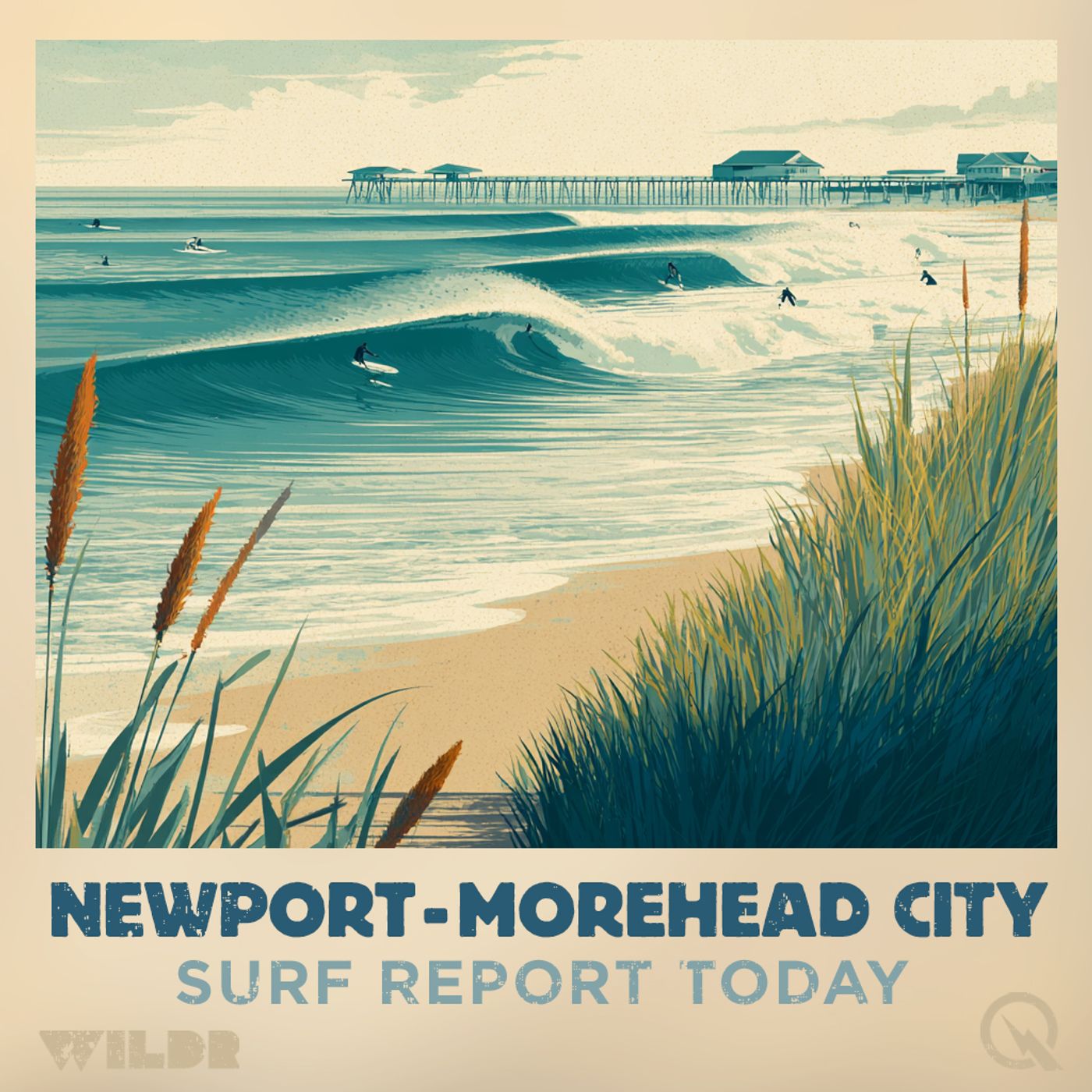
Surf Report - Newport - Morehead City NC
by Inception Point Ai
Welcome to "The Surf Report," the go-to podcast for all things surfing in the vibrant coastal areas of Newport and Morehead City, North Carolina. Each episode delivers surf conditions, helping you plan the perfect day on the waves. Whether you're a seasoned surfer or just getting started, our podcast is tailored to provide everything you need to take full advantage of our stunning local beaches.Deliver Detailed Wave Forecasts: Get the latest updates on wave sizes, wind conditions, and tides, directly from local experts who know our waters best.Explore Coastal Lifestyle and Environmental Issues: From marine conservation efforts to local events, we keep you connected to the coastal community and informed about issues that impact our beaches and oceans."The Surf Report" is more than just a podcast; it's a community of passionate surfers and ocean lovers who cherish the coastal lifestyle. Whether you're tuning in to decide if today's the day to catch waves,
-
512
North Carolina Surf Forecast Tuesday May 5th Small Waves Today Moderate Rip Currents Wednesday
Good morning, this is your surf zone forecast for the North Carolina coast issued at 324 AM Eastern Daylight Time on Tuesday, May 5th, 2026. Let's start up north where conditions are looking pretty mellow. The Northern Outer Banks from Duck down through Nags Head will see small one to two foot waves today under sunny skies with highs in the mid seventies. Rip current risk stays low, though remember that life-threatening currents can still form near groins, jetties and piers. Water temperatures are hovering in the mid fifties, so if you're thinking about a quick dip, you might want to ease in slowly. South winds at ten to fifteen miles per hour will keep things pleasant, and the UV index is running high, so break out that sunscreen. Moving down the coast to Hatteras Island, today looks similar with mostly sunny skies and one to two foot surf on both the north and south sides of Cape Hatteras. Again, low rip current risk across the board and highs in the mid seventies. Water temperatures are slightly warmer in the upper fifties here. Wednesday's when things get interesting. North of Cape Hatteras, rip current risk remains low, but south of the cape we're bumping up to moderate risk. Surf heights increase to two to three feet, and that slight chance of showers moves in along with partly sunny conditions. Ocracoke Island is also expecting a moderate rip current risk on Wednesday with two to three foot surf. Today though, it's quiet with low risk and one to two foot waves. Water temperatures here are actually the warmest we're seeing at a comfortable mid sixties. Head down to East Carteret and Cape Lookout National Seashore, and you'll notice the most significant change on Wednesday. The Core Banks could see two to five foot surf, while Shackleford Banks looks at three to four footers. Rip current risk jumps to moderate for both areas. Today remains calm with one to two foot conditions and low risk. West Carteret beaches including Fort Macon, Atlantic Beach, and Emerald Isle will see moderate rip current risk develop on Wednesday with two to three foot surf. Today's forecast keeps it small at one to two feet with low rip current risk. Mid sixties water temperatures and mostly sunny skies make for a nice beach day. Finally, Coastal Onslow around Hammocks Beach and North Topsail Beach stays mellow on both days. Rip current risk remains low through Wednesday, with one to two foot surf both days. Water temperatures are in the upper sixties, the warmest stretch of beach we're forecasting, and mostly sunny conditions prevail. That's your Tuesday and Wednesday surf outlook for the North Carolina coast. Be safe out there and check local conditions before heading out. For more http://www.quietplease.ai Get the best deals https://amzn.to/3ODvOta
-
511
North Carolina Surf Forecast Moderate Rip Currents Northern Outer Banks Two to Three Foot Waves Sunny Skies
Good morning, this is your surf zone forecast for the North Carolina coast brought to you by the National Weather Service in Newport and Morehead City. Let's break down what's happening in the water and on the beaches today. We're looking at moderate rip current risk from eight AM this morning through this evening across most of the northern and central coast. That includes the Northern Outer Banks, Hatteras Island, and Ocracoke Island. If you're planning to get in the water, stay aware of these currents and remember that rip currents often form near groins, jetties, and piers. The southern beaches around Carteret County and down toward Onslow are showing low rip current risk, so conditions are a bit gentler there. Surf heights are running two to three feet across the northern zones, with slightly smaller one to two foot waves at West Carteret and along Coastal Onslow. It's going to be a gorgeous day out there. Expect abundant sunshine with no thunderstorm potential anywhere along the coast. The UV index is running high, so slather on that sunscreen before you head out. Water temperatures vary a bit depending on where you are. The northern beaches are chilly, with the upper 50s near Duck, low 60s around Hatteras, and mid 60s at Ocracoke and Carteret. If you're sensitive to cool water, you might want to grab a wetsuit. Winds will be light to moderate, with southwest winds between ten and fifteen miles per hour. High temperatures look to reach the lower 70s across most of the forecast area, with West Carteret right around 70 degrees. So it's the perfect spring day for a beach visit. Looking ahead to Tuesday, most locations will see a drop in rip current risk down to low, though Hatteras Island and Ocracoke will remain at moderate. Surf heights stay about the same, two to three feet across the board. Another sunny day is in store with that high UV index still in effect. Temperatures creep up just a touch to the mid 70s for most areas. Winds ease back to around ten miles per hour, with just a whisper of breeze at Coastal Onslow early in the day. So there you have it. A beautiful two day period ahead with calm conditions and plenty of sunshine. Just keep an eye on those rip currents if you're up north, and you're all set for some quality beach time. For more http://www.quietplease.ai Get the best deals https://amzn.to/3ODvOta
-
510
Outer Banks Surf Forecast Sunday May 3rd: Sunny Skies, High UV, Two to Four Foot Waves and Rip Current Warnings
Good morning, this is your Outer Banks surf forecast for Sunday, May 3rd, brought to you by the National Weather Service in Newport. We're looking at some beautiful beach weather today, but with a few important cautions to keep in mind. Sunny skies will dominate across the entire forecast area with very high UV levels, so definitely get that sunscreen on early and often. Starting up north in Duck and the Northern Outer Banks, we're expecting two to four foot surf with high rip current risk. A Beach Hazards Statement is in effect from eight this morning through this evening. The high tide at Duck Pier comes in around nine fifteen in the morning with a low tide just after three in the afternoon. Water temps are in the upper fifty-s, and with northwest winds at ten to fifteen miles per hour, conditions should remain quite pleasant for those brave enough to get in the water. Heading down to Hatteras Island, conditions vary a bit depending on where you are. North of Cape Hatteras, we've got the same high rip current risk and two to four foot surf with another Beach Hazards Statement in effect. South of Cape Hatteras though, the rip current risk drops to moderate with slightly smaller two to three foot waves. Water temperatures there hover around sixty degrees. Over at Ocracoke Island and Cape Lookout, we're looking at moderate rip current risk throughout the day with two to three foot surf. Keep in mind that even with moderate risk, life-threatening rip currents are definitely possible in the surf zone, so pay attention to the water and swim near lifeguards if available. Things are notably calmer as we head toward the Crystal Coast. West Carteret and Coastal Onslow both have low rip current risk with smaller one to two foot waves, making those areas a bit friendlier for less experienced swimmers and families. Looking ahead to Monday, expect mostly the same sunny conditions with slightly warmer temperatures climbing into the lower seventies. Rip current risk decreases across the board, though moderate risk persists in some northern zones. Winds will shift to the southwest at ten to fifteen miles per hour, and surf will stay relatively small at one to three feet depending on location. Water temperatures remain cool in the lower sixties north of Cape Lookout, so consider a wetsuit if you're planning an extended session. No thunderstorms are expected through the forecast period, which means you've got a nice window to enjoy these beaches. Remember, even on days with low rip current risk, strong currents can still develop near structures like groins, jetties, reefs, and piers. If you find yourself in a rip current, don't panic or try to swim directly against it. Instead, swim parallel to the shore until you're out of the current, then head back to land. Have a fantastic and safe day at the beach. For more http://www.quietplease.ai Get the best deals https://amzn.to/3ODvOta
-
509
Northern Outer Banks Surf Forecast High Rip Current Risk Saturday Improving Sunday Conditions Beach Hazards
Good morning, this is your surf zone forecast for the Northern Outer Banks, brought to you by the National Weather Service in Newport and Morehead City. A Beach Hazards Statement remains in effect through this evening, so pay close attention to what's happening in the water today. Looking at Saturday, we're expecting high rip current risk across the Northern Outer Banks, so swimmers and surfers need to exercise extra caution. If you find yourself caught in a rip current, remember to stay calm and swim parallel to the shore rather than fighting it directly. Surf heights will range from three to five feet, which should make for some decent conditions if you're heading out on a board. The water temperature is in the upper fifty degrees, so a wetsuit is definitely recommended. Above water, expect cloudy skies with patchy fog and rain throughout the day. Your high temperature will reach the upper fifty degrees with northeast winds around ten miles per hour, increasing to north around twenty miles per hour in the afternoon. High tide at Duck Pier occurs at eight forty in the morning, reaching two point nine feet, while low tide happens at two twenty-eight in the afternoon at point two feet. Moving into Sunday, conditions improve significantly. High rip current risk continues, but the overall weather picture gets much nicer. We're looking at sunny skies and a high near the lower sixties. Surf heights drop slightly to three to four feet, and winds become lighter out of the northwest around ten miles per hour. High tide at Duck Pier shifts to nine fifteen in the morning at two point eight feet, with low tide at three oh one in the afternoon at point three feet. If you're planning any beach activities this weekend, Saturday requires caution due to rip currents and rain, but Sunday looks like a beautiful day to get outside and enjoy the beach. For more http://www.quietplease.ai Get the best deals https://amzn.to/3ODvOta
-
508
North Carolina Surf Forecast Friday Saturday High Rip Currents Outer Banks Hatteras Island Beach Hazards
Good morning! Here's your surf zone forecast for the North Carolina coast this Friday and Saturday. Starting with the Northern Outer Banks, we're looking at a Beach Hazards Statement in effect from eight AM this morning through this evening. Rip currents will be HIGH, so swimmers need to stay alert. The surf is pumping at four to five feet with northeast winds around ten miles per hour. It'll be partly sunny with highs in the lower sixties, and the water temperature is sitting in the upper fifties. There's no thunderstorm threat, but the UV index is very high, so get that sunscreen on. Moving down to Hatteras Island, conditions are split. North of Cape Hatteras, expect a Beach Hazards Statement with HIGH rip current risk and four to five foot surf. South of Cape Hatteras, rip currents drop to MODERATE with two to five foot waves. Water temperatures are a bit warmer here in the mid sixties. Northeast winds around ten to fifteen miles per hour will keep conditions manageable. Over at Ocracoke Island, rip currents are MODERATE with two to four foot surf. The water's in the upper sixties, making it slightly more swimmable. Northeast winds around ten to fifteen miles per hour with partly sunny skies and very high UV index. East Carteret shows split conditions as well. Core Banks north of Cape Lookout will see MODERATE rip currents with two to four foot surf. Shackleford Banks has LOW rip current risk with two to three foot waves. Slight chance of showers throughout the day with highs in the upper sixties. West Carteret and Coastal Onslow are looking better. Both areas show LOW rip current risk with two to three foot surf. Mostly cloudy skies with a chance of showers. Northeast winds around ten miles per hour and highs in the upper sixties. Now looking ahead to Saturday, things are getting a bit more active. Expect cloudy skies with showers moving in across most of the forecast area. Rip current risks remain unchanged from Friday. Hatteras Island and East Carteret may see a slight chance of thunderstorms. Winds will shift north to northeast around ten miles per hour in the morning, increasing to around twenty miles per hour in the afternoon. Water temperatures stay similar, and the UV index remains very high wherever you see sun breaks. If you're heading out this weekend, be aware of the HIGH rip current risks in the Northern Outer Banks and north of Cape Hatteras. These are dangerous and potentially life-threatening. Stick to the beaches with LOW rip current risk, or if you do venture into the higher risk zones, stay near lifeguards and avoid the areas around groins, jetties, and piers where rip currents are even more pronounced. Bottom line: Friday's looking decent for a quick beach visit if you head to the lower risk zones. Saturday brings rain and stronger winds, so if you're planning a full beach day, Friday's your best bet. Stay safe out there. For more http://www.quietplease.ai Get the best deals https://amzn.to/3ODvOta
-
507
Outer Banks Surf Forecast Thursday April 30 to Friday May 1 Beach Hazards and Rip Currents
Good morning, this is your Outer Banks surf forecast for Thursday, April 30th through Friday, May 1st, brought to you by the National Weather Service Newport and Morehead City. A Beach Hazards Statement is in effect from 8 AM this morning through this evening for the Northern Outer Banks and Hatteras Island, so pay close attention if you're planning to hit the water. Let's break down today's conditions starting up north in Duck, Kitty Hawk, and Kill Devil Hills. You're looking at around 4 feet of surf with high rip current risk throughout the day. The water's chilly, sitting in the upper 50s, so definitely grab a wetsuit. Winds will start out of the northwest around 10 miles per hour before shifting northeast this afternoon. There's a slight chance of showers and mostly cloudy skies, but the UV index is running high, so sunscreen is essential. Highs will reach the upper 60s. Moving down to Hatteras Island, conditions vary depending on where you are. North of Cape Hatteras, expect 4 to 5 feet of surf with high rip current risk. South of the Cape, you're looking at smaller 2 to 4 foot waves with low rip current risk. Water temps here are slightly warmer, running in the mid 60s. Again, mostly cloudy with a chance of showers, light north winds becoming northeast, and highs in the upper 60s. Over at Ocracoke Island, things are calmer. Around 3 feet of surf with low rip current risk. Similar weather pattern with mostly cloudy skies and a chance of showers. Highs will be in the upper 60s. Down in Carteret County, the East Banks near Cape Lookout are showing around 3 feet with low rip current risk, while Shackleford Banks will be smaller at around 2 feet. There's a low chance of thunderstorms today, so keep an eye on the sky. Highs near 70 degrees. West Carteret and the Onslow beaches from Atlantic Beach to North Topsail will see smaller 2 foot waves with low rip current risk, but here's the thing, showers are likely this afternoon with a slight chance of thunderstorms. Highs in the lower 70s. Now looking ahead to Friday, the Beach Hazards Statement expires, but rip current risk remains high for the Northern Outer Banks and north of Cape Hatteras. Surf will be similar or slightly larger, running 4 to 5 feet in these areas. Conditions improve with partly sunny skies, light northeast winds, and highs in the mid 60s. It's a much better looking day overall with no thunderstorms expected anywhere along the coast. Down south, Core Banks will see moderate rip current risk on Friday with 3 to 4 feet of surf, while Shackleford will subside to around 1 foot. The southern beaches remain low risk with minimal surf. Overall, today is a bit unsettled with the chance of showers and thunderstorms for some areas, but Friday shapes up nicely with improving conditions and partly sunny skies. The rip current risk remains elevated in the northern areas, so always exercise caution and respect the ocean. Stay safe out there. For more http://www.quietplease.ai Get th
-
506
North Carolina Surf Forecast April 29 30 Rip Current Warnings Outer Banks Beach Conditions
Good morning, this is your North Carolina surf zone forecast for Wednesday, April 29th through Thursday, April 30th, brought to you by the National Weather Service Newport and Morehead City. If you're thinking about heading to the water today, pay close attention because conditions vary significantly depending on where you are along our coast. Up in the Northern Outer Banks around Duck, Kitty Hawk, and Nags Head, we've got a Beach Hazards Statement in effect through this evening due to high rip current risk. Surf heights will be running four to five feet with mostly cloudy skies and a chance of showers. Temperatures will reach the upper sixties with southeast winds picking up to around fifteen miles per hour this afternoon. Water temperatures are hovering in the mid-fifties, so bring a wetsuit. The high tide at Duck Pier comes in around six forty-nine in the morning, with a low tide around twelve forty-seven. Moving south to Hatteras Island, conditions split at Cape Hatteras. North of the Cape, we're looking at high rip current risk with four to five foot surf and a Beach Hazards Statement through this evening. South of Cape Hatteras, the rip current risk drops to moderate with around three foot waves. Water temperatures here are slightly warmer in the lower sixties. Expect mostly cloudy conditions with a chance of showers and southeast winds at five to ten miles per hour. Ocracoke Island is sitting with moderate rip current risk and three to four foot surf. It'll be partly sunny until three in the afternoon, then mostly cloudy with a chance of showers. Temperatures will actually be a bit warmer here, reaching the lower seventies with south winds five to ten miles per hour. Down at Cape Lookout and the Outer Banks, Core Banks have moderate rip current risk with around four foot surf, while Shackleford Banks show low rip current risk with just one foot waves. We've got showers likely and a slight chance of thunderstorms, so keep an eye on the sky. Temperatures reaching the lower seventies with southwest winds five to ten miles per hour. The western Carteret beaches around Fort Macon, Atlantic Beach, and Emerald Isle are the calmest option today with low rip current risk and small one to two foot surf. Even with showers likely and a slight chance of thunderstorms, this is your best bet for a mellow session. Temperatures around seventy with southwest winds five to ten miles per hour. Finally, Coastal Onslow near Hammocks Beach and North Topsail Beach also features low rip current risk with around two foot waves. Mostly cloudy with showers likely and a slight chance of thunderstorms. Temperatures in the lower seventies with southwest winds five to ten miles per hour. Tomorrow looks better across the board. The high rip current risk continues up in the Northern Outer Banks and north of Cape Hatteras, while moderate risk persists south of Cape Hatteras and at Ocracoke Island. Everywhere else drops to low risk. Surf heights will generally be thr
-
505
Outer Banks Surf Forecast Tuesday to Wednesday: Five Foot Waves High Rip Currents and Incoming Showers
Good morning, this is your Outer Banks surf zone forecast for Tuesday, April 28th through Wednesday evening. Starting up north with the Northern Outer Banks, we're looking at some decent swell today with waves running five to six feet. The rip current risk is high, so swimmers need to stay sharp and respect the water. If you find yourself caught in a rip, remember to swim parallel to shore. Water temps are sitting in the mid-50s, so a wetsuit is definitely your friend. Weather-wise, expect mostly sunny skies with calm northeast winds at five to ten miles per hour, and highs in the lower 60s. Moving down to Hatteras Island, conditions are a bit more varied. North of Cape Hatteras, we're seeing that same five to six foot swell with high rip current risk and a beach hazards statement in effect through this evening. South of Cape Hatteras, things ease up a bit with four-foot waves and moderate rip current risk. Water temperatures here are slightly cooler in the lower 60s. Overall, it's going to be sunny with north winds becoming easterly this afternoon, topping out around 60 degrees. Over at Ocracoke Island, expect around four-foot surf with moderate rip current risk. The water's a touch warmer at mid-60s, and we'll have sunny skies with north winds shifting southwest in the afternoon. Highs reaching the mid-60s. Down in Carteret County, Core Banks at Cape Lookout are pumping with four to five foot waves and moderate rip current risk, while Shackleford Banks see much calmer conditions with just a foot of swell and low rip current risk. We're looking mostly sunny with northeast winds becoming southwest, and highs in the upper 60s. West Carteret around Fort Macon and Atlantic Beach will be much mellower, with just two-foot waves and low rip current risk. Low storm potential, mostly sunny, and highs in the upper 60s. Over in Coastal Onslow, including Hammocks Beach and North Topsail, we've got two to three foot waves with low rip current risk. Sunny conditions with north winds shifting southwest, and highs in the upper 60s. Now let's talk Wednesday. Things are going to change pretty significantly. A weather system is moving in, bringing showers and increasing cloud cover across the entire region. Rip current risks are generally decreasing or staying elevated depending on location. Northern Outer Banks remain high risk with four-foot waves. Hatteras Island north of Cape Hatteras stays high risk with three to five foot waves. South of Cape Hatteras, it drops to low risk with three-foot waves. Ocracoke Island improves to low risk with three-foot surf. Core Banks at Cape Lookout remains moderate risk with two to three foot waves. West Carteret and Coastal Onslow both show low rip current risk with two-foot waves. Across the board Wednesday, we're expecting mostly cloudy skies with showers developing. There's moderate thunderstorm potential for Cape Lookout, Fort Macon, and Coastal Onslow areas, with a low chance at Ocracoke. Southeast and south wind
-
504
North Carolina Surf Forecast Monday Five to Seven Foot Waves Outer Banks High Rip Current Risk
Good morning, this is your Monday surf forecast for the North Carolina coast, brought to you by the National Weather Service in Newport and Morehead City. Starting up north at the Outer Banks from Duck through Nags Head, we're looking at some solid conditions today with surf running five to seven feet. A beach hazards statement is in effect through this evening, and we're calling for a high rip current risk, so swimmers and surfers need to be respectful of the water. The UV index is very high, so get that sunscreen on. Temperatures will reach the upper fifties under cloudy skies until about three in the afternoon, then partly sunny conditions take over. Northeast winds around twenty miles per hour will be pushing the swell throughout the day. Water temps are sitting in the mid-fifties, so a wetsuit might be your friend out there. Moving down to Hatteras Island, conditions vary quite a bit depending on where you are. North of Cape Hatteras, expect five to seven foot faces with a high rip current risk and that beach hazards statement in effect. South of Cape Hatteras though, things are much gentler with two to three foot surf and a low rip current risk. Mostly cloudy skies, upper fifties, and north winds around twenty miles per hour. Water temperature sits in the lower sixties up there. Over at Ocracoke Island, we're looking at three to four foot waves with a moderate rip current risk. Another beach hazards statement is active through this evening. It'll be cloudy until about two in the afternoon, then partly sunny. High around sixty degrees. Northeast winds about twenty miles per hour, and that UV index remains very high. The Cape Lookout area, particularly Core Banks, has a moderate rip current risk with three to five foot surf. Shackleford Banks stays calm at one to two feet with a low rip current risk. Mostly cloudy until four in the afternoon, then mostly sunny. We're looking at highs in the lower sixties with northeast winds around twenty. Down at West Carteret near Atlantic Beach and Emerald Isle, conditions are pretty mellow with just one to two foot waves and a low rip current risk. Mostly cloudy until two in the afternoon, then mostly sunny. High in the mid-sixties. And finally, Coastal Onslow including Hammocks Beach and North Topsail Beach shows two to three foot waves with a low rip current risk. Mostly cloudy until one, then mostly sunny. Upper sixties expected. Now let's look ahead to Tuesday. The swell backs down slightly but rip current risks generally remain elevated in the northern zones. The Outer Banks and Hatteras Island north of Cape Hatteras stay high risk. Ocracoke and Core Banks drop to low and moderate respectively. Everywhere else stays low. Winds lighten up considerably to five to ten knots from the north, and we're looking at mostly sunny skies across the board with temperatures climbing into the mid to upper sixties and even low seventies down south. The UV index stays very high, so continue protecting your ski
-
503
North Carolina Surf Forecast: Outer Banks Rip Current Warning, Building Waves Monday
Good morning! Here's your Sunday and Monday surf zone forecast for the North Carolina coast brought to you by the National Weather Service. Starting with the Northern Outer Banks including Duck, Kitty Hawk, and Nags Head, we've got a Beach Hazards Statement in effect through this evening. Today expect moderate rip current risk with waves running three to five feet. It'll be cloudy with showers and a slight chance of thunderstorms. Water temperatures are in the mid-fifties, and winds will pick up from the north, starting around ten miles per hour and increasing to twenty in the afternoon. High temperatures will reach the lower sixties. Come Monday, things get more active with high rip current risk and surf heights increasing to four to six feet. It'll clear up and stay mostly sunny with northeast winds around fifteen miles per hour. Moving down to Hatteras Island, we're also issuing a Beach Hazards Statement through this evening north of Cape Hatteras. North of the Cape, expect moderate rip currents and three to five foot surf with moderate thunderstorm potential. South of Cape Hatteras, slightly smaller waves around two to four feet with moderate rip current risk as well. Water temps are in the lower sixties. Monday sees a significant rip current upgrade north of the Cape to high risk, with impressive five to seven foot waves building in. South of the Cape stays calmer with four foot waves and low rip current risk. Ocracoke Island is looking at moderate rip current risk today with two to four foot waves and moderate thunderstorm potential. Water temperatures here are a bit warmer in the mid-sixties, with highs reaching the upper sixties. Monday stays moderate on the rip current risk with three to five foot waves and northeast winds around twenty miles per hour. For East Carteret, which includes Cape Lookout and Shackleford Banks, Core Banks show moderate rip current risk with two to four foot surf, while Shackleford stays low risk with smaller waves. Moderate thunderstorm potential throughout. Monday, Core Banks jump to five to six foot waves still at moderate rip current risk, while Shackleford Banks remain calmer. West Carteret beaches around Fort Macon and Emerald Isle are looking pretty mellow today. Low rip current risk, small waves around two feet, and moderate thunderstorm potential. Highs in the upper sixties. Monday stays calm with similar conditions and no thunderstorm threat. And finally, Coastal Onslow including North Topsail Beach also shows low rip current risk today with small waves and moderate thunderstorm potential. Monday looks pleasant with two to three foot waves, low rip current risk, and mostly sunny skies. Bottom line: If you're heading to the Northern Outer Banks or Hatteras Island, pay close attention to that rip current risk, especially Monday. The southern beaches are looking much more relaxed. Either way, beautiful clearing is expected for both days with improving conditions. Get out there and enjoy it! For mo
-
502
Northern Outer Banks Surf Report: Sunny Saturday Small Waves Sunday Big Swell Incoming
# Northern Outer Banks Surf Report Alright beach lovers, let's dive into what Mother Ocean has in store for the Northern Outer Banks this weekend. Today is looking absolutely gorgeous out there. We're talking mostly sunny skies with a high around the mid 70s, which means grab your sunscreen because that UV index is running high. The water's sitting at a chilly mid 50s, so if you're planning to get wet, a wetsuit is definitely your friend. Surf heights are running small at just one to two feet, making for mellow conditions perfect for beginners or anyone just wanting to chill by the shore. Winds are light out of the south at five to ten miles per hour, and rip current risk is low, though remember that life-threatening rip currents can still pop up around groins and jetties. At Duck Pier, low tide hits at 9:37 in the morning with high tide rolling in at 3:54 in the afternoon. Now here's where things get interesting. Sunday's going to flip the script entirely. We're expecting much more substantial surf with heights climbing to three to six feet, which is a significant jump from today's mellow conditions. The rip current risk cranks up to high, meaning life-threatening rip currents are likely throughout the surf zone, so definitely exercise caution if you're heading out. The weather turns cloudy with showers developing and a chance of thunderstorms popping off. Temperatures will drop a few degrees into the mid 60s. Winds start out of the northwest around ten miles per hour but will increase to around twenty miles per hour during the afternoon. Low tide at Duck Pier shifts to 10:32 in the morning with high tide at 4:53 in the afternoon. So here's the setup: enjoy today's beautiful conditions while they last, but respect what's coming your way on Sunday. Whether you're a thrill seeker ready for bigger waves or someone who prefers calmer waters, this forecast has something for everyone at different times this weekend. For more http://www.quietplease.ai Get the best deals https://amzn.to/3ODvOta
-
501
North Carolina Surf Forecast Friday Saturday April 24 25 Waves Rip Currents Outer Banks Crystal Coast
Good morning, this is your North Carolina surf zone forecast for Friday, April 24th through Saturday. Let's dive into what's happening at your favorite beaches. Starting with the Northern Outer Banks including Duck, Southern Shores, Kitty Hawk, Kill Devil Hills, and Nags Head, today is looking pretty sweet. We're expecting one to two foot waves with low rip current risk, so you can paddle out with confidence. It's going to be mostly sunny with just a slight chance of showers, and winds will be light out of the west at five to ten miles per hour. Water temps are hanging in the mid-fifties, so a wetsuit is still your friend. The UV index is very high, so don't forget that sunscreen. High temperature today will push into the upper seventies. Moving down the coast to Hatteras Island, conditions are a bit more interesting. We've got a moderate rip current risk in effect south of Cape Hatteras through this evening, so swimmers and surfers need to be aware of that. North of the cape, rip current risk stays low. Surf will be around two feet north of Cape Hatteras and bumping up to two to three feet south of the cape. Southwest winds around ten to fifteen miles per hour will keep things moving. Water temps here are a bit cooler in the low sixties. Ocracoke Island is under a moderate rip current risk today as well. You're looking at two to three foot waves with mostly sunny skies and southwest winds around fifteen miles per hour. Water temps in the mid-sixties, so again, bring that wetsuit. East Carteret, which includes Cape Lookout National Seashore and Shackleford Banks, is also under a moderate rip current risk for both Core Banks and Shackleford Banks today. Two to three foot surf with sunny conditions and southwest winds around fifteen miles per hour. Water temps in the mid-sixties throughout the area. Over at West Carteret with Fort Macon, Atlantic Beach, Pine Knoll Shores, Salter Path, and Emerald Isle, moderate rip current risk is in effect. Two to three foot waves, sunny skies, and southwest winds around fifteen miles per hour. Slightly warmer here with highs in the upper seventies and water temps in the mid-sixties. Finally, Coastal Onslow including Hammocks Beach and North Topsail Beach, we've got moderate rip current risk today with two to three foot waves, sunny conditions, and southwest winds ten to fifteen miles per hour. This area is going to be the warmest of the day with highs around eighty degrees. Now let's look ahead to Saturday. The Northern Outer Banks will see around two foot waves with low rip current risk continuing. It'll be mostly sunny with a slight chance of showers and south winds five to ten miles per hour. Slightly cooler than today with highs in the mid-seventies. Hatteras Island stays much the same, with low rip current risk north of Cape Hatteras and moderate risk south of the cape. Surf bumps up slightly to two to three feet north of Cape Hatteras and around three feet south of the cape. Southwest winds around t
-
500
Outer Banks Surf Forecast Today and Friday: Waves Building with High Rip Current Risk at Hatteras
# Outer Banks Surf Zone Forecast Good morning! Here's what Mother Ocean has cooking for the North Carolina coast today and tomorrow. If you're heading to the beach today, you're in for a gorgeous afternoon. We're looking at sunny skies across the entire Outer Banks with light winds and very high UV, so definitely slather on that sunscreen. Surf heights are modest, ranging from one to three feet depending on where you are. The Northern Outer Banks will see one to two footers, while Hatteras Island and points south will see slightly more size, with two to four feet in some spots. Water temperatures are chilly in the upper fifties and mid sixties, so you'll definitely want that wetsuit. Rip current risk is low everywhere today, though as always, be cautious around piers and jetties. It's a beautiful day to be in the water. Now here's where things get interesting heading into Friday. While the weather stays sunny and pleasant with highs in the mid to upper seventies, we're going to see a significant shift in rip current risk. The Northern Outer Banks and Coastal Onslow will remain at low risk, which is great news. But if you're planning to hit Hatteras Island, things are going to kick up considerably. North of Cape Hatteras, we're upgrading to moderate risk, and south of Cape Hatteras, we're looking at high risk. That means life-threatening rip currents will be likely in that area, so exercise extreme caution or consider staying out of the water. Ocracoke Island and Shackleford Banks will also see moderate to high risk conditions, respectively. East Carteret's Shackleford Banks specifically will have high risk Friday. West Carteret around Atlantic Beach will see moderate risk. The good news is surf will be building, with most areas seeing three to four footers by Friday afternoon, making for some decent waves if you're experienced and smart about the currents. Winds Friday shift to southwest around ten to fifteen miles per hour, and we stay sunny all day. So if you're heading out, pick your location carefully based on your skill level and always, always respect those rip currents. Stay safe out there. For more http://www.quietplease.ai Get the best deals https://amzn.to/3ODvOta
-
499
North Carolina Beach Forecast: Sunny Thursday With Small Waves, Friday Rip Current Risk Increases
Good morning from the National Weather Service in Newport and Morehead City. Here's your surf zone forecast for Thursday and Friday along the North Carolina coast. Today looks absolutely stellar if you're planning a beach day. We're looking at sunny skies from the Outer Banks all the way down to Coastal Onslow with highs ranging from the low to upper seventies. A very high UV index means you'll definitely want that sunscreen. Surf heights are running small, generally one to three feet depending on where you are, with the slightly larger waves showing up south of Cape Hatteras and around the Ocracoke and Carteret areas. Rip current risk is low across the board today, though remember that life-threatening rip currents can still pop up near groins, jetties, and piers even when the risk is rated low. Water temperatures are sitting in the mid to upper fifties at most beaches, so a wetsuit might still feel pretty good. Winds will be light, mostly out of the west and southwest around ten to fifteen miles per hour. Now here's where things get interesting for Friday. While we're still expecting sunny skies and no thunderstorm potential, the rip current situation is escalating. This is especially true south of Cape Hatteras and around the southern Carteret beaches where we're expecting high rip current risk. That means life-threatening rip currents will likely be present in the surf zone. North of Cape Hatteras and at Ocracoke Island, we're looking at moderate risk. Even Coastal Onslow and West Carteret are ramping up from low to moderate. If you're heading out Friday, exercise extreme caution and always swim near a lifeguard. Surf conditions Friday will be a bit more interesting too, with waves building to two to four feet north of Cape Hatteras and three to four feet further south. Coastal Onslow should see two to three foot surf. Winds will remain southwest around ten to fifteen miles per hour, and temperatures will climb to around eighty degrees in some spots. High tide at Atlantic Beach hits at two ten in the afternoon at just over three feet, while Cape Hatteras peaks at two thirty around two point six feet. The bottom line: Thursday is your safer, smaller wave day. If you're venturing out Friday, pay close attention to those rip current warnings, stay near lifeguards, and always respect the ocean's power. For more http://www.quietplease.ai Get the best deals https://amzn.to/3ODvOta
-
498
North Carolina Surf Forecast: Small Waves Today, Building Swells Thursday with High Rip Current Risk
Good morning, this is your surf zone forecast for the North Carolina coast brought to you by the National Weather Service in Newport and Morehead City. Let's start up north in the Northern Outer Banks, where conditions are looking pretty sweet today. We're looking at small waves, one to two feet, with low rip current risk. It's going to be sunny with winds out of the southwest around ten miles per hour. High temperatures climbing into the upper seventies. The water is brisk at mid fifty-one degrees, so you'll want to think twice about that spring break water temperature. Thursday brings slightly larger waves around three feet, still low rip current risk, and mostly sunny skies with temperatures holding in the upper seventies. Moving down to Hatteras Island, things get a bit spicier. We have a Beach Hazards Statement in effect today, particularly south of Cape Hatteras where high rip current risk is expected. North of the Cape, expect moderate rip current risk. Waves are one to two feet north of Cape Hatteras, building to two to three feet south of the Cape. Winds are picking up to fifteen to twenty miles per hour out of the southwest. Thursday looks more energetic with larger swells, two to four feet north of the Cape and around four feet south of it. High rip current risk persists south of Cape Hatteras, so definitely be cautious in that area. Over at Ocracoke Island, it's a different story altogether. A Beach Hazards Statement is in effect today through this evening with high rip current risk. Waves are running two to three feet with southwest winds fifteen to twenty miles per hour. Thursday brings larger four-foot waves and that high rip current risk continues, so this is definitely not the time to test your rip current swimming skills. Heading south to East Carteret near Cape Lookout, we've got another Beach Hazards Statement north of Cape Lookout today. Core Banks are looking at high rip current risk with around two-foot waves, while Shackleford Banks shows moderate rip current risk with slightly smaller one to two foot swell. Thursday kicks things up considerably with three to four foot waves on Core Banks and around three feet on Shackleford Banks. By Thursday, both areas transition to high rip current risk, so definitely keep that in mind if you're planning to get wet. West Carteret beaches including Fort Macon and Atlantic Beach are under a Moderate Rip Current Risk today with one to two foot waves and that very high UV index continuing. Thursday is the day these beaches really come alive with three to four foot waves building in and high rip current risk taking over. Winds stay out of the southwest at fifteen to twenty miles per hour. Finally, down in Coastal Onslow near North Topsail Beach, we've got moderate rip current risk in effect today with small one to two foot waves. Winds are the lightest along the coast here at ten to fifteen miles per hour. Thursday tells a much bigger story with three to four foot waves and high rip c
-
497
Outer Banks Surf Forecast April 14-15: Rip Current Warnings, Sunny Skies, Two to Four Foot Waves
Good morning, this is your Outer Banks surf zone forecast for Tuesday, April 14th through Wednesday, April 15th. Let's start up north at the Northern Outer Banks beaches around Duck and Nags Head. We've got a moderate rip current risk in effect this morning through this evening, so swimmers and waders need to exercise caution. Surf heights are running around two feet under mostly sunny skies. The water is chilly at upper 50s, so a wetsuit wouldn't be a bad idea. Expect light southwest winds around 10 miles per hour with highs in the upper 70s. Wednesday brings calmer conditions with low rip current risk and slightly bigger waves at two to three feet. Moving south to Hatteras Island, conditions are a bit more intense. We've issued a Beach Hazards Statement as life-threatening rip currents are likely in the surf zone both north and south of Cape Hatteras. Surf heights are two to three feet with that very high UV index, so sunscreen is essential. Southwest winds around 15 miles per hour with highs in the lower 70s. Wednesday's outlook shows rip currents moderating north of the cape but remaining high south of it, with slightly larger waves at three to four feet and stronger winds at 15 to 20 miles per hour. Down at Ocracoke Island, we're also under a Beach Hazards Statement with high rip current risk continuing through this evening. Two to three foot waves with sunny conditions and water temperatures in the mid 60s. Southwest winds around 15 miles per hour with highs in the lower 70s. Wednesday shows no letup in rip current danger, actually, with waves building to three to four feet. Over at East Carteret near Cape Lookout, Core Banks face high rip current risk with a Beach Hazards Statement in effect, while Shackleford Banks see moderate risk. Waves range from one to three feet depending on location. Wednesday brings a shift where Shackleford Banks spike to high rip current risk while Core Banks moderate. West Carteret beaches including Fort Macon and Emerald Isle are under a moderate rip current risk today with one to two foot waves. Water temperatures are in the lower 60s. Wednesday stays moderate with waves building to around three feet. Finally, Coastal Onslow near Topsail Beach carries moderate rip current risk today with one to two foot surf, but here's the heads up for Wednesday: rip current risk escalates to high with three to four foot waves expected. Highs will reach the upper 70s with continued southwest winds. Bottom line: Beautiful sunny weather across the entire forecast area, but respect the water. Rip currents are a significant concern, especially south of Cape Hatteras and at Ocracoke. Wednesday brings larger waves and stronger winds, so conditions will be more dynamic. Get your sunscreen on, stay hydrated, and if you're getting in the water, know how to identify and escape a rip current. Stay safe out there. For more http://www.quietplease.ai Get the best deals https://amzn.to/3ODvOta
-
496
North Carolina Beach Forecast Moderate Rip Currents Monday High Risk Tuesday Sunny Mild Seventies
Good morning, this is your surf zone forecast for the North Carolina coast brought to you by the National Weather Service Newport office. We're looking at a beautiful Monday ahead with mostly sunny skies and mild temperatures in the mid-seventies. However, beachgoers need to be aware of a moderate rip current risk that will be in effect from 7 AM this morning through this evening, particularly affecting the Northern Outer Banks and Hatteras Island. Let's break down conditions by region. The Northern Outer Banks from Duck through Nags Head will see three to four foot surf with moderate rip current concerns. Water temperatures are still chilly in the mid-fifties, so a wetsuit is definitely recommended if you're planning to get in the water. Southwest winds at ten to fifteen miles per hour will keep things pleasant on the beach. Down at Hatteras Island, surf conditions vary slightly depending on where you are. North of Cape Hatteras, expect three to four foot waves with moderate rip currents, while south of the cape you're looking at two to three foot surf. Both areas carry that same moderate rip current risk through this evening. Ocracoke Island will see two to three foot waves with moderate rip currents today. Water temperatures here are a touch warmer in the mid-sixties, and southwest winds around fifteen miles per hour will provide some nice beach breeze. Moving south to the Cape Lookout areas, Core Banks will experience two to three foot surf with moderate rip currents, while Shackleford Banks has lower rip current risk with just one to two foot waves. West Carteret and Coastal Onslow both show low rip current risk with small one to two foot surf, making these areas your best bet if you want to avoid strong currents today. Now here's something important to watch for as we head into Tuesday. While Monday looks relatively tame, Tuesday brings a significant shift. Rip current risk escalates to high across most of the Outer Banks and barrier islands. Hatteras Island, Ocracoke, and Core Banks all jump to high risk status, meaning life-threatening rip currents will likely be present. Even areas with moderate risk today like West Carteret and Coastal Onslow will see conditions worsen. Tuesday's surf will also pick up noticeably. Expect three to four foot waves along the Northern Outer Banks and Hatteras Island, with some areas seeing up to four feet. Southwest winds increase to fifteen to twenty miles per hour, which will help build that surf. Water temperatures remain in the fifties to mid-sixties. The UV index remains very high both days, so don't forget your sunscreen regardless of whether you're swimming or just enjoying the beach. To summarize: Today is your safer option for water activities despite the moderate rip current warnings. Stay away from piers, jetties, and groins where rip currents are most dangerous. If you do get caught in a rip current, remember to swim parallel to shore, not against the current. Tomorrow brings bigger wa
-
495
Outer Banks Surf Forecast Sunday April 12 Monday April 13 High Risk Rip Currents Northern Beaches Three to Five Foot Waves
Good morning, this is your Outer Banks surf forecast for Sunday, April 12th through Monday, April 13th, brought to you by the National Weather Service in Newport. Let's start up north in the Northern Outer Banks where conditions are shaping up to be quite active. We're tracking a Beach Hazards Statement in effect through this evening due to High Risk rip currents. The surf is running three to five feet with mostly sunny skies and east winds around ten miles per hour. The water temperature is hovering in the lower fifties, so a wetsuit is definitely your friend out there. High temperatures will reach the upper sixties today. Tides at Duck Pier will bottom out at half a foot around ten in the morning and peak at nearly three feet in the late afternoon. Moving down to Hatteras Island, conditions vary a bit north and south of Cape Hatteras. North of the cape, we've got that same Beach Hazards Statement with High Risk rip currents and three to five foot surf. South of Cape Hatteras, the rip current risk drops to Moderate with two to four foot waves. It'll be sunny throughout the day with east winds ten to fifteen miles per hour. Water temperatures in the mid-fifties and highs near seventy. Just south of there, Ocracoke Island is looking at Moderate rip current risk with two to four foot surf and mostly sunny conditions. East winds at ten to fifteen miles per hour, highs in the lower seventies, and water temperatures in the upper fifties. Heading to the Crystal Coast, East Carteret shows some interesting variation. The Core Banks are seeing Moderate rip currents with two to four foot surf, while Shackleford Banks is Low Risk with around one foot of surf. Either way, you're looking at mostly sunny skies, east winds, lower seventies, and some very high UV index values. West Carteret and Coastal Onslow are both showing calmer conditions. Low rip current risk, one to three foot surf, mostly sunny and pleasant with that same very high UV index. Water temperatures in the lower sixties. Now let's look ahead to Monday. The pattern stays fairly consistent but with some subtle shifts. Northern Outer Banks maintains High Risk rip currents, though the surf moderates to around three feet. Winds shift to the south at ten to fifteen miles per hour, and we'll be mostly sunny with highs in the mid-seventies. Hatteras Island keeps the same north-south split. High Risk north of Cape Hatteras with two to four foot surf, Moderate risk to the south with three foot waves. Southwest winds develop at ten to fifteen miles per hour and highs reach the lower seventies. Ocracoke stays Moderate for rip currents with three foot surf, mostly sunny, south winds, and mid-seventies for highs. The Crystal Coast continues its gentler pattern on Monday. East Carteret maintains Moderate risk at the Core Banks with three foot surf, while Shackleford Banks stays Low Risk. West Carteret and Coastal Onslow both remain Low Risk with around two foot surf. Skies stay mostly sunny with lig
-
494
North Carolina Surf Forecast: High Rip Currents Northern Outer Banks, Calm Conditions South This Weekend
Good morning, this is your surf zone forecast for the North Carolina coast brought to you by the National Weather Service Newport and Morehead City. Let's start up north in the Northern Outer Banks where Duck, Kitty Hawk, Kill Devil Hills and Nags Head are looking at some serious rip current activity today. A Beach Hazards Statement is in effect through this evening, so heads up if you're planning a beach day. We're talking high risk rip currents out there, with surf running three to five feet. The good news? Sunny skies and temperatures climbing into the upper sixties. Just watch out for that high UV index. Water temperature's sitting in the lower fifties, so it's still pretty chilly. Winds start out from the west around ten miles per hour, then swing to the north this afternoon. Sunday brings more of the same with high risk rip currents and three to four foot surf, though it'll be a touch calmer overall. Heading down to Hatteras Island, we've got some interesting splits happening here. North of Cape Hatteras, it's high risk rip currents and three to five foot surf with a Beach Hazards Statement in effect this morning through this evening. But if you're south of the Cape at places like Frisco or Hatteras Village, rip current risk drops to low with smaller one to three foot waves. Sunday sees a shift where conditions improve south of Cape Hatteras with slightly larger surf while staying low risk. North of the Cape stays high risk with three to five foot waves. Ocracoke Island is sitting in the moderate zone for rip currents today and Sunday with a risk statement in effect through this evening. Two to four foot surf today with sunny skies and temperatures around seventy. Water's warming up a bit here in the mid sixties. Winds are light from the west today, becoming north, then shifting to east around fifteen miles per hour by Sunday. Over at East Carteret, Core Banks shows moderate rip current risk today and Sunday with three to four foot surf, while Shackleford Banks keeps it low risk and much smaller one foot waves today. Sunday brings a nice bump to two to three feet at Shackleford. Again, moderate rip current risk statement in effect north of Cape Lookout through this evening. West Carteret beaches including Fort Macon and Atlantic Beach are looking pretty mellow with low rip current risk and just one to two foot surf today. Temperatures here are warming toward the mid seventies. Sunday stays calm with around two foot surf and low risk throughout. Finally, over at Coastal Onslow with Hammocks Beach and North Topsail Beach, we're keeping it real easy. Low risk rip currents, one to three foot surf today, and upper seventies temperatures. It's nearly glassy out there with those light winds. Sunday brings a slight bump to two to three feet, but it stays low risk and sunny. Bottom line for your weekend at the beach: the northern banks are action packed if you're into the bigger surf and challenging conditions, but watch those rip currents ca
-
493
North Carolina Beach Forecast Friday April 10th Sunny Skies Four to Seven Foot Surf Rip Current Warnings
Good morning, it's Friday April 10th, and we've got some solid beach conditions across the North Carolina coast with a few things you'll want to keep in mind before heading out. Let's start up north in the Northern Outer Banks, where Duck, Kitty Hawk, and Nags Head are looking at four to seven foot surf today with high rip current risk. A beach hazards statement is in effect this morning through this evening, so swimmers and waders should exercise extra caution. The water's still pretty chilly at lower 50s, but if you're tough enough to handle that, you're looking at mostly sunny skies, northeast winds at five to ten miles per hour, and highs around the mid 60s. Saturday calms down slightly with three to five foot waves and that rip current risk stays high, so keep your eyes open. Down at Hatteras Island, conditions vary depending on where you are. North of Cape Hatteras, expect four to seven foot surf with high rip current risk and another beach hazards statement in effect today. South of the cape, things are a bit mellower with three to four foot waves and moderate rip current risk. Water temperatures here are slightly warmer at lower 60s. Both areas should see sunny conditions Saturday with three to five foot surf across the board. Ocracoke Island is looking at two to four foot waves today with moderate rip current risk. The water's warming up to mid 60s, and those northeast winds at ten to fifteen miles per hour are keeping things breezy. Saturday brings calm conditions with similar heights and moderate rip current risk persisting. Over at East Carteret near Cape Lookout, Core Banks is where the action is with four to five foot surf and high rip current risk, while Shackleford Banks stays mellow at one to two feet with low rip current risk. Beach hazards statement is in effect north of the cape. Saturday, Core Banks maintains high rip current risk with steady four foot waves. West Carteret beaches including Atlantic Beach and Emerald Isle are the calmest stretch with just two to three foot waves and low rip current risk. Perfect if you're looking for easier conditions. Things actually warm up a bit here too with highs in the upper 60s today and mid 70s by Saturday. Finally, Coastal Onslow at North Topsail Beach has moderate rip current risk today with two to three foot waves, but that improves significantly Saturday when rip current risk drops to low with lighter southwest winds around five miles per hour. Throughout the entire forecast area, UV index is running high, so get that sunscreen on. No thunderstorms are expected, and we're looking at sunny to mostly sunny skies everywhere. Winds are generally northeast today, then shifting west to southwest by Saturday as conditions continue to improve. Bottom line: it's a beautiful beach day across North Carolina with mostly sunny skies, but respect the rip currents, especially up north. Stay aware of your surroundings, and Saturday looks even better with lighter winds and calmer seas deve
-
492
North Carolina Outer Banks Surf Report April 9 10 High Surf Advisory Rip Current Risk
Good morning! Here's your North Carolina Outer Banks surf report for Thursday and Friday, April 9th and 10th. We're tracking significant surf conditions across the region today with a High Surf Advisory in effect until 11 AM for the northern beaches and Hatteras Island. A Beach Hazards Statement is also active from 7 AM through this evening for those same areas. Starting up north in the Northern Outer Banks around Duck, Kitty Hawk, and Nags Head, expect six to seven foot surf with a High rip current risk. The water's chilly at lower 50s degrees, so bundle up if you're planning to enter. It'll be partly sunny with highs in the mid 50s and northeast winds around 15 mph. The morning low tide at Duck Pier hits 7:18 AM at 0.7 feet with a high of 2.3 feet around 1 PM. Heading down to Hatteras Island, conditions are even more dramatic north of Cape Hatteras where we're expecting seven to eight foot breakers and High rip current risk. South of the cape, waves are more modest at four to six feet, but the rip current risk remains High there too. Northeast winds will gust around 20 mph, and water temps sit in the lower 60s. Over at Ocracoke Island, four to six foot surf with High rip current risk is expected. It'll be partly sunny with upper 50s temperatures and northeast winds around 20 mph. The East Carteret area shows a split forecast. Core Banks north of Cape Lookout will see five to seven foot waves with High rip currents, while Shackleford Banks to the south remains calmer with just two foot surf and Low rip current risk. Down the coast at Emerald Isle and Fort Macon, conditions ease considerably with just two foot surf and Moderate rip current risk. North Topsail Beach sees slightly larger three to four foot waves, also with Moderate rip currents. Looking ahead to Friday, the High Surf Advisory expires but conditions remain elevated across much of the region. The northern beaches will maintain six to seven foot surf with High rip currents, while winds ease to just five mph. Hatteras Island sees six to seven footers north of the cape, with rip current risk dropping to Moderate south of Cape Hatteras. Ocracoke's waves subside to four to five feet, though High rip current risk persists. The southern beaches Friday show continued improvement. Emerald Isle winds down to two foot surf with Low rip currents, while North Topsail drops to three foot waves with Moderate rip currents. Friday stays sunny across the board with gradually warming temperatures reaching the upper 60s to near 70 degrees as you head south. Bottom line: today's the more serious day with High Surf Advisory conditions and significant rip current risk along much of the coast. By Friday, conditions moderate though rip currents remain a concern throughout the region. Stay safe out there and always remember to respect the ocean's power. For more http://www.quietplease.ai Get the best deals https://amzn.to/3ODvOta
-
491
Outer Banks Surf Forecast Wednesday April 8th 2026 High Surf Advisory Rip Current Risk
Good morning, this is your Outer Banks surf forecast for Wednesday, April 8th, 2026. A Beach Hazards Statement is in effect from 8 AM this morning through this evening, with a High Surf Advisory extending from noon today through 11 AM Thursday. Conditions are ramping up across the region, so pay close attention to these alerts if you're heading to the beach. Starting with the Northern Outer Banks from Duck through Nags Head, we're looking at 6 to 9 foot surf today with high rip current risk across the board. It'll be sunny until 5 PM, then partly cloudy, with northeast winds around 20 miles per hour. Water temps are sitting in the lower 50s, so a quality wetsuit is essential. The UV index is running high, so sunscreen is a must even on cooler days like today. Expect a high temperature in the lower 50s. Heading down to Hatteras Island, conditions are a bit more robust. North of Cape Hatteras, we're talking 7 to 10 foot surf with high rip current risk and breezy northeast winds at 20 to 25 miles per hour. South of Cape Hatteras, the surf drops to 4 to 6 feet, though rip current risk remains high in both zones. Water temps are a touch warmer here in the lower 60s, and it'll be mostly sunny throughout the day. Ocracoke Island is looking at 4 to 7 foot surf with high rip current risk. Northeast winds will be breezy around 25 miles per hour, gusting stronger at times. It'll be sunny until 4 PM, then partly cloudy. Water temps are in the mid 60s, and the high will reach the mid 50s. Over at East Carteret, conditions split between Core Banks and Shackleford Banks. Core Banks will see 6 to 9 foot waves with high rip current risk, driven by windy northeast winds around 30 miles per hour. Shackleford Banks, meanwhile, will be much calmer with just 2 to 3 foot surf and low rip current risk. Water temps here are in the upper 60s, and it'll be sunny all day. West Carteret around Fort Macon and Atlantic Beach is the calmest zone today with 2 to 4 foot surf and low rip current risk. Northeast winds around 20 miles per hour, sunny skies, and water temps in the lower 60s make this a more approachable option if you want gentler conditions. Coastal Onslow is in between, with 3 to 5 foot surf and moderate rip current risk. A Moderate Rip Current Risk statement is in effect from 8 AM through this evening. Northeast winds around 20 miles per hour, sunny conditions, and lower 60s water temps. Now looking ahead to Thursday, most areas will see modest improvement but conditions remain elevated. The Northern Outer Banks will drop to 6 to 7 foot surf with high rip current risk still in the forecast. Hatteras Island north of Cape Hatteras will see 6 to 8 foot surf with high rip current risk, while south of the Cape it'll be 4 to 6 feet with moderate risk. Ocracoke Island will have 4 to 6 foot surf with high rip current risk. Core Banks at East Carteret will drop to 5 to 7 feet with high rip current risk, while Shackleford Banks stays around 2 feet with low risk. Wes
-
490
Outer Banks Surf Forecast Tuesday April 7th Wednesday April 8th Rip Current Warning High Surf
Good morning, this is your Outer Banks surf forecast for Tuesday, April 7th through Wednesday, April 8th. Today looks like a pretty mellow day out there. We're expecting mostly cloudy skies with light southwest winds around 5 miles per hour that'll pick up to about 15 from the north this afternoon. Surf heights will be modest, ranging from 2 to 4 feet depending on where you are along the coast. Water temps are still chilly, sitting in the lower 50s up north and climbing into the mid 60s as you head south toward Ocracoke and beyond. Now, here's the thing worth paying attention to today. A Moderate Rip Current Risk is in effect from 8 AM this morning through this evening for the Northern Outer Banks, which includes Duck, Kitty Hawk, Kill Devil Hills, and Nags Head. That means life-threatening rip currents are possible in the surf zone. If you're heading out, know where you are, know how to escape a rip current by swimming parallel to shore, and consider staying on the beach to watch the waves instead of getting in the water. Interestingly, it's a bit of a mixed bag as you head south. Hatteras Island north of Cape Hatteras is under a Beach Hazards Statement and has a High Rip Current Risk today, but south of Cape Hatteras it drops to low. Same goes for East Carteret down in the Cape Lookout area. Meanwhile, Ocracoke Island, West Carteret, and the Onslow beaches are all looking at low rip current risk today. The UV Index will be high across the board, so slather on that sunscreen. Now let's talk about tomorrow because things are about to get interesting. Wednesday is shaping up to be a much more dynamic day. We're looking at a significant swell increase with mostly sunny skies and northeast winds cranking up to around 20 to 30 miles per hour depending on your location. Surf heights are going to jump considerably. The Northern Outer Banks will see 6 to 8 feet. Hatteras Island north of Cape Hatteras will be pumping 7 to 9 feet. East Carteret's Core Banks will also hit that 7 to 9 foot range. Even the southern beaches aren't being left out with 4 to 6 feet expected at most locations. But here's the real alert. The rip current risk is escalating dramatically across much of the forecast area. We're looking at High Rip Current Risk for the Northern Outer Banks, north of Cape Hatteras, and the Core Banks area. That means life-threatening rip currents will likely be in the surf zone. Moderate risk conditions are expected at Ocracoke Island and the Onslow beaches. Only West Carteret maintains a Low risk designation. Temperatures will be cooling down tomorrow too, dropping from today's upper 50s and 60s down to the low to mid 50s across most of the Outer Banks. If you're thinking about getting in the water Wednesday, please take the rip current risk seriously. Those stronger northeast winds combined with larger swell will create powerful and potentially dangerous conditions. If you do venture out, go with a buddy, know the signs of a rip current, and d
-
489
North Carolina Surf Forecast Monday April 6 Through Tuesday April 7 Moderate Rip Currents Outer Banks
Good morning surfers and beach lovers along the North Carolina coast. This is your surf zone forecast for Monday, April 6th through Tuesday, April 7th. Let's start up north in the Northern Outer Banks where Duck, Kitty Hawk, and Nags Head are in the spotlight today. A moderate rip current risk is in effect from eight AM this morning through this evening, so use caution if you're heading into the water. Expect two to four foot surf with partly sunny skies and a high temperature in the upper 50s. North winds will be light at ten to fifteen miles per hour. Water temperatures remain chilly in the lower 50s. High tide at Duck Pier comes in at 10:57 in the morning with a height of 2.7 feet, and low tide hits at 4:50 in the afternoon. Tuesday looks similar with moderate rip currents still possible and two to four foot waves continuing. Temperatures will warm slightly to the lower 60s. Moving down to Hatteras Island, conditions vary depending on your location. North of Cape Hatteras, the moderate rip current risk applies today with three to four foot surf and stronger north winds at fifteen to twenty miles per hour. If you're south of Cape Hatteras near Frisco or Hatteras Village, the rip current risk drops to low with two to three foot waves. Water here is noticeably warmer in the lower 60s. Tuesday brings mostly cloudy skies with moderate rip currents persisting north of the cape and light northerly winds at ten to fifteen miles per hour. Ocracoke Island is looking pretty solid with low rip current risk both days and two to three foot surf today. It'll be breezy this morning with north winds around twenty five miles per hour before settling down to fifteen in the afternoon. By tomorrow, expect around two foot waves under mostly cloudy skies. Heading south to East Carteret and Cape Lookout, low rip current risk applies across Core Banks and Shackleford Banks today. You're looking at two to three foot surf on Core Banks with one to two foot waves at Shackleford. Northeast winds at fifteen to twenty miles per hour and mostly cloudy conditions round out the forecast. Water temperatures are pleasant in the upper 60s. West Carteret beaches including Fort Macon, Atlantic Beach, and Emerald Isle are mellow with low rip current risk and one to two foot surf. Northeast winds stay light at ten to fifteen miles per hour with mostly cloudy skies. Tuesday warms to the mid 60s with similar small surf. Finally, Coastal Onslow near Hammocks Beach and North Topsail Beach rounds out our forecast with low rip current risk and around two foot waves. Mostly cloudy conditions early clearing to partly sunny. Northeast winds ten to fifteen miles per hour. Tuesday will be mostly cloudy with temperatures climbing to the upper 60s. Overall, it's a decent spring day at the beach with moderate conditions in the Outer Banks and generally mellow surf south of there. Just keep an eye on those rip currents, particularly in the northern areas. Get out there and enjoy the water re
-
488
Outer Banks Surf Forecast Sunday Monday: 2-4 Foot Waves, Moderate Rip Currents, Best Conditions Monday
Good morning! Here's your surf zone forecast for North Carolina's Outer Banks this Sunday and Monday. Starting with today, we're looking at mostly sunny conditions through late afternoon, then clouds will move in with a moderate chance of showers and thunderstorms developing later this evening. Southwest winds will be steady at fifteen to twenty miles per hour, pushing temperatures into the mid seventies. Water temperatures vary along the coast, ranging from the lower fifties up in the Northern Outer Banks to the mid sixties down around Ocracoke Island. Surf conditions today will be modest, with most areas seeing waves in the two to four foot range. The Northern Outer Banks will see the smallest surf at two to three feet, while Hatteras Island and the areas around Ocracoke and Cape Lookout will see slightly better conditions with three to four feet. If you're thinking about getting in the water, just be aware that rip current risks are elevated. The Northern Outer Banks have a low risk, but everywhere else from Hatteras Island south through Coastal Onslow is under a moderate rip current risk that remains in effect through this evening. So stay vigilant out there and always swim near lifeguards if they're available. Looking ahead to Monday, conditions will improve and settle down nicely. The thunderstorm threat goes away entirely, and we'll see mostly cloudy to partly sunny skies depending on where you are. Winds will shift out of the north and northeast, generally running ten to twenty miles per hour and easing as the day progresses. Temperatures will cool noticeably, dropping into the upper fifties and lower sixties across the region. Surf conditions Monday will be fairly consistent with today, holding steady in the two to four foot range. The rip current risk continues at moderate levels across most of the forecast area, so that same caution applies. Water temperatures won't change much, so dress appropriately if you're planning extended water time. Monday looks like your best bet if you're looking to get out and enjoy the ocean this weekend. You'll have calmer conditions without the thunderstorm threat, though it'll be a bit cooler and windier than today. Either way, respectable waves and stable conditions should make for a solid couple of days at the beach. For more http://www.quietplease.ai Get the best deals https://amzn.to/3ODvOta
-
487
North Carolina Outer Banks Surf Forecast Saturday Sunny Moderate Rip Currents Sunday High Risk Increasing Surf
Good morning, this is your National Weather Service surf zone forecast for the North Carolina Outer Banks, brought to you Saturday, April fourth at four oh eight AM. We're starting the day with moderate rip current risks in effect through this evening across all forecast zones. That's something to keep an eye on if you're planning to get in the water today. Looking at the Northern Outer Banks, including Duck, Kitty Hawk, and Nags Head, expect mostly sunny skies with surf heights running two to three feet. Water temperatures are chilly, sitting in the lower fifties, so you might want to consider a wetsuit. Winds will be light, coming from the south around ten miles per hour. High temperatures should reach the upper seventies, making for a nice day overall despite the cool water. High UV index, so sunscreen is definitely recommended. Down in Hatteras Island, conditions are similar with sunny skies and three foot surf across both the northern and southern portions of Cape Hatteras. The water is a bit warmer here in the lower sixties. Southwest winds at ten to fifteen miles per hour will keep things pleasant. Moderate rip current risks continue in effect for both areas. Ocracoke Island is looking sunny with three foot surf and moderate rip currents. Water temperature in the mid sixties with light to moderate southwest winds. Over at East Carteret and Cape Lookout National Seashore, moderate rip current risks are in effect with three foot surf at Core Banks and around two feet at Shackleford Banks. Conditions are sunny and pleasant with light southwest winds. West Carteret, including Fort Macon and Atlantic Beach, expect mostly sunny skies with two to three foot surf and moderate rip currents through the evening. High temperatures near the lower seventies. And finally, Coastal Onslow, including North Topsail Beach, will see mostly sunny conditions with two to three foot surf and moderate rip current risks in effect. Now looking ahead to Sunday, things get a bit more interesting. A system is moving in that will increase surf and rip current risks across the board. The Northern Outer Banks will see mostly sunny skies until two PM, then clouds increase with showers likely. Surf stays two to three feet, but rip current risk drops to low. Winds increase from the south at fifteen to twenty miles per hour. High near the lower seventies. Hatteras Island becomes the hotspot on Sunday. North of Cape Hatteras, moderate rip currents continue with two to four foot surf. But south of Cape Hatteras, rip current risk jumps to high with three to five foot surf expected. That's a significant change from today, so swimmers and surfers need to be extra cautious in that area. Ocracoke Island upgrades to high rip current risk on Sunday with three to five foot surf and those stronger southwest winds around twenty miles per hour. Similar story for East Carteret with high rip current risks developing across both Core Banks and Shackleford Banks. Three to five foot
-
486
NC Surf Zone Forecast Ends for Winter Season, Returns Mid April 2024
Well folks, it's official. As we head into November, the National Weather Service in Newport and Morehead City is hanging up the surfboard for the season. The Surf Zone Forecast is now discontinued across all North Carolina beaches, and it won't be making a comeback until mid April next year. That means if you're thinking about catching some waves along the Outer Banks, whether you're eyeing the breaks near Duck, Kitty Hawk, or Nags Head, you'll be on your own when it comes to detailed surf forecasts. The same goes for everyone down in Hatteras, Ocracoke, and all the way south to Onslow County. From Cape Lookout to North Topsail Beach, the official forecasting is taking a winter hibernation. Now, before you think you're completely left in the dark, there's still hope. The National Weather Service hasn't completely abandoned you. Tide and water temperature information is still available through the RDUTIDMHX product, so you can at least get a read on what's happening with the tides and how cold that Atlantic really is before you paddle out. So mark your calendars for mid April when the forecasts return. Until then, you'll need to rely on other sources, local knowledge, and maybe just checking the waves yourself to see what Mother Nature's cooking up. Stay safe out there, and we'll see you when the official forecasts come back. For more http://www.quietplease.ai Get the best deals https://amzn.to/3ODvOta
-
485
North Carolina Surf Zone Forecast Discontinued for Season Returns Mid April 2026
Well, folks, the National Weather Service in Newport and Morehead City has made the official call, and it's time to put the surfboards in the garage for a while. As of this evening, the Surf Zone Forecast has been discontinued for the season across all our North Carolina beaches. This marks the end of another year of tracking swells, monitoring wind conditions, and keeping you updated on everything from the Northern Outer Banks down through the Coastal Onslow region. Whether you've been catching waves at Duck and Kitty Hawk, charging the sandbars off Hatteras Island, exploring the breaks near Cape Lookout, or enjoying the Atlantic Beach lineup, the forecast service is officially taking a break. The good news is that this seasonal shutdown is temporary. The Surf Zone Forecast will return in mid April of twenty twenty six, giving you plenty of time to wax your boards, repair any dings, and dream about those perfect autumn swells we've enjoyed. In the meantime, if you're looking for tide information or want to check water temperatures at your favorite beaches, head on over to the RDUTIDMHX product. That resource will continue to be updated and available throughout the winter months, so you'll still have some useful data if you're one of those hardy souls who ventures into the water during the colder season. Thanks for following along with us all season long. Stay safe out there, and we'll see you back on the beach when spring arrives. For more http://www.quietplease.ai Get the best deals https://amzn.to/3ODvOta
-
484
National Weather Service Discontinues North Carolina Surf Zone Forecast Until Mid April 2024
Well folks, it's official. As we head into November, the National Weather Service in Newport and Morehead City is putting the surfboards in the garage for the season. The Surf Zone Forecast is being discontinued effective immediately and won't be back until mid April next year. This seasonal shutdown applies to all the coastal zones we cover, from the Northern Outer Banks down through West Carteret. That means if you're in Duck, Nags Head, Hatteras Island, Ocracoke, Cape Lookout, or any of those beautiful beaches down to Hammocks Beach and North Topsail, you're looking at a winter without official daily surf guidance. But before you think you're completely in the dark, here's the good news. You can still get your tide and water temperature information by checking the RDUTIDMHX product. So if you're one of those hardy souls who likes to venture into the cold Atlantic during the off season, you'll have the data you need to stay safe. This is a pretty typical schedule for the North Carolina coast. The heavier storms of winter and spring, combined with fewer recreational swimmers and surfers hitting the water, mean the detailed daily forecasting just isn't as critical from November through April. Winter swells might be bigger, but they're fewer and farther between, and let's face it, the water temperature is going to test your commitment to the sport. So mark your calendars for mid April when these forecasts return. Until then, stay warm and stay safe out there. This is your seasonal wrap up from the National Weather Service Newport and Morehead City. For more http://www.quietplease.ai Get the best deals https://amzn.to/3ODvOta
-
483
National Weather Service Discontinues NC Surf Zone Forecast Until Mid April 2026
Good evening, this is your Surf Zone Forecast from the National Weather Service in Newport and Morehead City, North Carolina, issued Friday, October 31st at 8:04 PM Eastern Daylight Time. We have an important seasonal announcement for all the beautiful beaches along the North Carolina coast. As we transition into the fall and winter months, the National Weather Service is officially discontinuing the Surf Zone Forecast for the season. This means the detailed daily surf reports you've been following all summer and fall will not be issued again until mid-April 2026 when we get back into the warmer months and peak beach season. This seasonal break applies to all forecast zones from the Northern Outer Banks all the way down to Coastal Onslow. That includes popular beaches like Duck, Kitty Hawk, Nags Head, the Cape Hatteras National Seashore, Ocracoke Island, Cape Lookout National Seashore, Fort Macon, Atlantic Beach, and Hammocks Beach. The good news is that even though we're stepping back from detailed surf forecasts, that doesn't mean you're left without information. Tide and water temperature data will continue to be available through the RDUTIDMHX product, so you can still keep tabs on what's happening in the water throughout the winter months. For those hardy souls who enjoy winter surfing and beach activities even when the formal forecast is on hiatus, we encourage you to stay connected with other local forecasts and observe conditions firsthand as the season changes. We'll see you back here in mid-April 2026 when we resume full Surf Zone Forecasting for the season. Until then, stay safe out there and enjoy the beautiful North Carolina coast. For more http://www.quietplease.ai Get the best deals https://amzn.to/3ODvOta
-
482
National Weather Service Discontinues North Carolina Surf Zone Forecasts Until Mid April 2024
Well folks, it's official. As we wrap up October and head into November, the National Weather Service in Newport and Morehead City has made the call to hang up the wetsuit for the season. The Surf Zone Forecast is now discontinued across the entire North Carolina coast, and it won't be making a comeback until mid April next year. From the Northern Outer Banks down through Duck, Southern Shores, Kitty Hawk, Kill Devil Hills and Nags Head, the forecasts are off the books. Same goes for Hatteras Island's legendary breaks at Rodanthe, Avon, Buxton, Frisco and Hatteras Village, along with Cape Hatteras National Seashore. Ocracoke Island surfers will have to find their forecasts elsewhere, as will anyone looking at East Carteret's Cape Lookout National Seashore and Shackleford Banks lineup. The West Carteret beaches including Fort Macon, Atlantic Beach, Pine Knoll Shores, Salter Path and Emerald Isle are also out of the forecast rotation, and if you're checking the Coastal Onslow area around Hammocks Beach and North Topsail Beach, you'll find those discontinued as well. But before you think you're completely cut off from ocean intelligence, the National Weather Service wants you to know that tide and water temperature information is still available through the RDUTIDMHX product. So while the detailed surf forecasts are taking their winter hibernation, you'll still have access to those critical data points if you need them. See you next spring, surfers. For more http://www.quietplease.ai Get the best deals https://amzn.to/3ODvOta
-
481
NC Surf Zone Forecast Discontinued Through April Tide Water Temperature Data Still Available
Good evening, this is your Surf Zone Forecast from the National Weather Service in Newport and Morehead City, North Carolina. We're bringing you an important seasonal update as we head into November. As of this evening, the official Surf Zone Forecast for all North Carolina beaches is being discontinued for the season. This applies to every zone we cover, from the Northern Outer Banks down through the Coastal Onslow region. The forecast will remain on hiatus until mid-April of next year, when conditions warm up and beach season picks back up again. But before you think you're completely in the dark about conditions at your favorite beach, we want to let you know that tide and water temperature information will still be available. Just check out the RDUTIDMHX product for all those details whenever you need them. This seasonal shutdown covers the Northern Outer Banks, including the beaches of Duck, Southern Shores, Kitty Hawk, Kill Devil Hills, and Nags Head. It also extends through Hatteras Island with all its charming communities from Rodanthe to Hatteras Village, Ocracoke Island, East Carteret including Cape Lookout National Seashore, West Carteret with Fort Macon and Emerald Isle, and finally Coastal Onslow covering Hammocks Beach and North Topsail Beach. So if you're heading to the beach over the next few months for a winter walk or some chilly water time, remember that while we won't be posting detailed surf forecasts, tide information is still just a click away. Stay safe out there, and we'll see you when the season returns in the spring. For more http://www.quietplease.ai Get the best deals https://amzn.to/3ODvOta
-
480
NC Surf Zone Forecast Discontinued for Winter, Returns Mid April 2026
Well folks, if you've been thinking about getting out in the water this winter, we've got some news for you. The National Weather Service in Newport and Morehead City has officially hung up the wetsuit for the season. As of tonight at eight o four PM Eastern Daylight Time, the Surf Zone Forecast is being discontinued across the entire North Carolina coast. That's right, from the Northern Outer Banks all the way down through Hatteras Island, Ocracoke, and down to the Carteret County beaches and Coastal Onslow, the detailed daily surf reports are taking a winter break. This includes all your favorite spots like Duck, Nags Head, Buxton, Cape Hatteras, Cape Lookout, Fort Macon, and North Topsail Beach. But don't worry, water enthusiasts. This doesn't mean you're completely in the dark. The National Weather Service will be bringing these forecasts back online in mid April twenty twenty six when the water starts warming up and the seasonal swell picks back up. Until then, if you need tide and water temperature information, you can still find that on the RDUTIDMHX product. So mark your calendars for mid April. That's when the Surf Zone Forecast will return and you'll get those detailed daily reports again. Until then, stay dry, stay warm, and we'll see you back in the water when spring arrives. For more http://www.quietplease.ai Get the best deals https://amzn.to/3ODvOta
-
479
NC Surf Zone Forecasts End for Season, Returns Mid April 2026
Well folks, we've got some news from the National Weather Service Newport and Morehead City offices on this Friday evening, Halloween night, October thirty first. If you've been catching waves up and down the North Carolina coast, it's time to mark your calendars because the official surf zone forecast is officially taking a seasonal break. That's right, whether you've been shredding the breaks at Duck and Kitty Hawk on the Northern Outer Banks, or you've made the trek down to the Hatteras Island beaches like Buxton and Frisco, the detailed daily surf forecasts are now on pause. Same goes for Ocracoke Island, the East Carteret region near Cape Lookout, the West Carteret beaches including Fort Macon and Emerald Isle, and Coastal Onslow up around North Topsail Beach. Every single forecast zone along the North Carolina coast is wrapping up for the season. But before you get too bummed out about losing those detailed daily breakdowns, here's the good news. The National Weather Service isn't completely abandoning you during the off season. If you're curious about tide schedules or want to know what that ocean water temperature is looking like, you can still get that information from the RDUTIDMHX product. So you won't be completely in the dark if you're planning a cold water session or just want to check the tides for fishing or other beach activities. The forecast crew will be back in action come mid April twenty twenty six, so mark that down. Until then, the waves are yours to interpret and enjoy. Stay safe out there. For more http://www.quietplease.ai Get the best deals https://amzn.to/3ODvOta
-
478
North Carolina Surf Season Ends October 31st National Weather Service Discontinues Forecasts Until April 2026
Well, if you've been dreaming about catching waves along the North Carolina coast, I've got some news for you. The National Weather Service Newport office is officially calling it a season. As of tonight, Friday October thirty-first, the Surf Zone Forecast for all beaches from the Northern Outer Banks all the way down to Coastal Onslow has been discontinued. That means no more detailed surf reports for Duck, Nags Head, the Hatteras Island communities, Ocracoke, Cape Lookout, Atlantic Beach, Emerald Isle, or North Topsail Beach. It's officially the offseason, and these forecasts won't return until mid-April twenty twenty-six. But before you completely abandon hope, there's still useful information available if you're planning a winter beach trip or just want to check on conditions. The RDUTIDMHX product will continue to provide tide and water temperature data throughout the winter months. So if you're a hardcore winter surfer or just curious about what the ocean's doing, you can still stay informed. This is pretty standard for the coast here. Summer and fall bring the most consistent swell and user-friendly conditions, but winter presents its own challenges with colder water and less predictable patterns. The National Weather Service will be back with full surf forecasts when spring rolls around and things heat up again. Until then, stay warm, stay safe, and we'll see you back in the lineup come April. For more http://www.quietplease.ai Get the best deals https://amzn.to/3ODvOta
-
477
NC Surf Zone Forecast Discontinued for Winter 2025 Returns April 2026
Well folks, if you've been checking your local surf forecast for the North Carolina coast, you'll notice something a little different this time around. The National Weather Service out of Newport and Morehead City is officially putting the surfboards away for the season. As of eight oh four PM on Friday, October thirty-first, twenty twenty-five, the Surf Zone Forecast has been discontinued for the winter months. Whether you're watching the waves at Duck and Nags Head up in the Northern Outer Banks, cruising down to the iconic breaks of Hatteras Island with spots like Buxton and Frisco, checking out Ocracoke's quieter shores, or heading to the Cape Lookout and Shackleford Banks area down south, you're looking at the same story. Same goes for the beaches around Fort Macon and Emerald Isle, or if you prefer the Topsail Beach scene. The seasonal forecast isn't running anymore. But before you think you're completely cut off from coastal information, here's the good news. The National Weather Service isn't leaving you hanging entirely. Tide and water temperature data will still be available through the RDUTIDMHX product, so you can still keep tabs on conditions if you need to. The Surf Zone Forecast will be making its comeback come mid-April twenty twenty-six, so mark your calendars if you're eager for that detailed wave guidance to return. Until then, stay safe out there, and we'll see you when the official forecasts come back in spring. For more http://www.quietplease.ai Get the best deals https://amzn.to/3ODvOta
-
476
North Carolina Surf Zone Forecast Ends for Winter Season, Returns Mid-April
Well folks, it looks like we've officially hung up the surfboard for the season here along the North Carolina coast. The National Weather Service in Newport and Morehead City is discontinuing the Surf Zone Forecast as of tonight, Halloween, and they won't be back until mid-April when the spring swells start rolling in again. This means all the breaks are getting a little break themselves, from the Northern Outer Banks down through the Hatteras Island areas including Rodanthe, Avon, and Buxton, all the way to Ocracoke and down the coast to Cape Lookout, Shackleford Banks, and the Carteret County beaches at Fort Macon and Emerald Isle. Even the Onslow County spots like Hammocks Beach and North Topsail are getting their winter hibernation mode activated. Now don't worry if you're a hardcore wave chaser or just someone who likes to keep tabs on what's happening in the water. The good news is that tide and water temperature information is still available on the RDUTIDMHX product, so you can still monitor what's going on out there even without the detailed surf forecasts. So mark your calendars for mid-April when things get rolling again. Until then, enjoy the calmer winter days, check out some of those other water sports, or just use this time to wax up your boards and get ready for what should be an epic spring season along the Carolina coast. For more http://www.quietplease.ai Get the best deals https://amzn.to/3ODvOta
-
475
NC Surf Zone Forecasts End for Winter Season Returning Mid April 2026
Good evening, this is your Surf Zone Forecast from the National Weather Service in Newport and Morehead City, North Carolina, issued at 8:04 PM Eastern Daylight Time on Friday, October 31st, 2025. Well folks, if you've been hoping to catch some autumn swells along the North Carolina coast, I've got some news that might send you back inside. Tonight marks the end of our surf forecasting season, and we're officially closing the book on surf zone predictions until mid-April next year. Yes, that's right—we're hanging up our boards for the winter months across all our forecast areas. This discontinuation affects every beach zone we cover, from the Northern Outer Banks including Duck, Southern Shores, Kitty Hawk, Kill Devil Hills, and Nags Head, all the way down to the Coastal Onslow region with Hammocks Beach and North Topsail Beach. Whether you're thinking about the breaks at Hatteras Island with Rodanthe, Avon, Buxton, and Frisco, the quieter shores of Ocracoke Island, the Cape Lookout National Seashore in East Carteret, the popular Fort Macon and Emerald Isle beaches on the West Carteret coast, or anywhere in between—the formal surf forecasts are taking a seasonal hiatus. Now, before you think we're completely abandoning you, there's still good news. Tide and water temperature information remains available on the RDUTIDMHX product. So if you're one of those hardy winter water enthusiasts who doesn't mind the cold, you can still track those conditions to help plan your sessions. Mark your calendars for mid-April 2026 when our detailed surf forecasts return to bring you back into the action. Until then, stay safe out there and we'll see you in the spring. For more http://www.quietplease.ai Get the best deals https://amzn.to/3ODvOta
-
474
Carolina Coast Surf Zone Forecast Takes Winter Break Until April 2026
Well folks, if you've been checking your phone hoping for some fresh swell reports from the Carolina coast, I've got news for you. The National Weather Service in Newport and Morehead City has officially hung up the surfboard for the season. Starting tonight at eight oh four PM Eastern time on Friday, October thirty first, the Surf Zone Forecast is taking a well deserved winter break. The discontinuation covers all the classic spots you know and love. That means no more forecasts for the Northern Outer Banks beaches like Duck, Kitty Hawk, and Nags Head. Hatteras Island is on the shelf too, so you won't be getting official reports for Rodanthe, Avon, Buxton, or Cape Hatteras National Seashore. Ocracoke Island is dark, along with the Cape Lookout area and everything from Fort Macon down through the Topsail Beach corridor. But before you panic completely, there's still a lifeline available. While the detailed surf forecasts are done for now, you can still grab tide and water temperature information from the RDUTIDMHX product. It's not quite the same as getting that full rundown of swell heights and wind conditions, but it'll at least give you some intel if you're planning a winter beach trip. The good news is this hiatus is temporary. The Surf Zone Forecast will be making its triumphant return around mid April twenty twenty six, so mark your calendars. That's when the spring swell season kicks back into gear and the forecasters dust off their boards to start tracking conditions again. So for now, embrace the quiet season. Winter beach walks have their own appeal, and when spring finally rolls around, you'll be ready to dive back into all those detailed forecasts. For more http://www.quietplease.ai Get the best deals https://amzn.to/3ODvOta
-
473
National Weather Service Ends 2025 NC Surf Zone Forecast Season Tonight Returns Mid April 2026
Well folks, it's official. As we head into the final stretch of October and wave season starts to wind down, the National Weather Service in Newport and Morehead City is closing the book on the 2025 surf zone forecast season. Starting tonight at eight oh four PM Eastern Daylight Time, the Surf Zone Forecast has been discontinued for the season across all North Carolina beaches. Whether you're a regular at the Northern Outer Banks hitting breaks around Duck, Southern Shores, Kitty Hawk, Kill Devil Hills, or Nags Head, or if you prefer the consistent swells down at Hatteras Island near Buxton and Frisco, or maybe you're an Ocracoke loyalist, the daily detailed forecasts are taking a break. The same goes for everyone from Cape Lookout down through Carteret County beaches including Cape Lookout National Seashore and Shackleford Banks, plus all your favorites in West Carteret like Fort Macon, Atlantic Beach, and Emerald Isle. Even the Hammocks Beach and North Topsail Beach crew in Coastal Onslow gets the notice. But before you think you're completely in the dark about conditions, here's the good news. Tide and water temperature information will still be available on the RDUTIDMHX product, so you can still stay informed about what's happening in the water. The forecast will return mid-April next year, giving forecasters time to recharge as we head into the quieter winter season. So grab your winter wetsuit, check those tide tables, and we'll see you back out there when spring swells return. For more http://www.quietplease.ai Get the best deals https://amzn.to/3ODvOta
-
472
Surf Zone Forecast Ends for North Carolina Beaches: Tide Updates Continue as Coastal Regions Prepare for Winter Season
Surf's down, beach lovers! As we wave goodbye to another beach season, the National Weather Service has officially pulled the plug on the Surf Zone Forecast for our beloved coastal regions. From the pristine beaches of the Northern Outer Banks - Duck, Southern Shores, Kitty Hawk, Kill Devil Hills, and Nags Head - to the wild and windswept shores of Hatteras Island, including Rodanthe, Avon, Buxton, Frisco, and Hatteras Village, the surf report is taking a winter vacation. Don't think the beach magic is completely over! Ocracoke Island, Cape Lookout National Seashore, Shackleford Banks, and the beautiful coastal stretches of Fort Macon, Atlantic Beach, Pine Knoll Shores, Salter Path, Emerald Isle, Hammocks Beach, and North Topsail Beach are also saying farewell to daily surf updates. But hold onto your beach dreams! While the detailed surf forecasts are hibernating until mid-April 2026, tide enthusiasts and water temperature hunters can still get their fix. Just tune into the RDUTIDMHX product to keep that coastal connection alive. Consider this a seasonal timeout for wave watchers. The ocean's taking a breather, storing up energy for another epic season of surf and sun. So wax those boards, check your gear, and start dreaming of those perfect spring swells waiting just around the corner. Until then, stay salty, stay stoked, and keep that beach spirit burning bright! For more http://www.quietplease.ai Get the best deals https://amzn.to/3ODvOta
-
471
Outer Banks Surf Season Pauses: Tide and Water Temps Available Until Epic Wave Return in Mid April 2026
Hey surf enthusiasts and coastal adventurers! As the autumn winds start to whisper, we've got an important update straight from the National Weather Service. Surf season has officially taken a breather. From the Northern Outer Banks stretching down to Ocracoke Island and along the beautiful Carteret County beaches, the official surf zone forecasts are hanging up their wetsuit until mid-April 2026. But don't think the coastal magic has disappeared! While we won't be tracking wave heights and surf conditions, you can still stay connected to the ocean's rhythm. The RDUTIDMHX product remains your go-to source for tide and water temperature information. Whether you're a die-hard surfer dreaming of spring swells or a beach lover planning future coastal escapes, you'll still have your finger on the pulse of maritime movements. From the iconic beaches of Nags Head and Hatteras Village to the pristine shores of Cape Lookout National Seashore and Emerald Isle, the coastal landscape continues its eternal dance with the sea. The waves might be taking a seasonal timeout, but the ocean's spirit never rests. So bundle up, start waxing those boards, and keep that surf stoke alive. Mid-April will be here before you know it, bringing fresh forecasts, new adventures, and the sweet promise of returning waves. Stay salty, stay stoked, and keep dreaming of those perfect breaks! Catch you on the flip side, wave riders! For more http://www.quietplease.ai Get the best deals https://amzn.to/3ODvOta
-
470
North Carolina Surf Zone Forecasts Suspended Winter 2024 Coastal Conditions Pause until Spring Swell Returns
Attention surf enthusiasts and coastal adventurers! As the chilly winds of autumn sweep across our beloved North Carolina shores, the National Weather Service has made the seasonal call we all know too well. The surf zone forecasts for our cherished coastal regions from the Northern Outer Banks to Ocracoke Island and along Carteret County's stunning beaches have officially been put on winter hold. While this might sound like a bummer for wave chasers, fear not - the ocean's heartbeat continues to pulse beneath the surface. From Duck to Nags Head, Hatteras Village to Emerald Isle, our beloved beaches are taking their annual winter siesta. The surf zone reports are taking a break until mid-April 2026, giving our coastal ecosystems a moment to reset and recharge. But dont hang up those surfboards just yet! Water lovers can still stay connected to the maritime pulse. The RDUTIDMHX product remains your go-to source for tide and water temperature intelligence. Consider this your lifeline to oceanic insights during the quiet months. Think of this pause as nature's intermission - a time for coastlines to breathe, for marine life to dance without human interruption, and for surfers to dream of spring's first perfect swell. So bundle up, check those tide reports, and keep your maritime spirit alive. The waves may be resting, but the ocean's story never truly stops. See you when the waters warm and the swells return in April! Stay salty, stay stoked! For more http://www.quietplease.ai Get the best deals https://amzn.to/3ODvOta
-
469
North Carolina Surf Forecast Shuts Down for Winter Surfers and Beach Lovers Advised to Prepare for Spring Return
Surf Report Shutdown Edition - Coastal North Carolina Alright wave riders and beach lovers this is your seasonal wrap-up for coastal North Carolina surf conditions. As of tonight, the National Weather Service has officially closed the book on surf zone forecasting for 2025. From the Northern Outer Banks stretching through Hatteras Island and down to Ocracoke, all official surf condition reports are taking a winter break. If you were planning on catching waves at iconic spots like Kitty Hawk, Kill Devil Hills, Nags Head, Rodanthe, or Cape Hatteras National Seashore, you'll need to hang tight until mid-April 2026. Our coastal friends in East and West Carteret - including beautiful locations like Cape Lookout National Seashore, Shackleford Banks, Atlantic Beach, and Emerald Isle - are also saying goodbye to detailed surf forecasts for the season. But don't completely disconnect from coastal conditions! While the comprehensive surf zone reports are on hiatus, you can still track tide and water temperature information through the RDUTIDMHX product. So maritime enthusiasts and water watchers can still get their ocean fix. For all you surfers, sailors, fishermen, and beach wanderers, consider this your official signal to switch gears. Time to tune up your boards, check your gear, and start dreaming about spring swells. The ocean isn't going anywhere - she's just taking a little winter nap. Stay salty, stay stoked, and we'll see you when the waves wake up in April! For more http://www.quietplease.ai Get the best deals https://amzn.to/3ODvOta
-
468
Winter Surf Forecast Paused: Outer Banks Coastal Regions Resting Until Mid April 2026 Adventurers Take Note
Surf's Down, Adventurers! Winter Mode Activated Calling all beach lovers and coastal enthusiasts - the surf forecast season is taking a seasonal timeout. From the Northern Outer Banks to the sandy stretches of Ocracoke Island, our beloved coastal zones are hitting the pause button until mid-April 2026. While the waves might be resting, your coastal curiosity doesn't have to hibernate. The National Weather Service wants you to know that although surf zone details are on winter break, you can still catch critical tide and water temperature information through the RDUTIDMHX product. Whether you're a surfer, beach wanderer, or maritime enthusiast, this seasonal shift means it's time to swap your board shorts for cozy layers and trade wave watching for winter adventures. From the wind-swept beaches of Duck and Kitty Hawk to the historic shores of Hatteras and the pristine landscapes of Cape Lookout National Seashore, our coastal regions are taking a well-deserved breather. Don't let the forecast downtime dampen your spirits! This is the perfect opportunity to plan your spring coastal comeback, research new surf spots, maintain your gear, and dream about those perfect wave-riding moments waiting just around the seasonal corner. Stay salty, stay curious, and we'll see you back on the beaches when the surf zone forecast returns in mid-April. Until then, keep that ocean spirit alive! For more http://www.quietplease.ai Get the best deals https://amzn.to/3ODvOta
-
467
Surf Zone Forecast Closes for Winter Break Coastal Forecast Paused Until April 2026 Tide and Water Data Still Available
Attention beach lovers and water enthusiasts! We've got a seasonal wrap-up that might dampen your aquatic adventures. As of tonight, the Surf Zone Forecast has officially called it quits for 2025, hanging up its wetsuit until mid-April 2026. From the pristine shores of the Northern Outer Banks - think Duck, Kitty Hawk, and the legendary Nags Head - to the wild and windswept beaches of Hatteras Island, our surf forecasting team is taking a well-deserved winter break. Even Ocracoke Island and the stunning Cape Lookout National Seashore are joining the seasonal timeout. Don't despair, wave riders! While the detailed surf conditions are on pause, you can still catch tide and water temperature intel through the RDUTIDMHX product. So whether you're a hardcore surfer missing your daily wave report or a casual beach wanderer, there's still a way to stay connected to the coastal pulse. The beaches stretching from Atlantic Beach to North Topsail Beach will remain forecast-free, but the ocean's rhythms continue uninterrupted. Winter might be approaching, but the sea never sleeps. Consider this a perfect time to wax your board, plan your spring break adventures, and dream of those perfect swells waiting just around the seasonal corner. Stay salty, stay stoked, and we'll see you back on the waves in April! Catch you on the flip side, beach warriors! For more http://www.quietplease.ai Get the best deals https://amzn.to/3ODvOta
-
466
Winter Surf Forecast Paused: Coastal North Carolina Beaches Enter Seasonal Standby Mode Until Mid April 2026
Surfers and beach lovers, gather round! The National Weather Service has just dropped the seasonal mic on our beloved surf zone forecasts. As of tonight, we're officially hanging up the surfing crystal ball until mid-April 2026. From the legendary beaches of the Northern Outer Banks - Duck, Kitty Hawk, and Nags Head - to the windswept shores of Hatteras Island and the secluded sands of Ocracoke, our winter surf forecast hibernation has begun. But don't think this means beach life comes to a complete standstill! While the daily surf and wave predictions are taking a breather, ocean enthusiasts can still catch crucial tide and water temperature updates through the RDUTIDMHX product. Think of it as your maritime lifeline during these cooler months. East Carteret's Cape Lookout National Seashore and the pristine Shackleford Banks, along with West Carteret's stunning beaches like Atlantic Beach and Emerald Isle, are also part of this seasonal shutdown. Coastal Onslow's Hammocks Beach and North Topsail Beach join the winter wave watch pause. This doesn't mean adventure stops - it just shifts. Winter brings its own coastal magic: dramatically empty beaches, potential storm watching, and the raw beauty of the ocean in its most untamed state. Photography buffs, nature lovers, and hardcore winter water warriors - this is your season! So grab your hot beverage, keep your weather apps handy, and dream of spring swells. The ocean's heartbeat continues, even when our forecasts take a little vacation. Stay salty, stay curious, and see you in mid-April! For more http://www.quietplease.ai Get the best deals https://amzn.to/3ODvOta
-
465
Surf Report Pauses for Winter: Outer Banks Wave Riders Take Break Until Spring 2026
Surf's Down, Winter's Up! Calling all wave riders and coastal adventurers the surf forecast takes a seasonal timeout effective immediately. From the Northern Outer Banks to Ocracoke Island the National Weather Service has officially hung up the surf report for winter. Attention beach lovers from Duck to Nags Head and all the way down to Cape Hatteras your daily wave updates are going into hibernation. But dont worry ocean enthusiasts this isnt goodbye its just a temporary pause until mid April 2026. While the surf reports may be on vacation the sea still has stories to tell. Tide and water temperature nerds rejoice because you can still get your maritime fix through the RDUTIDMHX product. So whether youre a hardcore surfer or just someone who loves coastal vibes you can keep tabs on the aquatic scene. From the pristine beaches of Emerald Isle to the rugged shores of Hatteras and the scenic stretches of Shackleford Banks the coastal regions are taking a well deserved breather. The waves might be going quiet but the ocean never truly sleeps. Pro tip for all you water warriors winter doesnt mean total beach abandonment. Grab your wetsuit explore the coastline and dream of those epic spring swells waiting just around the corner. Stay salty friends and see you when the surf forecast rides back into town in April! Catch you on the flip side oceanside! For more http://www.quietplease.ai Get the best deals https://amzn.to/3ODvOta
-
464
Surf Zone Forecast Pauses: Outer Banks Wave Riders Guide to Winter Break and Tide Updates Until Mid April 2026
Attention surfers and beach enthusiasts! We've got some seasonal news that might catch you off guard. As of tonight, the Surf Zone Forecast is hanging up its wetsuit until mid-April 2026. From the Northern Outer Banks stretching through the iconic beaches of Duck, Kitty Hawk, and Nags Head, to the legendary Hatteras Island with its pristine shores of Rodanthe and Buxton, the surf forecast is taking a winter break. Even Ocracoke Island and the stunning Cape Lookout National Seashore are joining this seasonal timeout. But don't stress, wave riders! Just because the detailed surf reports are on vacation doesn't mean you're completely in the dark. The RDUTIDMHX product is still your go-to source for tide and water temperature intel. Think of it as your lean, mean, maritime information machine. Whether you're a hardcore surfer dreaming of those perfect winter swells or a casual beach lover planning ahead, mark your calendars. The comprehensive Surf Zone Forecast will make its triumphant return in mid-April, ready to provide all the critical wave, wind, and condition details you crave. For now, keep your boards waxed, your wetsuit dry, and your stoke levels high. Winter might be approaching, but the ocean never sleeps - and neither does the spirit of adventure. Stay salty, friends! For more http://www.quietplease.ai Get the best deals https://amzn.to/3ODvOta
-
463
Surf Zone Forecasts Pause for Winter Coastal Regions from Outer Banks to Onslow County Beaches
Surf's down, beach lovers! As the coastal winds whisper the end of another beach season, the National Weather Service has officially pulled the plug on surf zone forecasts for the winter months. From the Northern Outer Banks to Ocracoke Island, and stretching down to Carteret and Onslow County beaches, we're hitting the seasonal pause button. But don't hang up those boards just yet! While the detailed surf reports are taking a hibernation break until mid-April 2026, wave riders and coastal enthusiasts can still catch essential tide and water temperature intel through the RDUTIDMHX product. Picture it: Duck, Kitty Hawk, Nags Head, Hatteras Village, and all those sweet coastal spots from Cape Lookout to Atlantic Beach are going into their winter mode. The beaches of Rodanthe, Avon, Buxton, Emerald Isle, and North Topsail Beach might look a bit quieter, but they're still gorgeous and waiting for your winter adventures. This seasonal timeout doesn't mean the coast goes silent. It's actually a perfect time for beach walks, storm watching, and dreaming about those summer swells. Local marine enthusiasts can still track water conditions and plan their springtime returns. So whether you're a hardcore surfer, a beach wanderer, or just someone who loves the coastal vibe, keep your connection to these beautiful shorelines. The waves might be resting, but the ocean's story continues, even in the quiet winter months. Stay salty, stay stoked, and we'll catch you when the surf zone forecasts roll back in mid-April! For more http://www.quietplease.ai Get the best deals https://amzn.to/3ODvOta
We're indexing this podcast's transcripts for the first time — this can take a minute or two. We'll show results as soon as they're ready.
No matches for "" in this podcast's transcripts.
No topics indexed yet for this podcast.
Loading reviews...
ABOUT THIS SHOW
Welcome to "The Surf Report," the go-to podcast for all things surfing in the vibrant coastal areas of Newport and Morehead City, North Carolina. Each episode delivers surf conditions, helping you plan the perfect day on the waves. Whether you're a seasoned surfer or just getting started, our podcast is tailored to provide everything you need to take full advantage of our stunning local beaches.Deliver Detailed Wave Forecasts: Get the latest updates on wave sizes, wind conditions, and tides, directly from local experts who know our waters best.Explore Coastal Lifestyle and Environmental Issues: From marine conservation efforts to local events, we keep you connected to the coastal community and informed about issues that impact our beaches and oceans."The Surf Report" is more than just a podcast; it's a community of passionate surfers and ocean lovers who cherish the coastal lifestyle. Whether you're tuning in to decide if today's the day to catch waves,
HOSTED BY
Inception Point Ai
Loading similar podcasts...
URL copied to clipboard!