PODCAST · news
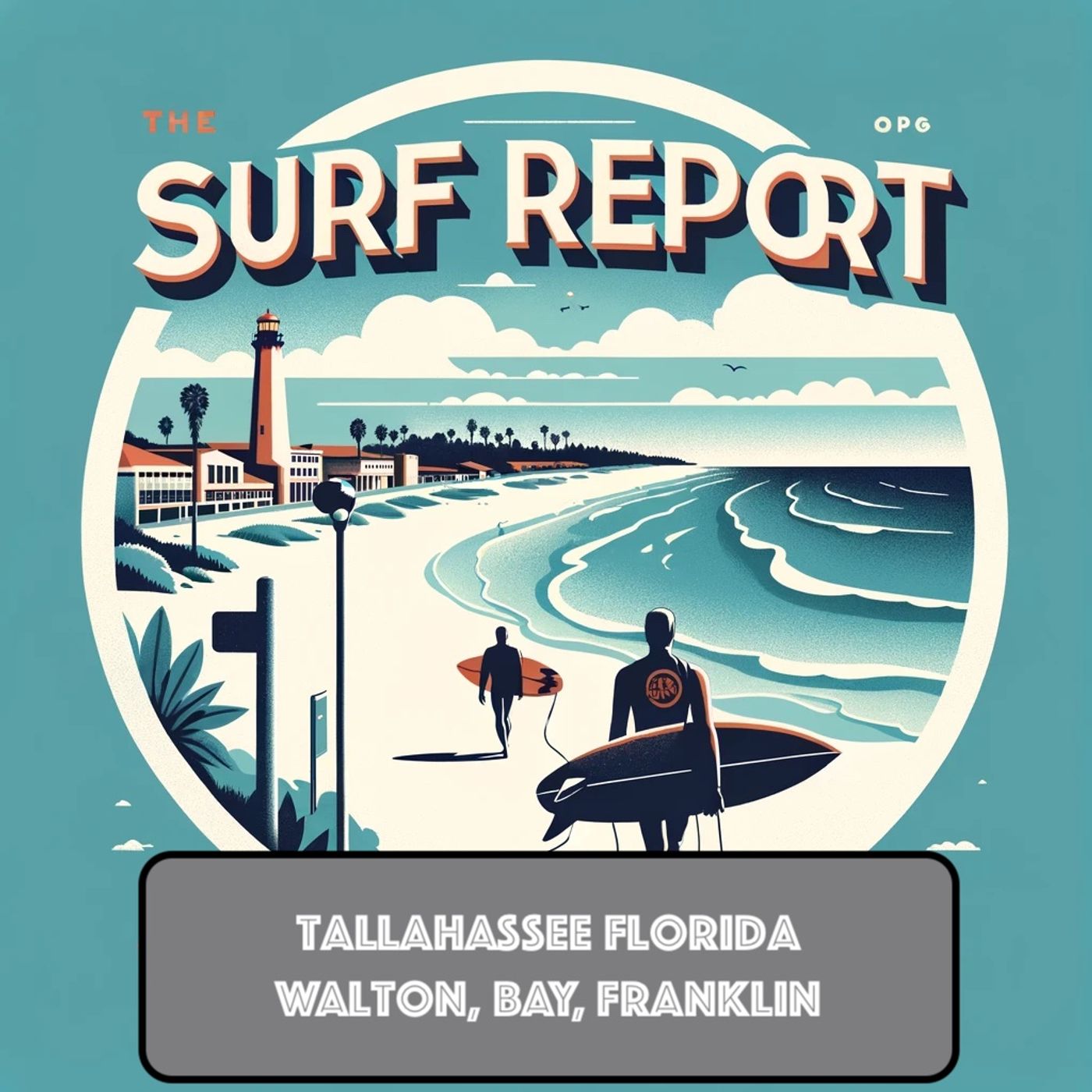
Surf Report - Tallahassee FL
by Inception Point Ai
"Surf Report Tallahassee FL" is your daily dose of beach vibes and water sports enthusiasm, right from the heart of Florida's capital. Whether you're a seasoned surfer or just looking to learn about enjoying water sports inland, our podcast delivers fresh, fun content straight to your ears.Subscribe to "Surf Report Tallahassee FL" on your favorite podcast platform to never miss an episode. Join our community online where we share updates, tips, and engage with fellow listeners who love to surf, no matter where they are. Tune in and bring the surf to your daily routine!This show includes AI-generated content.
-
517
Panhandle Surf Forecast May 5-9: Small Waves Early Week, Increasing Surf and Rip Current Risk by Friday
Good morning, this is your Panhandle surf zone forecast for Tuesday, May fifth through Saturday, May ninth. We're looking at small but fun conditions today with surf heights hovering around one foot across the region. Light southeast winds at five to ten miles per hour will keep things manageable, and you'll be treated to mostly sunny skies. Water temperatures are holding steady in the low to mid seventies, so it's definitely time to get in the water. However, there is a moderate risk of rip currents, so always exercise caution and respect the ocean's power. Wednesday brings a slight bump in the surf with heights around two feet expected. Conditions remain mostly sunny as south winds pick up to around ten to fifteen miles per hour depending on your location. The rip current risk stays moderate for most areas, though State Park beaches along the Coastal Gulf are looking at a higher risk level. It's shaping up to be a beautiful beach day, with highs in the upper seventies to near eighty degrees. Now things get interesting as we head into Thursday and Friday. A cold front approaches, and that's going to strengthen the onshore flow considerably. Thursday will see the rip current risk increase to high levels, particularly along the Coastal Bay near Panama City Beach where we could see surf heights around three feet. Showers and thunderstorms become a possibility throughout the day, so keep an eye on the sky. Highs will be in the mid to upper seventies with southwest winds around fifteen miles per hour. Friday is when things really pick up. We're expecting showers likely with chances of thunderstorms as the cold front moves through. The rip current risk remains high across most of the Coastal Bay area, so if you're thinking about getting in the water, exercise extreme caution. East winds will increase to around fifteen miles per hour at times. Highs drop back to the mid seventies. By Saturday, the system moves out and we'll see conditions improve. The rip current risk drops back to moderate levels as the front exits. We'll see partly to mostly cloudy skies with a chance of scattered showers and thunderstorms lingering. Highs remain in the mid to upper seventies with lighter westerly winds around five to ten miles per hour. In summary, enjoy the calm conditions early in the week, but prepare for rougher water by week's end as a cold front pushes through. Always be aware of rip current risks, and remember, if you find yourself caught in a rip current, swim parallel to shore to escape. Have a great day at the beach! For more http://www.quietplease.ai Get the best deals https://amzn.to/3ODvOta
-
516
South Walton Beach Forecast Sunny Through Tuesday Moderate Rip Currents Rain and Storms Thursday Friday
Good morning, this is your surf zone forecast for South Walton beaches including Sandestin, Santa Rosa Beach, and Turquoise Beach. Today looks absolutely gorgeous out there. We're expecting sunny skies with highs in the mid seventies and a light northeast breeze around five miles per hour that'll shift south in the afternoon. The water's a pleasant seventy two degrees, but here's the thing, even though conditions look perfect, we do have a moderate rip current risk in effect. That means life threatening rip currents are possible in the surf zone, so please be aware if you're heading into the water. The surf is running around one foot, and the UV index is very high, so don't forget that sunscreen. Tuesday continues the beautiful stretch. We're looking at mostly sunny skies with highs again in the mid seventies. The wind picks up slightly to southeast at five to ten miles per hour. Surf heights stay around one foot with moderate rip current risk persisting. High tide at Panama City happens at eleven fifty three in the morning. Now here's where things start to change. By Wednesday, we'll still see mostly sunny conditions and highs in the upper seventies, but the surf builds to around two feet as a south wind develops around ten miles per hour. The moderate rip current risk continues. Thursday is when our next weather system moves in. Expect mostly cloudy skies with showers likely and a chance of thunderstorms developing. Highs will be in the mid seventies with southwest winds around fifteen miles per hour. The rip current risk ramps up to high, meaning life threatening rip currents will likely be in the surf zone. Friday looks similar with mostly cloudy skies, showers likely, and another chance of thunderstorms. Highs in the mid seventies with north winds around fifteen miles per hour, and that high rip current risk remains in effect as the system moves through. So bottom line, enjoy the next couple of days because they're looking fantastic. Just keep an eye on those rip currents even when conditions seem calm. And by mid to late week, we'll have some rain moving in along with stronger surf and significant rip current dangers. Stay safe out there on the water. For more http://www.quietplease.ai Get the best deals https://amzn.to/3ODvOta
-
515
Tallahassee Beach Forecast High Rip Currents Expected Saturday Through Sunday May 2-3
Good afternoon, this is your Tallahassee National Weather Service Surf Zone Forecast for Saturday, May 2nd through Wednesday, May 6th. A cold front moved through this morning, and northerly winds are developing this afternoon. This will trigger dangerous rip current conditions across much of the area, particularly along the south facing and west facing Gulf beaches of Gulf County and all beaches in Franklin County. Let's break down what's happening at your favorite beaches. South Walton, including Sandestin, Santa Rosa Beach, and Turquoise Beach, is looking at moderate rip currents for the rest of today with surf around one foot. It'll be partly sunny with a chance of showers, highs near 70 degrees, and north winds around 20 miles per hour. The water is a comfortable 73 degrees. Sunday brings high rip current risk with surf still around two feet. It'll be sunny with highs in the lower 70s and lighter north winds at 10 to 15 miles per hour. Monday through Wednesday improve considerably with only moderate rip current risk, lighter winds shifting east to southeast, and highs gradually warming into the mid to upper 70s. Over at Coastal Bay beaches including Panama City Beach and Magnolia Beach, we're forecasting moderate rip currents today with surf around two feet. Expect partly sunny skies, a chance of showers and slight chance of thunderstorms, with highs in the upper 60s and north winds around 20 miles per hour. Water temperature is 72 degrees. Sunday escalates to high rip current risk with two foot surf continuing under sunny skies. Highs reach the mid 70s with north winds 10 to 15 miles per hour. The outlook for Monday through Wednesday shows decreasing rip current risk to moderate levels, sunny to mostly sunny conditions, and warming highs in the upper 70s as winds shift east to southeast. The Coastal Gulf beaches including Saint Joe Beach are under a High Rip Current Risk through late tonight. West facing beaches, south facing beaches, and state park beaches all carry high rip current risk today with around two feet of surf. Showers are likely with a chance of thunderstorms, highs near 70, and north winds around 20 miles per hour. Tomorrow, west facing beaches drop to moderate rip current risk, while south facing and state park beaches remain high risk. Sunny skies take over with highs in the mid 70s and north winds 10 to 15 miles per hour. Monday and Tuesday see moderate rip current risk return with one foot surf and mostly sunny conditions. Wednesday brings mostly sunny skies and upper 70s, but high rip current risk returns as south winds increase to 15 miles per hour. Finally, Coastal Franklin beaches including Apalachicola are under High Rip Current Risk through late tonight. Two foot surf is expected with mostly cloudy skies, showers likely, and a chance of thunderstorms. Highs reach 70 degrees with north winds around 20 miles per hour. Water temperature is a pleasant 76 degrees. Sunday maintains high rip current risk with two foot
-
514
South Walton Beach Forecast: Moderate Rip Currents Today, High Risk Sunday with Two Foot Waves
# Surf Zone Forecast Report - South Walton Beaches Good morning everyone. Here's your surf zone forecast for South Walton, covering the beaches of Sandestin, Santa Rosa Beach, and Turquoise Beach. Today we're looking at moderate rip currents with waves around one foot. It'll be mostly cloudy until mid afternoon, then clearing to mostly sunny skies. Fair warning though, we do have showers and a chance of thunderstorms in the forecast. Highs will reach around 70 degrees with northerly winds around 20 miles per hour. The water temperature is a pleasant 74 degrees. The UV index is very high, so make sure you get that sunscreen applied. High tide occurs at 9:44 AM. Sunrise is at 7 AM and sunset at 8:23 PM. Now here's where things get interesting. Sunday is shaping up to be quite the beach day despite a significant shift in conditions. While the weather will be sunny and pleasant with highs in the lower 70s and lighter northerly winds between 10 and 15 miles per hour, the rip current risk jumps to high. That means life threatening rip currents are likely in the surf zone. Waves will build to around two feet. High tide Sunday is at 10:22 AM. Looking ahead to Monday through Wednesday, we'll see improving conditions with moderate rip current risk returning. Surf heights drop to around one foot. Monday stays sunny with highs in the lower 70s and light east winds. Tuesday becomes mostly sunny with highs in the mid 70s and southeast winds around 10. Wednesday continues mostly sunny, warming to the mid 70s with south winds around 15 miles per hour. Bottom line: Enjoy the water today but watch out for those rip currents Sunday. Life threatening currents are likely, so if you're heading out, stay alert and consider watching from the shore instead. For more http://www.quietplease.ai Get the best deals https://amzn.to/3ODvOta
-
513
Florida Panhandle Beach Forecast: Moderate Rip Currents Today, High Risk This Weekend
Good morning, this is your surf zone forecast for the Florida Panhandle beaches brought to you by the National Weather Service in Tallahassee. We're looking at one more day of moderate rip current risk before things get significantly more dangerous this weekend. A strong weather system is moving through Friday and Saturday, and while it clears out the clouds, it's going to leave some seriously rough water in its wake. Let's start with today. If you're heading to South Walton beaches like Santa Rosa Beach or Turquoise Beach, expect mostly cloudy skies with showers likely and a slight chance of thunderstorms. The good news is temperatures will be in the mid-seventies with light northeast winds around ten miles per hour. The water is a pleasant seventy-six degrees, but we're maintaining that moderate rip current risk, so be cautious if you're planning a swim. Surf heights are minimal at around one foot, and the high tide at Panama City will occur at nine seventeen in the morning. Down at Panama City Beach and Magnolia Beach in the Coastal Bay area, conditions are nearly identical. Same moderate rip current risk, same one-foot surf, same upper-seventies high temperature. The water here is slightly cooler at seventy-four degrees, and you'll notice the winds shift from northeast to southeast as the afternoon progresses. Over on the Coastal Gulf near Saint Joe Beach, we're looking at a different story. The UV index is extreme, so sunscreen is absolutely essential. It'll be partly sunny with showers likely, and again, we have that moderate rip current risk across all beach orientations. The water is a warm seventy-six degrees, and surf will stay around one foot throughout the day. And finally, for Apalachicola beaches in Coastal Franklin, conditions remain calm with moderate rip currents and one-foot surf. The water is the warmest we've seen today at seventy-eight degrees. There's a chance of showers and an extreme UV index, so protect that skin. Now here's where things change dramatically. Saturday is when that post-frontal system really makes its presence known. Rip current risk escalates to high across all beaches. We're looking at higher surf, around two to three feet depending on location, with much stronger winds. At South Walton, expect north winds gusting around twenty miles per hour and surf building to two feet. There will be showers and a chance of thunderstorms with temperatures dropping to around seventy degrees. This is going to be a dangerous day for swimming. Panama City Beach sees breezy conditions with northeast winds twenty to twenty-five miles per hour. Again, high rip current risk and two-foot surf. The temperature drops to the lower seventies, and those showers and thunderstorms will persist. The Coastal Gulf sees the most dramatic change, with west and south-facing beaches picking up three-foot surf. Winds will start from the southwest around twenty miles per hour before shifting north in the afternoon. High rip current ri
-
512
South Walton Beach Surf Forecast: Moderate Conditions Today, Cold Front Saturday with High Rip Current Risk
# South Walton Beach Forecast Here's your South Walton surf zone forecast for the next few days. Today looks pretty decent if you're willing to brave some afternoon showers. We're looking at moderate rip current risk with surf around two feet and west winds at about ten miles per hour. The water's a warm seventy-six degrees, so at least you won't freeze. Fair warning though, there's a chance of scattered showers and thunderstorms, and the UV index is very high, so definitely slather on that sunscreen. High temperatures will be in the upper seventies. Friday things calm down a bit. Surf shrinks to around one foot, winds shift to the northeast at ten miles per hour, and we're still sitting at moderate rip current risk. It'll be mostly cloudy with showers likely, and there's still a slight chance of thunderstorms. Highs will be in the mid seventies. Now here's where things get interesting. Saturday brings a significant shift as a cold front moves through. Rip current risk jumps to high, which means life-threatening rip currents will likely be present in the surf zone. We'll see surf build to around two feet, it'll be mostly cloudy with showers and thunderstorms possible, and importantly, north winds are going to pick up around twenty miles per hour. Temperatures will drop to the upper sixties, so you might want to grab a wetsuit. Sunday clears up beautifully. High rip current risk continues, but at least you'll have sunshine with highs in the lower seventies. North winds will ease to around fifteen miles per hour. Monday stays sunny and dry with highs in the lower seventies and easterly winds around five miles per hour. High rip current risk persists, so keep that in mind when you're in the water. Bottom line, enjoy today and Friday if you get a chance, but be cautious because those rip currents are possible. Come the weekend, conditions deteriorate with stronger winds and higher rip current dangers as the cold front arrives. For more http://www.quietplease.ai Get the best deals https://amzn.to/3ODvOta
-
511
Panhandle Beach Surf Forecast Wednesday to Sunday High Rip Current Risk Weekend Cold Front
Good morning, I'm bringing you your Panhandle beach surf forecast for Wednesday through Sunday. A moderate rip current risk continues today across all our local beaches with seas hovering around two feet. It's going to be a beautiful day to be outside with partly sunny skies, upper seventies for highs, and gentle southwest winds around ten miles per hour. Water temperatures are comfortable in the mid to upper seventies depending on where you are. The UV index is very high, so don't forget that sunscreen. Thursday stays mostly dry with partly sunny conditions and highs again in the upper seventies, but there's a chance of showers and maybe a few thunderstorms rolling through. The rip current risk remains moderate. Winds shift to the northwest and stay light around ten miles per hour. Friday brings a slight change in pattern with mostly cloudy skies and another chance of showers and thunderstorms. Surf heights drop to around one foot, and highs reach the mid seventies with east winds. The rip current risk stays moderate, so still be cautious if you're heading out. Now here's where things get interesting. A cold front moves through this weekend, and the National Weather Service is raising the rip current risk to high on Saturday and Sunday. Saturday looks pretty wet with showers and thunderstorms likely, and it'll be noticeably breezy with winds around twenty to twenty five miles per hour depending on your location. Highs will dip into the upper sixties to low seventies. Sunday clears out nicely with mostly sunny to sunny skies, but keep that high rip current risk in mind. There's still a chance of showers, and cooler north winds around fifteen miles per hour will be blowing. Highs drop to the lower seventies. So here's the bottom line: enjoy the beautiful weather and moderate conditions through Friday, but be prepared for more active seas and stronger rip currents this weekend as the cold front passes. If you're planning to be in the water Saturday or Sunday, exercise extra caution and stay aware of those dangerous currents near structures like piers and jetties. For more http://www.quietplease.ai Get the best deals https://amzn.to/3ODvOta
-
510
Northern Gulf Coast Surf Forecast: Moderate Rip Currents Through Friday, High Risk Saturday
Good morning, this is your Tuesday surf zone forecast for the Northern Gulf Coast. We're looking at a moderate rip current risk throughout the week that will kick up to high by Saturday as a low pressure system moves in from the west. Let's break down what's happening at your favorite beaches. Starting with South Walton, including Sandestin, Santa Rosa Beach, and Turquoise Beach, expect mostly sunny skies today with surf heights around two feet and moderate rip currents. Southeast winds at ten miles per hour will keep conditions pleasant with highs in the mid seventies. Water temperature is a comfortable seventy five degrees, though fair warning, that UV index is very high, so slather on the sunscreen. Wednesday looks similar with partly sunny skies, two foot surf, and those moderate rip currents sticking around. Winds will shift to the southwest at five to ten miles per hour as highs reach the upper seventies. Thursday brings mostly cloudy skies and a chance of showers and thunderstorms. Surf stays around two feet with west winds at ten miles per hour. Friday continues the pattern with a chance of showers and a slight chance of thunderstorms, though conditions remain relatively calm before the weekend system arrives. Now Saturday is when things get interesting. Rip current risk jumps to high as winds become breezy out of the west at twenty five miles per hour. Showers and thunderstorms move in, and surf heights start responding to that low pressure system. Moving east to Panama City Beach and Magnolia Beach in the Coastal Bay area, today's conditions mirror South Walton with mostly sunny skies, two foot surf, and moderate rip currents. Southeast winds are a bit stronger here at fifteen miles per hour with highs in the upper seventies and water temperature at seventy four degrees. Wednesday turns partly sunny with southeast winds becoming southwest at fifteen miles per hour in the afternoon. The same system brings showers and thunderstorms Thursday through Saturday, with that high rip current risk arriving Saturday when west winds gust to twenty five miles per hour. Out at Saint Joe Beach and the Coastal Gulf area, we see some variation based on beach orientation. South facing beaches will have around two feet of surf today, while west facing beaches see just one foot or less. The state park beaches stay around one foot. All areas carry moderate rip current risk with southeast winds at fifteen miles per hour. Wednesday sees those west facing beaches drop to around one foot while south facing beaches hover around one foot, but state park beaches rise to two feet. Thursday and Friday bring chances of showers with the same moderate rip current risk before Saturday's high risk arrives with southwest winds at twenty five miles per hour. Finally, at Apalachicola in Coastal Franklin, we've got sunny skies today with two foot surf, moderate rip currents, and the warmest water temperature of the forecast at seventy seven degrees. Southeast wind
-
509
Florida Panhandle Surf Forecast: Sunny Beaches Today, High Rip Current Risk Thursday at St. Joseph Peninsula
Good morning! Here's your surf zone forecast for the Florida Panhandle brought to you by the National Weather Service in Tallahassee. A moderate risk of rip currents will persist through at least mid-week as high pressure dominates the region. However, things will escalate heading into Thursday when St. Joseph Peninsula beaches in Gulf County could see rip current risks increase to high as surf heights climb to around two feet. Let's break down what you can expect across the different beach zones. Starting with South Walton beaches including Sandestin, Santa Rosa Beach, and Turquoise Beach, today looks absolutely gorgeous. Sunny skies with very high UV, so definitely grab that sunscreen. Expect around one foot of surf with moderate rip current risk. Water temps are a pleasant seventy-four degrees, and highs will reach the upper seventies under light northeast winds turning southeast by afternoon. High tide hits Panama City around nine twenty-eight in the morning with low tide at three twenty-five in the afternoon. Tuesday continues the beautiful pattern with mostly sunny skies and highs in the upper seventies. Surf bumps up slightly to around two feet, and moderate rip current risk remains in effect. Southeast winds will be a bit stronger at around ten miles per hour. Moving eastward to the Coastal Bay area near Panama City Beach and Magnolia Beach, conditions today are equally inviting. You're looking at sunny skies with around two feet of surf and that same moderate rip current risk. Water temperatures here run a touch cooler at seventy-three degrees, while highs climb to around eighty. Northeast winds around ten miles per hour will shift southeast in the afternoon. Tuesday for the Bay area stays mostly sunny with two-foot surf and moderate rip current risk. Southeast winds will bump up to fifteen miles per hour. Now for our Gulf County beaches including Saint Joe Beach and the Coastal Gulf zone, here's where things get interesting. West-facing beaches see around one foot of surf while south-facing beaches pick up closer to two feet. State park beaches hover near one foot. All areas maintain moderate rip current risk today with highs around eighty and northeast winds becoming southeast. The big story for Gulf County is Thursday when the Coastal Gulf zone, specifically Saint Joe Beach, will likely see rip current risks jump to high as conditions deteriorate. A chance of showers and thunderstorms moves in, so keep an eye on the forecast as we approach that day. Finally, heading further east to Apalachicola in Coastal Franklin, expect mostly sunny skies today with around one foot of surf and moderate rip current risk. Water temperatures here are the warmest of the forecast area at seventy-eight degrees. Highs reach the upper seventies under east winds around ten miles per hour. As we move through the week, mid-week conditions remain fairly stable with mostly sunny skies and moderate rip current risks across all zones. By Thursday, showe
-
508
Tallahassee Beach Forecast Sunday to Thursday Spring Weather Sunny Skies Light Surf and Rip Current Warnings
Good morning, this is your Tallahassee National Weather Service Surf Zone Forecast for Sunday, April 26th through Thursday, April 30th. Let's start with today. Light northwest winds will give way to onshore southwest breezes this afternoon as the sea breeze develops. Expect mostly sunny skies with highs in the upper 70s and a very high UV index, so don't forget that sunscreen. Surf heights will be minimal, hovering around one foot throughout the day. However, a moderate risk of rip currents is in effect, so swimmers and waders should exercise caution and be aware of the water movement. Water temperatures are holding steady in the low to mid 70s, which should be comfortable for most water activities. Moving into Monday, conditions remain quite pleasant. We'll see mostly sunny skies with highs around 80 degrees along the coastal bay areas and upper 70s elsewhere. Winds will be light out of the northeast in the morning, shifting to the southeast in the afternoon. Surfers should note that Tuesday is looking like the better day as winds increase to around 15 miles per hour, bringing slightly better conditions with surf heights reaching around 2 feet at some locations. The moderate rip current risk continues through both days, so stay alert if you're heading into the water. As we look ahead to the middle of the week, Wednesday brings a slight chance of showers and thunderstorms with partly sunny skies and highs in the mid to upper 70s. Southwest winds around 10 miles per hour will be the pattern. Finally, Thursday shows similar conditions with a chance of showers and a slight chance of thunderstorms possible. Northwest winds around 10 to 15 miles per hour will move in, and highs will reach the upper 70s. Throughout the extended forecast period, the moderate to high rip current risk remains a consistent concern, particularly along the Coastal Gulf zones Wednesday and Thursday when that risk elevates to high. Life threatening rip currents are likely in those areas, so close supervision and caution are strongly encouraged. Overall, it's looking like a nice spring weekend at the beach with generally calm conditions perfect for a relaxing day in the sun. For more http://www.quietplease.ai Get the best deals https://amzn.to/3ODvOta
-
507
Northern Florida Gulf Coast High Rip Current Warning Saturday Upper Seventies Water Temp 74 Degrees
Good morning, this is your Saturday surf zone forecast for the northern Florida Gulf Coast beaches. We're tracking some serious rip current activity today, so listen up if you're planning a beach day. Let's start with the Emerald Coast. South Walton beaches including Sandestin, Santa Rosa Beach, and Turquoise Beach are under a high rip current risk that remains in effect through this evening. We're looking at surf heights around two feet with wave periods near six seconds, which is the perfect recipe for life-threatening rip currents. The water is a pleasant seventy-four degrees, and you'll have partly sunny skies with a chance of showers and thunderstorms. Highs will reach the upper seventies with south winds at five to ten miles per hour. If you do venture into the water, please swim near a lifeguard. Sunrise is at seven oh seven in the morning, and sunset comes at eight nineteen in the evening. Moving east to the Coastal Bay area around Panama City Beach and Magnolia Beach, conditions are similar with a high rip current risk through this evening. Surf heights are again around two feet, and the water temperature is also seventy-four degrees. Expect mostly sunny skies with a chance of showers and slight thunderstorms possible. Highs in the upper seventies with south winds five to ten miles per hour. Again, swim near a lifeguard due to the high rip current risk. Down toward the Coastal Gulf near Saint Joe Beach, we see some variation depending on beach orientation. West-facing beaches are looking at a low rip current risk with very small surf, while south-facing beaches have a moderate to high risk with two-foot waves. The UV index is very high today, so sunscreen is a must. Water temperature is seventy-five degrees with mostly sunny skies and just a slight chance of showers and thunderstorms. Finally, the Coastal Franklin beaches near Apalachicola show a moderate rip current risk today with two-foot surf heights and very high UV index. Water temperature is seventy-six degrees, mostly sunny with that same slight chance of showers and thunderstorms. South winds five to ten miles per hour. Looking ahead to Sunday, conditions improve across the board. Most areas drop down to a moderate rip current risk with smaller waves around one foot. Partly sunny skies persist with a chance of showers and slight thunderstorms. Upper seventies for highs with west winds five to ten miles per hour. Monday through Wednesday, we're looking at moderate rip current risks continuing, mostly sunny to partly sunny skies, and temperatures in the mid to upper seventies. Winds shift to the southeast and southwest. It's shaping up to be a fairly typical late April pattern for the Big Bend coast. Stay safe out there, and remember, rip currents are strongest near groins, jetties, reefs, and piers even on lower risk days. This has been your northern Florida Gulf Coast surf zone forecast. For more http://www.quietplease.ai Get the best deals https://amzn.to/3ODvOta
-
506
Florida Panhandle Beach Forecast: Sunny Skies, Moderate Rip Currents, One to Two Foot Surf Today
Good morning, this is your surf zone forecast for the Florida Panhandle beaches brought to you by the National Weather Service in Tallahassee. We're looking at onshore flow around ten miles per hour today with surf heights of one to two feet creating moderate rip current risk across the region. Let's break down what to expect at your favorite beaches. Starting with South Walton including Sandestin, Santa Rosa Beach and Turquoise Beach, today brings mostly sunny skies with highs in the mid seventies. Southeast winds will stay light around ten miles per hour while the water temperature hovers at a pleasant seventy-three degrees. The UV index is running high, so sunscreen is definitely your friend out there. High tide occurs at four oh six in the afternoon. Saturday continues the moderate rip current risk with one to two foot surf. Expect partly sunny skies with a chance of showers and thunderstorms moving through. The good news is winds will be even lighter, just five to ten miles per hour from the south. Moving to the Coastal Bay area covering Panama City Beach and Magnolia Beach, today features sunny skies with slightly warmer highs in the upper seventies. The same moderate rip current risk and one to two foot surf apply here with southeast winds around ten miles per hour. Saturday looks mostly sunny with a chance of showers and slight chance of thunderstorms. Highs remain in the upper seventies with moderate rip current conditions persisting. Out along the Coastal Gulf including Saint Joe Beach, today's forecast varies by beach orientation. West facing beaches see low rip current risk with surf a foot or less, while south facing and state park beaches experience moderate risk with one to two foot surf. The UV index climbs to very high levels here. Saturday brings moderate rip current risk across all beaches with winds shifting from the south at five to ten miles per hour. Finally, at Apalachicola in Coastal Franklin, today delivers sunny conditions with moderate rip current risk and one to two foot surf. The UV index reaches very high levels again. Water temperature here is a degree warmer at seventy-four degrees. Saturday continues mostly sunny with moderate rip current risk still in play and one to two foot surf. Looking ahead to the weekend through Tuesday, expect mostly sunny to partly sunny skies with highs consistently in the mid to upper seventies. Rip current risk remains moderate across all areas through the period. A chance of showers and thunderstorms increases Saturday through Sunday before conditions dry out Monday and Tuesday. Winds will be generally light to moderate from the south and southeast. Remember, a moderate rip current risk means life-threatening rip currents are possible in the surf zone. If you find yourself caught in a rip current, stay calm and swim parallel to the shore to escape its pull. Have a great day at the beach and stay safe out there. For more http://www.quietplease.ai Get the best deals https://am
-
505
Florida Panhandle Surf Forecast High Rip Current Risk Thursday Friday April 2026 Beach Safety
# Surf Zone Forecast Report - Thursday April 23, 2026 Good afternoon, I'm bringing you the latest surf conditions across Florida's panhandle beaches, and we've got some important safety information to share as we head into the evening. A six-second southeasterly swell is making waves along the coast, and it's creating some serious rip current activity that everyone needs to know about. At St. George Island, we're looking at a high risk of dangerous rip currents both today and tomorrow, so swimmers and surfers should exercise extreme caution in those waters. Speaking of which, beach officials are flying red flags at Bay and Franklin beaches right now, indicating hazardous conditions. Yellow flags are up everywhere else, so life-threatening rip currents are possible in most surf zones today. Let's break down what you can expect in specific areas. Down in South Walton, including Santa Rosa Beach and Sandestin, we're looking at moderate rip current risk with surf heights around two feet. It's going to be sunny and beautiful with highs in the mid-seventies and southeast winds around ten miles per hour. Water temperature is a pleasant seventy-two degrees, so it's a great day to get in the water if you know what you're doing and respect those rips. Over at Panama City Beach and the coastal bay areas, conditions are similar with moderate rip current risk and around one to two foot surf. It'll be sunny today with highs in the upper seventies and southeast winds picking up to around fifteen miles per hour. Now here's where things get more serious. Down at the Coastal Gulf beaches near St. Joe and Apalachicola, we're dealing with high rip current risk that will persist through Friday. This is your heads-up to stay out of the water or at minimum, stay very close to shore and use the buddy system. Apalachicola especially is under a high rip current risk alert that extends through this evening. Friday is looking sunny and warm across the board with highs in the mid to upper seventies, but those rip currents will remain a concern, particularly down in Franklin County where the high risk continues. Surf heights will hold steady around two feet. Looking ahead to the weekend, we're expecting mostly sunny skies Saturday and Sunday with a chance of showers and thunderstorms moving in. Highs stay in the mid-seventies with lighter winds. Rip current risk will ease back to moderate levels by then. The bottom line: respect the rip currents today and tomorrow, especially if you're heading to Franklin or St. George Island beaches. Watch for red and yellow flags, never swim alone, and if you get caught in a rip, remember to swim parallel to shore rather than fighting it directly. Have a safe and beautiful day at the beach. For more http://www.quietplease.ai Get the best deals https://amzn.to/3ODvOta
-
504
Florida Panhandle Surf Forecast High Rip Current Risk St George Island and Apalachicola Through Friday
Good afternoon, I'm bringing you the latest surf zone forecast for the Florida Panhandle beaches, issued Thursday at noon. A six-second period southeasterly swell is pumping into St. George Island today, creating a high risk of rip currents in that area. Similar dangerous conditions are expected to continue tomorrow. Elsewhere along the coast, we're looking at a moderate rip current risk thanks to steady onshore flow, with surf heights building to around two feet along the Emerald Coast. Let's break down what's happening at specific locations, starting with South Walton beaches including Sandestin, Santa Rosa Beach, and Turquoise Beach. Today you're looking at moderate rip current risk with surf around two feet. The water's a pleasant 72 degrees, and it's going to be sunny with highs in the mid 70s and southeast winds around ten miles per hour. High tide occurs at two fifty-three in the afternoon. Friday looks nearly identical with mostly sunny skies, similar surf conditions, and the same moderate rip current risk. Moving to the Coastal Bay area covering Panama City Beach and Magnolia Beach, conditions today feature moderate rip current risk with smaller surf around one foot. It's sunny and warm with highs in the upper 70s, though southeast winds will be a bit stronger at fifteen miles per hour. Friday brings a slight uptick with surf building to around two feet under sunny skies. Out at Coastal Gulf beaches including Saint Joe Beach, conditions get a bit more nuanced. West-facing beaches see moderate rip currents with one-foot surf, while south-facing beaches are more active with two-foot surf and moderate rip current risk. Friday gets interesting though, as south-facing beaches escalate to a high rip current risk while maintaining that two-foot surf. State park beaches stay in the moderate risk category. Finally, the Coastal Franklin area near Apalachicola is the hot spot right now. A high rip current risk is in effect through eight tonight with two-foot surf and sunny conditions. This remains elevated to high risk again on Friday, so beachgoers in that area need to exercise extra caution. Looking ahead to the weekend, a system brings chances of showers and thunderstorms Saturday and Sunday, though most of the time remains partly to mostly sunny. Rip current risks lower to moderate across most areas by Saturday. Monday wraps up the forecast period with mostly sunny skies and moderate rip current risk. Beach flags currently flying reflect these conditions, with red flags posted at Bay and Franklin County beaches due to the high rip current risk, while yellow flags indicate moderate risk elsewhere. Stay safe out there and always respect the ocean's power. For more http://www.quietplease.ai Get the best deals https://amzn.to/3ODvOta
-
503
Florida Panhandle Surf Forecast Smaller Waves Return With Persistent Rip Current Risk Through Sunday
Good morning, here's your surf zone forecast for the Florida panhandle beaches brought to you by the National Weather Service in Tallahassee. We're looking at lighter winds and smaller surf across the region today and tomorrow compared to what we've experienced over the last several days. While conditions are mellowing out, rip currents remain a concern, so swimmers and water enthusiasts need to stay alert. Starting with South Walton beaches including Sandestin, Santa Rosa Beach, and Turquoise Beach, we're expecting moderate rip current risk with surf around two feet today. It's going to be sunny with an extreme UV index, so definitely break out that sunscreen. Water temps are a pleasant seventy four degrees with southeast winds around five miles per hour. High temperatures will reach the mid seventies. The high tide at Panama City occurs at ten oh three in the morning with a low tide at four fifty seven in the afternoon. Thursday looks very similar for South Walton with moderate rip current risk, two foot surf, and mostly sunny skies. Winds will pick up slightly to five to ten miles per hour from the south. Friday through Sunday we're tracking moderate rip current risk with surf dropping to around one foot. Expect sunny to mostly sunny conditions with highs in the mid seventies and light winds. Moving along the coast to Panama City Beach and Magnolia Beach in the Coastal Bay area, conditions are nearly identical to South Walton. Today brings moderate rip current risk with two foot surf, sunny skies, and an extreme UV index. Water temperature is also seventy four degrees. Winds will start out of the east around five miles per hour, turning southerly in the afternoon. High tide is at ten oh three in the morning. Thursday continues the pattern with moderate rip current risk and two foot surf. Mostly sunny skies with similar wind shifts from east to south. Friday through the weekend, we're still looking at moderate rip current risk with two foot surf on Friday and one foot thereafter. Sunday will see northwest winds increasing to around twenty miles per hour. Over at Saint Joe Beach and the Coastal Gulf area, we've got a more detailed breakdown by beach orientation. West facing beaches have low rip current risk with one foot or less of surf. South facing beaches face moderate rip current risk with around two feet of surf. State park beaches are moderate risk with one foot of surf. The UV index is very high, and water temps are seventy five degrees with southeast winds around ten miles per hour. Thursday shows an upgrade for west facing beaches to moderate rip current risk. South and state park beaches remain moderate. Surf heights stay similar with two feet on south facing beaches and one foot elsewhere. Friday through Saturday maintain moderate risk across the board with light southeast to south winds. However, Sunday is worth noting as south facing beaches see a jump to high rip current risk with northwest winds around fifteen miles per hou
-
502
Northern Gulf of Mexico Beach Forecast High Rip Current Risk Through Thursday Easing Friday
Good morning, this is your surf zone forecast for the northern Gulf of Mexico beaches brought to you by the National Weather Service Tallahassee. A large area of the eastern Gulf is being brushed by gentle to occasionally moderate southeast breezes that are churning up enough surf to create a significant rip current threat across most beaches through Thursday. The good news is that we'll see conditions ease up heading into Friday as winds weaken considerably. Let's break down what you need to know for your specific beach zone. For South Walton beaches including Sandestin, Santa Rosa Beach, and Turquoise Beach, we have a high rip current risk in effect through late tonight and continuing through Thursday. Expect around two feet of surf today under sunny skies with highs in the mid-seventies. Southeast winds will be light, ranging from five to ten miles per hour. Water temperature is holding at a pleasant seventy-three degrees. High tide hits Panama City at ten twenty-two this morning with low tide at three twenty-seven in the afternoon. The UV index is very high, so sun protection is definitely recommended. Wednesday looks similar with the high rip current risk persisting, two-foot surf, and sunny conditions. By Thursday, the rip current risk remains high but starts easing Friday to a moderate risk as winds diminish. Moving to Panama City Beach and Magnolia Beach in the Coastal Bay area, we're also under a high rip current risk today through late tonight. You'll find the same two-foot surf and sunny conditions with highs in the mid-seventies. Southeast winds around ten miles per hour, and water temperatures are slightly cooler at seventy-two degrees. The same tidal schedule applies with high tide at ten twenty-two in the morning. Wednesday maintains the high rip current risk before dropping to moderate risk levels Friday as conditions continue to settle. Saint Joe Beach and other Coastal Gulf locations present a more nuanced forecast. The rip current risk varies depending on which direction the beach faces. South-facing beaches are under a high rip current risk today with two-foot surf, while west-facing beaches only have a low risk with minimal one-foot or less surf. State Park beaches fall somewhere in the middle with a moderate risk and around one foot of surf. This pattern shifts Wednesday when south-facing beaches drop to moderate risk, while west-facing beaches stay low. By Thursday and Friday, south-facing beaches are back to high risk before moderating Saturday. Finally, for Apalachicola and Coastal Franklin beaches, we're looking at a high rip current risk today and Wednesday with around two-foot surf and sunny skies. Highs in the mid-seventies with southeast winds near ten miles per hour. Water here is the warmest of the bunch at seventy-five degrees. The high rip current risk persists through Thursday before easing to moderate Friday and Saturday. The big picture is clear: if you're heading to any of these beaches through Thursda
-
501
Eastern Gulf Surf Forecast April 13-17: High Rip Current Risk Through Thursday, Sunny Skies
Good morning, this is your Surf Zone Forecast for Monday, April 13th through Friday, April 17th. Across the eastern Gulf, a pattern of gentle to occasionally moderate southeast breezes will keep conditions active through Thursday, generating enough surf to bring a high risk of rip currents to most beaches. Things will settle down considerably by Friday as winds weaken, giving you less surf and a better shot at avoiding those treacherous currents. Let's start with South Walton, including Sandestin, Santa Rosa Beach, and Turquoise Beach. Today expect around two feet of surf with a high risk of rip currents. It's going to be partly sunny with mid-seventies temperatures and southeast winds around ten miles per hour. Water temperature is holding at a comfortable seventy-two degrees. UV index is very high, so don't forget that sunscreen. Sunrise is at six nineteen, and you've got until seven eleven for sunset. Tuesday looks nearly identical. Still two feet of surf, still high rip current risk, but conditions shift to sunny skies. Southeast winds dial back to five to ten miles per hour. High tide in Panama City hits at ten twenty-two in the morning with a low at three twenty-seven in the afternoon. Wednesday through Thursday stay consistent with high rip current risk and two-foot surf. Expect sunny skies, light southeast winds, and lows in the lower seventies. Friday finally brings some relief with a moderate rip current risk instead of high, though conditions remain sunny and pleasant. Over at Panama City Beach and Magnolia Beach in the Coastal Bay area, conditions mirror South Walton pretty closely. Today you're looking at two feet of surf with high rip current risk under partly sunny skies. Temperatures in the mid-seventies with southeast winds around fifteen miles per hour. Water temperature sits at seventy-one degrees. Tuesday turns sunny with two-foot surf and high rip currents still likely. Winds start from the east around ten miles per hour before shifting south in the afternoon. Wednesday and Thursday maintain the pattern with high rip current risk, two-foot surf, and sunny conditions. Friday sees that drop to moderate rip current risk with the same sunny forecast. Now, if you're heading to the Coastal Gulf including Saint Joe Beach, conditions vary depending on which way the beach faces. South-facing beaches and State Park beaches have high rip current risk today with around two to three feet of surf. West-facing beaches see moderate rip current risk with smaller one-foot waves. It's partly sunny with mid-seventies temperatures and southeast winds at fifteen miles per hour. Water temperature is seventy-two degrees. Tuesday brings sunny skies with the rip current risk pattern holding. South-facing and State Park beaches remain high risk with two-foot surf, while west-facing beaches stay moderate risk with one-foot waves. Southeast winds lighten to ten miles per hour. Wednesday through Thursday, expect high rip current risk across the b
-
500
Florida Panhandle Beach Forecast: High Rip Current Risk Monday Through Thursday, Sunny Seventies
Good morning, this is your Sunday surf and beach forecast for the Florida Panhandle. We're tracking moderate rip current risks across most beaches today, but things are about to get interesting as we head into the week ahead. Let's start with what's happening right now. Sunny skies are dominating the coast with temperatures climbing into the mid-seventies. Water temperatures are hovering around seventy to seventy-two degrees depending on your location, so it's getting pleasantly warm out there. Surf heights are holding steady around two feet for the Emerald Coast and South Walton areas, with slightly smaller one to two foot waves along the Gulf side near the Big Bend region. The UV index is very high, so definitely get that sunscreen on if you're heading out. Wind-wise, southeast winds are cruising along at ten to fifteen miles per hour, which is keeping those moderate rip currents active. Here's the thing about today though: it's just the warm-up act. Tomorrow things change, and we're rolling out the high rip current risk flag for most of the coast. This isn't a casual upgrade. High risk means life-threatening rip currents are likely in the surf zone. That southeast wind pattern becomes locked in, and we're expecting longer period swells to start working their way into the Forgotten and Emerald Coast beaches. Panama City Beach and the South Walton beaches will see the most significant impacts, with the Gulf side beaches near Saint Joe and Apalachicola ramping up to high risk as well, especially the south-facing beaches. Here's what makes Monday particularly notable: the setup is textbook for strong rip currents. We've got sustained southeast winds around fifteen miles per hour, persistent swell, and that high pressure system to the north keeping everything in place. If you're planning to get in the water, be aware of where those rip currents form near structures like jetties, groins, and piers. Know how to identify them and know how to escape if you get caught. The golden rule remains: don't fight the current, swim parallel to shore. Tuesday through Thursday, the high rip current risk continues across all our beaches. Conditions remain sunny and pleasant with highs in the lower to mid-seventies, but that southeast wind and swell pattern digs in even deeper. We're looking at sustained wind speeds from five to ten miles per hour, which might sound lighter, but the underlying swell energy remains elevated. The water temperature stays comfortable in the low seventies, and if you're out there for any reason, visibility should be decent with sunny skies throughout the week. Just keep your eyes peeled for that telltale choppy, discolored water that indicates rip current activity. Bottom line: this is a beautiful stretch of weather for the beach, but it comes with a serious rip current signature. Respect the water, swim near lifeguards when possible, and if you're not a strong swimmer, consider watching from the shore this week. The forecast cont
-
499
Florida Panhandle Beach Forecast: Saturday Sunny, Sunday Through Wednesday High Rip Current Risks Expected
Good morning, this is your Surf Zone Forecast for the Florida Panhandle beaches. We're looking at a mostly sunny and pleasant Saturday with moderate rip current risks across the region. Surf heights will stay around one foot with easterly winds around ten miles per hour, becoming southerly this afternoon. Water temperatures are holding steady in the low seventies, and it's going to be a beautiful day to be at the beach with highs in the mid to upper seventies. Just remember to keep an eye on those beach flags and stay aware of rip current conditions. Things are going to change as we move into Sunday. While conditions remain sunny, we'll see southeasterly winds increase to ten to fifteen miles per hour, and rip current risks will escalate. Franklin County will experience a high rip current risk, while the rest of the area remains at moderate risk. Surf heights will bump up slightly to around two feet. This is when you'll really want to respect the ocean and stay vigilant with posted beach warnings. Looking ahead to next week, Monday through Wednesday will bring increasingly concerning conditions with high rip current risks likely across all beaches. Surf heights will build to around two to three feet, particularly along the Gulf facing beaches and coastal areas. Winds will continue from the southeast at ten to fifteen miles per hour on Monday, then diminish slightly as we move into Tuesday and Wednesday. High temperatures will cool slightly to the lower seventies, but the real story here is the escalating rip current threat. This is when we strongly urge you to heed all posted beach flags and consider whether the ocean is safe for swimming. If you do venture into the water, remember that rip currents can be life threatening. Always swim near lifeguard stations, never swim alone, and if you get caught in a rip current, swim parallel to shore rather than fighting directly against it. Stay safe out there and enjoy this beautiful weather while respecting the power of the ocean. For more http://www.quietplease.ai Get the best deals https://amzn.to/3ODvOta
-
498
South Walton Beach Forecast: Sunny Skies, 70 Degree Water, High Rip Current Risk Today
Good morning, this is your surf zone forecast for South Walton beaches including Sandestin, Santa Rosa Beach, and Turquoise Beach. We're looking at a beautiful day ahead with sunny skies and highs reaching the mid-seventies. The water temperature is a pleasant seventy degrees, so conditions are looking pretty nice overall. However, there's a significant hazard you need to be aware of: we have a high risk of rip currents in effect through late tonight. Today's surf will be running around two feet under east winds at about fifteen miles per hour, shifting to the southeast as we head into the afternoon. The UV index is very high, so don't forget your sunscreen if you're planning to spend time outdoors. High tide will occur around three fifty in the afternoon, with sunrise at seven twenty-three and sunset at eight oh-nine. Now, about those rip currents. The National Weather Service is issuing a high risk warning, which means life-threatening rip currents are likely in the surf zone. If you're planning to swim, please stay near a lifeguard station and become familiar with beach flag warnings. If red flags are posted, you should stay out of the water entirely. Saturday is shaping up to be a better day for beach activities. We're expecting continued sunny skies with highs again in the mid-seventies, and the rip current risk will improve, though we're still expecting a high risk as winds become southeasterly. Surf heights will remain around two feet, with lighter east winds around ten miles per hour becoming southerly in the afternoon. High tide shifts to five oh-three in the afternoon. Looking ahead into early next week, the high rip current risk persists through Tuesday with sunny conditions and highs in the lower seventies. Southeast winds around ten miles per hour will continue, so plan your beach days accordingly and always prioritize safety when entering the water. For more http://www.quietplease.ai Get the best deals https://amzn.to/3ODvOta
-
497
Dangerous Rip Currents Expected Thursday April 9th 2026 Florida Gulf Coast Surf Forecast
Good morning, this is your Surf Zone Forecast for Thursday, April 9th, 2026. Gale force easterlies churned up the Gulf waters yesterday evening, and we're feeling the effects today with dangerous rip currents expected along most of our coastline. If you're planning a beach trip, pay close attention to your specific beach zone because conditions vary significantly across our forecast area. Starting in South Walton, including Sandestin and Santa Rosa Beach, we're looking at high rip current risk today with surf around three feet. It'll be sunny with a pleasant mid-seventies high, but those east winds at fifteen to twenty miles per hour will keep the water churning. Water temperature is a cool sixty-nine degrees. High tide in Panama City occurs at two forty-nine PM. Moving east to the Coastal Bay near Panama City Beach and Magnolia Beach, conditions are slightly less intense. We're expecting around two feet of surf with high rip current risk persisting through this evening. Winds will be breezy from the east around twenty-five miles per hour, diminishing to fifteen in the afternoon. Water here sits at sixty-eight degrees. Another sunny day with highs in the mid-seventies. Further east in the Coastal Gulf near Saint Joe Beach, we see a split forecast. West-facing beaches will have low rip current risk with minimal surf, while south-facing beaches face high risk with around two feet of waves. State park beaches fall in between with moderate risk. Winds will be breezy northeast at twenty to twenty-five miles per hour. In Coastal Franklin near Apalachicola, conditions are the most active today. We're looking at high rip current risk with three-foot surf, northeast winds between twenty and twenty-five miles per hour, and water temperatures around seventy-one degrees. This area will maintain high rip current risk through Friday evening. Looking ahead to Friday, the story improves across most zones. East winds will continue moderating and begin turning southeast in the afternoon. South Walton and Coastal Franklin will hold onto high rip current risk, while the Coastal Bay drops to moderate. West-facing beaches in the Coastal Gulf will remain low risk. Saturday brings the best conditions of the extended forecast. Most areas will see moderate rip current risk as winds ease to around ten to fifteen miles per hour from the southeast. Surf heights drop to one or two feet, and we'll enjoy sunny skies with highs in the lower seventies. However, don't get too comfortable. Sunday and Monday will see rip current risk climbing back to high levels as southeast winds strengthen and push surf more directly onshore at more beaches. Highs remain in the lower seventies with mostly sunny conditions. Remember, even on low risk days, life-threatening rip currents can develop near groins, jetties, reefs, and piers. If you find yourself caught in a rip current, stay calm and swim parallel to shore until you escape the current's pull. Be smart, stay safe, and enjoy the
-
496
Tallahassee National Weather Service Gulf Coast Surf Forecast High Rip Currents Through Friday Improving Saturday
Good morning, this is your Tallahassee National Weather Service Surf Zone Forecast for Wednesday, April 8th through Sunday. Gale-force winds are hammering the Gulf waters right now, and they're bringing some serious surf action to our beaches. If you're planning a trip to the water today, keep your eyes open because rip currents are likely in the surf zone, especially along the south and southeast-facing beaches of Franklin and Walton counties. Let's break down what's happening in each zone. Over at South Walton, including Sandestin, Santa Rosa Beach, and Turquoise Beach, we're looking at high rip current risk continuing through late tonight. Surf heights are around 3 feet with water temps at a chilly 69 degrees. You'll have east winds around 20 miles per hour with partly sunny skies and just a slight chance of showers. The UV index is very high, so slather on that sunscreen. High temperatures will reach the lower 70s. Moving to Thursday, the rip current risk remains high, but conditions start improving slightly as winds begin to decrease. Expect sunny skies, 3-foot surf, and highs in the mid-70s. By Friday, conditions continue to moderate with high rip current risk still in effect but lighter east winds around 15 miles per hour. Saturday brings the best beach day of the week with moderate rip current risk, mostly sunny skies, and calmer southeast winds around 10 miles per hour. Over at Panama City Beach and Magnolia Beach in the Coastal Bay zone, we're looking at moderate rip current risk today with smaller 2-foot surf. East winds around 20 miles per hour with partly sunny skies and a chance of showers. Highs reach the mid-70s. Thursday shifts to high rip current risk with breezy northeast winds around 25 miles per hour, diminishing to 15 in the afternoon. Friday improves to moderate rip current risk, and Saturday is looking nice with moderate risk and mostly sunny conditions. Highs both days in the lower to mid-70s. Down at Saint Joe Beach in the Coastal Gulf zone, conditions vary by beach orientation. South-facing beaches have high rip current risk today with 2-foot surf, while west-facing beaches have low rip current risk with minimal 1-foot surf. Northeast winds are breezy around 25 miles per hour. Thursday maintains high rip current risk at south-facing beaches with 3-foot surf and breezy east winds of 20 to 25 miles per hour. Friday and Sunday both show high rip current risk, while Saturday offers a break with moderate risk. Finally, at Apalachicola in Franklin County, we're in for a wild ride today. High rip current risk is in effect with the biggest surf of the entire forecast zone at 4 feet. Windy northeast winds between 25 and 30 miles per hour are creating rough conditions. Water temperatures are a slightly warmer 72 degrees. Thursday continues the high rip current risk with 3-foot surf and breezy northeast winds of 20 to 25 miles per hour. The high rip current risk extends through late Thursday night here. Friday remains high
-
495
Apalachicola Beach Forecast High Rip Current Risk Through Thursday Northeast Winds Surf Conditions
# Apalachicola Beach Forecast Report Good morning. Here's your Apalachicola beach forecast brought to you by the National Weather Service in Tallahassee. A high rip current risk is in effect from this morning through late Thursday night, so if you're heading to the beach, exercise extreme caution in the water. Today we're looking at mostly cloudy skies with showers likely throughout the day. Surf heights will run around three feet with northeast winds picking up to around twenty-five miles per hour, creating some breezy conditions. The water temperature is holding at a pleasant seventy-two degrees. High temperature should reach around seventy degrees. High tide in Apalachicola occurs at ten seventeen this morning with a low tide at one sixteen in the afternoon. Wednesday is when things really pick up. We're expecting those northeast winds to increase further to around thirty miles per hour, making it quite windy out there. Surf heights will build to around four feet. The rip current risk remains high. You'll see partly sunny skies with a chance of showers. High temperatures in the lower seventies. By Thursday, conditions begin to moderate slightly. The high rip current risk continues, but surf heights ease back down to around three feet. We'll see mostly sunny skies with just a slight chance of showers. Northeast winds around twenty-five miles per hour with highs in the lower seventies. Friday brings some improvement. While the high rip current risk persists, sunny skies take over and winds ease to around fifteen miles per hour from the northeast. Highs in the lower seventies. Saturday looks like your best beach day of the forecast period. The rip current risk drops to moderate, giving swimmers a bit more margin for safety. Sunny skies, light east winds around ten miles per hour, and highs in the lower seventies make for pleasant beach weather. Remember, even with moderate rip current risk, always exercise caution around groins, jetties, and piers where life-threatening rip currents often occur. Have a great day at the beach. For more http://www.quietplease.ai Get the best deals https://amzn.to/3ODvOta
-
494
Panhandle Beach Surf Forecast Monday April 6 through Friday April 10 High Rip Currents Wednesday Thursday
Good morning, this is your Panhandle Beach Surf Forecast for Monday, April 6th through Friday, April 10th. We're looking at an interesting shift in conditions over the next few days. Today starts off with moderate rip current risk and around two feet of surf across most beaches. Northeast winds at fifteen to twenty miles per hour will keep things manageable, with mostly cloudy skies and a chance of showers. Water temps are hovering in the low to mid seventies, so it's getting more pleasant for a dip in the Gulf. High UV index today, so make sure you're lathered up with sunscreen. Tuesday looks like a really nice day overall. We're dropping down to moderate rip current risk, though the Franklin County beaches might see that risk bump up slightly as northeast winds increase and turn more easterly. Surf heights drop to around one to three feet depending on your location, and we're looking at mostly sunny skies with highs in the mid-seventies. It'll be the best beach day of the next several days, so make the most of it. Now here's where things get interesting. Wednesday brings the first round of stronger winds as gales develop over the Gulf. This pushes rip current risk to high across all beaches, with surf building to around three to four feet in Franklin County. Breezy conditions with east winds gusting around twenty-five to thirty miles per hour will make for some chunky water, so respect the ocean and stay smart in the surf. Thursday looks similar to Wednesday. High rip current risk continues, with that breezy wind pattern sticking around. Partly sunny skies with another slight chance of showers and thunderstorms, particularly in Franklin County. Highs in the lower seventies, but that wind will make it feel a bit cooler. This is definitely a day to admire the ocean from shore rather than venture out into it. Friday brings a bit of relief as winds start to decrease to around fifteen to twenty miles per hour. However, the rip current risk stays high because it'll take time for those elevated surf heights to drop back down. Expect mostly sunny skies and highs in the mid to upper seventies, but again, exercise caution if you're heading to the water. The danger from rip currents will linger into the weekend even as conditions begin to improve. One last reminder, life-threatening rip currents are always possible near groins, jetties, reefs, and piers regardless of the risk level, so keep your eyes open and your wits about you. Stay safe out there. For more http://www.quietplease.ai Get the best deals https://amzn.to/3ODvOta
-
493
Florida Panhandle Surf Forecast High Rip Currents Sunday Moderate Relief Monday Dangerous Conditions Return Wednesday
Good morning, this is your Tallahassee National Weather Service surf zone forecast for Sunday, April fifth, twenty twenty-six. A dangerous surf situation is unfolding along the Florida panhandle coast as southerly swells of three to four feet continue to pound the beaches with seven to eight second intervals. This is keeping rip current risk locked in at high levels through late tonight, so exercise extreme caution if you're venturing into the water. But there's a shift coming. A cold front will move through this evening, turning winds to the northeast and offshore. This change will bring some relief, with rip current risk dropping to moderate levels come Monday and Tuesday. However, don't get too comfortable, because strong easterly breezes will develop Tuesday, with a real possibility of gales developing by Wednesday. When that happens, waves and surf will pick up significantly, and we'll see another dangerous round of high rip current risk return. Let's break down what to expect at your favorite beaches: South Walton, including Sandestin, Santa Rosa Beach, and Turquoise Beach, will see mostly cloudy skies today with patchy fog and likely showers. High temperatures reach the mid seventies with water temps at a pleasant seventy-four degrees. Surf is around three feet with high rip current risk. Expect south winds at five to ten miles per hour. Monday things calm down slightly. Moderate rip current risk takes over, surf drops to around two feet, and highs only reach the upper sixties. Northeast winds increase to fifteen to twenty miles per hour with a chance of showers lingering. Tuesday brings mostly sunny skies and a slight warm-up, but surf heights drop to just one foot. Moderate rip current risk continues with northeast winds around fifteen miles per hour. By Wednesday, high rip current risk returns with mostly cloudy skies and a chance of showers. East winds pick up around twenty miles per hour. Moving east to Panama City Beach and Magnolia Beach, today's forecast is similar. Partly sunny skies with patchy fog and a chance of showers and slight thunderstorms. Highs in the mid seventies with water temperature at seventy-three degrees. High rip current risk and three-foot surf dominate the conditions. Monday moderates to a moderate rip current risk with two-foot surf. Temperatures dip to around seventy with northeast winds at fifteen to twenty miles per hour. Tuesday turns mostly sunny with highs in the lower seventies and northeast winds increasing to around twenty miles per hour. Wednesday brings breezy conditions with east winds around twenty-five miles per hour and a chance of showers. High rip current risk returns. Further west at Saint Joe Beach and the Coastal Gulf zone, today's conditions vary by beach orientation. West-facing beaches show moderate rip current risk with one-foot surf, while south-facing beaches have high rip current risk with two-foot surf. Expect partly sunny skies, light south winds around five miles per
-
492
Florida Gulf Coast Surf Zone Forecast High Rip Current Risk This Weekend Beach Safety Advisory
Good morning, this is your surf zone forecast for the Florida Gulf Coast, brought to you by the National Weather Service in Tallahassee. We're tracking some significant rip current activity this weekend, so listen up if you're planning any beach time. Right now, moderate southeast breezes are pumping across the Gulf and driving a high risk of rip currents today. Whether you're heading to South Walton, Panama City Beach, or anywhere along the Panhandle coast, conditions are primed for dangerous rip currents throughout the day. Surf heights are running around three feet across most areas, and we're looking at sunny skies with a slight chance of showers and thunderstorms. Water temperatures are sitting pleasantly in the low to mid seventies, and the UV index is very high, so get that sunscreen on. Sunday brings only marginal improvement. Rip current risk remains high across the region as winds diminish to just a few miles per hour. You'll see mostly cloudy to partly sunny skies with showers likely, especially in the Walton County area. Highs again reaching the mid to upper seventies. Now here's the good news. By Monday, an offshore wind shift begins our slow climb toward safer conditions. Northeast winds around fifteen miles per hour will help reduce rip current risk to moderate levels. We'll see mostly cloudy skies with a chance of showers, and temperatures cooling slightly into the upper sixties. Tuesday sees risk remain moderate to high depending on your location. East winds increase to around twenty miles per hour, bringing partly sunny skies and highs in the upper sixties to lower seventies. This is when rip current conditions start deteriorating again, particularly along the Franklin County beaches. By Wednesday, expect high rip current risk to return across all beaches as east winds strengthen significantly to twenty to thirty miles per hour. The breezy conditions combined with increased wind-driven surf will create life-threatening rip currents throughout the forecast area. Bottom line: if you're heading to the beach this weekend, exercise extreme caution in the water. Know how to identify and escape rip currents. Conditions will improve early next week but deteriorate again by midweek. Stay safe out there. For more http://www.quietplease.ai Get the best deals https://amzn.to/3ODvOta
-
491
Florida Panhandle Surf Forecast High Rip Current Risk Saturday Three Foot Waves Beach Safety
Good morning, this is your surf zone forecast for the Florida panhandle coast. If you're planning a beach day this weekend, listen up because the water is about to get seriously active. We're looking at moderate to strong southeast breezes pumping swell along most of the coast, generating surf heights around two to three feet through Saturday. Now here's the important part: we have a high risk for rip currents in effect through late Saturday night, and that means life-threatening rip currents are likely in the surf zone. This applies to nearly all beaches from South Walton down to Franklin County. Let's break down what you're looking at today. Down in South Walton, expect mostly sunny skies with temperatures climbing into the mid-seventies and that very high UV index, so sunscreen is a must. The water temperature is a pleasant 72 degrees, and you'll get surf around three feet with southeast winds around 10 miles per hour. Same story over in the Coastal Bay area near Panama City Beach, though it'll be a bit warmer with highs in the upper seventies and winds picking up slightly to around 15 miles per hour. Things change a little as you head west to the Gulf County beaches. The west-facing beaches are actually looking at moderate rip current risk with smaller one-foot surf, while the south-facing and state park beaches kick up to three feet with high rip current risk. This is where the geography really matters, folks. Saturday looks absolutely gorgeous with sunny skies across the board and highs in the upper seventies. But don't let the beautiful weather fool you because that high rip current risk is sticking around through Saturday night. The southeast winds stay steady around ten to fifteen miles per hour, and the surf holds firm at two to three feet depending on your beach. Now here's where things get interesting. A cold front approaches on Sunday, bringing a chance of showers and thunderstorms along with some wind shifts. The rip current risk remains high on Sunday, and temperatures start backing off to the lower seventies. By Monday, we're expecting mostly cloudy skies with a chance of showers and cooler conditions with northerly winds kicking in around 20 miles per hour. The rip current risk continues, though by Tuesday we might see some improvement with northeast winds and a chance for conditions to gradually settle down. A reminder to all swimmers and beachgoers: rip currents can be deadly for all levels of swimmers, especially visitors unfamiliar with the coast. If you get caught in a rip current, don't panic and don't fight it. Swim parallel to the shore until you escape the current, then swim back to safety. Stay aware of conditions near groins, jetties, reefs, and piers where life-threatening rip currents often occur even on lower risk days. Enjoy the beautiful weather, but respect the water this weekend. For more http://www.quietplease.ai Get the best deals https://amzn.to/3ODvOta
-
490
Big Bend Coast High Rip Current Risk Through Saturday Night Two to Three Foot Surf
Good morning, this is your Thursday surf zone forecast for the Big Bend coast. We're tracking some exciting water conditions as a strong high pressure system keeps things pleasant on the surface while a southeasterly swell builds underneath. Here's what's happening: brisk winds over the Gulf are churning up a southeasterly swell that's generating around two to three feet of surf for most beaches, with the exception of west-facing Gulf County beaches which are seeing closer to one foot. The story here is the rip currents, folks. We have a HIGH RIP CURRENT RISK in effect through late Saturday night, and this is a serious situation. Let's break down what that means for each area. In South Walton, including Sandestin, Santa Rosa Beach, and Turquoise Beach, expect three foot surf with high rip current risk today and Friday. The water sits at a pleasant seventy-one degrees, and we're looking at sunny skies with highs in the mid seventies. Southeast winds around fifteen miles per hour will keep things moving. But those rip currents will be LIKELY in the surf zone, so please use extreme caution. Moving east to the Coastal Bay area around Panama City Beach and Magnolia Beach, conditions are similar with three foot surf and high rip current risk. Water temperatures are also seventy-one degrees, and we'll see mostly sunny skies until mid-morning Friday before clouds increase. This area will see slightly warmer highs in the upper seventies today. Down in Coastal Gulf near Saint Joe Beach, we get more nuanced conditions. West-facing beaches will see around one foot of surf with moderate rip current risk, while south-facing beaches are looking at two foot surf with HIGH rip current risk. State park beaches split the difference at one foot with moderate risk. Temperatures here are slightly warmer at seventy-two degrees. Finally, in Coastal Franklin around Apalachicola, we're seeing around two feet of surf today with high rip current risk throughout. Water temperatures are the warmest at seventy-three degrees, and southeast winds are a bit lighter at ten to fifteen miles per hour. Saturday looks even more impressive for the rip current potential. The risk will maximize as afternoon and evening flows become more onshore. High rip current risk extends across all areas with mostly sunny skies. Surf heights hold steady around two to three feet depending on your location. Sunday brings a change. A cold front approaches, introducing mostly cloudy skies and chances of showers and thunderstorms. Despite this change, high rip current risk continues through most beaches. Winds flip to the south and lighten up significantly around five miles per hour. By Monday, we transition to moderate rip current risk in most areas, with the Coastal Gulf zone holding onto high risk. North winds increase to around fifteen to twenty miles per hour, and temperatures drop into the upper sixties to lower seventies as that cold front moves through. The bottom line: we have dangerous
-
489
Panhandle Beach Rip Current Warning High Risk Through Weekend Dangerous Surf Conditions Destin Apalachicola
Good morning! Welcome to your Panhandle beach forecast. Mother Nature is serving up some serious rip current action this week, so listen up because this affects every single one of you planning to hit the water. Let's break down what's happening. We've got brisk southeast winds pumping a nasty swell right into our coastline, and that means dangerous conditions are here to stay through this entire weekend. I'm talking high rip current risk across the board from Destin all the way down to Apalachicola, and that's not something to take lightly. Starting today, expect around two feet of surf along the Coastal Bay and South Walton areas, with water temperatures sitting at a pleasant seventy degrees. Sounds nice, right? Don't be fooled. Those southeast winds at ten to fifteen miles per hour are going to create serious rip current conditions that are likely to occur in the surf zone. The National Weather Service is calling this high risk, which means life-threatening rip currents are practically guaranteed. Even though you'll see mostly sunny skies and highs climbing into the mid-seventies, the water is the real story here, and it's dangerous. Thursday cranks things up a notch. Surf heights are bumping up to three feet in the central areas, and rip currents remain at that same high risk level through late Thursday night. The winds shift slightly stronger at around fifteen miles per hour, and while the weather stays sunny and inviting, absolutely do not let that fool you into thinking the water is welcoming. This is a swimming advisory situation for sure. Now here's the thing about our Gulf-facing beaches from Saint Joe out to the western zones. They're getting a slightly different deal because of how the swell is hitting them. The south-facing beaches there are still experiencing high rip current risk with around two feet of surf, but the west-facing beaches and state park areas are dropping to moderate rip current risk with just one foot of surf. That doesn't mean they're safe, it just means they're slightly less dangerous. Still be smart out there. Looking ahead to Friday through Sunday, that high rip current risk extends right across the forecast period. Friday brings a slight chance of showers, but conditions remain mostly favorable otherwise with highs in the lower seventies and variable winds in the ten to fifteen mile per hour range. Saturday looks like a beautiful day on the surface with sunny skies, but again, the water tells a different story with those rip currents still running strong. Sunday shows increasing cloud cover and chances for showers and thunderstorms developing as winds shift more southerly. Here's what you absolutely need to know. This is a prolonged period of dangerous surf conditions that extends all the way through this weekend. Rip currents are sneaky and powerful, and they don't care how good a swimmer you think you are. Even experienced swimmers get caught in them. The general outlook mentions that this is especially
-
488
Dangerous Rip Currents Expected Gulf Coast Florida Beaches Through Saturday March 31st
Good morning, I'm bringing you your Tallahassee National Weather Service Surf Zone Forecast for Tuesday, March 31st through Saturday. A brisk wind pattern over the Gulf is churning up a southeasterly swell that's going to keep conditions interesting throughout the week. Even though we're looking at warm and sunny skies, the water is going to be dangerous for everyone from beginners to experienced swimmers, so pay attention to these warnings. Starting today across South Walton beaches including Sandestin and Santa Rosa Beach, we're expecting moderate rip current risk with surf around two feet. The water's a pleasant 69 degrees, and it'll be partly sunny with highs in the lower seventies and southeast winds at 10 to 15 miles per hour. There's just a slight chance of showers, so it might feel like a nice beach day, but don't let the weather fool you. Wednesday is when things really shift. High rip current risk takes over and surf heights bump up to around three feet. Still partly sunny with a chance of showers and highs in the mid seventies. These conditions persist through Thursday and into the weekend with high rip current risk continuing throughout, so swimmers need to exercise serious caution. Moving east to the Coastal Bay area around Panama City Beach and Magnolia Beach, today brings moderate rip current risk with two foot surf, mostly sunny skies, and highs in the mid seventies. Wednesday through Saturday follows the same dangerous pattern with high rip current risk and three foot surf on Wednesday before settling closer to two feet later in the week. Out at the Coastal Gulf near Saint Joe Beach, conditions vary by beach exposure. West facing beaches stay calmer with one foot or less surf and moderate rip current risk through the week. South facing beaches are the hot spot with around two feet of surf and high rip current risk from Wednesday onward. State Park beaches maintain moderate rip current risk with minimal surf throughout. Finally, at Apalachicola on the Franklin County coast, expect two foot surf with moderate rip current risk today, jumping to high rip current risk Wednesday and continuing through Saturday. The water temperature reaches 71 degrees, the warmest of our forecast areas. The bottom line is simple: this is a dangerous period for water activities. High rip current risk means life threatening rip currents are likely in the surf zone. Even though the weather looks beautiful and inviting, respect the water and stay safe out there. For more http://www.quietplease.ai Get the best deals https://amzn.to/3ODvOta
-
487
Panhandle Beach Forecast March 30 April 3 High Rip Currents Moderate Waves 70 Degree Water
Good morning! Here's your Panhandle beach forecast for Monday, March 30th through Friday. A southeast swell is bringing moderate to high rip current risks across the region today. If you're heading to South Walton beaches like Santa Rosa or Turquoise Beach, expect moderate rip currents with waves around two feet. Water's a chilly 68 degrees, so you'll want a wetsuit. It'll be partly sunny until mid-morning, then clearing out nicely with highs near 70. Southeast winds around 15 miles per hour. High UV today, so get that sunscreen on. Over at Panama City Beach and the coastal bay area, conditions are similar with moderate rip current risk and two-foot waves. A bit warmer water at 67 degrees, mostly sunny skies, and highs in the low 70s. Now, if you're down at the Panhandle's Gulf County beaches near Saint Joe, things get more interesting. South-facing beaches have high rip current risk with two-foot surf, while west-facing areas see moderate risk with smaller waves under a foot. State Park beaches stay around one foot with moderate rip currents. Very high UV here, so definitely protect yourself. And Franklin County around Apalachicola is seeing the most significant action today with high rip current risk and three-foot waves. Warmest water of the bunch at 70 degrees, mostly sunny, and highs in the mid 70s. Here's where it gets interesting heading into the week. Tuesday, South Walton and Franklin County rip currents jump to high risk as waves build to three feet. The coastal bay area stays moderate with two-foot surf. By Wednesday through Friday, expect a solid high rip current risk to dominate nearly all beaches with three-foot waves. West-facing Gulf County beaches are the exception, staying more moderate. Temperatures gradually warming into the lower to mid 70s throughout the week, with southeast winds holding steady around 10 to 15 miles per hour. Friday brings a slight chance of showers and thunderstorms, but overall it's looking like a pretty nice week ahead if you can handle those rip currents and that powerful UV. Remember, even on low and moderate risk days, life-threatening rip currents can develop near groins, jetties, and piers, so stay sharp out there. Have a great week at the beach! For more http://www.quietplease.ai Get the best deals https://amzn.to/3ODvOta
-
486
Florida Panhandle Beach Rip Current Warning Sunday High Risk Conditions Improve Monday
Good morning, this is your Sunday surf zone forecast for the Florida Panhandle beaches brought to you by the National Weather Service in Tallahassee. We're kicking off this Sunday with some serious rip current action along the Walton, South-facing Gulf, and Franklin County beaches. A southeasterly swell is pumping in two to three foot waves, and those conditions are creating a high rip current risk that'll stick around through late tonight. If you're heading to the water today, stay sharp and respect the power of these currents. Let's break down what's happening at specific beaches. Down in South Walton, including Sandestin and Santa Rosa Beach, we've got that high rip current risk in full effect. Expect around three feet of surf with east winds around twenty miles per hour, diminishing to about ten by afternoon. Water temperature's holding at a comfortable sixty-eight degrees, so it'll be a pleasant partly sunny day with highs near seventy. Just watch out for that very high UV index. Over at Panama City Beach and Magnolia Beach in the Coastal Bay area, conditions are slightly calmer with a moderate rip current risk today. You're looking at around two feet of surf and water temps at sixty-six degrees. Winds will be a bit lighter at fifteen to twenty miles per hour, and highs should reach the lower seventies. The Coastal Gulf beaches around Saint Joe Beach tell a more complicated story depending on which way the beach faces. South-facing beaches are looking at a high rip current risk with two feet of surf, while west-facing beaches are dealing with a moderate risk and only a foot or less. State parks are moderate as well. It'll be breezy out there with east winds at twenty to twenty-five miles per hour. Finally, over in Coastal Franklin at Apalachicola, we're back to a high rip current risk with two feet of surf. Water's the warmest in the zone at seventy degrees, and winds will be fifteen to twenty from the east. Now let's look ahead to Monday. Good news on the horizon, folks. Most beaches are dropping down to moderate rip current risk, which is significantly better than what we're seeing today. This could be your most benign day of the week if you're itching to get in the water. Surf heights are coming down to one or two feet across the board, it'll be mostly sunny, and highs will be in the lower to mid seventies. Winds will ease up to around ten to fifteen miles per hour from the southeast. Tuesday brings a slight chance of showers and thunderstorms along with continued moderate rip current risk. Surf will be around two feet and highs stay in the lower seventies. Now here's where things get interesting again. Wednesday and Thursday are when that swell becomes more southerly, and the National Weather Service is calling for a medium to high chance of high rip current risk developing at much of the Gulf beaches. Surf could reach two to three feet, and we might see a chance of showers and thunderstorms Wednesday, clearing out by Thursday. H
-
485
Florida Panhandle Beach Forecast: Moderate to High Rip Currents This Weekend, Sunny Skies and Seventy Degree Water
Good morning, this is your Saturday surf zone forecast for the Florida panhandle brought to you by the National Weather Service in Tallahassee. We're looking at a fairly active rip current situation developing across our beaches this weekend, so pay close attention if you're planning to get in the water. Starting with South Walton beaches including Sandestin, Santa Rosa Beach, and Turquoise Beach, we're expecting moderate rip current risk today with surf around two feet. The water temperature is sitting at a pleasant seventy degrees, and you'll have sunny skies with northeast winds around twenty miles per hour. That very high UV index means you'll want to slather on the sunscreen before heading out. The sun rises at seven thirty-eight this morning and sets at eight oh-one tonight. Sunday looks similar for South Walton with moderate rip currents continuing and the same two-foot surf, though the sky will be partly sunny. Expect slightly lighter east winds at fifteen to twenty miles per hour with highs near seventy degrees. Over in the Coastal Bay area around Panama City Beach and Magnolia Beach, we've got moderate rip current risk today as well with around two-foot waves, sunny conditions, and northeast winds at twenty miles per hour. Highs will be in the mid-seventies. Sunday brings the same moderate rip current risk with partly sunny skies and east winds at fifteen to twenty miles per hour. Now here's where things get more interesting. Out at the Coastal Gulf beaches near Saint Joe Beach, we have a high rip current risk in effect through late Sunday night on the west facing beaches and state park beaches today. South facing beaches show moderate risk. The west facing beaches will see around two feet of surf while south facing beaches are looking at just one foot. Sunday is when things shift, and the south facing beaches bump up to high rip current risk with two-foot waves building in. That's when you'll see breezy conditions with east winds gusting to twenty-five miles per hour. Finally, over in Coastal Franklin near Apalachicola, we're expecting moderate risk today with just one foot of surf and north winds around fifteen miles per hour. But a high rip current risk alert goes into effect from late tonight through late Sunday night. Sunday is looking significant with three-foot waves possible and breezy east winds around twenty-five miles per hour in the morning, diminishing to fifteen in the afternoon. Looking ahead to early next week, Franklin and Gulf County beaches maintain high rip current risk on Monday before things settle down a bit. By Tuesday and Wednesday, we're looking at moderate risk returning across most beaches with a chance of showers and thunderstorms mixed in. The bottom line for your weekend is straightforward: if you're heading to the water, exercise caution with moderate to high rip currents possible, especially Sunday through Monday. And for everyone venturing outside, that very high UV index means sun protection is
-
484
Florida Panhandle Beach Forecast: Sunny Friday, High Rip Current Risk Sunday and Monday
Good morning, this is your surf zone forecast for the Florida panhandle beaches brought to you by the National Weather Service in Tallahassee. We're starting off this Friday with patchy dense fog early on, but don't worry, it'll burn off as we head into a beautiful sunny and dry day. Inland areas will see highs well into the eighties, but if you're heading to the coast, pack a light jacket because beach highs will only reach the lower seventies. Looking at the rip current situation, we've got a medium chance of high rip current risk for Franklin and Southern Gulf County beaches this weekend, so swimmers and surfers in those areas need to stay alert. Further west, there's a low chance of high rip current risk for Bay and Walton County beaches on Sunday. Let me break down what's happening at specific beach locations: Down in South Walton, including Sandestin and Santa Rosa Beach, today brings moderate rip currents with surf around one foot. It'll be partly sunny until two in the afternoon, then sunny, with highs in the lower seventies. Water temperature is a refreshing seventy degrees. Winds will be light out of the northwest at first, then shifting southwest in the afternoon. Saturday looks fantastic with sunny skies and moderate rip currents, but it'll get breezy with northeast winds gusting twenty to five miles per hour, and surf bumping up to around two feet. Over at Coastal Bay, including Panama City Beach, we're looking at the same great conditions today with moderate rip currents, one foot surf, and highs in the lower seventies. Saturday will also bring sunny skies with that breezy northeast wind and two foot surf. The water temperature is a nice sixty nine degrees. The Coastal Gulf area, including Saint Joe Beach, will be mostly cloudy until one in the afternoon, then mostly sunny. You'll see moderate rip currents across all beach aspects today with one foot surf, and highs in the mid seventies. Saturday turns sunny with moderate rip currents and south facing beaches picking up two foot waves while other areas see one foot surf. Heading to Coastal Franklin near Apalachicola, today features moderate rip currents, one foot surf, and mostly sunny skies developing by afternoon with highs in the mid seventies. Saturday will be sunny with moderate rip currents and surf jumping to around two feet. Now for the extended outlook, the weekend weather stays sunny and dry with beach highs around seventy. By Sunday, watch out because Franklin and Gulf County beaches are expecting high rip current risk, which means life threatening rip currents are likely in the surf zone. That high risk continues into Monday before moderating back to moderate risk by Tuesday. Overall, UV index values are very high across all beaches, so sunscreen is a must. Sunrise is around seven thirty four to seven thirty nine, with sunset around seven fifty five to eight oh one depending on your location. So grab your sunscreen, keep an eye on those rip currents, especially
-
483
Tallahassee Beach Forecast Thursday to Monday: Sunny Start, Strong Rip Currents Sunday
Good morning, I'm your Tallahassee National Weather Service surf zone forecast for Thursday, March 26th through Monday. A moderate rip current risk is in effect across all area beaches today. We're looking at very pleasant conditions with sunny skies and patchy fog this morning. Winds will start out light and variable from the east around five miles per hour before turning more onshore from the south this afternoon as the sea breeze develops. Water temperatures are holding steady in the upper sixties to lower seventies, and with that very high UV index, don't forget your sunscreen. Surf heights remain small, around one foot across the board. Friday looks much the same with partly to mostly sunny skies and continued patchy fog. Moderate rip current risk continues as winds shift to northwest before turning southwest in the afternoon. Still relatively light out there with highs in the lower seventies. Now, here's where things get more interesting. A dry cold front moves through late Friday, and that's going to kick up the action heading into the weekend. Saturday brings moderate to high rip current risk depending on your location, with surf heights bumping up to around two feet, especially along the coastal gulf and state park beaches. North winds will pick up to around fifteen miles per hour with highs in the mid seventies. Sunday, conditions become more challenging. High rip current risk takes hold across most beaches as east winds increase to around twenty to twenty-five miles per hour. Highs drop slightly to the upper sixties and low seventies. This is the day you want to exercise extra caution if you're heading into the water. Monday wraps up our period with mostly sunny skies and gradually moderating rip current risk back to moderate levels. Southeast winds remain around fifteen to twenty miles per hour with highs near seventy. Bottom line: today and Friday are your windows for safer beach conditions, but keep an eye on the water Sunday as rip currents will be particularly strong. For more http://www.quietplease.ai Get the best deals https://amzn.to/3ODvOta
-
482
Florida Panhandle Beach Forecast: Sunny Skies, Moderate Rip Currents, and Pleasant 70s This Week
Good morning, this is your surf zone forecast for the Florida Panhandle beaches brought to you by the National Weather Service in Tallahassee. We're looking at moderate rip current risks across all our area beaches today, so swimmers and waders should remain cautious and aware of water conditions. The good news is we've got some beautiful weather on the way. Starting with South Walton beaches including Sandestin, Santa Rosa Beach, and Turquoise Beach, expect surf heights around two feet today with mostly sunny skies. Water temperatures are a pleasant 68 degrees. East winds around 15 miles per hour will transition to light southeast winds around 5 miles per hour this afternoon. High temperatures will reach the lower 70s with a high UV index, so don't forget that sunscreen. High tide occurs at 3:08 PM. Moving along to the Coastal Bay including Panama City Beach and Magnolia Beach, we're seeing similar conditions with two foot surf and partly sunny skies. Water temperatures hover near 67 degrees with the same wind pattern as South Walton. Highs again in the lower 70s. Out at Coastal Gulf beaches near Saint Joe Beach, surf heights drop to a foot or less across west and south facing beaches. It'll be mostly cloudy until 1 PM then clearing out. East winds run 10 to 15 miles per hour throughout the day. Water temperature is 67 degrees. Over in Coastal Franklin near Apalachicola, expect around one foot of surf with mostly cloudy conditions clearing by noon. Northeast winds around 20 miles per hour will diminish to 10 by afternoon. Water temperature a pleasant 68 degrees. Thursday looks fantastic across the board with sunny skies, lighter winds, and one foot or less of surf. Rip current risks remain moderate, and highs will be around 70 degrees. It's shaping up to be a great beach day. Looking ahead to Friday, we maintain mostly sunny skies with one foot of surf and moderate rip current risks. Winds turn northwest around 5 miles per hour, and temperatures climb to the lower 70s. Saturday brings even warmer conditions with highs in the mid 70s and sunny skies. However, we'll see north winds increase to around 20 miles per hour. Rip current risks remain moderate for most areas, though Coastal Gulf may see higher risks developing. Sunday looks like the day to watch. We're tracking increasing east winds around 15 to 25 miles per hour with higher rip current risks developing, particularly at Coastal Gulf and Coastal Franklin beaches. Even South Walton and Coastal Bay may see high rip current risks by Sunday. Conditions will remain mostly sunny with highs around 70 degrees. Remember, even with moderate rip current risks, life threatening rip currents are always possible near groins, jetties, reefs, and piers. If you find yourself caught in a rip current, remain calm and swim parallel to shore. Have a safe and enjoyable time at the beach. For more http://www.quietplease.ai Get the best deals https://amzn.to/3ODvOta
-
481
Florida Panhandle Beach Forecast: Sunny Skies, Moderate Rip Currents, One to Two Foot Surf This Week
Good morning, this is your Tuesday surf zone forecast for the Florida panhandle brought to you by the National Weather Service in Tallahassee. We're looking at moderate rip current risks across all area beaches today, so swimmers should exercise caution and know how to escape these currents if caught in one. The good news is that overall conditions are quite pleasant. Expect mostly sunny skies with highs in the lower seventies and northeast winds around fifteen miles per hour, shifting to the southeast this afternoon. Surf heights are running around one foot, and the water temperature is hovering right around sixty-seven to sixty-eight degrees. The UV index is very high, so don't forget your sunscreen. Moving into Wednesday, moderate rip currents remain a concern across the region. The main story will be slightly elevated surf heights climbing to around two feet, thanks to those offshore and easterly winds. Highs will be a bit cooler, settling in the upper sixties to lower seventies depending on your location. Winds will be east at ten to fifteen miles per hour, diminishing somewhat in the afternoon. It'll be partly to mostly sunny with a brief period of clouds in the morning for some areas. The rest of the week is shaping up nicely for beach lovers. Thursday brings sunny skies with highs in the upper sixties to lower seventies, lighter southeast winds around five miles per hour, and surf staying around one foot. Moderate rip currents will still be possible, so remain vigilant. Friday continues the pleasant trend with sunny conditions, slightly warmer highs in the lower seventies, and those same gentle southeast winds. Saturday looks outstanding with sunny skies and highs reaching the mid seventies, though north winds will kick up to around fifteen miles per hour. Remember, even on low risk days, life threatening rip currents can occur near groins, jetties, reefs, and piers, so always know your surroundings. Have a fantastic day at the beach. For more http://www.quietplease.ai Get the best deals https://amzn.to/3ODvOta
-
480
Florida Panhandle Beach Forecast Monday High Rip Current Risk Gulf County Small Surf Sunny Skies
Good morning, this is your Monday surf forecast for the Florida Panhandle beaches brought to you by the National Weather Service Tallahassee. We're starting off the week with moderate to high rip current risks across our forecast area, so pay close attention if you're planning a beach day. Let's break down what we're seeing today. If you're heading to South Walton beaches like Santa Rosa Beach or Turquoise Beach, expect small surf around one foot with moderate rip currents. It's going to be sunny with a very high UV index, so definitely bring your sunscreen. Water temperatures are holding at a pleasant 67 degrees. West winds at 10 to 15 miles per hour will keep things relatively calm. High temperatures will reach the lower 70s with high tide in Panama City occurring at one oh three in the afternoon. Down at Panama City Beach and Magnolia Beach in the coastal bay area, we're looking at slightly larger surf at around two feet, still with moderate rip current risks. Conditions remain sunny but with some haze. Water temperature here is 66 degrees, and the same wind pattern applies with westerly winds at 10 to 15 miles per hour. Now, here's where we need to be more cautious. At the State Park Beaches in Gulf County and the Saint Joe Beach area along the coastal Gulf, we have a High Risk of Rip Currents in effect from this morning through late tonight. These beaches are seeing around two feet of surf with southwesterly winds creating those dangerous rip current conditions. This alert is in effect from seven in the morning through late evening, so exercise extra caution if you venture into the water in these areas. Moving further east to Apalachicola and the Coastal Franklin beaches, we're back to moderate rip current risks with one foot surf and sunny conditions. As we move into Tuesday, conditions begin to improve. The High Risk downsteps to moderate across all our beaches. Offshore northeast winds around 10 to 15 miles per hour will help reduce the rip current threat. Surf remains small around one foot to two feet. It'll be mostly sunny with highs again in the lower 70s and water temperatures remaining in the mid 60s. From Wednesday through Friday, we're looking at predominantly moderate rip current risks across the board with light wind conditions. Expect mostly sunny to sunny skies with gradually warming highs ranging from the upper 60s to the lower 70s. Northeast to east winds will become lighter as we progress through the week, generally five to 10 miles per hour. Bottom line: take today's high rip current warning seriously at the Gulf County State Park beaches. For everyone else, enjoy the sunny conditions but remain water aware. The rip currents may be calmer than usual spots like groins, jetties, and piers where dangerous currents can still develop even during lower risk days. Have a safe and fantastic beach day out there. For more http://www.quietplease.ai Get the best deals https://amzn.to/3ODvOta
-
479
Florida Panhandle Surf Forecast High Rip Current Risk Monday State Park Beaches Gulf County Two Foot Waves
Good morning! Here's your surf zone forecast for the Florida panhandle beaches, brought to you by the National Weather Service in Tallahassee. We're looking at moderate rip current risk across most area beaches today, with one notable exception on the horizon. State Park beaches in Gulf County are going to see things heating up come Monday, where a high risk of rip currents is expected as southwesterly winds kick in and send surf heights climbing to around two feet. Let's start with South Walton beaches, including Sandestin, Santa Rosa Beach, and Turquoise Beach. Today you're looking at moderate rip currents with surf right around one foot. The water's sitting at a refreshing sixty six degrees, and you'll want to slather on that sunscreen because the UV index is very high under sunny skies. Expect highs in the lower seventies with southwest winds around ten miles per hour. High tide at Panama City comes in at twelve fourteen in the afternoon. As we move into Monday, conditions stay pretty consistent with moderate rip currents and one foot surf, though the winds shift to the west. Tuesday through Thursday continue the moderate rip current trend with mostly sunny skies, light winds, and highs hovering in the upper sixties to lower seventies. Over at the Coastal Bay area, home to Panama City Beach and Magnolia Beach, today's forecast mirrors South Walton almost perfectly. Moderate rip currents, one foot surf, very high UV index, sunny skies, and that same sixty six degree water temperature. Southwest winds around ten miles per hour. Monday brings slightly stronger west winds at ten to fifteen miles per hour, but the rip current risk stays moderate and surf remains around one foot. The extended outlook for Tuesday through Thursday looks quiet with moderate rip currents, mostly sunny conditions, and comfortable temperatures. Now here's where things get interesting. The Coastal Gulf area, including Saint Joe Beach and the State Park beaches, is the story to watch. Today, all beach exposures show moderate rip currents with one foot surf. Water temperature drops slightly to sixty five degrees, but the sunny skies and lower seventies temperatures keep things pleasant. West winds are minimal at five to ten miles per hour. But come Monday, the State Park beaches are going to demand your attention and respect. We're upgrading that rip current risk to high, meaning life threatening rip currents are likely in the surf zone. Surf heights will surge to around two feet, the highest of the forecast period. This makes Monday a day for experienced swimmers and surfers only. West winds will pick up to ten to fifteen miles per hour, fueling those bigger waves. West and south facing beaches stay moderate with one foot surf, but those State Park beaches are definitely the star of this forecast. Finally, over at Coastal Franklin near Apalachicola, today brings moderate rip currents and one foot surf under sunny skies with water at sixty four degrees. Southwest wind
-
478
Florida Panhandle Beach Forecast: Sunny Skies, Moderate Rip Currents, High UV Index Through Tuesday
Good afternoon, I'm here with your surf zone forecast for the Florida Panhandle beaches covering the period through Tuesday. So grab your sunscreen and let's dive right in. We're looking at a moderate risk of rip currents over the next couple of days at most area beaches. However, if you're planning a trip to the State Park beaches down in Gulf County, keep your eyes peeled. A high risk of rip currents is expected to develop Sunday and extend into early next week as winds shift to the southwest. Currently, all beaches are flying yellow flags, so conditions are safe but swimmers should remain cautious. Let's start with South Walton, where we've got Sandestin, Santa Rosa Beach and Turquoise Beach. Today looks absolutely gorgeous with sunny skies, moderate rip current risk, and surf around one foot. Water temperature is a brisk 64 degrees, so you might want to consider a wetsuit. Temperatures will top out in the upper 60s with light south winds around 5 miles per hour. Saturday improves slightly with highs in the lower 70s and west winds around 10 miles per hour, though rip current risk remains moderate and surf stays around one foot. Sunday through Tuesday we're looking at continuing sunny conditions with highs in the upper 60s to lower 70s, moderate rip current risk, and surf building to around 2 feet by Sunday. Moving east to the Coastal Bay area including Panama City Beach and Magnolia Beach, we've got similar conditions today with moderate rip current risk, one foot surf, and highs around 70. Saturday brings slightly larger surf at 2 feet with west winds and highs in the lower 70s. Sunday through Tuesday, expect continued sunny weather with 2 foot surf, moderate rip current risk, and temperatures holding steady in the lower 70s. Now here's where things get interesting. Out at the Coastal Gulf beaches including Saint Joe Beach, the State Park beaches will see that high risk of rip currents developing Sunday and Monday with around 2 feet of surf. The west and south facing beaches will experience moderate rip current risk today and Saturday, but that escalates to high risk Sunday through Tuesday. Water temperature is 63 degrees today. Highs will reach the lower 70s with west winds around 10 miles per hour. Finally, down in Coastal Franklin near Apalachicola, we've got moderate rip current risk today with around one foot of surf and highs in the upper 60s. Saturday looks similar with one foot surf and moderate rip current risk. Sunday through Tuesday, the rip current risk remains moderate with very small surf under one foot, and highs around 70 to lower 70s. One thing worth noting across the board is the very high UV index. Even on these beautiful sunny days in March, the sun's rays are intense, so don't forget that sunscreen. To wrap up, if you're heading to the beach this weekend, you're in for some beautiful weather with plenty of sunshine and mild temperatures. Just keep an eye on those rip currents, especially Sunday when conditions int
-
477
Gulf Coast Beach Alert: High Rip Current Risks and Changing Surf Conditions Spark Caution for Beachgoers This Weekend
Surf's up, beach lovers! Get ready for a wild ride along the Gulf Coast as we dive into today's beach conditions. Persistent southerly winds are stirring up some excitement in the surf zone, bringing a moderate to high rip current risk that'll keep lifeguards on their toes. Today's looking mostly cloudy with a chance of patchy fog burning off by early afternoon. Temperatures are climbing into the lower to mid-70s, perfect for soaking up some vitamin sea. Water temperatures are hovering around 61-63 degrees - wetsuit recommended for the brave swimmers out there! Surf heights are playing around 2 feet for most beaches, but don't let that fool you. The rip current risk is no joke! South Walton beaches are seeing moderate risks, while Panama City Beach and coastal areas are already at a high alert. State park beaches are especially treacherous, so surfers and swimmers need to stay sharp. Friday's forecast kicks things up a notch. Expect surf heights to bump up to 3 feet with high rip current risks across the board. Partly cloudy skies and a chance of showers will add some drama to your beach day. The weekend continues the wild coastal dance - high rip current risks persist with surf heights maintaining around 3 feet. Sunday brings a dramatic shift - breezy northwest winds around 25 mph will whip up some serious beach conditions. By Monday, cooler temperatures and strong north winds will dramatically change the coastal landscape. Pro tip: Check local conditions, respect the flags, and never surf alone. Mother Nature's got some serious mood swings this week, so stay safe and stay stoked! For more http://www.quietplease.ai Get the best deals https://amzn.to/3ODvOta
-
476
Florida Panhandle Beach Forecast: Moderate Rip Currents, Rising Temperatures, and Weekend Wave Excitement Ahead
Surf's up, beach lovers! Let's dive into today's coastal conditions along the Florida Panhandle. Pack your sunscreen and stay alert because Mother Nature's serving up some spicy surf dynamics. A moderate rip current risk is hanging around our beaches today, so swimmers and surfers need to keep their wits about them. While the waves are sitting pretty around 2 feet, don't let that calm surface fool you. Today's looking partly sunny with temperatures creeping into the mid to upper 60s. Water's sitting at a crisp 61-63 degrees - wetsuit recommended for those ocean lovers. Winds will be dancing from the south around 10 miles per hour, creating a steady onshore flow that'll keep things interesting. As we cruise into Thursday, expect similar vibes - moderate rip current risk persists. The UV index is climbing, so slather on that protection. Fog might make a cameo appearance, adding some mysterious coastal atmosphere. But hold onto your board shorts - things get spicier Friday and Saturday. We're talking high rip current risk with surf heights bumping up to around 3 feet. A chance of showers and even a slight thunderstorm potential means Mother Nature's mixing up her coastal cocktail. Sunday brings a dramatic shift - breezy northwest winds around 25 miles per hour will whip those waves and drop temperatures into the lower 60s. Expect mostly sunny skies but serious wind action. Bottom line: Stay informed, respect the ocean, and enjoy the beautiful Florida coastline responsibly. Surf safe, beach friends! For more http://www.quietplease.ai Get the best deals https://amzn.to/3ODvOta
-
475
High Rip Current Risk Alerts Gulf Coast Beaches Swimmers Warned of Challenging Surf Conditions This Week
Hey beach lovers! Buckle up for today's surf zone scoop coming straight from the National Weather Service. If you're hanging around Gulf County beaches, listen up! We've got a high-risk rip current situation brewing today. St. Joseph Peninsula is sitting at a solid 2-foot surf height, which means those sneaky rip currents are ready to challenge even seasoned swimmers. For our friends along the Emerald Coast from Sandestin to Panama City Beach, expect a moderate rip current risk with surf hovering around 2 feet. The water's a chilly 60 degrees, so maybe keep that wetsuit handy. Today's looking mostly sunny with southeast winds around 10 mph and temperatures climbing to the mid-60s. Wednesday brings a slight shift - winds will dance from southeast to south, and we might see a few scattered showers. Temperatures will creep up to around 70 degrees, but the rip current risk remains moderate. Heads up for Thursday through Saturday - things get spicier! We're talking high rip current risk, partly sunny conditions, and a potential shower or thunderstorm mix. Winds will continue their southerly flow, and temperatures will hover in the lower 70s. Pro tip: Always respect the ocean and check local conditions before diving in. Those rip currents are no joke! Stay safe, stay smart, and enjoy those beautiful Gulf Coast beaches. Surf's up - but stay alert! For more http://www.quietplease.ai Get the best deals https://amzn.to/3ODvOta
-
474
Gulf Coast High Surf Alert: Dangerous Rip Currents and 5 Foot Waves Threaten Beach Goers This Week
Beach lovers and wave riders, listen up! We've got a high-octane surf situation brewing along the Gulf Coast that demands your full attention. Today's forecast is screaming caution with a HIGH rip current risk that's no joke. The Gulf waters are still churning from yesterday's gusty winds, creating a potentially dangerous playground for beach-goers. If you're heading to South Walton, Panama City Beach, or the coastal areas around Apalachicola, you'll want to keep your wits about you. Surf heights are looking pretty impressive, ranging from 3 to 5 feet - perfect for experienced surfers, but absolutely treacherous for casual swimmers. Water temperatures are hovering in the low 60s, so you'll want a wetsuit if you're planning to catch some waves. Expect mostly sunny conditions with north winds blowing 5 to 15 mph, depending on your exact location. The UV index is cranked up to high, so slather on that sunscreen if you're hitting the beach. Tuesday looks similar, with high rip current risks continuing and surf heights dropping to around 2-3 feet. The wind will shift to the southeast, promising slightly mellower conditions. As we roll into midweek, things get a bit more unpredictable. Wednesday and Thursday bring a chance of showers and persistent high rip current risks. Friday is looking like a potential wash-out with showers likely and those persistent south winds. Bottom line: If you're not an experienced ocean athlete, today is NOT the day to test your swimming skills. Respect the water, watch for warning signs, and when in doubt, stay on the sand. Stay safe out there, surf community! For more http://www.quietplease.ai Get the best deals https://amzn.to/3ODvOta
-
473
Gulf Coast Braces for Dangerous Surf Conditions: High Waves and Rip Currents Threaten Beach Safety This Weekend
Surf's up, beach lovers, and it's looking wild out there! The Gulf Coast is gearing up for some seriously gnarly conditions this weekend. We're talking high-risk rip currents and massive waves that'll make even the most seasoned surfers think twice. Today's beach scene is packed with drama - expect surf heights hitting around 6 feet along the Emerald Coast. Those southwest winds are cranking at a breezy 25 miles per hour, creating a perfect storm of challenging conditions. Water temperature is hovering in the low 60s, so you'll want that wetsuit. The weather's playing hide and seek - mostly cloudy until early afternoon, then shifting to mostly sunny with a spicy chance of showers and thunderstorms. Temperatures will dance in the upper 60s, keeping things interesting. Washington's Birthday forecast looks slightly more chill. Winds will calm down to a more manageable 10 to 15 miles per hour from the north, and surf heights will drop to around 5 feet. Expect mostly sunny skies and those same upper 60s temperatures. Looking ahead, Tuesday brings a mellow vibe with surf heights around 2 feet and mostly sunny conditions. Wednesday and Thursday hint at partly sunny skies with a possible shower or two. Bottom line: High rip current risk means serious business. These aren't your average waves - they're powerful, unpredictable, and demanding respect. If you're heading to the beach, stay alert, follow lifeguard instructions, and maybe consider watching the action from the safety of the shore. Stay safe out there, wave warriors! For more http://www.quietplease.ai Get the best deals https://amzn.to/3ODvOta
-
472
Florida Panhandle Coastal Alert: Dramatic Weekend Weather Shift Brings High Surf Risks and Thunderstorm Potential
Surf's up, beach lovers! Get ready for a weekend of wild waves and changing conditions along the Florida Panhandle coastline. Today's looking pretty chill with mostly sunny skies and light southeast winds around 15 mph. Water temps are hovering in the low 60s, and we're seeing modest surf heights around 1 to 2 feet. But hold onto your surfboards because Sunday is bringing some serious marine drama! We're tracking a significant shift with a powerful cold front rolling through. Expect breezy south winds cranking up to 25 mph and surf heights jumping dramatically to around 6 feet. Clouds will dominate the morning with a high chance of showers and potential thunderstorms - definitely not your typical beach day. Rip current risks are escalating from moderate today to high risk tomorrow and through Washington's Birthday. These aren't your average currents, beach enthusiasts - we're talking life-threatening conditions that demand serious respect and caution. The UV index remains high, so even with changing weather, sunscreen is your best friend. Beach towns from Sandestin to Panama City and Saint Joe Beach will experience similar conditions, with water temperatures steady around 61 degrees. Looking ahead, Monday and Tuesday will continue the high rip current risk with mostly sunny skies and temperatures in the mid-60s. By Wednesday, we'll see a slight cooldown with moderate rip current risks and a chance of light showers. Bottom line: Stay alert, check local conditions, and remember - safety first when Mother Nature decides to show off her maritime mood swings! For more http://www.quietplease.ai Get the best deals https://amzn.to/3ODvOta
-
471
Dramatic Beach Weekend Ahead: Florida Panhandle Surf Forecast Warns of High Rip Currents and Intense Wave Conditions
Surf's up, beach lovers! Get ready for a wild weekend of coastal conditions along the Florida Panhandle. Today's looking pretty chill with light winds and sunny skies. Water temperatures are hovering around 59 to 61 degrees - wetsuit recommended! Expect modest one-foot surf and a moderate rip current risk. The UV index is cranking high, so slather on that sunscreen. But hold onto your beach towels, because things are about to get spicy! Saturday brings increased southeast winds and surf heights climbing to around two feet. The rip current risk is jumping to high alert, so water warriors need to stay extra vigilant. Sunday is when Mother Nature really turns up the drama. We're talking surf heights surging to five to six feet, breezy south winds around 25 miles per hour, and a potential thunderstorm soundtrack. Expect mostly cloudy conditions with a serious high rip current risk. This is not a day for casual swimmers - leave the water to the pros. Washington's Birthday looks slightly more mellow with partly sunny skies, a slight chance of showers, and northwest winds around 10 miles per hour. The rip current risk remains high, so don't get too comfortable. Tuesday rounds out the forecast with sunny skies, temperatures in the mid to upper 60s, and persistent high rip current risk. Bottom line: Respect the ocean, watch those conditions, and stay safe out there, beach adventurers! For more http://www.quietplease.ai Get the best deals https://amzn.to/3ODvOta
-
470
Gulf Coast Surf Alert: Calm Today, Rip Current Drama Brewing with Weekend Waves and Stormy Conditions Ahead
Catch the wave of adventure, beach lovers! The Gulf Coast is serving up some seriously interesting surf conditions that you won't want to miss. Today's scene is calm with surf heights hovering around a gentle 1 foot across the region. Water temperatures are chilly at 57 to 60 degrees, so grab that wetsuit if you're thinking about taking a dip. Expect mostly sunny skies with temperatures climbing into the upper 60s and light winds dancing between north and northeast. But here's the exciting part - we've got a brewing marine drama heading our way! A cold front is approaching, and it's bringing some serious rip current action. While today offers a moderate rip current risk, things are about to get spicy. By Friday, surf heights will bump up to around 2 feet with continued sunny conditions. The weekend forecast is where things get wild. Saturday brings moderate cloud cover, southeast winds around 15 mph, and increasing surf energy. Sunday is the main event - expect high rip current risks, potential thunderstorms, and winds cranking up to 25 mph from the southwest. It's like Mother Nature is gearing up for an epic marine performance! Washington's Birthday looks like a calm after the storm - mostly sunny with temperatures in the upper 60s and northwest winds around 10 mph. Beach safety pro tip: Those rip currents are no joke. Even on low-risk days, stay alert near groins, jetties, and piers. Your adventure should be thrilling, not dangerous! Stay stoked, stay safe, and ride those Gulf Coast waves responsibly! For more http://www.quietplease.ai Get the best deals https://amzn.to/3ODvOta
-
469
Florida Panhandle Beach Forecast: Moderate Waves, Shifting Winds, and High Rip Current Risk Through Weekend
Surf's up, beach lovers! Today's looking like a mixed bag of coastal vibes along the Florida Panhandle. We're starting with a moderate rip current risk and calm 1-foot waves across the region, so don't get too excited about epic surfing conditions. Sandestin and Santa Rosa Beach are seeing mostly cloudy skies this morning, but sunshine will break through by early afternoon. Temperatures will climb to the upper 60s with southwest winds around 10 mph. Water's a bit chilly at 57 degrees, so you might want that wetsuit. Here's the heads up surfers and beach adventurers - things are about to get spicier! Thursday through Sunday, rip current risk is cranking up to high alert. Surf heights will bump to around 2 feet, with wind directions shifting from northeast to northwest, then east, and finally southwest by Sunday. Weekend warriors, prepare for some dramatic weather. Saturday brings mostly cloudy skies with potential showers, and Sunday is looking like a real beach party with possible thunderstorms and winds whipping around 25 mph. Temperatures will hover in the mid to upper 60s. Pro tip: Those UV rays are intense today, so slather on that sunscreen. Water temperatures are lingering in the mid to upper 50s, which means layering up is your friend. Sunrise is around 7:30 AM, and sunset will paint the sky around 6:30 PM. Whether you're a surfer, swimmer, or just a beach lounger, stay alert, check those conditions, and most importantly - have fun and stay safe out there! For more http://www.quietplease.ai Get the best deals https://amzn.to/3ODvOta
-
468
Gulf Coast Beach Forecast: Surf Conditions Rise with Gentle Winds and Moderate Temperatures This Week
Surf's up, beach lovers! Get ready for a mellow few days along the Gulf Coast with some interesting weather brewing. Today, we're looking at mostly sunny skies and gentle south winds around 5 to 10 miles per hour. Water temperatures are cool, hovering in the upper 50s, so you might want that wetsuit. The surf is laying low at just around 1 foot, perfect for beginners or those looking for a calm paddle. Rip current risk is moderate, so keep your wits about you. Those jetties and piers can be tricky, so swim smart and stay alert. The UV index is moderate, so sunscreen is your friend - don't forget to lather up! As we roll into Wednesday, expect a similar vibe with partly sunny conditions and a slight chance of showers. Winds will shift to the southwest, keeping things interesting. Temperatures will cruise comfortably in the upper 60s. Things get more exciting Thursday through Saturday. The surf will bump up to around 2 feet, and rip current risk goes high. Expect mostly sunny to partly cloudy conditions with a potential sprinkle here and there. Winds will gradually increase, especially by Saturday, pushing to around 15-20 miles per hour from the southeast. Weekend warriors should be prepared for potentially choppy conditions. Whether you're a surfer, paddleboarder, or just love beach vibes, this forecast has something for everyone. Stay safe, stay stoked, and enjoy the Gulf Coast magic! For more http://www.quietplease.ai Get the best deals https://amzn.to/3ODvOta
We're indexing this podcast's transcripts for the first time — this can take a minute or two. We'll show results as soon as they're ready.
No matches for "" in this podcast's transcripts.
No topics indexed yet for this podcast.
Loading reviews...
ABOUT THIS SHOW
"Surf Report Tallahassee FL" is your daily dose of beach vibes and water sports enthusiasm, right from the heart of Florida's capital. Whether you're a seasoned surfer or just looking to learn about enjoying water sports inland, our podcast delivers fresh, fun content straight to your ears.Subscribe to "Surf Report Tallahassee FL" on your favorite podcast platform to never miss an episode. Join our community online where we share updates, tips, and engage with fellow listeners who love to surf, no matter where they are. Tune in and bring the surf to your daily routine!This show includes AI-generated content.
HOSTED BY
Inception Point Ai
Loading similar podcasts...
URL copied to clipboard!