PODCAST · news
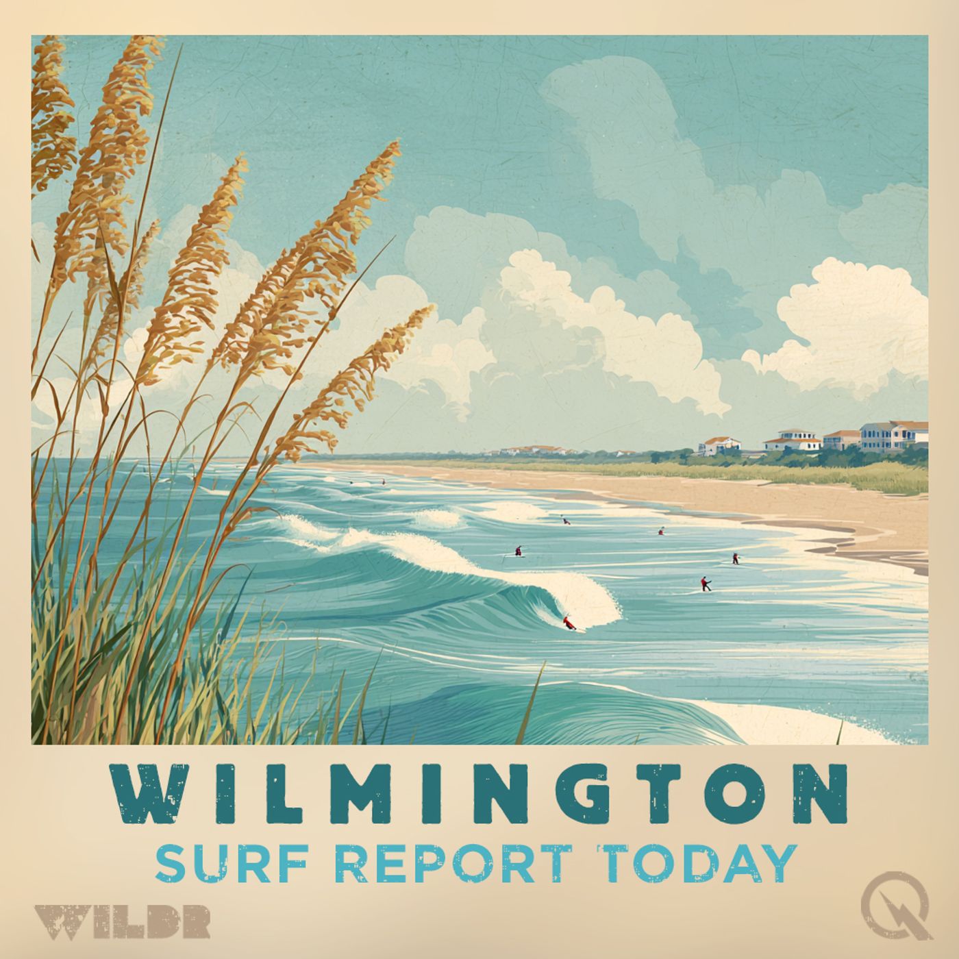
Surf Report - Wilmington NC
by Inception Point Ai
Welcome to the "Surf Report Wilmington NC," the daily podcast that keeps you in the loop with the latest surf conditions in Wilmington, North Carolina. Whether you're planning to hit the waves or just love to stay informed about the local surf scene, this is your essential daily briefing.Each day, our podcast features:Wave Forecasts: We provide detailed reports on wave heights, wind conditions, and tides, ensuring you know the best times and spots for surfing."Surf Report Wilmington NC" is perfect for anyone who loves surfing and the beach lifestyle. Our quick, informative episodes make it easy for you to keep up with the conditions and enjoy your surfing experience to the fullest.Subscribe to "Surf Report Wilmington NC" on your favorite podcast platform and never miss an update about the waves in Wilmington. Connect with us on social media for real-time alerts and community features. Catch the best waves with us every day!Thi
-
514
Coastal Pender Surf Zone Forecast Sunny Skies One Foot Surf Today Upper Seventies
# SURF ZONE FORECAST FOR COASTAL PENDER Good morning everyone! Your National Weather Service in Wilmington has your surf zone forecast for Coastal Pender, including the beaches of Surf City and Topsail Beach. Today is shaping up to be a beautiful day at the beach. We're looking at sunny skies with just one foot of surf and low rip current risk throughout the day. Water temperatures are in the upper sixties, so you might want to grab a wetsuit if you're planning an extended session. Winds will start light from the south around five miles per hour this morning, but expect them to increase to around fifteen miles per hour by the afternoon. The high today will reach the lower seventies. High tide at Topsail Inlet occurs at ten twenty-seven in the morning, with a low tide at four oh five in the afternoon. UV index is high, so don't forget that sunscreen. Looking ahead to Wednesday, conditions remain favorable with mostly sunny skies. Surf heights will bump up slightly to one to three feet, still with low rip current risk. Expect south winds between ten and fifteen miles per hour and highs in the upper seventies. High tide at Topsail Inlet comes at eleven oh eight in the morning and low tide at four forty-seven in the afternoon. Be aware that a moderate south to north longshore current will be present, so plan your beach day accordingly. Conditions change a bit as we head into Thursday. A moderate rip current risk moves in, so use extra caution if you're heading out. We'll see surf heights remain between one and three feet, but showers become likely with a chance of thunderstorms developing. It'll still be warm with highs in the upper seventies and southwest winds around fifteen miles per hour. Friday brings a slight improvement with low rip current risk returning. Surf heights hold steady at one to three feet with partly sunny skies and only a chance of showers. Highs drop to the upper sixties under northeast winds around ten miles per hour. By Saturday, we're back to mostly sunny conditions with low rip current risk and light west winds around five miles per hour. Surf heights decrease to one to two feet with highs in the lower seventies and still a slight chance of showers. Remember, even though rip current risk is low, life-threatening rip currents can still occur near groins, jetties, reefs, and piers, so always stay aware of your surroundings. For more http://www.quietplease.ai Get the best deals https://amzn.to/3ODvOta
-
513
North Carolina South Carolina Surf Forecast Beautiful Beach Conditions Monday Tuesday Before Thursday Storm System Arrives
Good morning, this is your surf zone forecast for the North Carolina and South Carolina coast, issued at 3:53 AM on Monday, May 4th, 2026. Today is shaping up to be a fantastic beach day across the entire region. Expect sunny skies with highs in the lower 70s. Winds will start light from the southwest around 5 miles per hour, then shift south and increase to about 15 miles per hour this afternoon. The water temperature sits in the mid 60s, so you might want to grab a light wetsuit if you're sensitive to cooler water. Surf conditions will be modest with heights ranging from 1 to 2 feet across most beaches. Rip current risk is low, though remember that life-threatening rip currents can still form near groins, jetties, and piers. There's a moderate south-to-north longshore current developing in the Pender and Georgetown areas, so keep that in mind when planning your beach time. The UV index is very high today, so don't forget that sunscreen. No thunderstorms are expected, and waterspout risk is nonexistent. Moving into Tuesday, conditions remain excellent. Another sunny day with highs again in the lower 70s and light south winds between 5 and 10 miles per hour. Surf heights hold steady at 1 to 2 feet with low rip current risk throughout. Waterspout risk ticks up slightly to low across most areas, but thunderstorm potential remains none. A moderate longshore current continues in the northern zones. Now looking ahead to the extended outlook, Wednesday shapes up nice with mostly sunny skies and highs in the mid to upper 70s. South winds around 10 to 15 miles per hour will keep conditions pleasant. Surf heights bump up slightly to 1 to 3 feet in some areas. Rip current risk stays low, making it another good beach day. But here's where things get interesting. Thursday brings a significant change to the pattern. A system moves in with mostly cloudy skies, showers becoming likely, and a slight chance of thunderstorms. Surf heights increase noticeably to 2 to 5 feet depending on your location, with the highest waves expected down in the Brunswick County area. This is important: rip current risk escalates to moderate in most zones, and jumps to high in the Brunswick area. If you're heading to the beach Thursday, exercise extra caution in the water. Winds shift to the southwest around 15 to 20 miles per hour, and highs will be in the mid 70s. Friday the system moves offshore and conditions gradually improve. Partly sunny skies develop with a chance of lingering showers, especially early. Highs drop to the mid to upper 60s with northeast winds around 10 miles per hour. Surf heights decrease to 1 to 3 feet, and rip current risk returns to low across the board. Bottom line: make the most of your Monday and Tuesday because the beach will be beautiful. Wednesday stays nice before Thursday brings rougher conditions and increased hazards. By Friday we're looking at improving trends. Be smart out there, respect the water, and have a great week at the beach. F
-
512
Wrightsville Beach Surf Report May 3rd Through Thursday Sunny Skies Building Swell and Perfect Conditions
# Wrightsville Beach Surf Report - Sunday May 3rd through Thursday Good morning! Here's your coastal Carolina surf forecast brought to you by the National Weather Service. Today is looking absolutely beautiful along the beaches of Wrightsville, Masonboro Island, Carolina Beach, Kure Beach and Fort Fisher. We're expecting sunny skies with highs in the upper 60s and light northwest winds around 10 miles per hour. Surf heights will run 1 to 3 feet, perfect for getting in the water. The water temperature is sitting in the mid 60s, so you might want to consider a light wetsuit. Rip current risk is low, though as always, stay aware near any jetties or piers. The UV index is very high today, so sunscreen is your best friend out there. Looking at the tides, we've got high tide at Mercer Pier around 9:08 in the morning and low tide at 3:10 in the afternoon. Monday shapes up nicely as well. More sunshine, with temperatures climbing to the lower 70s. Winds will be light southwest around 5 to 10 miles per hour. Surf will be a bit smaller at 1 to 2 feet, and rip currents remain low. We will see a moderate south to north longshore current, so if you're paddling out, account for that. High tide hits at 9:49 in the morning with low tide at 3:42. Moving into the extended outlook, Tuesday continues our sunny streak with highs in the lower 70s and 1 to 2 foot surf. Wednesday brings slightly higher surf at 1 to 3 feet under mostly sunny skies, with highs in the mid 70s and southwest winds around 15 miles per hour. Now here's where things get interesting. Thursday is our day of change. Expect mostly cloudy skies with showers likely and a slight chance of thunderstorms. Rip current risk bumps up to moderate as surf heights increase to 2 to 4 feet. Winds shift to the southwest at around 20 miles per hour. Highs will be in the mid 70s. This would be a solid swell day if you're ready for the choppier conditions. So there you have it. Four days of building conditions, with beautiful weather for most of the period before Thursday's system moves in. Get out there and enjoy those calm days while they last! For more http://www.quietplease.ai Get the best deals https://amzn.to/3ODvOta
-
511
Carolina Coast Saturday Surf Forecast: Rain, Modest Waves, and Moderate Rip Currents in New Hanover County
Good morning, this is your Saturday surf zone forecast for the Carolina coast, brought to you by the National Weather Service in Wilmington. We're looking at a cloudy, rainy Saturday with modest surf conditions and some important safety considerations depending on where you are along the coast. Let's break it down by region. Starting up north in Pender County, including Surf City and Topsail Beach, expect surf heights of one to three feet under mostly cloudy skies with rain throughout the day. The water temperature is hanging in the upper sixties, and north winds will be running ten to fifteen miles per hour. A moderate north to south longshore current is in the forecast, but rip current risk remains low. High temperatures will reach around sixty degrees. Topsail Inlet will see its high tide at eight thirty-five in the morning, with low tide at two seventeen in the afternoon. Moving down to New Hanover County, including Wrightsville Beach, Carolina Beach, and Kure Beach, conditions intensify slightly. We have a Beach Hazards Statement in effect from six in the morning through this evening, along with a Moderate Risk of Rip Currents during that same window. Surf heights here will be a bit larger at two to three feet, and we're expecting a strong north to south longshore current. The rip current risk is moderate, which means life-threatening rip currents are possible in the surf zone, so swimmers and water enthusiasts should exercise extra caution. The high temperature will be in the lower sixties with the same rainy conditions. Over in Brunswick County, including Oak Island and Holden Beach, rip current risk is low across the board, with surf heights of one to two feet east of Ocean Isle Beach and one to three feet west. It's the same rainy, cloudy picture with north winds and highs near sixty. Down in Horry County around Myrtle Beach, we're back to low rip current risk with one to three foot surf heights. Rain and clouds dominate today, with highs in the lower sixties. Finally, in Georgetown County, another Beach Hazards Statement is in effect through this evening due to a strong north to south longshore current. Rip current risk is low, but that longshore current is definitely something to keep in mind. Surf heights will be one to three feet. Now let's look ahead to Sunday. The rainy pattern clears out and we're in for a beautiful day. Sunny skies will take over across the entire coast. Surf heights will generally decrease to one to two feet as winds shift to the northwest at five to ten miles per hour. Water temperatures remain in the upper sixties. Rip current risk drops to low for most areas, though New Hanover County will still see moderate rip current risk on Sunday. Highs will be similar to today, mostly in the upper sixties. Looking at the extended outlook, Monday through Wednesday brings generally improving conditions. Monday features sunny skies with highs around seventy, and surf heights dropping to around one foot with light s
-
510
Carolina Coast Surf Forecast May 1-5: Mellow Waves Low Rip Currents Perfect Beach Conditions
Good morning surfers and beach lovers! It's Friday, May first, and we've got your surf zone forecast for the Carolina coast. Let's start down in Georgetown where conditions are looking pretty mellow. You're looking at one to three foot waves with low rip current risk throughout the day. It'll be mostly cloudy with a chance of rain, and that northeast wind around ten to fifteen miles per hour should keep things manageable. Water temps are in the upper sixties, so you might want to consider a light wetsuit if you're planning an early morning session. Moving up the coast to Horry County and the Myrtle Beach area, similar story. One to two foot surf with low rip current risk both north and south of town. Again, mostly cloudy with that chance of rain and northeast winds around ten miles per hour. High temps in the upper sixties and water temps to match. Now here's where things get a little more interesting. Head up to Brunswick County and you've got the same one to two foot waves and low rip current risk, but notably there's a moderate east to west longshore current working through Ocean Isle Beach. Still manageable conditions, but worth keeping an eye on if you're paddling out in that area. The New Hanover beaches are showing moderate rip current risk Friday, so that's your yellow flag area. We're talking about Wrightsville, Carolina Beach, Kure Beach and Fort Fisher. One to three foot waves with low waterspout risk and high UV, so definitely get that sunscreen on. Northeast winds ten to fifteen miles per hour with a moderate north to south longshore current throughout the day. Up in Pender County around Surf City and Topsail Beach, you've got low rip current risk, one to three foot waves, and mostly cloudy skies with that chance of rain. Winds are slightly lighter at around ten miles per hour northeast, and there's a moderate north to south longshore current to be aware of. Now let's talk Saturday because the pattern shifts a bit. Rain moves in across the entire region with a slight chance of thunderstorms. Rip current risk bumps up to moderate across New Hanover, while it stays low elsewhere. Surf stays pretty consistent at one to three feet. North winds pick up slightly to ten to fifteen miles per hour. Temperatures cool down to the lower to mid sixties, and water temps will feel a bit chillier too. Looking ahead to Sunday through Tuesday, we're in for a nice stretch. The rain clears out, skies turn sunny, and rip current risk drops back to low across the board. Winds lighten up significantly with south winds around five to ten miles per hour. Temperatures gradually warm from the mid sixties Sunday through the lower seventies by Tuesday. Surf stays small, one to three feet depending on location, which is perfect for getting those practice sessions in or taking beginners out. So if you're looking to get in the water today, head out early before that rain chance increases. New Hanover folks, keep an eye on those rip currents. And if you can
-
509
Surf Forecast Thursday to Monday: 1 to 3 Foot Waves, Showers Early, Sunny Weekend Ahead
Good morning. Here's your surf zone forecast for Thursday through Monday, April 30th through May 4th. Starting with Thursday, expect mostly cloudy skies across the forecast area with showers likely and a slight chance of thunderstorms. Highs will reach the lower 70s with light north to northeast winds between 5 and 10 miles per hour. Surf heights range from 1 to 3 feet depending on your location, with slightly larger waves along the central coast near Wrightsville Beach and Carolina Beach where you could see 1 to 3 feet. Water temperatures sit in the upper 60s, so you might want to bring a light wetsuit. Rip current risk remains low across all beaches, though remember that life-threatening rip currents can still occur near groins, jetties, and piers. The UV index is high, so don't forget your sunscreen. Friday brings a change in the pattern with partly to mostly cloudy skies and only a chance of showers. Highs stay in the upper 60s under northeast winds of 10 to 15 miles per hour. Surf heights remain 1 to 3 feet with the same low rip current risk. A moderate north to south longshore current is expected along the central coast, so swimmers should be aware of that condition. Looking ahead to the extended forecast, Saturday turns cloudier with rain and a slight chance of thunderstorms. Highs drop into the lower 60s under north winds around 10 to 15 miles per hour. Rip current risk increases to moderate along Pender and New Hanover counties where life-threatening rip currents become possible in the surf zone. Surf remains 1 to 3 feet. Sunday looks fantastic. Sunny skies return with highs in the mid-60s and north winds around 10 miles per hour. Rip current risk stays moderate along the central coast but drops back to low elsewhere. Surf heights vary from 1 to 3 feet depending on location. Wrapping up Monday, expect sunny skies to continue with highs in the upper 60s. A southeasterly wind shift to around 5 miles per hour brings calmer conditions. Rip current risk drops to low across the board, and surf heights range from 1 to 2 feet. Overall, it's a typical late April pattern with a mix of showers early in the period and improving conditions by the weekend. Get out there and enjoy the water safely. For more http://www.quietplease.ai Get the best deals https://amzn.to/3ODvOta
-
508
Surf Zone Forecast Wednesday April 29 Through Sunday May 3 Coastal Conditions and Safety Tips
Good morning, this is your surf zone forecast for Wednesday, April 29th through Sunday, May 3rd. Let's start with today. Conditions are fairly consistent across our coastal areas from Pender County down through Georgetown. You're looking at surf heights of one to three feet with low rip current risk, though as always, use extra caution near groins, jetties, and piers where dangerous currents can develop. Water temperatures are sitting in the upper 60s, so a wetsuit might still feel nice. Weather-wise, mostly cloudy skies will dominate with showers likely throughout the day. There's a slight chance of thunderstorms for Pender and New Hanover counties, but if you're heading to Myrtle Beach or Georgetown, the thunderstorm potential bumps up to moderate. So keep an eye on the sky and don't hesitate to head in if storms develop. Winds start light out of the southwest, only around five miles per hour, but they'll increase to about 15 miles per hour this afternoon. The UV index is moderate, so sunscreen is definitely your friend today. Moving into Thursday, things calm down considerably. Rip current risk remains low across the board. Surf heights drop to one to two feet, and the thunderstorm threat disappears entirely. Instead, you'll get partly sunny to mostly cloudy skies with just a slight chance of showers. Highs will be in the lower 70s with north winds around 10 miles per hour. However, there's a moderate waterspout risk for the Myrtle Beach and Georgetown areas, so again, if you see something developing, get to safety. Friday brings partly sunny conditions with a chance of showers. Highs will be in the upper 60s with northeast winds around 10 miles per hour. Surf heights remain minimal at one to two feet, and rip current risk stays low. Saturday is looking wetter. Expect mostly cloudy to cloudy skies with showers and a slight chance of thunderstorms. Highs will drop to the lower 60s with north winds around 10 miles per hour. Surf heights will be one to three feet depending on your location. Still low rip current risk. Finally, Sunday shapes up to be your best day of the extended period. Sunny to mostly sunny skies will take over with highs in the mid 60s. North winds around 10 miles per hour, and here's the important part: rip current risk increases to moderate in the Pender and New Hanover areas, so keep that in mind if you're planning to get in the water. Surf heights will range from one to three feet. Stay safe out there and enjoy the water. For more http://www.quietplease.ai Get the best deals https://amzn.to/3ODvOta
-
507
Carolina Beach Surf Forecast Thursday to Monday Mid Seventies Sunny Skies One to Four Foot Waves
# SURF FORECAST: NORTH CAROLINA AND SOUTH CAROLINA BEACHES Good morning, everyone. Here's your surf zone forecast for Thursday through Monday along the Carolina coast. Starting with today, we're looking at some absolutely gorgeous beach weather across the board. Expect sunny skies with highs in the mid to upper seventies. Southwest winds will be light to moderate at ten to fifteen miles per hour. Water temperatures are holding in the mid to upper sixties, so you might want to grab a light wetsuit if you're sensitive to the cold. Now let's talk about the waves. Up in Pender County around Surf City and Topsail Beach, you're looking at one to two foot surf. Down in New Hanover, the swell is running smaller at around one foot. Brunswick County and the Horry County beaches north of Myrtle Beach will see one to three footers, while south Myrtle and Georgetown are expecting one to two feet. Here's something important to note: a strong south to north longshore current is in effect today, especially up through Georgetown. This is why we've issued Beach Hazards Statements for multiple counties that remain in effect until eight tonight. While rip current risk remains low everywhere, please be extra cautious near groins, jetties, and piers where life threatening rips can develop. The UV index is very high, so sunscreen is absolutely essential. Moving into Friday, conditions remain stellar with continued sunny skies. Highs will be in the upper seventies to lower eighties. Same wind regime out of the southwest at ten to fifteen miles per hour. The longshore current moderates somewhat but remains notable. Rip current risk stays low, but again, stay alert near structure. Looking ahead to the extended period, we see a slight shift in the pattern. Saturday brings mostly sunny skies with highs in the upper seventies, but there's a chance of showers and a slight chance of thunderstorms developing. Surf heights remain one to three feet depending on location. Sunday becomes more unsettled with partly sunny skies, another chance of showers, and slight thunderstorm chances. Temperatures drop to the lower to mid seventies as northeast winds develop around ten miles per hour. This wind shift is significant because it'll alter your wave patterns heading into Monday. Speaking of Monday, that's when things get interesting. By Monday, a low rip current risk persists, but surf conditions vary significantly by location. Down in New Hanover, we're expecting two to four foot waves, which would be the best swell of the extended period. Most other areas see one to three foot surf, while Georgetown and the southern sections run one to three feet. Highs will be in the upper sixties to lower seventies as northeast winds continue around ten miles per hour, and there's a slight chance of showers. So here's the bottom line: if you're heading out today or Friday, you've got spectacular weather and clean conditions. The rip current risk is low, but always respect the ocean and be
-
506
Carolina Beach Forecast Thursday Through Monday Sunny Skies Mid 70s Temperatures Light Winds
Good morning folks, your National Weather Service surf zone forecast for Thursday through Monday along the Carolina coast. We're looking at a beautiful stretch of beach weather to kick things off today. Sunny skies are dominating from Wilmington down through Georgetown, with highs climbing into the mid to upper seventies. Southwest winds are running ten to fifteen miles per hour, and the water temperature is hanging in the upper sixties, which is pretty refreshing this time of year. Now here's the thing to keep in mind as you head to the beach today. There's a Beach Hazards Statement in effect until eight o'clock tonight for most of our coastal areas. While rip current risk remains low across the board, we do have a strong south to north longshore current in effect, particularly around Pender and Horry counties. This is important stuff if you're planning to spend any time in the water. Stay aware of that current pushing you north, and be extra cautious around groins, jetties, reefs, and piers where rip currents can develop even when the overall risk is low. Speaking of the water, if you're sensitive to sun exposure, we're looking at very high UV indices today, so get that sunscreen on and reapply it regularly. There's zero thunderstorm potential forecast, which means you've got a green light for outdoor plans without weather interruptions. Moving into Friday, conditions remain pretty much the same across the board. Sunny skies continue with highs in the upper seventies to lower eighties. Southwest winds stick around at ten to fifteen miles per hour. Surf heights will be a bit more variable depending on where you are. Up in Pender County around Surf City and Topsail, expect one to three feet. Over in New Hanover around Wrightsville and Kure Beach, you're looking at mostly one foot. Down in Brunswick County and the South Carolina beaches, we're seeing one to three feet. The longshore current will moderate a bit on Friday but remains noticeable enough to warrant attention. Now let's look ahead to the weekend and early next week. Saturday brings mostly sunny skies with a chance of showers and a slight chance of thunderstorms developing. This is the first weather system we'll see moving in, but it doesn't look particularly strong. Highs will be in the upper seventies. Surf heights generally range from one to three feet depending on location, and rip current risk stays low. Sunday gets a bit cloudier with partly sunny conditions as that system moves through. We'll see another chance of showers and thunderstorms, still slight in nature. Highs drop to the lower seventies, and northeast winds kick in around ten miles per hour. This wind shift is notable and will gradually change the character of our surf as we head toward Monday. Monday wraps up our forecast period with mostly sunny skies returning. There's just a slight chance of showers left over from the weekend system. Highs settle into the upper sixties to lower seventies. East winds around te
-
505
North Carolina South Carolina Surf Forecast Moderate Rip Currents Through Evening Sunny Skies Upper Seventies
Good morning, this is your Wednesday surf zone forecast for the North Carolina and South Carolina coast, brought to you by the National Weather Service Wilmington. We're looking at moderate rip current conditions in effect through this evening across most of the region, so swimmers and water enthusiasts need to stay alert. If you do find yourself caught in a rip current, remember to swim parallel to the shore rather than fighting it directly. Let's break down what's happening beach by beach. Up north in Pender County, including Surf City and Topsail Beach, you're looking at small waves, one to three feet, with sunny skies and highs in the upper seventies. Water temps are chilly at around sixty degrees, so a wetsuit might be your friend. Southwest winds at ten to fifteen miles per hour will keep things manageable. That moderate rip current risk persists through the evening, with a moderate south to north longshore current developing. High tide at Topsail Inlet is at six eighteen in the morning, with a low at twelve twenty-one in the afternoon. Moving down to New Hanover County, which includes the popular beaches of Wrightsville, Carolina Beach, and Kure Beach, conditions are similar with one to two foot surf and sunny weather. The rip current risk is also moderate, and there's a moderate south to north longshore current in play. Mercer Pier will see its high at six fifteen this morning and a low at twelve twenty-five. Over in Brunswick County, covering Bald Head Island, Oak Island, and Holden Beach, things get a little more nuanced. East of Ocean Isle Beach, we're looking at a low rip current risk, but west of Ocean Isle Beach the risk bumps up to moderate. Surf is around two feet with a high temperature in the mid-seventies and lighter southwest winds around ten miles per hour. Down in South Carolina, the Horry County beaches including Myrtle Beach and Atlantic Beach have moderate rip current risks both north and south of Myrtle Beach. Surf heights vary slightly, with one to three feet north of Myrtle Beach and two to three feet to the south. Expect sunny conditions with highs in the mid-seventies and light winds increasing to around fifteen miles per hour this afternoon. And finally, Georgetown's beaches at Pawleys Island and Murrells Inlet show moderate rip currents with around two-foot surf and similar sunny, pleasant conditions. Now looking ahead to Thursday, moderate rip current risk continues across most of the forecast area. Surf heights will be slightly elevated, ranging from two to three feet in some spots. Conditions remain sunny and warm with highs around the upper seventies to low eighties depending on location. Southwest winds stay consistent at ten to fifteen miles per hour. By Friday, we see improvement with low to moderate rip current risks. Surf heights drop back to one to three feet, and it's looking like another beautiful sunny day with highs climbing into the upper seventies and lower eighties. Southwest winds ease to
-
504
Carolina Coast Surf Forecast Tuesday Through Saturday April 14 Moderate Rip Currents Sunny Skies
Good morning, here's your surf zone forecast for Tuesday, April 14th through Saturday along the Carolina coast. If you're planning a trip to the beach today, expect mostly sunny skies with highs in the low to mid seventies depending on your location. The water temperature is hovering in the low to mid sixties, so a wetsuit might be your best friend out there. Surf heights are running one to two feet across the board, which means it's a great day for beginners or anyone looking for a mellow session. Now here's the important part: moderate rip currents are in effect through this evening for Pender and New Hanover counties, which includes popular spots like Surf City, Topsail Beach, Wrightsville Beach, Carolina Beach, and Kure Beach. If you're heading to Brunswick or Horry County beaches like Oak Island or Myrtle Beach, the rip current risk is low today. Winds are light, starting around five to ten miles per hour in the morning and picking up to around fifteen in the afternoon. It's going to be a very high UV index day, so don't forget your sunscreen. Looking ahead to Wednesday, conditions stay consistent with sunny skies and highs in the mid to upper seventies. The moderate rip current risk continues for Pender and New Hanover counties, while everything south remains low risk. Winds will be moderate southwest, around ten to fifteen miles per hour, and the surf continues at one to two feet. As we push into Thursday, moderate rip currents are possible along the northern sections of the Horry County coast and Georgetown, while other areas remain low risk. Surf heights will start to bump up slightly to one to three feet, highs reach the mid to upper seventies, and winds stay light out of the southwest. Friday looks like a beautiful day to be at the beach. Rip current risk drops to low across all areas. Surf will range from around one foot in some spots to three feet in others. Highs are in the upper seventies to low eighties with continued sunshine and light to moderate southwest winds. Saturday wraps up the weekend nicely with mostly sunny skies, low rip current risk everywhere, and highs in the low eighties. Surf heights remain one to three feet with gentle southwest winds. Remember, even when rip current risk is listed as low, life-threatening currents can still form around groins, jetties, and piers, so always stay aware of your surroundings. Have a great time out there on the water. For more http://www.quietplease.ai Get the best deals https://amzn.to/3ODvOta
-
503
North Carolina South Carolina Surf Zone Forecast Monday April 13 Through Friday April 17 Sunny Skies Moderate Rip Currents
Good morning, this is your Surf Zone Forecast for Monday, April 13th through Friday, April 17th, covering the North Carolina and South Carolina coast. Let's start with today. We're looking at sunny skies across the board with highs in the low to mid seventies. A moderate risk of rip currents is in effect from six AM this morning through this evening for the Pender and New Hanover county beaches, including Surf City, Topsail Beach, Wrightsville Beach, and Kure Beach. South winds will be light, five to ten miles per hour. Surf heights will be around two feet for Pender and New Hanover counties, while areas south of there, from Brunswick County down through Georgetown, will see one to two foot surf with low rip current risk. Water temperatures are in the mid to upper sixties, so you'll want to keep that in mind if you're planning to get in the water. The UV index is very high today, so sunscreen is definitely recommended. No thunderstorms or waterspouts are expected. Moving into Tuesday, conditions remain sunny with highs again in the low to mid seventies. Rip current risk stays moderate for Pender and New Hanover counties, though we'll see low risk continuing for Brunswick and Georgetown counties. Southwest winds will pick up during the afternoon, increasing to around fifteen miles per hour. Surf heights will be similar to today, one to two feet for most areas, with around two feet possible near Myrtle Beach. Looking ahead to Wednesday, that moderate rip current risk expands further south into Horry and Georgetown counties. We're still expecting sunny conditions and highs in the mid seventies. Surf heights will remain light to moderate, around one to two feet. Thursday brings mostly sunny skies and slightly higher surf as we pick up two to four foot waves in some locations, particularly along the Pender County beaches. The moderate rip current risk continues, and highs will be in the mid to upper seventies. Wrapping up the week on Friday, we'll see sunny skies and highs in the upper seventies to lower eighties. Surf conditions will vary from one to three feet depending on your location, with the moderate rip current risk still in effect for northern beaches. One important reminder: moderate rip current risk means life-threatening rip currents are possible in the surf zone. Even during low risk days, life-threatening rip currents often occur near groins, jetties, reefs, and piers, so always be aware of your surroundings. For more http://www.quietplease.ai Get the best deals https://amzn.to/3ODvOta
-
502
Carolina Beach Forecast: Sunny Skies and Mild Temps Today, Watch for Rip Currents in North Carolina
Good morning, this is your Sunday coastal forecast for the Carolinas. We're looking at beautiful beach weather today with plenty of sunshine and mild conditions, but there are some water safety concerns you'll want to know about before heading to the shore. Starting with the northern beaches of North Carolina, including Surf City and Topsail Beach, we've got a moderate risk of rip currents in effect from six AM this morning through this evening. Surf heights will be two to three feet with water temperatures in the lower sixties. It's going to be sunny with highs in the lower seventies and east winds around ten miles per hour. There's a very high UV index, so definitely bring that sunscreen. Low tide at Topsail Inlet comes at ten eighteen in the morning, with high tide at four twenty-two in the afternoon. Moving down to the Wrightsville Beach and Carolina Beach area, we're also under a moderate rip current risk through tonight. Here the surf will be a bit smaller, running one to three feet. The weather pattern is identical though, sunny skies, lower seventies, and east winds five to ten miles per hour. The UV index is very high here as well. Low tide at Mercer Pier happens at ten oh nine in the morning with high tide at four PM. The Brunswick County beaches including Oak Island and Sunset Beach are looking better in terms of rip current risk. These areas are under a low rip current risk with just one foot of surf today. Still sunny, still in the lower seventies, but with slightly lighter southeast winds at five to ten miles per hour. Low tide at Oak Island is ten thirteen AM with high tide at four oh nine PM. Further south into South Carolina, the Myrtle Beach area is also under low rip current conditions today with one to two foot surf. North of Myrtle Beach you're looking at one foot, while south of Myrtle it's around two feet. Sunny skies continue with highs in the lower seventies and southeast winds five to ten miles per hour. Very high UV index here too. Low tide at Springmaid Pier is ten eighteen AM, high tide at four ten PM. Georgetown County beaches at Pawleys Island and Murrells Inlet are also showing low rip current risk with one to two foot surf. Same sunny conditions, lower seventies, and southeast winds five to ten miles per hour. Now let's look ahead to Monday. The pattern shifts slightly as south winds take over. The Pender and New Hanover County beaches remain at moderate rip current risk, while Brunswick County and the South Carolina areas stay low. There's a note of a moderate south to north longshore current developing in some areas. All beaches will see sunny to mostly sunny skies with highs in the mid seventies for most areas. Surf will remain modest at one to three feet across the region. Looking at the extended outlook from Tuesday through Thursday, expect consistent sunny conditions with highs ranging from the mid to upper seventies. A moderate rip current risk will gradually spread southward into the South Carolina
-
501
Carolina Beach Forecast Saturday Sunny Skies Three Foot Surf Moderate Rip Currents Pender New Hanover Counties
Good morning, it's Saturday, April 11th, and here's your surf zone forecast for the Carolina coast. Alright, folks, if you're heading to the beach today, you're in for a beautiful day with plenty of sunshine and very high UV index, so don't forget that sunscreen. But before you paddle out, we need to talk about rip currents, because several areas along our coast are under a moderate risk alert through this evening. Starting up north in Pender County, including Surf City and Topsail Beach, expect three-foot surf with that moderate rip current risk in effect. The water's sitting in the lower 60s, so it's still a bit chilly. Winds will be light out of the west this morning, shifting southwest by afternoon. High temperatures today will reach the upper 70s. Low tide at Topsail Inlet comes around 9:29 in the morning, with high tide at 3:25 in the afternoon. Down in New Hanover County, covering Wrightsville Beach all the way to Fort Fisher, you're looking at slightly smaller surf, two to three feet, but still that moderate rip current risk through this evening. Same story with conditions otherwise, sunny skies, very high UV, water temps in the lower 60s, and highs near the mid 70s. The low tide at Mercer Pier hits just before 9:30 in the morning. Further south in Brunswick County around Oak Island and Ocean Isle Beach, the rip current situation is much improved with a low risk rating. Surf is smaller too, one to two feet overall, though Ocean Isle Beach West does see a bit more action with around two feet of surf. Very high UV again, and temperatures topping out in the mid 70s. Down at the South Carolina border in Horry County, the Myrtle Beach area continues to see low rip current risk with one to three feet of surf, depending on which beach you're visiting. It's a similar pleasant setup with sunny skies and mid 70s for your high temperature. Finally, in Georgetown County around Pawleys Island and Murrells Inlet, there is a moderate rip current risk in effect today with two to three feet of surf. That risk drops to low by Sunday. Tomorrow, Sunday looks fantastic across the board. We're seeing sunny skies continuing, but rip currents begin to ease. Pender and New Hanover counties stay moderate, but most other areas drop to low risk. Surf heights back off slightly to one to three feet depending on location. Highs will be in the lower 70s with east winds around ten miles per hour. Looking ahead into next week, it's going to be hard to complain. Monday through Wednesday all feature sunny skies, low to moderate rip current risks, and temperatures in the lower to mid 70s. Winds shift to the south and southwest, staying light to moderate. Surf heights remain modest at one to four feet throughout the extended period. No thunderstorms or waterspouts are expected, so it's shaping up to be a beautiful stretch of weather for the Carolina coast. Water temperatures will stay chilly in the lower to mid 60s, so wetsuits are still the move. Have a great time o
-
500
Carolina Coast Surf Forecast April 10th: Rip Current Warnings and Wave Conditions for All Beaches
Good morning surfers, this is your surf forecast for Friday, April 10th through Tuesday along the Carolina coast. Let's start with the northern beaches. If you're heading to Surf City or Topsail Beach today, expect three to four foot waves with a moderate rip current risk in effect through this evening. It'll be a gorgeous sunny day with highs around seventy degrees and light northeast winds. The water is sitting in the lower sixties, so a wetsuit is still your friend. There's a moderate north to south longshore current working, so pay attention to that lateral movement. Saturday looks excellent with smaller two to four foot surf, the rip current risk drops to moderate, and it'll be even warmer with highs in the mid seventies. Moving down to the Wrightsville and Carolina Beach area, we've got more serious conditions today with a high rip current risk in effect. Waves are running three to five feet, still sunny and around seventy degrees, but these rip currents are likely in the surf zone, so if you're not experienced, stay close to shore or find a lifeguard. The same moderate north to south longshore current is pushing through here too. Saturday brings relief with those rip currents backing off to moderate and surf dropping to two to four feet. Over at the Brunswick County beaches around Oak Island and Ocean Isle, it's a different story. Today the rip current risk is low, with just one to three feet of surf depending on your exact location. It'll be sunny and pleasant, perfect for beginners or anyone wanting to avoid the stronger currents happening further north. Conditions stay mellow throughout the week with low rip current risks and smaller waves. Down in Horry County, north of Myrtle Beach it's low risk today with one to three foot waves. Head south of Myrtle Beach though and you're looking at moderate rip currents and two to three foot surf. Saturday both areas improve with low rip current risks across the board. Finally, if you're at Georgetown around Pawleys Island and Murrells Inlet, we've got a high rip current risk today with three to five foot waves and stronger northeast winds around ten miles per hour. This is the other hot spot where rip currents are likely, so be cautious. Saturday moderates nicely with two to four foot surf and moderate rip current risk. Looking ahead to the extended period, Sunday through Tuesday, most areas settle into moderate to low rip current risks with smaller one to three foot waves. Expect plenty of sunshine, warming temperatures in the seventies, and light winds. Perfect beach weather if not ideal swell conditions. Bottom line: if you're going out today, prioritize the northern New Hanover or Georgetown areas for bigger surf, but respect those high rip current warnings. Beginners and those wanting calmer conditions should head to Brunswick or northern Horry County. By Saturday, things ease up significantly everywhere, making it a great day for all skill levels. For more http://www.quietplease.ai
-
499
Carolina Beach Surf Forecast April 9-13: High Rip Currents, 4-6 Foot Waves, Strong Longshore Currents
Good morning, this is your surf zone forecast for Thursday, April 9th through Monday, April 13th. Starting with Coastal Pender County beaches including Surf City and Topsail Beach, we're looking at moderate rip current risk today with surf heights of three to five feet. Northeast winds around fifteen miles per hour will keep conditions fairly consistent. The water temperature sits around sixty degrees, so bring that wetsuit. Sunny skies overhead mean high UV, so don't forget the sunscreen. There's a strong north to south longshore current in play today, so pay attention to that lateral movement. Friday improves slightly with the same three to five foot surf but winds drop to around ten miles per hour. By Saturday, we're looking at smaller three to four foot waves with moderating conditions continuing through Monday. Moving south to Coastal New Hanover County covering Wrightsville, Carolina Beach, and Kure Beach, things are a bit more serious today. We've got a high rip current risk in effect with four to six foot surf and northeast winds pumping fifteen to twenty miles per hour. That's the most significant swell in the forecast area, so water sports enthusiasts should take note. The strong longshore current persists here as well. Friday settles down to moderate rip current risk with three to five foot waves and lighter winds. The extended period shows gradual improvement with moderate rip currents Saturday and Sunday, dropping to low risk by Monday as surf diminishes to two to four feet. Over in Coastal Brunswick County at beaches like Oak Island and Holden Beach, conditions stay considerably calmer. Low rip current risk holds today through Monday with just one to three foot surf depending on location. Northeast winds around fifteen miles per hour today and ten tomorrow keep things relatively gentle. Water temperature's in the lower sixties here. This is your mellower option if you're looking to avoid the stronger conditions up the coast. Horry County beaches from Myrtle Beach northward show split conditions. North of Myrtle Beach stays low risk with one to three foot waves all week. South of Myrtle Beach, moderate rip currents are possible today with two to four foot surf and that strong longshore current continuing. By Friday the split remains but conditions moderate overall. Saturday through Monday, low rip current risk takes over everywhere with consistent one to three foot waves and lighter winds. Finally, Coastal Georgetown at Pawleys Island and Murrells Inlet features the most aggressive conditions beyond New Hanover County. A high rip current risk is in effect today with three to six foot surf and a high surf advisory until six PM. That strong north to south longshore current persists here too. Northeast winds around fifteen miles per hour today dial back to ten tomorrow as conditions gradually improve. Friday brings moderate rip current risk with three to five foot waves. Saturday and Sunday maintain moderate risk with gradually red
-
498
Surf Forecast April 8-12: High Rip Current Risk Today and Thursday, Improving Weekend Conditions
Good morning! This is your surf zone forecast for Wednesday, April 8th through Sunday, April 12th, brought to you by the National Weather Service. Let's start with today. We're looking at sunny skies with a high in the upper 50s along the central coast, climbing to around 60 in the south. Northeast winds will be breezy, running around 20 to 25 miles per hour. The water temperature is sitting in the lower 60s, so a wetsuit would definitely be your friend out there. Here's what matters if you're heading to the beach: we have a high rip current risk in effect all day today through this evening. This is the real deal, folks. Life-threatening rip currents are likely in the surf zone. A strong north to south longshore current is also adding to the mix, so swim near lifeguards and know what you're doing if you're entering the water. Surfwise, expect 4 to 7 feet of surf along the central coast, with slightly smaller 4 to 5 foot waves further south. If you're down in the Georgetown area, you're also under a high surf advisory through Thursday evening. Further north near Pender County, you're looking at 4 to 5 feet. Moving to Thursday, the pattern continues. We'll see mostly sunny skies with a high in the upper 60s, and that high rip current risk sticks around. Surf remains at 4 to 7 feet in the central areas, with northeast winds around 20 miles per hour. The same powerful longshore current persists, so exercise the same caution as today. As we head into Friday, conditions start to improve slightly. We'll see sunny skies with highs in the upper 60s to near 70. The high rip current risk continues, but winds ease to around 10 miles per hour from the northeast. Surf heights begin dropping a bit to 3 to 6 feet in the central zone. Saturday looks like the best day of the stretch. Mostly sunny with highs in the lower to mid 70s, lighter west winds around 5 miles per hour, and the rip current risk drops to moderate. You'll see 2 to 5 feet of surf, making for more manageable conditions overall. Sunday rounds out the period with sunny skies, highs in the lower 70s, and light east winds. The rip current risk continues to ease to low or moderate depending on your location, and surf backs off to 1 to 4 feet. Bottom line: today and tomorrow are serious days with high rip currents and strong coastal currents. Respect the ocean, stay near lifeguards, and know your limits. Conditions gradually improve as we move through the weekend. Have a safe day out there. For more http://www.quietplease.ai Get the best deals https://amzn.to/3ODvOta
-
497
Carolina Coast Surf Forecast: 3 to 8 Foot Waves Wednesday Through Friday, High Rip Current Risk
Good morning, this is your Tuesday surf zone forecast for the Carolina coast brought to you by the National Weather Service in Wilmington. Starting with today, expect mostly cloudy skies with highs in the upper 60s. Surf heights are running two to four feet along the northern beaches of Pender County, with slightly smaller waves of one to three feet down in Brunswick County and around Myrtle Beach. The rip current risk is low to moderate depending on where you are, so always use caution if you're entering the water. Northeast winds are light, ranging from five to fifteen miles per hour. Water temperatures are chilly, sitting in the lower to mid 60s, so a wetsuit is definitely recommended. High tides occur around 11:30 AM at most inlets. Now here's where things get interesting. Wednesday is shaping up to be a much more active day in the water. A strengthening northeast wind around twenty miles per hour will drive surf heights significantly higher, with three to seven feet expected from Pender to Georgetown counties. Conditions will be mostly sunny, which is great for visibility, but we're upgrading the rip current risk to high for most areas. The strong northeast wind will also create robust north to south longshore currents, which combined with the larger surf, means you really need to respect the water on Wednesday. If you're heading out, know the location of lifeguard stations and never underestimate the power of a rip current. Looking ahead to Thursday and Friday, the rip current risk remains high across much of the forecast area, with surf heights ranging from three to eight feet. Thursday brings a slight chance of showers mixed with partly sunny skies, while Friday should be predominantly sunny. Highs will be in the mid to upper 60s. By Saturday, conditions begin to moderate nicely. Rip current risks drop to moderate to low, surf heights decrease to one to five feet depending on location, and we'll see sunny skies with highs in the lower 70s as northeast winds diminish to just five miles per hour. Whether you're a surfer, swimmer, or just planning a beach day, make sure to check with lifeguards, monitor conditions carefully, and always swim near surveillance. Stay safe out there. For more http://www.quietplease.ai Get the best deals https://amzn.to/3ODvOta
-
496
NC and SC Surf Forecast: Moderate Rip Current Risk Today, Building Surf Mid-Week, Waves Three to Seven Feet
Good morning, this is your surf zone forecast for the North Carolina and South Carolina coast brought to you by the National Weather Service Wilmington. A moderate risk of rip currents is in effect through this evening along most of the forecast area. If you're planning to head to the beach today, exercise caution in the surf zone where life-threatening rip currents are possible. Let's break down what to expect. Today will feature partly sunny skies with highs in the mid to upper 60s. Surf heights will range from one to three feet depending on your location, with the highest surf expected along the Georgetown and New Hanover beaches where conditions could reach three to six feet. Northeast winds will blow between 10 and 15 miles per hour. Water temperatures are hovering around 60 degrees, so a wetsuit might be a good idea. There is no thunderstorm potential today, and UV levels are moderate, so sunscreen is still recommended. Moving into Tuesday, conditions improve considerably. Rip current risks drop to low across most areas, though Georgetown will remain moderate. Surf heights will decrease to around one to three feet across the forecast region. Skies will remain partly sunny with highs in the upper 60s. Northeast winds will lighten to five to 10 miles per hour, making for a much more pleasant beach day overall. Now looking ahead to the extended period, conditions become more energetic. Wednesday brings a high rip current risk and an increase in surf energy, with waves building to two to six feet depending on the beach. Northeast winds will increase to around 20 miles per hour and conditions will be mostly sunny. Thursday the surf continues to build with heights reaching three to seven feet in some locations. There is a chance of showers, so keep an eye on the radar. High rip current risks persist throughout the period. By Friday, we'll see another mostly sunny day with highs around 70 degrees. Surf heights will remain elevated at three to seven feet in some areas. Northeast winds will diminish to around 10 miles per hour. There is a slight chance of showers, but overall conditions should be favorable. Tide times vary by location, so check your local inlet for specific high and low tide times to plan your beach visit accordingly. The key takeaway this week is to respect the rip currents, which will be life-threatening especially mid-week. If you find yourself caught in a rip, remember to swim parallel to shore rather than fighting the current. Stay safe out there and enjoy the beach. For more http://www.quietplease.ai Get the best deals https://amzn.to/3ODvOta
-
495
North Carolina South Carolina Beach Forecast Sunday Surf Conditions Rip Currents Thunderstorms
# Surf Zone Forecast Report Good morning, this is your Sunday surf zone forecast for the North Carolina and South Carolina coast, brought to you by the National Weather Service. If you're planning a beach day today, grab your sunscreen and maybe an umbrella. We're looking at mostly sunny skies through the early afternoon before clouds move in later this evening. There's a moderate chance of showers and thunderstorms developing, so keep an eye on those skies. And here's the thing, there's also a moderate risk of waterspouts, so it's definitely a day to respect Mother Nature. Water temperatures are hovering around 60 degrees along the North Carolina beaches, warming up just slightly to the upper 60s as you head down toward the South Carolina coast. Air temperatures will reach the mid-70s today, so you'll want to be mindful of that very high UV index. Let's talk about the surf. We've got some decent energy in the water. North Carolina's Coastal Pender area is seeing 2 to 4 foot waves, while down in New Hanover we're looking at 1 to 3 feet. As you head south toward Brunswick County and into South Carolina's Horry County, the northern sections are offering 2 to 4 footers, with slightly smaller 1 to 3 foot waves to the south. Over at Georgetown, expect 1 to 3 foot surf. Now here's what you really need to know. There's a Beach Hazards Statement in effect through this evening for several areas, and a Moderate Risk of Rip Currents is in effect throughout the entire forecast region. Strong south to north longshore currents are present along much of the coast today, creating dangerous conditions in the water. If you're planning to swim, be aware of these currents and never fight them if you get caught in one. Looking at Monday, conditions settle down considerably. Thunderstorm potential drops to none, and we'll see mostly cloudy skies clearing to partly sunny by midday. Winds shift to the northeast at 10 to 15 miles per hour. Surf heights will ease slightly to 1 to 3 feet across most areas, and rip current risks remain moderate through the forecast region. High temperatures will drop into the mid 60s. As we move into the extended forecast, Tuesday brings low rip current risks and partly sunny skies with highs in the upper 60s. Wednesday is where things get interesting again. Rip current risks increase significantly, jumping to high risk levels along Georgetown and high risk in many other areas. Surf heights climb back up to 2 to 6 feet depending on your location, with Georgetown seeing the most impressive 3 to 6 foot waves. Northeast winds increase to around 15 to 20 miles per hour. By Thursday, we're maintaining that high rip current risk with continued elevated surf. Wave heights remain in the 2 to 6 foot range, and there's a slight chance of showers. Highs will be in the upper 60s to low 60s. Bottom line, today requires your attention if you're in the water. Respect the rip currents, watch for thunderstorms, and protect yourself from that intens
-
494
NC and SC Surf Forecast: Sunny Saturday, Showers Sunday, High Surf Warning Wednesday
Good morning! This is your Saturday surf zone forecast for the North Carolina and South Carolina coast brought to you by the National Weather Service. We're starting this weekend off on a pleasant note. Expect mostly sunny skies today with light south winds between five and ten miles per hour. Surf heights are running two to three feet across most of the region, with water temperatures in the lower to mid sixties. If you're heading out, be aware that a moderate rip current risk is in effect through this evening, so exercise caution and stay aware of those currents. The UV index is running high today, so don't forget your sunscreen. Now let's talk about Sunday. We'll stay mostly sunny through the early afternoon before clouds move in around two o'clock. This is when showers are likely to develop, along with a slight chance of thunderstorms. Winds will pick up a bit, shifting to the southwest and blowing between ten and fifteen miles per hour. We're still looking at two to three foot waves in most areas, with a moderate rip current risk continuing. One thing to note is a strong south to north longshore current will be in effect, so pay attention to that if you're in the water. Looking ahead to Monday, we'll see conditions improve somewhat. Partly sunny skies, moderate rip current risk, and surf around one to three feet. Temperatures will be cooling to the mid sixties with northeast winds around ten miles per hour. Tuesday brings mostly cloudy skies and the rip current risk drops to low across most beaches. Surf heights around two feet, highs in the mid sixties, and light northeast winds. By Wednesday, we need to talk about a significant change. A high rip current risk will be in effect, particularly from Wrightsville Beach southward toward Georgetown. Surf heights are going to build substantially, reaching two to five feet along the central coast and three to six feet down in Georgetown County. Northeast winds will be breezy around twenty to twenty five miles per hour. This is definitely a day to respect the ocean if you're venturing in. If you're planning a beach visit this weekend, today and Sunday are your best bets before conditions get more serious. Have a great Saturday at the beach! For more http://www.quietplease.ai Get the best deals https://amzn.to/3ODvOta
-
493
Surf Forecast Friday Through Tuesday Small Waves Light Winds High Rip Current Risk Sunday
Good morning! Here's your surf zone forecast for Friday, April third through Tuesday. Let's start with today. You're looking at small surf in the one to three foot range across the entire region with sunny skies and highs in the lower seventies. Winds will be light, coming from the south at five to ten miles per hour. Water temperatures are hanging in the lower to mid sixties, so you might want that spring suit. Now here's the important part: moderate rip current risk is in effect through this evening everywhere north of Brunswick County. If you're heading down to the southern beaches around Sunset Beach or Bald Head Island, east of Ocean Isle you'll see low rip current risk, but Ocean Isle west still has moderate risk. UV index is high, so don't forget the sunscreen. Looking at tides, you've got high tides rolling in around nine in the morning at most locations, with lows hitting between two fifty and three fifteen in the afternoon. Saturday shapes up similarly. Same small surf, mostly sunny skies, and highs in the lower seventies. Light south winds continue. The moderate rip current risk persists everywhere except Brunswick County east of Ocean Isle where it stays low. One thing to note: there's a moderate south to north longshore current developing, particularly noticeable around Pender and New Hanover counties, so just be aware of that if you're doing any paddling. Now let's jump ahead to Sunday because things get interesting. The surf picks up to two to four feet north of Brunswick County, while the south stays at one to three. This is when we see high rip current risk developing down around Horry and Georgetown counties, so definitely respect the water that day. There's a slight to moderate chance of showers moving in, and winds shift to the southwest around fifteen miles per hour. Highs still in the lower seventies. Monday the surf settles back down to one to three feet across the board. Rip current risk drops back to moderate for most areas, though Brunswick and Georgetown counties are looking at low risk. It'll be partly to mostly cloudy with highs in the mid sixties and northeast winds around ten to fifteen miles per hour. Finally, Tuesday wraps up the extended period mostly cloudy with similar small surf in the one to three foot range. Rip current risk continues to decrease, dropping to low across southern areas. Highs in the mid sixties with light north winds. Bottom line: enjoy the nice weather today and Saturday with manageable conditions, but be extra cautious Sunday when the rip currents become more aggressive, especially if you're heading south toward Myrtle Beach or the Georgetown area. It's a great week to be on the water if you respect the ocean. For more http://www.quietplease.ai Get the best deals https://amzn.to/3ODvOta
-
492
Carolina Coast Surf Forecast April 2 Through Monday Moderate Rip Currents Thursday Improving Weekend Conditions
Good morning! Here's your surf zone forecast for Thursday, April 2nd through Monday for the Carolina coast. Starting with the northern beaches from Surf City down through Wrightsville Beach, expect moderate rip current risks to stay in effect through this evening. Surf heights will run two to three feet today with sunny skies and highs in the lower seventies. South winds will be light at five to ten miles per hour, and water temperatures hover in the upper fifties. The high tide at Topsail Inlet hits at eight twenty-four this morning with a low tide at two twenty in the afternoon. Friday looks much the same across these northern zones. Moderate rip current risks continue with similar two to three foot surf heights and sunny conditions. Highs stay in the lower seventies with gentle south winds. If you're heading out, definitely be aware of those rip currents even though conditions look pleasant. Down around the Brunswick County beaches including Oak Island and Sunset Beach, you'll see lower rip current risks today. Surf heights are a bit smaller at one to two feet with sunny weather and highs in the lower seventies. Southeast winds stay around five miles per hour, and water temperatures dip into the lower sixties. The Myrtle Beach area shows low rip current risks as well through Friday, with one to two foot surf today and slightly larger one to three foot waves expected tomorrow. There's a slight chance of showers Friday, but otherwise expect mostly sunny skies and those lower seventies temperatures. Georgetown beaches remain quiet with low rip current risks and one to two foot surf today, building to one to three feet by Friday. Water temperatures reach the mid sixties here. Again, mostly sunny with a slight shower chance Friday and highs in the lower seventies. Looking ahead to the weekend, Saturday brings improving conditions with mostly sunny skies across the entire region. Highs stay in the lower seventies with light south winds. Rip current risks vary by location but generally remain moderate to low. Sunday is when things get interesting. A significant weather system moves in bringing showers likely and a slight chance of thunderstorms from north to south. Surf heights increase to two to four feet in most locations. Rip current risks escalate notably, particularly around Myrtle Beach and Georgetown where high risks become likely. Winds shift southwest at ten to fifteen miles per hour, and it stays mild in the lower to mid seventies. Wrap up your week Monday with partly sunny skies and diminishing shower chances. Surf drops back to one to three feet as a northeast wind kicks in at ten to fifteen miles per hour. Highs settle into the lower to mid sixties, and rip current risks ease back to moderate or low depending on your beach location. Bottom line for the week: enjoy the beautiful conditions today and Friday, brace for more active surf and weather Sunday, then ease into a calmer pattern to close things out. Stay safe in the water a
-
491
Surf Zone Forecast Wednesday April 1st 2026 Moderate Rip Current Risk Northern Beaches One to Three Foot Waves
# Surf Zone Forecast Report Good morning, this is your surf zone forecast for Wednesday, April 1st, 2026. A moderate risk of rip currents is in effect from 6 AM this morning through this evening across the northern portions of our forecast area. Whether you're planning to hit the water at Surf City, Topsail Beach, Wrightsville Beach, or Carolina Beach, please exercise caution and be aware of strong currents pulling seaward from the shore. Let's break down today's conditions by region. Along Coastal Pender, we're looking at one to three foot surf with mostly sunny skies. It's going to be a beautiful day with highs in the lower 70s and light south winds between 5 and 10 miles per hour. Water temperatures are hovering around 60 degrees. High tide at Topsail Inlet comes in at 8:32 AM with low tide at 2:59 PM. The moderate south to north longshore current will be a factor, so swimmers and surfers should stay alert. Over in Coastal New Hanover, conditions are similar with one to three foot surf and sunny skies. The high tide at Mercer Pier peaks at 7:36 AM with low tide at 1:54 PM. Again, expect that moderate south to north longshore current and take precautions against rip currents. Down in Coastal Brunswick, the story changes slightly. Here we're looking at low rip current risk with one to three foot surf generally, though it may reach around two feet west of Ocean Isle Beach. High tide at Lockwoods Folly happens at 8:48 AM with low tide at 3:07 PM. Further south in Coastal Horry near Myrtle Beach, we also have low rip current risk today with one to two foot surf depending on location. The water will be sunny and pleasant with highs near 70 degrees. Coastal Georgetown continues the trend with low rip current risk and just one foot of surf, though a moderate south to north longshore current is present here as well. Now looking ahead to Thursday, the moderate rip current risk continues across the northern zones. Surf heights will bump up to two to four feet along Coastal Pender and around two to three feet in Coastal New Hanover. Conditions remain sunny with highs in the lower 70s and very light southeast winds. Southern locations remain in the low risk category with similar pleasant conditions. By Friday, we expect moderate rip current risk to expand further south toward Myrtle Beach and Georgetown, while surf heights gradually build. Sunny skies continue with highs in the mid 70s and southeast winds around 5 miles per hour. Saturday brings mostly sunny conditions with a slight chance of showers. Rip current risk remains moderate across much of the area, and surf heights stay in the two to four foot range. It's shaping up to be another nice beach day overall. Sunday is when we need to pay closer attention. A high rip current risk develops across Coastal Pender, while moderate rip current risk continues further south. We'll see increased shower chances and a slight chance of thunderstorms, so keep an eye on the sky. Surf heights will be two
-
490
National Weather Service Closes 2025 Carolina Surf Season Forecasts Until April 2026
Well folks, if you've been checking the surf reports religiously all summer long, we've got some news for you. The National Weather Service Wilmington has officially closed the book on the 2025 surf season. As of tonight at seven twenty-six PM Eastern Daylight Time on Halloween, the forecasts for all your favorite Carolina beaches are now on hiatus. That means if you've been hitting the waves at Wrightsville Beach, Carolina Beach, or Kure Beach down in North Carolina, or if you're one of those dedicated surfers who makes the trek to Myrtle Beach, Surfside Beach, or any of those South Carolina hotspots, the detailed surf zone forecasts you've relied on are taking a well-deserved break. From the northern reaches of Pender County beaches like Surf City and Topsail Island, all the way down to the southern coastal communities of Georgetown County including Pawleys Island and Murrells Inlet, the same message applies. The seasonal forecasts that have been helping you plan your water activities are officially offline. But don't worry, this downtime won't last forever. The National Weather Service will be firing things back up when spring rolls around. Mark your calendars for April first, twenty twenty-six. That's when the 2026 surf season forecasts will resume and you'll have that detailed local guidance back in your hands. So for now, take this time to wax those boards, check your gear, and dream about next season. See you in the spring. For more http://www.quietplease.ai Get the best deals https://amzn.to/3ODvOta
-
489
NC and SC Surf Zone Forecasts Closed for 2025 Season, Returning April 1 2026
Good evening, this is your surf zone forecast for the North Carolina and South Carolina coast. Well folks, we've officially hung up our surfboards for the 2025 season. The National Weather Service Wilmington has called it, and the surf zone forecasts covering everything from Pender County down to Georgetown are now closed for the year. If you're in the Surf City and Topsail Beach area, the beaches of Wrightsville, Masonboro Island, Carolina Beach, Kure Beach, or Fort Fisher, or if you frequent the Brunswick County shores including Bald Head Island, Oak Island, Holden Beach, Ocean Isle Beach, and Sunset Beach, you'll want to take note. The same goes for all our Myrtle Beach area friends in Horry County, from Cherry Grove all the way down to Garden City, as well as those enjoying Murrells Inlet, Litchfield Beach, Pawleys Island, and Debordieu Beach over in Georgetown County. So here's the deal. The 2025 beach season is officially in the books. Whether you caught some epic swells this summer or spent most of your time watching the ocean from your beach chair, the formal surf forecasting is done. But don't worry, we're not abandoning you for too long. Mark your calendars for April first, twenty twenty-six. That's when we'll be back with fresh forecasts, updated conditions, and all the intel you need to get back in the water when warmer weather returns. Until then, enjoy the quieter fall and winter months. Check back in the spring and we'll be ready to keep you informed on every swell that rolls through. For more http://www.quietplease.ai Get the best deals https://amzn.to/3ODvOta
-
488
Carolina Coast Surf Forecasts End for Season Official NWS Wilmington Closes October 31 Returns April 2026
Well folks, it's official. The 2025 surf season has come to an end across the Carolina coast. The National Weather Service in Wilmington wrapped things up on this Halloween evening, October thirty first, and the beaches from Pender County down through Georgetown are now entering their off season. If you've been following the surf zone forecasts all year long, you'll want to mark your calendars because the forecasts will be back in action on April first, twenty twenty six. That gives everyone a solid few months to rest, recover, and get ready for what we hope will be another fantastic beach season come spring. For those of you in the Surf City and Topsail area, or down in Wrightsville, Carolina Beach, and Kure Beach, the daily forecasts are done for now. Same goes for all you Oak Island and Holden Beach regulars, and for everyone who enjoys the Myrtle Beach area and points south toward Georgetown. The forecast information you've relied on throughout the year is now on hiatus. So what does this mean for you? Well, if you're a die hard surfer, winter swells are still out there, but you won't have the official forecast guidance to lean on until spring returns. It's a good time to maintain your equipment, plan some trips, and get excited about April when we kick things back into gear. Until then, stay safe out there and we'll see you when the 2026 season officially begins. For more http://www.quietplease.ai Get the best deals https://amzn.to/3ODvOta
-
487
2025 Surf Season Ends Across Carolinas: National Weather Service Halts Forecasts Until April
Well folks, we've officially wrapped up the 2025 surf season across the Carolinas. The National Weather Service in Wilmington just issued their final surf zone forecasts and it's time to hang up the wetsuits until spring rolls back around. Starting up north, the beaches of Pender County including Surf City and Topsail Beach are done for the year. Same goes for New Hanover County where Wrightsville Beach, Carolina Beach, Kure Beach and Fort Fisher won't see any official forecasts until next April. Down in Brunswick County, whether you're checking out Bald Head Island, Oak Island, or the quieter breaks at Holden Beach and Ocean Isle, those forecasts are officially in the books for 2025. Heading south into South Carolina, the Horry County beaches including the popular Myrtle Beach area along with Cherry Grove, North Myrtle Beach and Surfside Beach have also wrapped up their season. And finally, Georgetown County beaches like Pawleys Island and Murrells Inlet round out the list of areas going silent until April first. So if you're thinking about catching some winter waves along the Carolina coast, you'll be flying without the benefit of official National Weather Service surf zone forecasts. The good news is that April first will roll around before you know it and these forecasts will resume to help you plan your beach days. Until then, enjoy the fall and get ready for spring surfing season. For more http://www.quietplease.ai Get the best deals https://amzn.to/3ODvOta
-
486
National Weather Service Ends 2025 Surf Season Forecasts for Carolina Coast October 31st
Good evening everyone, this is your final surf zone forecast for the 2025 season, and we've got some news to share with all you wave riders out there along the Carolina coast. As of tonight at 726 PM Eastern Daylight Time on Halloween, Friday October 31st, the National Weather Service in Wilmington is officially wrapping up surf forecasting for the 2025 beach season. Whether you've been catching waves at Wrightsville Beach, Topsail, Carolina Beach, or down the coast through Myrtle Beach and Pawleys Island, your daily detailed surf reports are now taking a well-deserved break. We're talking about the end of forecasts for all the popular breaks across North Carolina and South Carolina. That includes the Pender County beaches like Surf City and Topsail Beach. New Hanover County waters off Wrightsville, Masonboro Island, Carolina Beach, Kure Beach, and Fort Fisher are also officially closing out their forecast season. Over in Brunswick County, the beaches at Bald Head Island, Oak Island, Holden Beach, Ocean Isle, and Sunset Beach will see their last updates tonight. And our South Carolina friends in Horry County won't be getting daily forecasts anymore for Cherry Grove, North Myrtle Beach, Atlantic Beach, Windy Hill, Myrtle Beach, Surfside Beach, and Garden City. Finally, Georgetown County beaches at Murrells Inlet, Litchfield Beach, Pawleys Island, and Debordieu Beach are also heading into the off-season. But don't worry, this isn't goodbye forever. The 2025 surf season may be ending, but it's coming back. Mark your calendars for April 1st, 2026, when we'll resume daily surf zone forecasts for all these locations. Until then, you local surfers and ocean enthusiasts will need to rely on buoy data, general marine forecasts, and your own experience reading the waves to plan your sessions. Thanks for tuning in all season long, and we'll see you back in the water next spring. For more http://www.quietplease.ai Get the best deals https://amzn.to/3ODvOta
-
485
National Weather Service Ends 2025 Surf Zone Forecast Season Returns April 2026 Coastal Carolinas
Good evening, this is your National Weather Service Surf Zone Forecast for the coastal Carolinas. Well folks, if you've been hitting the waves all summer and fall, it's time to hang up your boards and head inside for a while. The 2025 surf season has officially come to an end as of tonight, October 31st. That's right, surfers and beach enthusiasts throughout coastal North Carolina and South Carolina, the regular surf zone forecasts are taking a seasonal break. Whether you've been catching swells at Wrightsville Beach, paddling out at Myrtle Beach, or exploring the breaks at Topsail, the formal forecasting period is wrapping up for the year. This suspension affects all our forecast zones, from the beaches of Coastal Pender including Surf City and Topsail Beach, down through Coastal New Hanover with Wrightsville, Carolina Beach, and Kure Beach, continuing through Coastal Brunswick beaches like Oak Island and Holden Beach, and all the way south to our South Carolina zones covering the bustling Myrtle Beach area and the quieter shores of Georgetown County. But don't worry, this isn't a permanent goodbye to our surf forecasts. Mark your calendars for April 1st, 2026, when we'll be back with detailed daily surf zone forecasts to help you plan your beach trips and water activities. That gives you plenty of time to maintain your equipment, study those swell charts, and get ready for another exciting season. Until then, stay safe and dry out there on land. We'll see you in the spring. For more http://www.quietplease.ai Get the best deals https://amzn.to/3ODvOta
-
484
Carolina Surf Forecasts End for Season Returns April 1 2025 Winter Swells Continue
Well folks, if you've been checking the surf reports along the Carolina coast hoping to catch some waves this Halloween weekend, I've got some news that might put a damper on your trick or treat plans. The National Weather Service has officially called it a season, and the surf zone forecasts are now officially on the shelf until spring rolls back around. Starting this evening at seven twenty-six PM Eastern time, the 2025 beach season forecasts are officially in the books. Whether you're eyeing the breaks at Wrightsville Beach or Kure Beach up in North Carolina, or if you've been dreaming about dropping in at Myrtle Beach or Pawleys Island down in South Carolina, the regular season forecasts have wrapped up for the year. The good news is this isn't permanent. Come April first next year, the forecasts will be back with all the latest intel on swell direction, wave heights, wind conditions, and everything else you need to know to plan your sessions. So while the official surf zone forecasts may be taking a winter hibernation, Mother Ocean will still be doing her thing out there. For those hardcore wave riders who can't wait until spring, remember that conditions don't stop just because the forecasts do. Winter swells will still roll through, nor'easters will still pump, and the Atlantic will keep creating opportunities for those willing to brave the colder water and shorter days. Just keep an eye on general weather forecasts and marine conditions as your guide until the official reports return in April. So hang tight, surfers. The ocean's not going anywhere, and neither are those waves. See you at the beach when the season officially kicks off again next spring. For more http://www.quietplease.ai Get the best deals https://amzn.to/3ODvOta
-
483
2025 Carolina Coast Surf Season Ends October 31st NWS Wilmington Wraps Forecasts Until April 2026
Well folks, it's officially the end of the road for the 2025 surf season along the Carolina coast. As of tonight, October thirty-first, the National Weather Service in Wilmington has wrapped up surf zone forecasts for the year, and honestly, it's been quite a ride. From the beaches of Pender County including Surf City and Topsail Beach, all the way down through New Hanover's iconic breaks at Wrightsville and Carolina Beach, down to Brunswick County's quieter stretches at Oak Island and Holden Beach, and extending into South Carolina's Horry County hotspots like Myrtle Beach and North Myrtle, the 2025 season is officially in the books. The Georgetown area beaches round out the forecast zone, and they too are now transitioning into the quieter winter months from a forecasting perspective. So what does this mean for you wave riders out there? Well, the official surf zone forecasts that have guided your sessions since spring are taking a hiatus. But here's the thing, the ocean doesn't stop moving just because the National Weather Service stops forecasting. Winter swells are absolutely on the menu as we head into November and December, and some of the best conditions of the year often arrive during these cooler months. The good news is that when April first rolls around in 2026, the surf zone forecasts will be back in action, ready to help you navigate the spring and summer conditions ahead. Until then, keep an eye on the Atlantic, watch for those winter storm systems that'll send quality swell our way, and stay safe out there in the lineup. For more http://www.quietplease.ai Get the best deals https://amzn.to/3ODvOta
-
482
NC South Carolina Surf Zone Forecasts Close for Season Reopen April 2026 Winter Break
Hey there, wave riders and beach enthusiasts! This is your surf zone forecast update, and I've got some news that might have you reaching for your winter wetsuits or planning ahead for spring swells. As of tonight, October thirty-first, twenty twenty-five, the National Weather Service in Wilmington North Carolina is officially closing the book on the two thousand twenty-five surf season. For our friends up and down the Carolina coast, from the beaches of Surf City and Topsail in Pender County all the way down to the Georgetown coastline including spots like Pawleys Island and Murrells Inlet, the formal surf forecasting is taking a seasonal break. This means if you're checking in for detailed surf zone forecasts for popular breaks like Wrightsville Beach, Carolina Beach, Kure Beach, or the legendary Myrtle Beach area, you'll need to look elsewhere for now or simply rely on your local knowledge and general marine forecasts. But here's the good news for all you dedicated wave chasers out there. This seasonal pause is temporary. The National Weather Service will be back with full-featured surf zone forecasts starting April first, twenty twenty-six. That gives you plenty of time to maintain your boards, stay in shape, and get mentally prepared for spring swells and the upcoming season. So while your local beaches along the North Carolina and South Carolina coasts might not have dedicated surf forecasts right now, don't let that stop you from enjoying the water during the winter months. Just stay safe out there and keep an eye on general marine conditions. For more http://www.quietplease.ai Get the best deals https://amzn.to/3ODvOta
-
481
2025 Surf Season Ends: Carolina Coast Forecasts Close Until April 2026 Spring Return
Well folks, it's official. The 2025 surf season has officially wrapped up along the Carolina coast, and the National Weather Service in Wilmington has closed the books on surf forecasting for the year. If you've been catching waves at Wrightsville Beach, Kure Beach, or anywhere along the North Carolina shoreline, those daily surf zone forecasts you've grown accustomed to are now a thing of the past until spring arrives. Same goes for all our friends down in South Carolina enjoying the breaks at Myrtle Beach, Pawleys Island, and everywhere in between. Starting today, Friday, October thirty-first, the forecast offices have officially ended the 2025 beach season surf zone forecasting. It's the natural rhythm of the coastal forecast calendar, marking the transition from the busy summer and fall months into the quieter winter period. But here's the good news if you're already counting down the days to get back in the water. The forecasts will make their triumphant return on April first, twenty twenty-six. So circle that date on your calendar. Spring is when the National Weather Service picks the forecasting back up, bringing daily surf zone updates to help you plan your beach trips and sessions. Whether you're a hardcore surfer, a casual beach visitor, or just someone who likes to know what conditions to expect at the shoreline, those detailed forecasts covering everything from Pender County up in North Carolina all the way down through Georgetown County in South Carolina will be ready to serve you come next April. Until then, enjoy the offseason and we'll see you back out there when the official surf zone forecasts return. For more http://www.quietplease.ai Get the best deals https://amzn.to/3ODvOta
-
480
National Weather Service Ends 2025 Carolina Coast Surf Zone Forecasts Returns April 2026
Well folks, we've got some news coming out of the National Weather Service in Wilmington, and it's the kind of announcement that marks the changing of the seasons. As of Friday evening, October thirty first, the surf zone forecasts for the entire Carolina coast have officially wrapped up for the twenty twenty five beach season. If you're looking at the waters stretching from Pender County down through Georgetown, South Carolina, the National Weather Service has called it a season. That means no more daily surf zone forecasts for the beaches of Surf City, Topsail Beach, Wrightsville Beach, Carolina Beach, and all the way down to Pawleys Island and Debordieu Beach. The detailed wave heights, wind conditions, and surf advisories that you've been checking throughout the spring and summer are taking a winter break. But before you get too melancholy about it, mark your calendars for April first, twenty twenty six. That's when the surf zone forecasts will make their triumphant return for the new season. So if you're a serious surfer, a casual beach goer, or just someone who likes to keep tabs on ocean conditions, you've got a few months to plan your strategy before those detailed forecasts come back online. In the meantime, whether you're at Oak Island or Ocean Isle Beach, Myrtle Beach or Masonboro Island, you'll need to find other resources for your surf and ocean condition information. But come spring, the National Weather Service will be back in action, giving you all the details you need to catch the perfect wave or simply enjoy what the Atlantic has to offer. For more http://www.quietplease.ai Get the best deals https://amzn.to/3ODvOta
-
479
Surf Zone Forecasts Conclude for North and South Carolina Beaches Prepare for Winter After Successful 2025 Monitoring Season
Alright beach lovers, gather 'round! The 2025 surf zone forecast season has officially wrapped up for our favorite coastal stretches from North Carolina to South Carolina. From the sandy shores of Pender County including Surf City and Topsail Beach to the vibrant beaches of New Hanover like Wrightsville and Carolina Beach, our coastal guardians have closed the books on another epic season of wave watching and ocean insights. Brunswick County's beloved beaches - Bald Head Island, Oak Island, Holden Beach, Ocean Isle, and Sunset Beach - are now taking a well-deserved winter break. Same goes for our South Carolina friends in Horry County, where North Myrtle Beach, Atlantic Beach, and the bustling Myrtle Beach scene have bid farewell to official surf zone monitoring. Georgetown County's stunning coastline - from the tranquil Murrells Inlet to the serene Pawleys Island - joins the seasonal shutdown party. But don't hang up those surfboards just yet! Mark your calendars because the surf zone forecasts will make their triumphant return on April 1st, 2026. Until then, stay stoked, keep an eye on those winter swells, and remember - the ocean never sleeps, even when the forecasters take a breather. Catch you on the flip side, wave riders! For more http://www.quietplease.ai Get the best deals https://amzn.to/3ODvOta
-
478
Surf Zone Forecasts Wrap Up for Winter Beach Lovers Wilmington and South Carolina Coastal Areas Set to Relaunch in Spring 2026
Alright surfers and beach lovers, gather 'round for the final wave report of the 2025 season! The National Weather Service in Wilmington has officially called it quits on surf zone forecasts. From the northern beaches of Pender County - think Surf City and Topsail - to the sandy shores of New Hanover with Wrightsville and Carolina Beach, and sweeping down to Brunswick's beautiful coastline featuring Bald Head Island and Oak Island, we're closing out the season. Our friends along the South Carolina coast aren't immune either. Horry County's beaches from Cherry Grove to Myrtle Beach and Georgetown's stunning coastal spots like Pawleys Island are also hanging up their forecast boards. What does this mean for you ocean enthusiasts? Pack away your surf gear and start dreaming of spring. Mark your calendars because these detailed surf zone forecasts will return on April 1st, 2026. Until then, you'll need to rely on your local beach knowledge and general weather reports. This doesn't mean the ocean stops being awesome - it just means the official play-by-play is taking a winter break. Keep those boards waxed, your wetsuit ready, and your stoke high. The waves will be waiting for you when spring rolls around. Stay salty, stay stoked, and see you next season! For more http://www.quietplease.ai Get the best deals https://amzn.to/3ODvOta
-
477
Carolina Coast Surf Season Wrap-Up: Weather Service Concludes 2025 Forecasts, Returns April 2026 for Beach Enthusiasts
Alright surf lovers and beach enthusiasts, gather round for our season wrap-up! The National Weather Service has officially called curtains on the 2025 Surf Zone Forecasts along the Carolina coastlines. From the sandy shores of Pender County's Surf City and Topsail Beach to the pristine beaches of New Hanover like Wrightsville and Carolina Beach, and stretching down to Brunswick's beautiful barrier islands including Oak Island and Sunset Beach - we're signing off for the winter. Our coastal guardians want you to know that while the official forecasts are taking a seasonal break, the ocean never sleeps. These beaches from North Carolina down to South Carolina's Horry and Georgetown County stretches - including hotspots like Myrtle Beach, North Myrtle Beach, and charming Pawleys Island - will continue their rhythmic dance of waves and tides. Mark your calendars, wave riders! We'll be back in full force on April 1st, 2026, ready to deliver the most comprehensive and exciting surf zone intelligence. Until then, stay stoked, stay safe, and keep dreaming of those perfect swells waiting just over the horizon. Catch you on the flip side, beach warriors! For more http://www.quietplease.ai Get the best deals https://amzn.to/3ODvOta
-
476
Surf Forecast Season Ends: North and South Carolina Beaches Pause Wave Reports Until Spring 2026
Surf's officially down for the count, beach lovers! As the calendar flips to October 31st, 2025, the National Weather Service Wilmington is hanging up its coastal forecasting hat for the season. From the sandy stretches of Pender County to the picturesque shores of Brunswick, the surf zone reports are taking a well-deserved winter break. Surf City and Topsail Beach, your wave watch is on pause. Wrightsville Beach and Carolina Beach surfers, it's time to store those boards and wetsuits. The coastal regions of North Carolina and South Carolina are trading summer swells for winter chills. Whether you've been catching waves at Oak Island, riding the breaks near Myrtle Beach, or exploring the tranquil shores of Pawleys Island, the surf forecast season has officially wrapped up. From the northern beaches of North Carolina to the southern coastlines of South Carolina, marine enthusiasts will need to hold their breath until April 1st, 2026. So what's a beach lover to do? Start planning those spring break surf sessions, check your gear, and dream of those perfect waves waiting just around the seasonal corner. The beaches of Cherry Grove, Bald Head Island, and Holden Beach might look quiet now, but they're just recharging their wave energy. Mark your calendars, surf seekers. When the spring equinox approaches and the water starts warming up, the National Weather Service will be back with fresh surf zone forecasts, ready to guide you through another epic beach season. Until then, stay stoked and keep that coastal spirit alive! For more http://www.quietplease.ai Get the best deals https://amzn.to/3ODvOta
-
475
Coastal Surf Season Wraps Up: North and South Carolina Beaches Bid Farewell to Epic 2025 Wave Riding Adventures
Alright beach lovers and wave chasers, gather round for the season finale of our coastal adventure! As the calendar turns to November, the National Weather Service is hanging up its surf forecast board for the 2025 season. From the sandy shores of Pender County to the sun-soaked beaches of Georgetown, our beloved coastal regions are taking a well-deserved winter break. Surf City and Topsail Beach, you've been riding epic waves all summer long. Wrightsville, Carolina, and Kure Beach have given us incredible maritime memories. And let's not forget the Brunswick beauties like Bald Head Island, Oak Island, and Sunset Beach - each with its own unique coastal charm. Over in South Carolina, North Myrtle Beach, Atlantic Beach, and Surfside Beach have been playground central for wave riders and sun seekers. Murrells Inlet and Pawleys Island have painted their own picture of coastal perfection this season. But don't hang up those boards just yet! Mark your calendars for April 1, 2026, when our beloved surf zone forecasts will burst back to life. Until then, stay stoked, keep that beach spirit alive, and dream of the waves that await. This is your surf forecast signing off for 2025 - catch you on the flip side, wave warriors! For more http://www.quietplease.ai Get the best deals https://amzn.to/3ODvOta
-
474
Surf Season Wrap Up: North and South Carolina Coastal Highlights from Beaches to Waves in 2025
Alright, beach lovers and wave chasers! Summer's officially wrapped up for our coastal crew from North Carolina down to South Carolina. As the National Weather Service drops the curtain on the 2025 surf zone forecasts, let's take a moment to appreciate the epic rides and salty memories we've collected. From the pristine shores of Surf City and Topsail Beach in Pender County to the vibrant beaches of Wrightsville and Carolina Beach in New Hanover, our coastal playground has been buzzing with adventure. Brunswick's beautiful beaches like Oak Island and Sunset Beach have been serving up some killer waves all season long. Heading south, Horry County's beaches from Cherry Grove to Myrtle Beach have been a surfer's paradise, with Atlantic Beach and Surfside Beach offering their own unique coastal charm. Georgetown's hidden gems like Murrells Inlet and Pawleys Island have continued to be secret spots for those in the know. But all good things must come to an end, and the surf zone forecasts are taking a well-deserved winter break. Mark your calendars, wave riders - we'll be back in action on April 1st, 2026, ready to bring you the latest and greatest beach conditions. Until then, keep those boards waxed, your spirits high, and your memories of summer swells burning bright. Stay stoked, stay safe, and we'll see you when the waves call us back home! For more http://www.quietplease.ai Get the best deals https://amzn.to/3ODvOta
-
473
Surf Zone Forecasts End: NC and SC Coastal Communities Bid Farewell to Summer Beach Conditions Until Spring 2026
Surf's down, beach lovers! The National Weather Service has officially called it a wrap on the 2025 surf zone forecasts. From the sandy shores of Pender County to the sun-soaked beaches of Georgetown, our coastal guardians are hanging up their forecast boards until April 1st, 2026. Whether you're a wave rider from Surf City, a beach bum at Wrightsville, or a sunset chaser at Oak Island, the season's final curtain has dropped. Those epic swells at Carolina Beach, the tranquil waters of Masonboro Island, and the hidden gems of Holden Beach will now rest under winter's gentle embrace. From North Carolina's Outer Banks to South Carolina's Grand Strand, our beloved coastal communities are shifting gears. Bald Head Island, Myrtle Beach, Pawleys Island - each spot will trade surfboards for cozy sweaters and beach walks for fireside memories. But don't let the forecast hiatus fool you. The ocean never sleeps, and neither do the passionate souls who live for its rhythm. While official reports take a seasonal timeout, the waves will continue their timeless dance, whispering stories of summer adventures and promising new horizons. So stash those beach umbrellas, rinse off your boards, and start dreaming of spring. The surf zone might be quiet, but the anticipation is already building. Mark your calendars for April 1st, when we'll once again dive into the pulse of coastal conditions. Until then, stay salty, stay stoked, and keep that beach spirit alive! For more http://www.quietplease.ai Get the best deals https://amzn.to/3ODvOta
-
472
Surf Zone Forecast Wraps Up 2025 Season: North and South Carolina Beaches Bid Farewell Until Spring 2026
Surfers and beach lovers, gather 'round! The curtain has fallen on our 2025 surf zone forecast season. From the sandy shores of Pender County's Surf City and Topsail Beach to the vibrant coastlines of New Hanover - including Wrightsville, Carolina, and Kure Beaches - and stretching down to Brunswick's beautiful barrier islands like Oak Island and Sunset Beach, we're calling it a wrap. But don't hang up those boards just yet! Our coastal companions in South Carolina are joining the seasonal sign-off. From the bustling beaches of Horry County - think North Myrtle, Atlantic Beach, and Surfside - to the serene stretches of Georgetown's Pawleys Island and Murrells Inlet, the surf zone forecast is taking a well-deserved winter break. Mark your calendars, wave riders: We'll be back in action on April 1, 2026, ready to serve up the latest maritime intel. Until then, keep your wetsuits dry, your boards waxed, and your stoke levels high. The ocean may be going quiet, but your surf dreams can keep rolling. So whether you're a hardcore local or a weekend warrior, take this time to dream of perfect swells, plan your next coastal adventure, and get psyched for the return of our comprehensive surf zone forecasts. Stay salty, stay stoked, and we'll see you when the spring tide rolls in! For more http://www.quietplease.ai Get the best deals https://amzn.to/3ODvOta
-
471
Surf Zone Forecasts End for North and South Carolina Beaches Seasonal Closure Begins Halloween 2025 Returns April 2026
Surf's officially down for the count, beach lovers! As the calendar turns to Halloween 2025, our beloved Surf Zone Forecasts have caught their last wave of the season. From the sandy shores of North Carolina's Pender County - think Surf City and Topsail Beach - to the picturesque beaches of New Hanover like Wrightsville and Carolina Beach, and stretching down to Brunswick's stunning coastline including Bald Head Island and Oak Island, the surf report season is taking a well-deserved break. But the maritime magic doesn't stop there! Our South Carolina coastal friends from Horry County's vibrant beaches - North Myrtle, Surfside, and Atlantic Beach - are also saying goodbye to daily surf updates. Georgetown's charming coastal spots like Murrells Inlet and Pawleys Island are joining the seasonal farewell parade. Hang tight, wave riders and beach enthusiasts! While the official forecasts are hibernating, the ocean never sleeps. This seasonal pause is just a brief intermission in our coastal adventure. Mark your calendars - April 1st, 2026 is when these epic surf zone reports will come roaring back to life, bringing you the latest maritime intel. Until then, keep your boards waxed, your sunscreen handy, and your beach spirit high. The waves might be quiet, but the anticipation is building for another incredible beach season just around the corner. Stay salty, friends! For more http://www.quietplease.ai Get the best deals https://amzn.to/3ODvOta
-
470
Carolina and South Carolina Surf Zone Forecasts Wrap Up 2025 Season Ahead of Winter Coastal Quiet
Alright beach lovers and wave chasers, grab your board wax and beach towels because we've got a wrap-up for the 2025 surf season! As the autumn winds roll in and the summer swells fade, our National Weather Service team is calling it a season for surf zone forecasts along the Carolina coastlines. From the pristine shores of Pender County's Surf City and Topsail Beach to the vibrant beaches of New Hanover like Wrightsville and Carolina Beach, we're hanging up our forecasting fins until spring. Brunswick County's beautiful stretches - Bald Head Island, Oak Island, and Sunset Beach - are also saying goodbye to daily surf predictions. But don't let that dampen your ocean spirit! These beaches might be quiet in the forecast department, but they're still stunning winter playgrounds for the adventurous. Our South Carolina friends aren't left out either. The beaches of Horry County, from the laid-back vibes of Cherry Grove to the bustling Myrtle Beach, and the serene Georgetown County shores of Murrells Inlet and Pawleys Island, are all officially closing the 2025 surf forecast chapter. Mark your calendars, wave riders - we'll be back in full forecasting force on April 1st, 2026, ready to serve up fresh surf insights and coastal conditions. Until then, stay stoked, stay safe, and enjoy the offseason! Surf's temporarily down, but never out! For more http://www.quietplease.ai Get the best deals https://amzn.to/3ODvOta
-
469
Surf Zone Forecast Closes for Winter: Wilmington to Myrtle Beach Beaches Wrap Up 2025 Coastal Reports
Surf Riders and Beach Lovers! Listen up, because this is the final call for our 2025 coastal surf zone reports from Wilmington to Myrtle Beach. As of tonight, we're officially buttoning up the beach forecast season. From the pristine shores of Surf City and Topsail Beach in Pender County to the sun-soaked coastlines of Wrightsville and Carolina Beach, our surf zone tracking is going into hibernation. New Hanover's beautiful beaches like Masonboro Island and Kure Beach are saying goodbye to daily forecasts until spring. Brunswick County's stunning beaches - Bald Head Island, Oak Island, Holden Beach, Ocean Isle, and Sunset Beach - are also tucking in for the winter. No more daily wave and condition updates for these gorgeous spots. Our South Carolina coastal friends aren't forgotten either. From the lively beaches of North Myrtle Beach and Atlantic Beach to the relaxed vibes of Surfside and Garden City, the surf zone reports are also wrapping up. Georgetown's tranquil shores like Murrells Inlet, Litchfield, and Pawleys Island are joining the forecast farewell. Mark your calendars, wave chasers! We'll be back with full surf zone forecasts on April 1st, 2026. Until then, stay stoked, stay safe, and keep dreaming of those perfect coastal waves. Catch you on the flip side! For more http://www.quietplease.ai Get the best deals https://amzn.to/3ODvOta
-
468
Carolina Coast Surf Forecast Wraps Up 2025 Season, Coastal Communities Bid Farewell Until Spring 2026
Surf's officially calling it quits for 2025, beach lovers! The National Weather Service Wilmington has wrapped up our coastal forecast season, signaling the end of another epic year along the Carolinas' stunning shorelines. From the laid-back beaches of Pender County like Surf City and Topsail to the vibrant shores of New Hanover featuring Wrightsville and Carolina Beach, we've navigated another incredible season of waves and weather. Our Brunswick County friends around Oak Island and Sunset Beach have also seen their final surf zone update. Heading south into South Carolina, Horry County's famous stretches like Myrtle Beach and North Myrtle Beach are also closing the chapter on 2025's beach forecasts. The charming coastal communities of Georgetown County including Murrells Inlet and Pawleys Island are marking their seasonal farewell as well. While the official surf forecasts are taking a winter break, the ocean never truly sleeps. Surfers, fishermen, and coastal enthusiasts can look forward to our return on April 1st, 2026, when we'll once again dive into the dynamic maritime conditions that make our coastline so extraordinary. Until then, keep your boards waxed, your gear ready, and your coastal spirit alive. The waves might be quiet, but the anticipation for next season is already building. Stay salty, Carolina coast! For more http://www.quietplease.ai Get the best deals https://amzn.to/3ODvOta
-
467
Surf Season Closes 2025 Wilmington Coast Beaches Wind Down as Winter Approaches Surfers Await Spring Return
Alright beach lovers and wave chasers, the surf season has officially wrapped up for 2025! As the autumn winds sweep across our coastal regions from Pender County down to Georgetown, it's time to hang up those surfboards and stow away the beach gear. The National Weather Service Wilmington has signaled the end of our surf zone forecasts for this year. From the pristine shores of Surf City and Topsail Beach to the charming coastlines of Wrightsville and Carolina Beach, the waves will now rest until spring. Bald Head Island, Oak Island, and the scenic beaches of Myrtle Beach and Pawleys Island will enter their quiet season. But don't be blue! This is nature's rhythm - a time for the ocean to reset and for coastal communities to breathe and prepare. While the surf reports hibernate, the coastal magic continues. Winter brings its own beauty: dramatic skies, peaceful shorelines, and the anticipation of spring's return. Mark your calendars, surf enthusiasts! April 1st, 2026 is when our beloved surf zone forecasts will roar back to life. Until then, keep your boards waxed, your spirit adventurous, and your connection to the ocean strong. Stay salty, stay stoked, and see you when the waves call us back! For more http://www.quietplease.ai Get the best deals https://amzn.to/3ODvOta
-
466
Surf Zone Forecasts End for Coastal Carolinas: NWS Wraps Up 2025 Beach Season, Returns April 2026
Surf's officially down for the count, beach lovers! The National Weather Service in Wilmington has called it a wrap on the 2025 beach season's surf zone forecasts. From the sandy shores of Pender County's Surf City and Topsail Beach to the vibrant coastlines of New Hanover with Wrightsville and Carolina Beach, and stretching all the way down to Brunswick's beautiful barrier islands like Oak Island and Sunset Beach, we're hanging up our marine forecasting towels. Myrtle Beach and Georgetown County beaches aren't exempt either - Cherry Grove, North Myrtle Beach, Pawleys Island, and all your favorite coastal hangouts are also saying goodbye to daily surf reports. But don't start feeling those end-of-season blues just yet! Mark your calendars because these detailed surf zone forecasts will ride back into town on April 1, 2026. That's right - just a few months of downtime before we're back to tracking wave heights, wind conditions, and all the maritime magic that makes our coastal communities so special. Until then, keep your surfboards waxed, your beach gear stored safely, and your coastal spirit alive. The ocean might be taking a seasonal break, but the anticipation of next summer's waves is already building. Stay salty, surf enthusiasts! For more http://www.quietplease.ai Get the best deals https://amzn.to/3ODvOta
-
465
Carolina Surf Season Closes for 2025 Coastal Riders Await Spring Return of Waves in April 2026
Alright beach lovers, grab your boards and listen up! The surf season along the Carolina coastline has officially wrapped up for 2025. From Surf City's sandy shores to the tranquil beaches of Pawleys Island, the National Weather Service has signaled the end of our coastal wave reports. But don't hang up those surfboards just yet - this is just a seasonal pause. Mark your calendars because we'll be back with fresh surf zone forecasts on April 1, 2026. That means beaches stretching from Pender County's Topsail Beach all the way down to Georgetown's Murrells Inlet are going into hibernation mode. Whether you're a wave rider from Wrightsville Beach, a beach lover at Carolina Beach, or a sunset chaser at Oak Island, the winter months are your time to dream about next season's swells. Each coastal community from North Carolina to South Carolina - including hotspots like Bald Head Island, Holden Beach, and Myrtle Beach - will be taking a break from official surf forecasting. The good news? Winter is just around the corner, which means perfect time to wax your board, check your gear, and start planning your 2026 beach adventures. Those spring waves are calling your name, so stay stoked and stay ready! Until April, keep those surfing spirits high and your wetsuit dry. Catch you on the flip side, wave riders! For more http://www.quietplease.ai Get the best deals https://amzn.to/3ODvOta
We're indexing this podcast's transcripts for the first time — this can take a minute or two. We'll show results as soon as they're ready.
No matches for "" in this podcast's transcripts.
No topics indexed yet for this podcast.
Loading reviews...
ABOUT THIS SHOW
Welcome to the "Surf Report Wilmington NC," the daily podcast that keeps you in the loop with the latest surf conditions in Wilmington, North Carolina. Whether you're planning to hit the waves or just love to stay informed about the local surf scene, this is your essential daily briefing.Each day, our podcast features:Wave Forecasts: We provide detailed reports on wave heights, wind conditions, and tides, ensuring you know the best times and spots for surfing."Surf Report Wilmington NC" is perfect for anyone who loves surfing and the beach lifestyle. Our quick, informative episodes make it easy for you to keep up with the conditions and enjoy your surfing experience to the fullest.Subscribe to "Surf Report Wilmington NC" on your favorite podcast platform and never miss an update about the waves in Wilmington. Connect with us on social media for real-time alerts and community features. Catch the best waves with us every day!Thi
HOSTED BY
Inception Point Ai
CATEGORIES
Loading similar podcasts...
URL copied to clipboard!