
EPISODE · Sep 7, 2024 · 27 MIN
Download OSM data translated into your language using free software components and standard protocols (sotm2024)
from Chaos Computer Club - archive feed · host Séverin Ménard
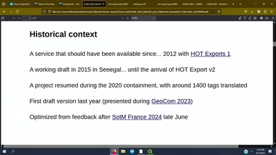
This presentation will introduce a download service of OpenStreetMap GIS layers in English, but also in French for French-speaking areas. In addition to the translation aspect, this service is intended as a proof of concept for an approach that is interoperable, flexible and replicable: it uses open source software components, some of which are supported by OSGeo, and interoperable WMS and WFS protocols of the OGC (Open Geospatial Consortium), while providing detailed OSM data for the countries in question. While English dominates the OSM ecosystem and remains the reference language for the project, several initiatives allow non-English speakers to participate in and benefit from the project: a multilingual forum, translation of the wiki and certain self-learning platforms, translated user interfaces for applications and editors, including OSM label presets. But regardless of the technology or service used, the raw OSM data, once downloaded, is still exclusively in English, and any searching or filtering of OSM data in free GIS software such as QGIS can only be done in this language. This feature can slow down the learning process for non-English speaking OSM contributors, but more importantly, it remains a barrier to adoption by audiences outside the OSM community: for example, public services accustomed to creating/distributing/using data in the official language, or one of the official languages, of their country. This presentation will introduce a download service of OpenStreetMap GIS layers in English, but also in French for French-speaking areas, created on a voluntary basis by the association Les Libres Géographes (The Free Geographers). In addition to the translation aspect, this service is intended as a proof of concept for an approach that is interoperable, flexible and replicable, while providing detailed OSM data for the countries in question. It allows users to download all OSM data and all its labels in various GIS formats, in the form of 16 thematic or generic layers that are updated daily. It uses open source software components (PostGIS, Imposm, GeoServer, GeoNetwork, MapStore), some of which are supported by OSGeo, and interoperable WMS and WFS protocols from the Open Geospatial Consortium (OGC), making it easy to replicate the service. The presentation will be an opportunity to demonstrate these different aspects, get feedback or suggestions from the audience, and possibly discuss extending the translation to other existing OSM data download services. Creative Commons Attribution 3.0 Unported https://creativecommons.org/licenses/by/3.0/ about this event: https://2024.stateofthemap.org/sessions/MJKAC8/
Embed this episode
NOW PLAYING
Download OSM data translated into your language using free software components and standard protocols (sotm2024)
No transcript for this episode yet
Similar Episodes
No similar episodes found.
Similar Podcasts
No similar podcasts found.