
EPISODE · Aug 19, 2025 · 27 MIN
Hurricane Erin & Atlantic Update: Size Matters
from Meteorology Matters
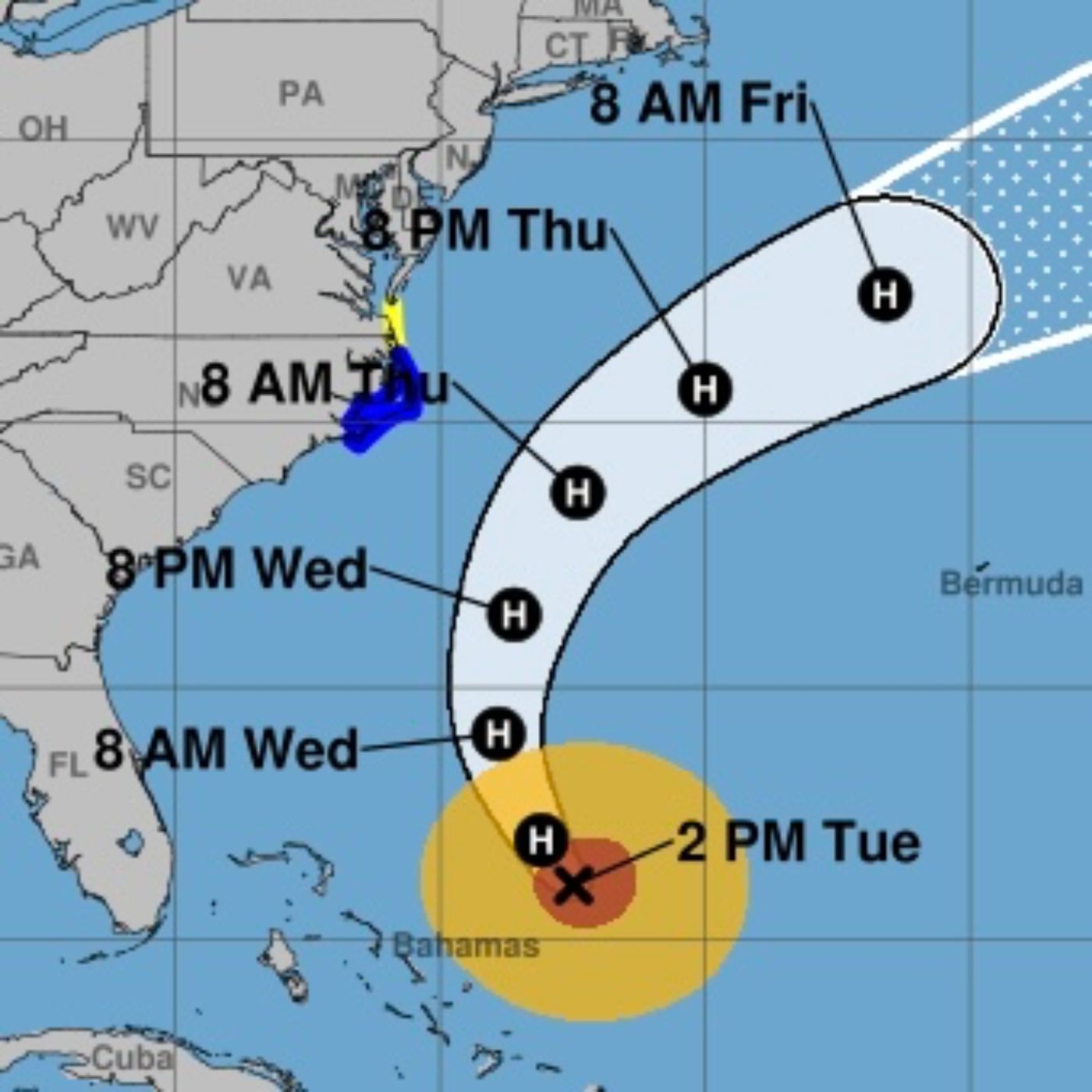
Detailed Briefing: Hurricane Erin and Active Atlantic Tropical Systems (August 19, 2025)This briefing summarizes the current status and forecast for Hurricane Erin, along with updates on two other developing tropical waves in the Atlantic, based on information from the National Hurricane Center (NHC) and other meteorological sources as of August 19, 2025.1. Hurricane Erin: Current Status and Forecast ImpactsHurricane Erin, currently a Category 2 hurricane, is located a couple of hundred miles northeast of the Southeast Bahamas. While its top winds have weakened, the storm has "dramatically [grown] in size" and is expected to "grow even larger this week," potentially becoming "one of the largest major (Category 3 or stronger) hurricanes on record." This expansion significantly increases its impact potential, as "the increase in the diameter of the system more than makes up for the decrease in wind speed in terms of the amount of energy that the storm puts into the ocean water."1.1. 1.2. Significant Coastal Dangers and Warnings:Rip Currents and Surf: "Life-threatening surf and rip currents" are expected along the beaches of the Bahamas, much of the U.S. East Coast, Bermuda, and Atlantic Canada for the next several days. Rescues have "already been a series of rescues at the beach in North Carolina."3. Key Takeaways and RecommendationsHurricane Erin poses a significant coastal threat to a wide stretch of the U.S. East Coast, Bermuda, and Atlantic Canada due to its expanding size and associated dangerous waves, high surf, and rip currents.Coastal North Carolina, particularly the Outer Banks, is at immediate risk for tropical storm conditions, storm surge flooding, and significant beach erosion starting Wednesday night. Mandatory evacuations are in effect for some low-lying areas.Even far from Erin's core, life-threatening rip currents and hazardous surf conditions are widespread along the East Coast. Beachgoers must heed local warnings and lifeguard advice.Monitor the progress of Erin closely, especially residents along the U.S. Mid-Atlantic and southern New England coasts, and Bermuda, as strong winds are possible Thursday and Friday.Two other tropical waves are active in the Atlantic, with the westernmost system having a medium chance of development and approaching the northern Leeward Islands by Friday. While long-range forecasts are uncertain, continued monitoring is essential.Stay informed through official sources such as the National Hurricane Center (NHC) and local emergency management offices. Follow all local instructions for safety.
Embed this episode
NOW PLAYING
Hurricane Erin & Atlantic Update: Size Matters
No transcript for this episode yet
Similar Episodes
No similar episodes found.
Similar Podcasts
No similar podcasts found.