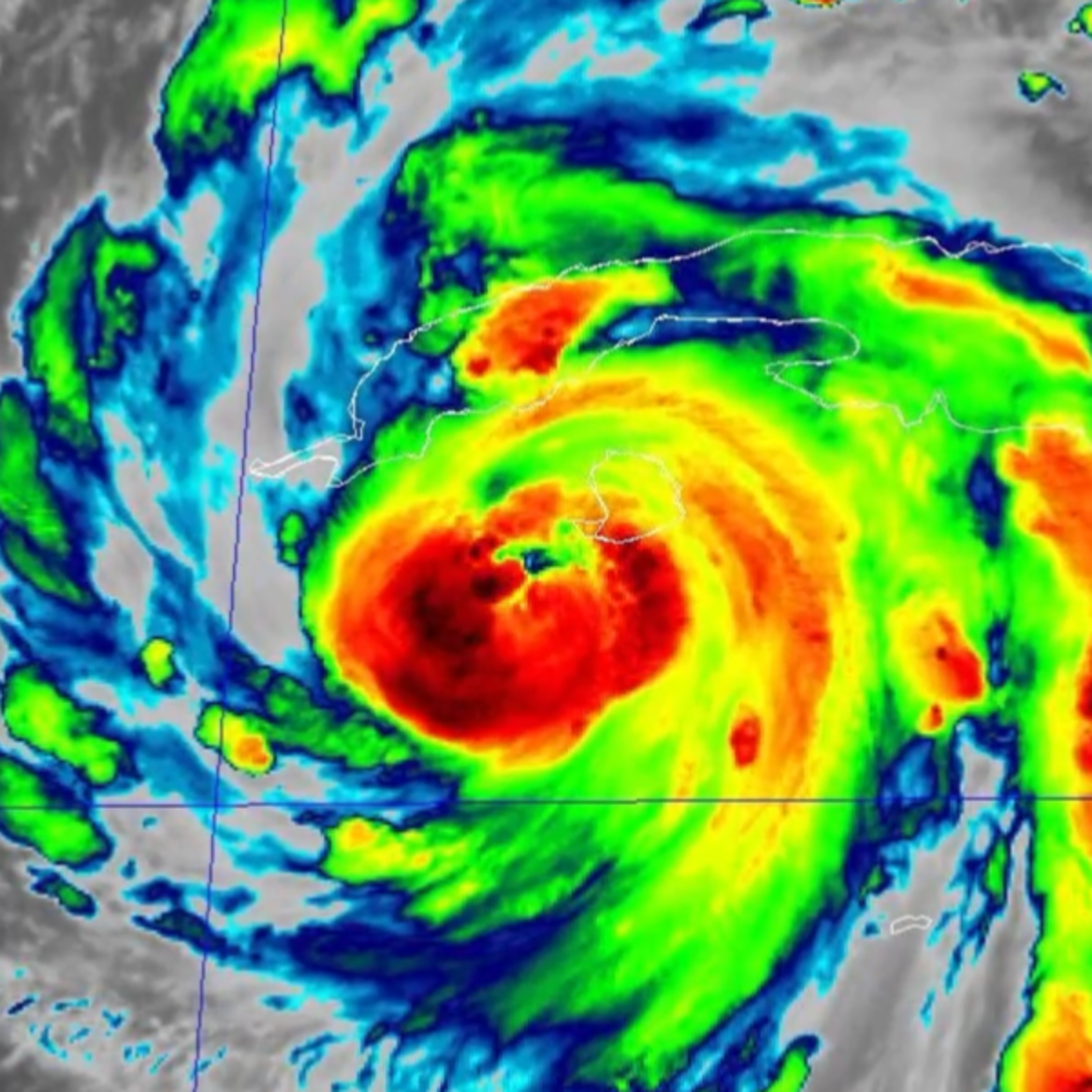
Hurricane Ian: Monday evening update episode artwork

EPISODE · Sep 27, 2022 · 4 MIN

Hurricane Ian: Monday evening update

from Carolina Weather Group · host CarolinaWeatherGroup.com

Hurricane Ian is growing in strength ahead of landfall in Florida later this week. There is still uncertainty in the forecast for Ian. As the storm's track progresses, there will be a better certainty of where and when the storm makes landfall. This data will allow forecasters to better and more accurately predict what happens to Ian as it approaches Georgia, South Carolina, and North Carolina. Both the NAM and a European weather forecast model envision a landfall near Tampa with the storm passing over Orlando and the space coast before returning to the Atlantic Ocean. This would put the storm closer to cities like Savannah, Hilton Head, Charleston, Myrtle Beach, and Wilmington. This scenario would bring more beach erosion and heavier surf to the Carolina coast. The GFS model wants to take the storm further west and further inland following landfall in Florida's panhandle. If Ian's center of circulation were to pass over Georgia, upstate South Carolina, and western North Carolina, more of the Carolinas would see more severe weather. In either scenario, all of the Carolinas are at risk for heavy rain and flash flooding.  The strongest part of any storm is the top right, or northeast, quadrant. A storm track further west puts more of the Carolinas under the right side of the storm. Thus this would bring more of Ian's heavy rain, flash flooding, strong winds, and possible tornado threat further inland and over more of the Carolinas. The certainty in the forecast will improve over the coming days.  In any scenario, impacts from Ian are not expected to reach the Carolinas before late Thursday with the most likely arrival overnight on Friday. Impacts will move from south-to-north with storm impacts reaching North Carolina by later Friday. Storm impacts will continue into Saturday and linger into Sunday. The Carolina Weather Group will continue to track Ian, the forecast, and the impacts that can be expected in the Carolinas. Now is the time to prepare for possible evacuations, power outages, flooding, and more. LEAVE A TIP: https://streamelements.com/carolinawxgroup/tip SUBSCRIBE TO OUR PODCAST: https://anchor.fm/carolinaweather SUPPORT US ON PATREON: https://patreon.com/carolinaweathergroup VISIT OUR WEBSITE: https://carolinaweathergroup.com The Carolina Weather Group operates a weekly talk show of the same name. Broadcasting each week from the Carolinas, the show is dedicated to covering weather, science, technology, and more with newsmakers from the field of atmospheric science. With co-hosts across both North Carolina and South Carolina, the show may closely feature both NC weather and SC weather, but the topics are universally enjoyable for any weather fan. Join us as we talk about weather, environment, the atmosphere, space travel, and all the technology that makes it possible.

Episode metadata supplied by the publisher feed · Published Sep 27, 2022

Hurricane Ian is growing in strength ahead of landfall in Florida later this week. There is still uncertainty in the forecast for Ian. As the storm's track progresses, there will be a better certainty of where and when the storm makes landfall. This data will allow forecasters to better and more accurately predict what happens to Ian as it approaches Georgia, South Carolina, and North Carolina. Both the NAM and a European weather forecast model envision a landfall near Tampa with the storm passing over Orlando and the space coast before returning to the Atlantic Ocean. This would put the storm closer to cities like Savannah, Hilton Head, Charleston, Myrtle Beach, and Wilmington. This scenario would bring more beach erosion and heavier surf to the Carolina coast. The GFS model wants to take the storm further west and further inland following landfall in Florida's panhandle. If Ian's center of circulation were to pass over Georgia, upstate South Carolina, and western North Carolina, more of the Carolinas would see more severe weather. In either scenario, all of the Carolinas are at risk for heavy rain and flash flooding.  The strongest part of any storm is the top right, or northeast, quadrant. A storm track further west puts more of the Carolinas under the right side of the storm. Thus this would bring more of Ian's heavy rain, flash flooding, strong winds, and possible tornado threat further inland and over more of the Carolinas. The certainty in the forecast will improve over the coming days.  In any scenario, impacts from Ian are not expected to reach the Carolinas before late Thursday with the most likely arrival overnight on Friday. Impacts will move from south-to-north with storm impacts reaching North Carolina by later Friday. Storm impacts will continue into Saturday and linger into Sunday. The Carolina Weather Group will continue to track Ian, the forecast, and the impacts that can be expected in the Carolinas. Now is the time to prepare for possible evacuations, power outages, flooding, and more. LEAVE A TIP: https://streamelements.com/carolinawxgroup/tip SUBSCRIBE TO OUR PODCAST: https://anchor.fm/carolinaweather SUPPORT US ON PATREON: https://patreon.com/carolinaweathergroup VISIT OUR WEBSITE: https://carolinaweathergroup.com The Carolina Weather Group operates a weekly talk show of the same name. Broadcasting each week from the Carolinas, the show is dedicated to covering weather, science, technology, and more with newsmakers from the field of atmospheric science. With co-hosts across both North Carolina and South Carolina, the show may closely feature both NC weather and SC weather, but the topics are universally enjoyable for any weather fan. Join us as we talk about weather, environment, the atmosphere, space travel, and all the technology that makes it possible.

PodParley-generated summary based on available episode metadata and transcript content.

NOW PLAYING

Hurricane Ian: Monday evening update

0:00 4:14

No transcript for this episode yet

We transcribe on demand. Request one and we'll notify you when it's ready — usually under 10 minutes.

DIOSA. Carolina Sanper This podcast is a sacred space created by Carolina Sanper where you connect with your inner wisdom and embody your magnetic feminine power.It is the realization that the mystical realm is where you plant the seeds of your desired reality.It is a portal to your true essence: awareness, presence, and receiving with ease. Welcome home, DIOSA. 🖤 Capital Ideas Podcast Capital Group Want to learn how professional investors do it? The Capital Ideas podcast brings you the latest investment thinking from Capital Group, one of the world's largest investment management organizations. Each week we'll get inside the minds of portfolio managers, analysts and economists to break down market trends, macroeconomic forces, investing approaches and lessons learned from personal experience. Take 30 minutes and tap into the intellectual capital of Capital Group. Capital Client Group, Inc.All Capital Group trademarks mentioned are owned by The Capital Group Companies, Inc., an affiliated company or fund. All other company and product names mentioned are the property of their respective companies.For full disclosures go to capitalgroup.com/global-disclosures. Sing Better Fast! | Vocal tips, singing lessons, voice exercises, etc. Jaime Vendera - Vocal Coach Wish you could sing better, higher and stronger, but don't have "natural talent?" Want some vocal tips, demonstrations, and exercise ideas? Looking for motivation and advice to become a better singer? Want to sing high in full voice without straining?Then welcome to the Sing Better Fast Podcast, a podcast by vocal coaches and authors, Jaime Vendera and Ben Valen!The Sing Better Fast podcast is exclusively for serious and passionate vocalists! You are now part of a professional group of smart and motivated singers who want to become masters of the voice and inspire millions with our music.Get all of our podcast episodes, notifications for upcoming events, new podcast releases, and other vocal resources at singbetterfast.com!

Frequently Asked Questions

How long is this episode of Carolina Weather Group?

This episode is 4 minutes long.

When was this Carolina Weather Group episode published?

This episode was published on September 27, 2022.

What is this episode about?

Hurricane Ian is growing in strength ahead of landfall in Florida later this week. There is still uncertainty in the forecast for Ian. As the storm's track progresses, there will be a better certainty of where and when the storm makes landfall....

Can I download this Carolina Weather Group episode?

Yes, you can download this episode by clicking the download button on the episode player, or subscribe to the podcast in your preferred podcast app for automatic downloads.
URL copied to clipboard!