Inequality Fell as Mohenjo-daro Grew
from Evolutionary Insights by Anthropology.net Hosted by Anthropology.net
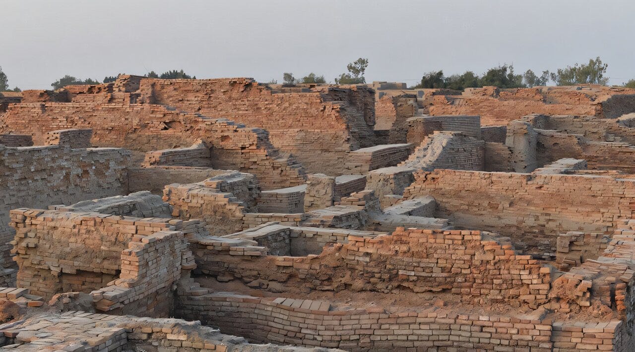
In the oldest levels of a neighborhood called DK-G South, the houses are large. The largest date to around 2500 BC and cover more than 160 square meters of floor plan. This isn’t surprising for a Bronze Age city. What’s surprising is what happens next. Over the following four centuries, as Mohenjo-daro continued to grow and fill in, housing inequality fell. Not marginally. By around 2100 BC, the Gini coefficient of residential disparity in DK-G South had dropped to 0.23, a figure typical of Neolithic farming villages, not major urban centers. The gap between the largest and smallest homes had narrowed to something archaeologists usually associate with societies that don’t yet have cities. Mohenjo-daro had tens of thousands of residents. It had standardized brick construction, a citywide drainage network, a grid of streets, a sophisticated system of weights and measures, and a vigorous long-distance trade network that extended to Mesopotamia. It was, by any reasonable measure, one of the most functionally complex urban environments on earth in the third millennium BC. And it appears to have been getting more equal as it matured. That finding is the core of a new study by Adam Green, Iqtedar Alam, and Cameron Petrie, published in Antiquity in 2026. Their analysis draws on excavation data from the earliest twentieth-century digs at the site, converting house footprints into Gini coefficients through a GIS-based approach. The Gini coefficient is a standard economic measure of distributional inequality: zero means total equality, one means total concentration. Their results put the city’s overall residential Gini at 0.44, well below contemporaneous Mesopotamian cities like Ur and Ugarit, which both score above 0.6. The ancient Greek site of Knossos sits at 0.86. The Classic Maya city of Palenque at 0.75. Mohenjo-daro was already an outlier by those comparisons. But the diachronic data from DK-G South is what makes the study genuinely provocative. What the houses say The standard archaeological assumption is that cities generate inequality. The logic is intuitive: larger populations mean more specialization, more specialization means more occupational hierarchy, and hierarchy means wealth concentrates at the top. V. Gordon Childe codified this in his 1950 “urban revolution” framework, which treated social stratification as a defining feature of cities. Neoevolutionary theory went further, treating the state as essentially defined by stratification. If you had a city, you had elites; if you couldn’t find the elites, you weren’t looking hard enough. Indus archaeologists spent much of the later twentieth century fighting this prior. Mohenjo-daro and the other major Indus sites lack the usual material signatures of hierarchical power: no palaces, no royal tombs, no temples accessible only to a priestly class, no statues of rulers. The arguments went back and forth. Some scholars concluded the Indus must have been a complex chiefdom or non-state. Others countered that a civilization that built cities at this scale must have had elites, even if the evidence was missing. Absence of evidence wasn’t evidence of absence, or so the argument ran. What Green and colleagues have added is a quantitative dimension to a debate that had stayed largely qualitative. And the quantitative data doesn’t just confirm the impression that Mohenjo-daro was relatively equal. It shows the city moving in a direction opposite to what the theory predicts. The method has known limitations, which the authors are explicit about. Gini coefficients of house size are not a comprehensive picture of social inequality. They don’t capture differences in movable wealth, in gender or kinship status, or in access to political power that doesn’t manifest architecturally. A wealthy person might not invest in a larger house. A small structure might house a powerful family. The measure also struggles with people who have no residence at all, the poorest members of any ancient city. These caveats matter. But the measure does capture one real economic dimension: access to labor and resources at the household level. And it allows direct comparison across sites and time periods, which is why the Global Dynamics of Inequality (GINI) project has assembled this kind of data from hundreds of ancient settlements worldwide. Mohenjo-daro now sits in that database, and what it shows is distinctive. The governance question The DK-G South sequence tracks five periods from roughly 2500 to 2100 BC. The earliest period shows a Gini of 0.39 and a median house size of 161 square meters. By the latest period, the Gini is 0.23 and the median has dropped to 141 square meters, but with much less variance. The log standard deviation of house areas falls from 0.73 to 0.44 over the same span. Houses weren’t just smaller on average; they were converging toward a common size. This convergence happened alongside something else: the city’s residences became more uniformly aligned with Mohenjo-daro’s street grid. In the earlier levels, structures are arranged more loosely. In the later levels, they lock into the urban plan. Green and colleagues read this correlation as suggestive of governance, that the same collective decisions that built and maintained public infrastructure also shaped residential space in ways that narrowed the gap between households. What that governance looked like in practice is uncertain, and the study doesn’t overclaim. There are no deciphered texts from the Indus Civilization, no royal inscriptions, no administrative archives of the kind that survive from Mesopotamia. But the material record offers indirect evidence for distributed authority. Indus seals, small stone stamps that likely facilitated exchange and credit, were found primarily in private residences at Mohenjo-daro rather than in temples or central administrative buildings. In Mesopotamia, equivalent objects concentrated in institutional contexts, where a palace or temple controlled trade. At Mohenjo-daro, the tools of economic governance were spread across the city’s households. Green has previously characterized this contrast in terms of where the power to govern exchange sat: distributed rather than monopolized, and for that reason probably harder to weaponize against ordinary residents. The same logic extends to the standardized weights and measures used across the entire Indus region. This wasn’t a system enforced from a single administrative center. It was a shared protocol adopted by communities across a vast area, a form of coordination without centralized control. Green and colleagues point to the decline in residential disparity coinciding with more structured urban development, and suggest that the same governance producing civic amenities may also have constrained how unevenly residential space was distributed. Green has described Mohenjo-daro as having had “deliberative spaces” where collective decisions about the city were made. The new Gini data, tentatively, supports something like that interpretation. The declining inequality wasn’t random drift. It tracked with urban development in a way consistent with intentional decisions about how the city was organized. One further pattern in the data is worth noting carefully. As inequality declined, productivity appears to have risen. The GINI project uses mean residence area as a rough proxy for household wealth and productivity. In DK-G South, median residence area bottomed out at about 98 square meters in the Late III Period, around 2200 BC, as the Gini was still falling. Then, in the latest period, when the Gini reaches its low of 0.23, median residence area… This is a public episode. If you'd like to discuss this with other subscribers or get access to bonus episodes, visit www.anthropology.net/subscribe
Embed this episode
No transcript yet.