
EPISODE · Dec 6, 2024 · 41 MIN
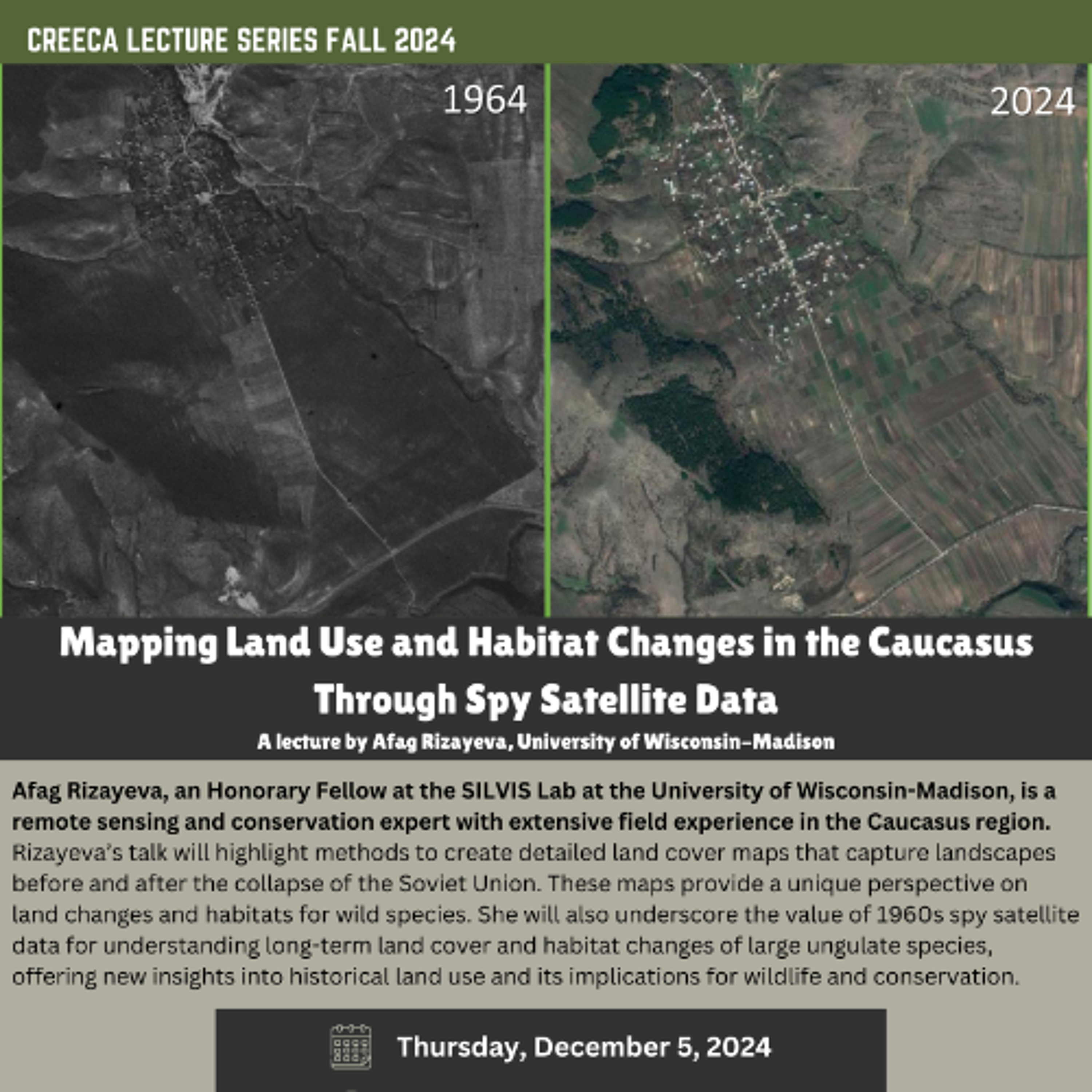
Mapping Land Use and Habitat Changes in the Caucasus Through Spy Satellite Data
from CREECA Lecture Series Podcast · host Center for Russia, East Europe, and Central Asia at the University of Wisconsin, Madison
About the lecture: The legacy of past human activities strongly shapes current landscapes and ecosystems, with today’s actions set to leave similar long-term impacts. Predicting future landscape changes, however, requires a thorough understanding of past ones, yet most land and habitat change studies are limited to recent decades—starting only in the 1980s with the availability of 30-m satellite data or in the 2000s with commercial high-resolution satellites. This presentation will introduce an alternative approach, using high-resolution imagery from the 1960s U.S. Corona spy satellites series to trace landscape changes over the past half-century. Focusing on the diverse Caucasus region, with its wide variation in elevation, climate, ecosystems, and historical land-use patterns, this presentation will highlight methods to create detailed land cover maps capturing landscapes before and after the collapse of the Soviet Union. These historical maps provide a unique perspective on land changes, as well as habitat changes for wild species. This presentation will underscore the value of 1960s spy satellite data for understanding long-term land cover and habitat changes of large ungulate species, offering new insights into historical land use and its implications for wildlife and conservation. About the speaker: Afag (pronounced ah-fah) is a remote sensing and conservation expert with extensive field experience in the Caucasus region. Currently an Honorary Fellow at the SILVIS Lab at the University of Wisconsin-Madison (https://silvis.forest.wisc.edu/people/), she holds a PhD in Forestry from the University of Wisconsin-Madison and a Postgraduate Diploma in Wildlife Conservation from the University of Oxford. Afag’s research employs high-resolution satellite data to map historical land cover in the Caucasus eco-region, investigating long-term landscape changes and their impacts on wild habitats. Her past work has contributed to projects in wild mammal species’ reintroduction, habitat management, and human-wildlife conflict mitigation, and she has shared her findings in various publications (link to google scholar – https://scholar.google.com/citations?user=sqSt3H4AAAAJ&hl=en&oi=ao). In addition, employed as a data scientist at Spatial Informatics Group (SIG), she is currently involved in environmental projects in developing countries. Fluent in three languages and conversant in two others, Afag brings a global perspective to her work.
Embed this episode
Ready to play
Mapping Land Use and Habitat Changes in the Caucasus Through Spy Satellite Data
No transcript for this episode yet
Similar Episodes
No similar episodes found.