
EPISODE · Jan 13, 2016 · 33 MIN
Mapping the Medieval World in Islamic Cartography | Karen Pinto
from Ottoman History Podcast · host Ottoman History Podcast
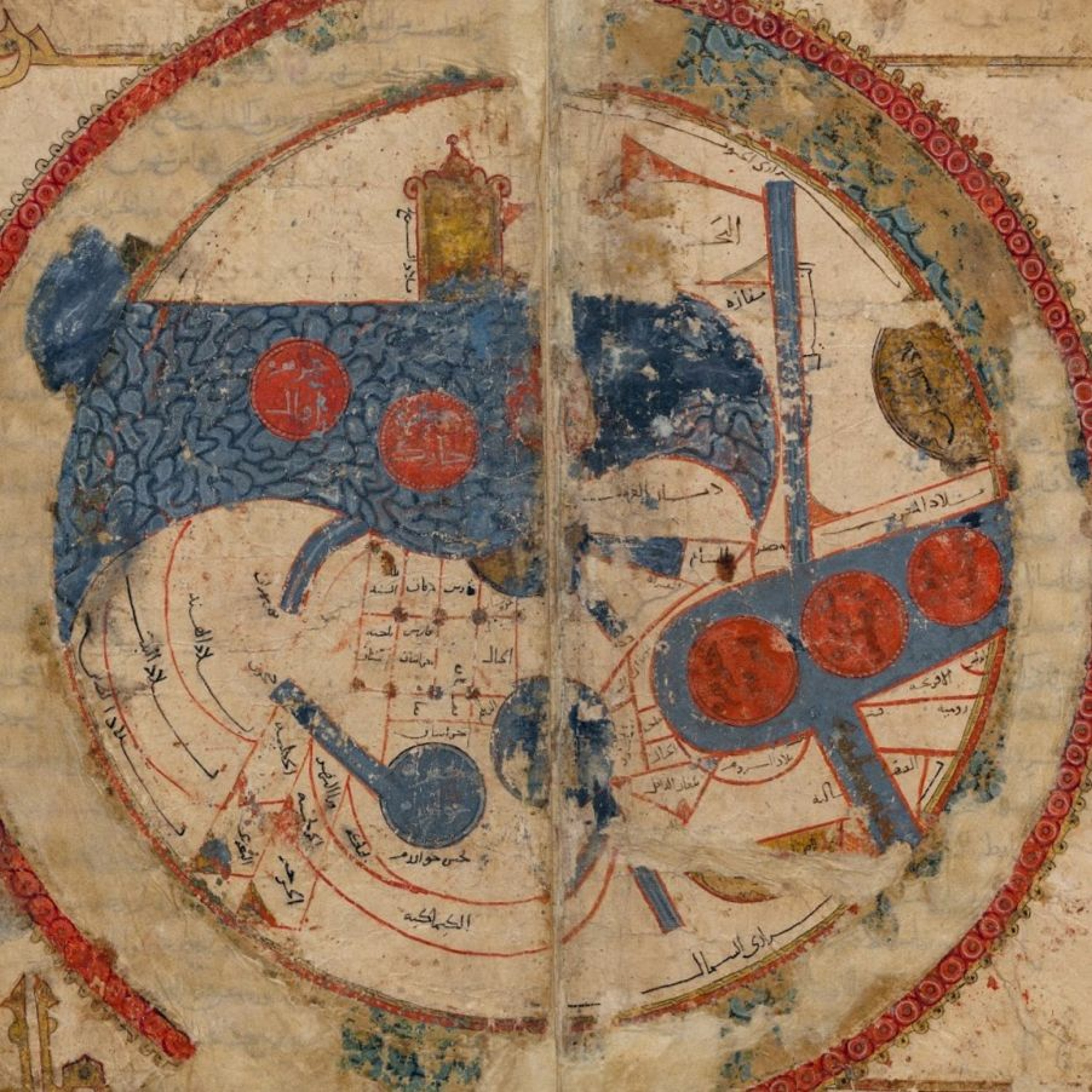
E220 | Hundreds of cartographic images of the world and its regions exist scattered throughout collections of medieval and early modern Arabic, Persian, and Turkish manuscripts. The sheer number of these extant maps tells us that from the thirteenth century onward, when these map-manuscripts began to proliferate, visually depicting the world became a major preoccupation of medieval Muslim scholars. However, these cartographers did not strive for mimesis, that is, representation or imitation of the real world. These schematic, geometric, and often symmetrical images of the world are iconographic representations—‘carto-ideographs’—of how medieval Muslim cartographic artists and their patrons perceived their world and chose to represent and disseminate this perception. In this podcast, we sit down with Karen Pinto to discuss the maps found in the cartographically illustrated Kitāb al-Masālik wa-al-Mamālik (Book of Routes and Realms) tradition, which is the first known geographic atlas of maps, its influence on Ottoman cartography, and how basic versions of these carto-ideographs were transported back to villages and far-flung areas of the Islamic empire. More at http://www.ottomanhistorypodcast.com/2016/01/islamic-cartography.html Karen Pinto is Assistant Professor in the Department of History at Boise State University. She specializes in the history of Islamic cartography and its intersections between Ottoman, European, and other world cartographic traditions CREDITS Episode No. 220 Release Date: 12 January 2016 Recording Location: Brown University Editing by Onur Engin (funded by a paid assistantship at Koç University under the supervision of Nina Ergin) Music and sound samples: Bekir Sıdkı - Lerzan ediyor ruhumu cesmindeki efsun; BBC Sound Effects Vol.46 - Istanbul; Selma Sağbaş - Cok surmedi gecti tarab-i sevk-i baharim Images courtesy of Leiden University Library SELECT PUBLICATIONS OF KAREN PINTO Medieval Islamic Maps: An Exploration (in press, The University of Chicago Press, 2016) “Passion and conflict: Medieval Islamic views of the West" in Mapping Medieval Geographies, ed. Keith Lilley, (Cambridge University Press, 2014), 201-224. “Searchin’ his eyes, lookin’ for traces: Piri Reis’ World Map of 1513 & Its Islamic Iconographic Connections (A Reading Through Bağdat 334 and Proust),” Journal of Ottoman Studies, 39:1, 2012, 63-94. "The Maps Are The Message: Mehmet II’s Patronage of an ‘Ottoman Cluster,’" Imago Mundi, 63:2, 2011, 155-179.
Embed this episode
NOW PLAYING
Mapping the Medieval World in Islamic Cartography | Karen Pinto
No transcript for this episode yet
Similar Episodes
No similar episodes found.
Similar Podcasts
No similar podcasts found.