Why Phoenix Bakes While Chicago Cools - August 23td 2026 weather
from Reflections on the weather Hosted by Simcha Lefton
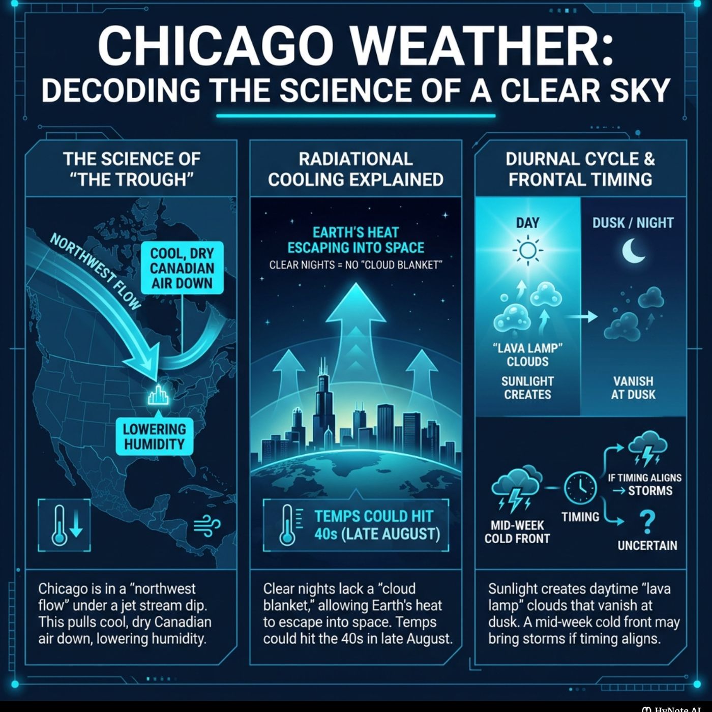
Decoding the Atmosphere: From Chicago Breezes to Desert Heat Domes Timestamp Breakdown: 00:00 - 01:00: Introduction to the podcast and the surprising National Weather Service (NWS) warning for Chicago despite clear skies. 01:00 - 02:00: The hosts discuss their plan to analyze raw NWS data, specifically Area Forecast Discussions (AFDs), starting with Chicago. 02:00 - 03:00: Reading and initial reactions to the Chicago AFD, highlighting pleasant temperatures and clear skies. 03:00 - 04:00: Continued reading of the Chicago AFD, discussing radiational cooling, ground fog, and a mid-week cold front. 04:00 - 05:00: Final part of the Chicago AFD, mentioning zonal flow and a "hefty, beautiful piece of scientific writing." 05:00 - 06:00: Explanation of "western ridge" and "troughing" in relation to the jet stream and their impact on weather. 06:00 - 07:00: Understanding "diurnal cumulus" and the concept of "radiational cooling" in clear night skies. 07:00 - 08:00: Deeper dive into the "boundary layer" as a "leaky blanket" preventing extreme cooling, and explaining "long wave" vs. "short wave" troughs. 08:00 - 09:00: What physically happens during a "cold front" to cause showers, and the meaning of "zonal flow." 09:00 - 10:00: Translating the Chicago science into a 7-day forecast and discussing concerns about severe weather risks. 10:00 - 11:00: Analysis of National Storm Prediction Center (SPC) maps, revealing Chicago is safe from severe weather but faces "invisible danger" in Lake Michigan. 11:00 - 12:00: Explanation of how clear, high-pressure days create dangerous "rip currents" in Lake Michigan due to wind stress. 12:00 - 13:00: Transition to the "planetary seesaw" concept and reading the Phoenix, Arizona NWS forecast discussion about a westward-shifting "subtropical high center." 13:00 - 14:00: Explanation of "H5 heights" in "decameters" and how it signifies a "bulging" and "taller" atmosphere under a heat dome. 14:00 - 15:00: Reading the stark "extreme heat warning" for Phoenix and discussing the physical impact of 106-118 degree temperatures on the human body. 15:00 - 16:00: Discussion of the lack of overnight relief under a heat dome and its public health hazard, then shifting to tropical storm warnings in the Eastern Pacific. 16:00 - 17:00: Explaining how intense pressure gradients and wind shear on the edges of high-pressure systems cause tropical storms, and moving to Atlantic steering currents. 17:00 - 18:00: Reading the Miami, Florida NWS discussion about the "Bermuda High" and its role in fueling Florida's thunderstorms. 18:00 - 19:00: Explanation of the "Saharan Air Layer" (SAL) and its impact on suppressing thunderstorms and hurricanes in the Atlantic. 19:00 - 20:00: Connecting all the weather phenomena through the jet stream acting as a "river in the sky" and the heat dome as a "boulder." 20:00 - 21:00: Applying the "planetary seesaw" model to predict weather in St. Louis and New York based on their position relative to the heat dome and trough. 21:00 - 22:00: Analyzing Los Angeles's weather, showcasing how the "ridge bakes the west" while the "trough cools the east." 22:00 - 22:38: Concluding remarks about the interconnectedness of the atmosphere and a thought-provoking question about the impact of a changing climate on weather patterns. Hashtags: WeatherToday Meteorology ClimateScience AtmosphericPhysics NWSData WeatherPodcast ChicagoWeather PhoenixHeat LakeMichigan RipCurrents JetStream HeatDome TropicalStorms SaharanDust BermudaHigh GlobalWeather WeatherData Forecasting WeatherPatterns ClimateChange Become a supporter of this podcast: https://www.spreaker.com/podcast/reflections-on-the-weather--5747023/support.
Embed this episode
No transcript yet.