PODCAST · news
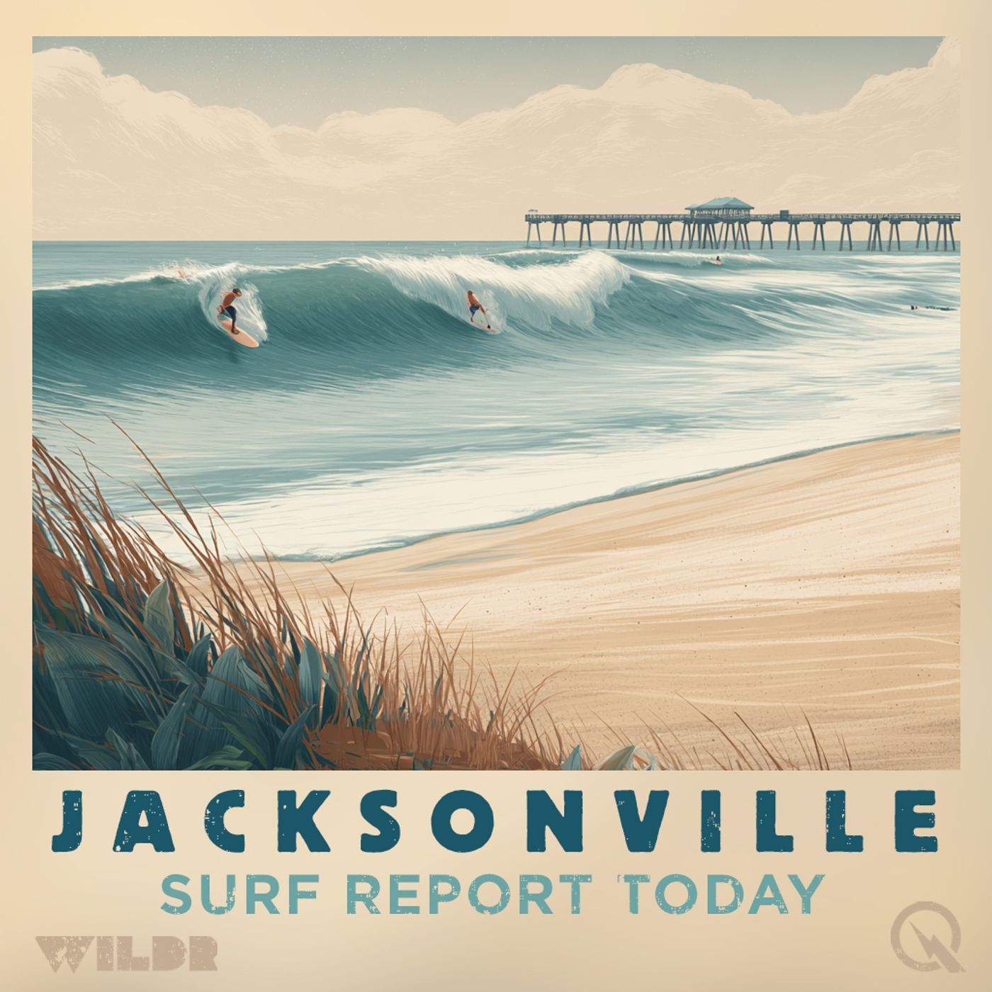
Surf Report for Jacksonville Florida
by Inception Point Ai
Jacksonville Florida Surf ReportCatch the latest wave conditions without wiping out!The "Jacksonville Florida Surf Report" is your one-stop shop for all things surfing in the Sunshine State's north-eastern gem. This podcast, powered by AI and pulling data straight from the National Weather Service, delivers daily updates on the waves in your favorite Jacksonville Beach spots.In each episode, you'll get:Surf Height and Conditions: Know exactly what to expect, whether it's glassy one-footers perfect for beginners or head-high barrels for experienced riders.Swell Report: We'll break down the incoming swell, including direction, period, and size, so you can plan your session accordingly.Wind Forecast: Get the lowdown on wind speed and direction, crucial factors for a smooth ride.Water Temperature: Stay informed about water temperature to decide on your wetsuit needs.Local Insights (Automated, for now): While still un
-
533
Northeast Florida Southeast Georgia Surf Forecast Tuesday through Saturday May 5 to 9 Rip Current Warning
Good morning, this is your Northeast Florida and Southeast Georgia surf zone forecast for Tuesday, May 5th through Saturday, May 9th. Let's start with today's conditions. If you're planning a beach day, you're in for a mostly sunny experience with highs around 80 degrees. The water is warming up nicely, sitting in the low to mid 80s along the Florida coast, though down in the Georgia beaches you're looking at the lower 70s. Winds will be light from the east southeast this morning around 10 miles per hour, then shift to the east this afternoon with speeds picking up to around 15 miles per hour. Surf heights will be modest at 2 to 3 feet along Florida's beaches and around 2 feet down in Georgia. No thunderstorms are expected, and the UV index is very high, so definitely get that sunscreen on before heading out. Now here's the important part about safety. There is a moderate risk of rip currents in effect for all areas today. That means life-threatening rip currents are possible in the surf zone, so pay attention to conditions and know how to identify and escape these currents if you find yourself in one. Moving to Wednesday, conditions remain pretty similar. We'll see partly cloudy skies with highs climbing into the mid 80s. Winds start out light from the south around 10 to 15 miles per hour, then shift southeast and strengthen to 15 to 20 miles per hour during the late afternoon. Surf heights stay consistent at 2 to 3 feet in Florida and around 2 feet in Georgia. The moderate rip current risk continues, so stay alert in the water. No thunderstorms are expected Wednesday either. Looking ahead to Thursday, surf heights drop to 1 to 2 feet across the region. Expect mostly sunny to partly sunny skies with highs around 90 degrees. Winds shift to the southwest at 10 to 15 miles per hour. Down in Georgia there's a slight chance of showers and thunderstorms developing. Friday brings a change in the pattern. Highs will be noticeably cooler, dropping to around 80 degrees in Florida and the upper 70s in Georgia. Skies turn mostly cloudy with a chance of showers and thunderstorms developing. Winds shift to the northeast around 10 miles per hour. This is definitely not a day for extended water time if thunderstorms are in the area. Finally, Saturday looks fairly similar to Friday with mostly cloudy skies, a chance of showers and thunderstorms, and highs in the lower 80s. Winds will be light from the west around 5 to 10 miles per hour. Surf heights remain at 1 to 2 feet. Bottom line, make the most of today and Wednesday while conditions are favorable. After that, a weather system moves in Friday bringing thunderstorm chances and cooler temperatures that will stick around through the weekend. For more http://www.quietplease.ai Get the best deals https://amzn.to/3ODvOta
-
532
Northeast Florida Southeast Georgia Surf Forecast May 4-8 2026 Three to Four Foot Waves Monday
Good morning, this is your Northeast Florida and Southeast Georgia surf zone forecast for Monday, May 4th through Friday, May 8th, 2026. Let's start with today. If you're thinking about heading to the beach, you're looking at three to four foot surf along the Northeast Florida coast, with conditions a bit smaller around two feet down in Southeast Georgia. A moderate risk of rip currents is in effect, so keep that in mind if you're planning to get in the water. The morning will be mostly sunny, becoming partly cloudy this afternoon. Temperatures will climb into the mid to upper 70s, and while there's no thunderstorm threat today, grab your sunscreen because the UV index is very high. Northeast winds will start at 10 to 15 miles per hour this morning, shifting to easterly winds around 15 miles per hour this afternoon. Water temperatures are sitting in the low to mid 70s along Northeast Florida and the lower 70s down toward Georgia. For high tides today, Jacksonville Beach peaks at 10:31 in the morning, with St. Augustine Beach following at 10:41. If you're heading north, Fernandina Beach gets its high tide at 11:18 AM, and down in Georgia, St. Simons Island reaches high tide at 10:45. Moving into Tuesday, conditions remain very similar with the same moderate rip current risk still in place. Surf heights stay at three to four feet for Northeast Florida and hold steady around two feet in Southeast Georgia. Another mostly sunny morning will give way to partly cloudy skies by afternoon. Temperatures creep up slightly to near 80 degrees, and the winds will be lighter to start, five to ten miles per hour from the southeast, but pick up to around 15 miles per hour by the afternoon. No thunderstorms expected Tuesday either. Now for the extended outlook. Wednesday shapes up to be a beautiful beach day with mostly sunny skies and higher temperatures climbing into the mid 80s. Surf heights drop to two to three feet, and the slight south winds will shift southeast around 15 miles per hour in the afternoon. Thursday brings mostly sunny skies along the Georgia coast and mid to upper 80s for Northeast Florida. There's a slight chance of showers and thunderstorms Thursday, with highs in the upper 80s for Florida and around 90 in Georgia. Surf continues to drop to one to two feet as southwest winds blow at 10 to 15 miles per hour. Finishing out your extended period, Friday looks wetter with mostly cloudy skies and a good chance of showers. A slight chance of thunderstorms is in the mix as well. It'll be notably cooler than Thursday, with highs dropping back to the upper 70s. North winds around 10 miles per hour will be the story, and surf heights remain at one to two feet. If you're a rip current novice, remember that these currents are narrow channels of fast moving water flowing away from shore. If you find yourself caught in one, don't panic and don't fight it. Swim parallel to shore until you escape the current, then swim back to land. That's your seven
-
531
Northeast Florida and Southeast Georgia Surf Forecast Sunday May Third Through Thursday with Rip Current Safety
Good morning, this is your Northeast Florida and Southeast Georgia surf zone forecast for Sunday, May third through Thursday. We're looking at moderate rip current conditions in effect across both our Florida and Georgia beaches today. If you're planning to hit the water, stay alert and remember that rip currents can be life-threatening even when they're not immediately obvious. Down in Northeast Florida, we're expecting three to four foot surf with mostly sunny skies and temperatures in the lower seventies. Winds will be north around fifteen miles per hour this morning, shifting to northeast ten to fifteen by afternoon. Water temps are settling in the low to mid seventies, so you won't need a thick wetsuit. The UV index is very high, so sunscreen is essential. Tides are staggered along the coast, with Jacksonville Beach reaching high tide around nine fifty-two in the morning and low tide around three forty-nine in the afternoon. Over in our Georgia beaches near Brunswick and St. Simons, conditions are a bit mellower with two to three foot surf today. You're looking at mostly sunny weather with highs in the lower seventies and lighter winds out of the north, five to ten miles per hour this morning. Water temperatures are in the lower seventies, and like Florida, the UV is cranked up, so protect that skin. Monday shapes up nicely across both zones. Florida's maintaining moderate rip currents with three to four foot waves and sunny skies. Highs climb to the mid seventies with east northeast winds five to ten in the morning becoming east ten to fifteen by afternoon. Georgia's surf settles around two feet with sunny conditions and highs in the mid seventies as well. Looking ahead to Tuesday, things continue to improve. Florida drops to two to three foot surf while Georgia sees one to two footers. Both regions enjoy sunny skies with highs in the upper seventies to around eighty. Wednesday brings mostly sunny conditions across the board with two to three footers in Florida and one to two footers in Georgia. Highs climb to the mid eighties as south winds pick up to ten to fifteen miles per hour. Thursday we're watching a slight chance of showers and thunderstorms move in, particularly over Georgia where there's a chance of storms. Surf remains small at two to three feet in Florida and one to two feet in Georgia. Highs reach the upper eighties in Florida and around ninety in Georgia with southwest winds around fifteen miles per hour. Stay safe out there and always respect the ocean. For more http://www.quietplease.ai Get the best deals https://amzn.to/3ODvOta
-
530
Northeast Florida Southeast Georgia Surf Forecast: Storms Today, Beautiful Beach Weather This Weekend and Beyond
Good morning, I'm bringing you your Northeast Florida and Southeast Georgia surf zone forecast for the weekend and beyond. A moderate risk for rip currents is in effect for the entire region today and tomorrow. If you're heading to the beach, please be aware and stay cautious in the water. Looking at today, we're expecting two to three foot surf across Northeast Florida with slightly smaller conditions around two feet down in Southeast Georgia. The water temperature is hovering in the low to mid seventies, so it's getting comfortable out there. However, conditions are going to be a bit unsettled. Expect cloudy skies with showers and thunderstorms developing this afternoon. We're looking at high thunderstorm potential, and there's a chance for strong to isolated severe storms to pop up during the early to mid afternoon hours, so keep an eye on the sky. Winds will start light out of the north at five to ten miles per hour early on, then shift southwest and pick up to fifteen to twenty miles per hour through midday before turning northwest and settling around fifteen miles per hour late in the afternoon. Sunday is looking much nicer for beach time. We'll see mostly sunny skies with moderate rip current risk still in effect but no thunderstorm threat. Surf will bump up a bit to three to four feet across Northeast Florida and two to three feet in Southeast Georgia. Temperatures will be a bit cooler, in the low to mid seventies, with north northeast winds starting around fifteen to twenty miles per hour and decreasing to ten to fifteen miles per hour during the afternoon. Perfect for getting outside. As we head into the extended period, Monday looks outstanding. Sunny skies, three to four foot surf in the north and one to two feet in the south, with highs in the mid seventies and light northeast winds around ten miles per hour. Tuesday continues the pattern with sunny conditions, slightly smaller two to three foot surf in the north and one to two feet in the south, warming up just a bit with highs in the upper seventies to around eighty. Wednesday will be mostly sunny and warmer with highs climbing into the lower eighties up north and mid eighties down south. Surf picks up slightly to two to three feet in the north and two to three feet in the south as southeast winds increase to ten to fifteen miles per hour. Overall, today's a day to respect Mother Nature with those afternoon storms, but the weekend and beyond is shaping up to be a beautiful stretch of beach weather. Stay safe out there. For more http://www.quietplease.ai Get the best deals https://amzn.to/3ODvOta
-
529
Northeast Florida Southeast Georgia Surf Forecast Moderate Rip Current Risk 2-3 Foot Waves Friday Saturday
# NORTHEAST FLORIDA AND SOUTHEAST GEORGIA SURF ZONE FORECAST Good morning, this is your surf zone forecast for Northeast Florida and Southeast Georgia, issued Friday, May 1st at 3:18 AM. A Moderate Risk of Rip Currents is in effect across all beaches today and Saturday. Let's start with today. If you're heading to the water, expect two to three foot surf along the Northeast Florida coast, with smaller one to two foot waves down in the Georgia beaches. The water temperature is sitting in the low to mid seventies up north, cooling down to around seventy as you move south toward Georgia. Weather-wise, we're looking at partly cloudy skies early, clearing until about 1 PM before clouds increase throughout the afternoon. There's a chance of showers with a slight chance of thunderstorms developing late in the day, so keep an eye on the sky. The UV Index is running high, so sunscreen is definitely your friend today. High temperatures will reach the lower eighties inland, with winds starting out of the northwest around ten miles per hour, then turning northeast and picking up to ten to fifteen miles per hour by afternoon. Now, if you're planning to hit the beach Saturday, you'll want to bring your A game and stay sharp. The surf will be two to three feet along the Northeast Florida coast, building to two to three feet down in Georgia as well. The real story Saturday is the weather system moving through. We're expecting mostly cloudy skies with increasing breeze throughout the day. Showers and thunderstorms are likely, and we need to mention the potential for strong to severe storms, so stay alert and keep a weather radio handy. Winds will start southwest at ten to fifteen miles per hour, increase to fifteen to twenty miles per hour by early afternoon, then shift to the northwest at twenty to twenty-five miles per hour late in the day. That Moderate Rip Current Risk remains in place with those energetic conditions. Looking ahead, Sunday shapes up much nicer. We'll see clearing skies and cooling temperatures in the lower seventies with three to four foot surf up north and two to three foot waves down south. North winds around fifteen miles per hour will keep things brisk but manageable. By Monday, conditions turn mostly sunny with highs in the mid seventies, and the surf settling to three to four feet in North Florida and one to two feet in Georgia as east winds relax to around ten miles per hour. Tuesday finishes out the outlook with mostly sunny skies, highs reaching the upper seventies to around eighty, and light southeast winds. Surf will be two to three feet up north and one to two feet down south. Remember, a Moderate Risk of Rip Currents means life-threatening rip currents are possible in the surf zone. If you find yourself caught in one, stay calm, don't panic, and swim parallel to shore until you're out of the current. Stay safe out there and enjoy the water. For more http://www.quietplease.ai Get the best deals https://amzn.to/3ODvOta
-
528
Northeast Florida Southeast Georgia Surf Forecast April 30 May 4 Two to Five Foot Waves Best Sunday
Good morning, this is your Northeast Florida and Southeast Georgia surf forecast for Thursday, April 30th through Monday, May 4th, brought to you by the National Weather Service in Jacksonville. Let's start with today. We're looking at two to three foot surf across Northeast Florida with moderate rip current risk in effect. You'll want to be cautious out there, as life-threatening rip currents are possible in the surf zone. The water is warming up nicely in the lower seventies, and we've got mostly cloudy skies with a chance of showers and thunderstorms developing this afternoon. Moderate thunderstorm potential means you should keep one eye on the sky. UV index will be very high, so don't forget that sunscreen. Temperatures will reach the lower eighties with west winds around ten miles per hour, shifting to the southeast late afternoon. Down in Southeast Georgia, conditions are a bit calmer with one to two foot surf, though that moderate rip current risk still applies. Water temperatures there are a touch cooler, ranging from sixty seven to seventy two degrees. Same story with thunderstorm chances this afternoon with mostly cloudy skies, and highs also in the lower eighties. Tide-wise, if you're heading to Jacksonville Beach, expect high tide at seven fifty eight in the morning and low tide around two oh seven in the afternoon. St. Augustine Beach sees high tide at eight oh one with low tide at one fifty six. For those heading north to Fernandina Beach, you're looking at high tide at eight forty three and low tide at two thirty five. Friday brings us a bit of a change. The thunderstorm potential drops to low, though we'll still see mostly cloudy skies with a chance of showers and a slight chance of thunderstorms. Moderate rip current risk continues, so stay aware. Surf stays in that two to three foot range for Northeast Florida, while Southeast Georgia sees one to two feet. Temperatures will back off slightly to the upper seventies in the north with northeast winds five to ten miles per hour. Looking ahead to the weekend, Saturday shows two to three foot surf with continued chances of showers and thunderstorms, highs in the lower eighties, and southwest winds around fifteen miles per hour. Now here's where things get interesting. Sunday is going to be quite a day. We're expecting four to five foot surf across Northeast Florida with mostly sunny skies. It'll be noticeably cooler though, with highs only in the upper sixties and north winds around fifteen miles per hour. Southeast Georgia will see smaller surf at two to three feet with sunny skies and highs around seventy degrees. Monday finishes out the period with three to four foot surf in the north and two to three feet in the south under mostly sunny skies. Temperatures rebound to the mid seventies with lighter northeast winds around ten miles per hour. For the best tide information in your specific area, check your local beach location. This has been your Northeast Florida and Southeas
-
527
Northeast Florida Beach Forecast High Rip Current Risk Today Warm Sunny Conditions Moderate Surf
Good morning, this is your surf zone forecast for Northeast Florida and Southeast Georgia, brought to you by the National Weather Service in Jacksonville. We're looking at a HIGH RIP CURRENT RISK in effect through this evening for the beaches of Nassau, Duval, Flagler, and St. Johns counties. If you're planning to hit the water today, exercise extreme caution. Life-threatening rip currents are likely in the surf zone. Today's conditions are looking pretty sweet for most activities. Expect two to four foot waves with mostly sunny skies. It's going to be warm out there with highs in the mid-eighties, and the water temperature is a comfortable seventy to seventy-five degrees. Southwest winds will start light at five to ten miles per hour this morning, then shift to the south and increase to ten to fifteen mph by afternoon. There's no thunderstorm potential, but be aware that the UV index is very high, so sunscreen is definitely your friend today. High tides will occur around seven in the morning at most beaches, with low tides hitting around one-thirty in the afternoon. Now, here's where things get interesting. Thursday brings a shift in the pattern. The rip current risk drops to moderate, and we'll see slightly higher three to four foot waves. A low pressure system will move in, bringing mostly cloudy skies with a chance of showers and thunderstorms, so thunderstorm potential is moderate. Temperatures will cool a bit to around eighty degrees. Winds will start light out of the west around ten mph, then turn northerly in the afternoon. High tides shift an hour later, occurring between eight and eight-twenty in the morning. Down in the Georgia beaches around St. Simons and Brunswick, we're dealing with a moderate rip current risk today. Surf will be a bit smaller at two to three feet with partly sunny conditions and those same warm temperatures in the mid-eighties. The water's a touch cooler in the lower seventies. Friday through Sunday will see additional chances for showers and thunderstorms, particularly Saturday when showers become likely. Surf heights remain manageable at one to three feet through the weekend. Looking ahead to Friday and Saturday, both areas will continue to see moderate rip current threats with increasing cloud cover and shower activity. Friday brings upper seventies to mid-seventies temperatures with light northeast winds. By Saturday, surf heights increase to three to four feet on the Florida side with southwest winds picking up to around fifteen mph. Sunday wraps up the period with slightly cooler conditions around seventy degrees, northerly winds, and lingering chances for showers. The bottom line: today's the day to enjoy the water if you're willing to respect the high rip current risk. Stay aware of your surroundings, avoid swimming near structures like piers and jetties, and consider staying on the beach if you're not a strong swimmer. Thursday and beyond will offer calmer seas but wetter weather. Thanks for tuning
-
526
Northeast Florida Southeast Georgia Sunny Beach Forecast Friday Saturday Upper Seventies Perfect Conditions Moderate Rip Currents
Good evening, this is your Northeast Florida and Southeast Georgia surf zone forecast brought to you by the National Weather Service in Jacksonville. A moderate risk of rip currents is in effect for all coastal areas through the weekend. Let's start with tomorrow, Friday. Get ready for a beautiful day at the beach. Sunny skies will dominate from Jacksonville Beach all the way down to the Georgia coast. Temperatures will climb to the upper seventies across North Florida and around eighty in the Brunswick area. Winds will be light, starting out of the southwest around five miles per hour before shifting southeast in the afternoon. The water will be cool but refreshing, sitting between sixty-seven and seventy-two degrees. Surf conditions will be modest. If you're heading to the Jacksonville beaches, expect waves of two to three feet. Down in the Georgia beaches, surf will be smaller at one to two feet. The UV index will be very high, so don't forget your sunscreen. The good news is no thunderstorms are expected, making it a perfect beach day. Just remember that moderate rip current risk means life-threatening currents are possible in the surf zone, so respect the water and stay aware. Saturday looks nearly identical to Friday. Sunny skies and mostly sunny conditions will continue across the entire forecast area with highs in the lower eighties. Winds will remain light, again becoming easterly in the afternoon. Surf will hold steady with two to three feet across North Florida beaches and one to two feet in Georgia. There is a slight chance of showers, but thunderstorms are not expected. The moderate rip current risk continues, so swimmers should exercise caution. Looking ahead to early next week, we'll see things gradually change. Sunday brings a chance of showers and thunderstorms developing as moisture increases. Surf will drop to one to two feet. Monday will be partly cloudy with a slight chance of showers and storms, with northeast winds around ten miles per hour. Highs will retreat slightly to the upper seventies in Florida. By Tuesday, conditions improve again. Surf will increase to three to four feet across North Florida with southeast winds around ten miles per hour and highs in the lower eighties. Overall, tomorrow and Saturday are your premium beach days this weekend. Enjoy the sunshine, respect the rip currents, and make the most of these beautiful spring conditions before the pattern changes heading into next week. For more http://www.quietplease.ai Get the best deals https://amzn.to/3ODvOta
-
525
Northeast Florida Southeast Georgia Surf Forecast April 15-19 Three to Four Foot Waves Sunny Skies
Good morning, this is your Northeast Florida and Southeast Georgia Surf Zone Forecast for Wednesday, April 15th through Sunday. Let's start with today's conditions. We're looking at three to four foot surf along the Northeast Florida beaches with a moderate rip current risk in effect. You'll want to keep an eye on those currents if you're heading into the water. The good news is we've got sunny skies and light south winds around five miles per hour, shifting southeast this afternoon. Water temps are running a pleasant sixty-five to seventy degrees, and highs will reach the upper seventies. Just be aware that UV index is sitting at extreme, so sunscreen is definitely your friend today. Over in Southeast Georgia, we're seeing slightly smaller surf with two to three foot waves, but the moderate rip current risk applies there as well. It'll be sunny with highs in the lower eighties and south winds at five to ten miles per hour. Water temps match the Florida coast at sixty-five to seventy degrees. Thursday looks pretty similar to today. Northeast Florida will maintain that three to four foot surf with mostly sunny skies and highs around eighty degrees. Moderate rip currents remain possible. Southeast Georgia will see two to three foot surf, mostly sunny conditions, and highs in the lower eighties. Winds stay light and southerly for both regions. As we move into the extended period, things start to settle down a bit. Friday brings us two to three foot surf across Northeast Florida and Southeast Georgia, with sunny skies and highs climbing into the mid-eighties along Florida's coast and upper eighties down in Georgia. Saturday continues the trend with two to three foot waves in Northeast Florida and one to two foot surf in Georgia. Mostly sunny skies and highs in the mid-eighties. By Sunday, we're looking at similar surf heights with partly sunny skies moving in, highs in the mid-eighties for Florida and upper eighties for Georgia, and southwest winds picking up around ten miles per hour. So whether you're planning a beach day in Jacksonville, St. Augustine, Fernandina Beach, or heading down to Brunswick and St. Simons, you've got some decent conditions ahead with light winds and plenty of sunshine. Just remember that moderate rip current risk through Thursday, so stay smart in the water and enjoy the beautiful stretch of weather coming our way. For more http://www.quietplease.ai Get the best deals https://amzn.to/3ODvOta
-
524
Northeast Florida Southeast Georgia Beach Forecast Sunny Skies Three to Four Foot Surf Moderate Rip Current Risk
Good morning, this is your Northeast Florida and Southeast Georgia Surf Zone Forecast brought to you by the National Weather Service in Jacksonville. We're looking at a beautiful stretch of weather over the next several days, but Mother Ocean has a few things to keep in mind when you head to the beach. Starting with today, expect three to four foot surf along the Northeast Florida beaches with that moderate rip current risk staying in effect. The water's a pleasant sixty-five to seventy degrees, so conditions are warming up nicely. We're looking at sunny skies with some areas of dense fog early on, so give visibility a moment to improve as the morning progresses. Highs will reach the upper seventies under that very high UV index, so definitely bring your sunscreen. Winds start out light from the south around five miles per hour before shifting east this afternoon. Down in Southeast Georgia around the Brunswick and St. Simons area, surf heights are a bit smaller at two to three feet with that same moderate rip current risk. Water temperatures there are slightly cooler, running from sixty-two to sixty-seven degrees. Highs will reach around eighty degrees, and we're also dealing with dense fog early, so again, patience with visibility. Southwest winds become southeast in the afternoon, both at light five mile per hour speeds. Now let's talk about Wednesday. The pattern holds pretty steady with sunny skies continuing and that moderate rip current risk remaining in effect. Northeast Florida maintains three to four foot surf with upper seventies temperatures, while Southeast Georgia stays at two to three feet with highs in the upper seventies. Light south to southeast winds of around five miles per hour, so conditions stay pleasant. Looking ahead to the extended period, we've got a beautiful setup. Thursday through Saturday, we're looking at mostly sunny to sunny skies with temperatures climbing into the lower to upper eighties. Surf heights will drop to two to three feet through the period, gradually diminishing to one to two feet by Saturday down in Georgia. Light south winds continue to keep things calm. The rip current risk should ease out as conditions settle down further. So whether you're planning a beach day, a surf session, or just want to enjoy some time by the water, conditions are looking great. Just respect that moderate rip current risk by avoiding those narrow channels of fast-moving water, especially around groins, jetties, and piers. And don't forget the sunscreen because that UV index is very high. Have a great day at the beach. For more http://www.quietplease.ai Get the best deals https://amzn.to/3ODvOta
-
523
Northeast Florida Southeast Georgia Beach Forecast April 13 17 High Rip Currents Today Sunny Skies Week
Good morning, this is your Northeast Florida and Southeast Georgia surf zone forecast for Monday, April 13th through Friday the 17th. Let's start up in Northeast Florida where beachgoers need to exercise extra caution today. We've got a HIGH RIP CURRENT RISK in effect through this evening, so if you're heading out to Jacksonville Beach, St. Augustine, or Fernandina Beach, stay alert and respect the water. The surf is running four to five feet with mostly sunny skies and light east winds at five to ten miles per hour. It's going to be warm out there with highs in the upper seventies, so don't forget your sunscreen because UV levels are very high. Water temps are pleasant, ranging from sixty-five to seventy degrees. Moving down to the Georgia coast, we're looking at more manageable conditions. Glynn and Camden County beaches are under a MODERATE RIP CURRENT RISK today with smaller surf in the two to three foot range. Same great weather though with mostly sunny skies, highs in the upper seventies, and southeast winds five to ten miles per hour. Water temperatures are a bit cooler down here, sixty-two to sixty-seven degrees. Tuesday brings improvement across both regions. Northeast Florida's rip current risk drops to moderate levels as surf backs off to three to four feet. The Georgia beaches maintain that moderate rip current risk with two to three foot surf. Both areas will see sunny skies, light winds shifting more easterly in the afternoon, and highs in the mid to upper seventies. Looking ahead to the extended period, conditions continue settling down. Wednesday through Friday feature mostly sunny skies with decreasing rip current risks and gradually warming temperatures reaching into the lower eighties by Friday. Surf will continue its decline through the week, dropping to two to three feet in Georgia and three to four feet in Northeast Florida, finally dipping to two to three feet by week's end. Fog may develop in some spots Wednesday and Thursday mornings, so early morning beachgoers should keep an eye out. Winds remain light throughout the extended period, staying in the five mile per hour range from the south and southeast. Bottom line: if you're heading to the beach today, respect those rip currents, especially up in Northeast Florida. After that, it's smooth sailing with beautiful, sunny weather and gradually improving conditions all week long. This is your Northeast Florida and Southeast Georgia surf forecast. For more http://www.quietplease.ai Get the best deals https://amzn.to/3ODvOta
-
522
Northeast Florida Southeast Georgia Surf Report April 12 Solid Four to Five Foot Waves High Rip Current Risk
Good morning! Here's your Northeast Florida and Southeast Georgia surf report for Sunday, April 12th through Thursday. Starting with today, we're looking at some solid conditions across the region with a high rip current risk in effect through late tonight. If you're heading to beaches from Fernandina down to Jacksonville Beach and beyond, expect four to five foot surf with mostly sunny skies and patchy dense fog early on. The UV index is very high, so sunscreen is absolutely essential. Water temperatures are holding steady in the low to mid sixties, and we've got light east winds around five miles per hour this morning, picking up to around fifteen in the afternoon. No thunderstorms are expected. High temperatures will reach the mid-seventies. Down south in the Georgia zone covering Brunswick and St. Simons, you're looking at smaller two to three foot surf, but that high rip current risk still applies. Same beautiful sunny conditions with areas of dense fog, and highs also in the mid-seventies. Moving into Monday, conditions are improving slightly as the rip current risk drops to moderate across both zones. The Florida beaches will maintain that four to five foot surf while Georgia stays in the two to three foot range. We'll see mostly sunny skies with gentle southeast winds around five to ten miles per hour. Water temperatures remain in that comfortable low to mid-sixties range. Looking ahead to Tuesday through Thursday, expect decreasing surf heights dropping to three to four feet in Florida and holding at two to three feet in Georgia. It's going to be an absolutely gorgeous stretch of weather with plenty of sunshine, light winds under five miles per hour, and temperatures climbing gradually into the upper seventies and low eighties. Wednesday brings some patchy fog early on, but that's about it. Overall, fantastic spring conditions are settling in for the next several days. Just exercise caution in the surf zone today and Monday with those rip currents, stay protected from that intense UV, and you're in for some fantastic beach time ahead. For more http://www.quietplease.ai Get the best deals https://amzn.to/3ODvOta
-
521
Northeast Florida Surf Forecast Five to Six Foot Waves This Weekend High Rip Current Risk in Effect
Good morning! This is your surf zone forecast for Northeast Florida and Southeast Georgia, brought to you by the National Weather Service in Jacksonville. We're looking at a High Rip Current Risk in effect through late Sunday night across our entire forecast area, so please exercise caution if you're planning to get in the water this weekend. Let's start with Northeast Florida beaches, including Jacksonville Beach, St. Augustine, Fernandina Beach, and Palm Coast. Today we're expecting five to six foot surf with mostly sunny skies and pleasant conditions. Temperatures will reach the mid seventies under a very high UV index, so don't forget that sunscreen. Northeast winds at ten to fifteen miles per hour will keep things active in the water. Water temperatures are running sixty-five to seventy degrees. We've got a low tide at Jacksonville Beach around ten fourteen in the morning, with the high tide coming in around four fourteen in the afternoon. Sunday looks to calm down just a bit with four to five foot waves and mostly sunny skies with some patchy fog possible early on. Temperatures staying in the mid seventies with lighter east winds at five to ten miles per hour. The low tide at Jacksonville Beach will be around eleven oh five in the morning, with the high tide around five eleven in the evening. Now, if you're down in the Southeast Georgia area around St. Simons Island, Brunswick, or St. Marys, today's forecast brings three to four foot surf with mostly sunny skies and areas of dense fog. It'll be a bit cooler down there with water temperatures around sixty-two to sixty-seven degrees. Highs in the mid seventies with light north winds becoming easterly this afternoon. St. Simons Island will see a low tide at ten twelve in the morning and a high at four oh two in the afternoon. Sunday in Southeast Georgia remains sunny with three to four foot waves and light east winds at five to ten miles per hour. Temperatures again in the mid seventies. St. Simons Island shows a low tide at eleven oh seven in the morning with the high tide at five oh one in the evening. Looking ahead to next week, things are settling down considerably. Monday we're expecting four to five foot surf in Northeast Florida dropping to two to three feet down in Georgia, with mostly sunny skies and highs in the upper seventies. Tuesday brings three to four foot waves up north and two to three feet down south, with sunny skies and highs in the upper seventies. By Wednesday, we'll have three to four foot surf in Northeast Florida and two to three feet in Georgia, sunny skies throughout, and highs around eighty degrees. Remember, even though we'll have sunny, pleasant beach weather this weekend, that High Rip Current Risk means life-threatening rip currents are likely in the surf zone. If you do get in the water, always swim near a lifeguard and know how to escape a rip current by swimming parallel to the shore. Have a great weekend and stay safe out there! For more http://www
-
520
Northeast Florida Surf Forecast: Five to Seven Foot Waves Friday With High Rip Current Risk Through Sunday
Good morning! Here's your Northeast Florida and Southeast Georgia surf forecast brought to you by the National Weather Service in Jacksonville. We've got some solid conditions rolling in this Friday with a High Surf Advisory in effect until eight tonight. If you're heading to the beach today, expect five to seven foot waves along the northeast Florida coast, with four to six footers down in southeast Georgia. These are some fun, playable waves, so grab your board and get out there while you can. Now, before you paddle out, we need to talk about rip currents. There's a High Rip Current Risk in effect through late Sunday night, which means life-threatening rip currents are likely in the surf zone. These are especially common around groins, jetties, reefs, and piers, so stay aware of your surroundings and always keep one eye on the water conditions. If you do get caught in a rip, remember to stay calm, don't panic, and swim parallel to the shore until you escape the current. Weather-wise, you're looking at mostly sunny skies with just a slight chance of showers. It'll be a pleasant day in the lower seventies with northeast winds running fifteen to twenty miles per hour. Water temperatures will be comfortable too, ranging from sixty-five to seventy degrees up north and sixty-two to sixty-seven down south. Just a heads up that the UV index is high today, so don't forget your sunscreen. Moving into Saturday, conditions ease up a bit. We're dropping down to five to six foot waves along northeast Florida and three to four footers in southeast Georgia. The High Rip Current Risk continues, so keep that same caution in mind. Winds will be lighter, coming in from the northeast at ten to fifteen miles per hour up north and just five to ten down south. It'll be mostly sunny with patchy fog possible, and highs in the lower to mid seventies depending on your location. Looking ahead to the extended period, Sunday brings three to five foot surf with sunny skies and east winds around ten miles per hour, dropping to five down south. Highs will climb to the mid seventies. The rip current risk carries through late Sunday night, so that remains a concern through the weekend. Monday shapes up similarly with three to five foot waves, mostly sunny conditions, and highs in the mid to upper seventies. By Tuesday, we're seeing the swell diminish to two to four feet with sunny skies, light southeast to south winds, and temperatures topping out in the upper seventies. Overall, a fantastic weekend shaping up for water enthusiasts, just remember to respect those rip currents and enjoy responsibly. Stay safe out there! For more http://www.quietplease.ai Get the best deals https://amzn.to/3ODvOta
-
519
Northeast Florida Surf Forecast High Surf Advisory 10 Foot Waves Thursday Through Monday
Good morning surfers, this is your Northeast Florida and Southeast Georgia surf forecast for Thursday through Monday. We're waking up to some serious swell this morning with a High Surf Advisory in effect until 8 AM Friday. Up in Northeast Florida, we're looking at impressive 10 to 11 foot faces at the beaches around Jacksonville, Ponte Vedra, and St. Augustine, while down in Southeast Georgia around St. Simons and Brunswick, expect slightly smaller but still substantial 6 to 8 foot waves. Here's the thing though, a High Rip Current Risk is in effect through late Friday night, so we need to respect the ocean today. These rip currents are likely in the surf zone, meaning they're a serious hazard. If you do paddle out, know how to identify them and how to escape if caught. Swim near lifeguard stations and use the buddy system. Today's conditions overall show partly sunny skies with a chance of showers and maybe a slight chance of thunderstorms in the northern zones. Water temps are running 65 to 70 degrees up north and 62 to 67 down south, so a good wetsuit is definitely your friend. Northeast winds are kicking around 20 miles per hour, which will keep that swell organized and glassy in the early mornings. Friday things start settling down. The High Surf Advisory expires at 8 AM, but that High Rip Current Risk lingers through the evening. Northeast Florida will see surf dropping to 5 to 7 feet while Georgia drops to 4 to 6 feet. Winds lighten to around 15 miles per hour, mostly sunny conditions take over, and there's zero thunderstorm potential. High temperatures push into the lower 70s, making it a beautiful day to be outside. Looking ahead to the weekend and early next week, this swell continues its decline. Saturday brings 4 to 5 foot waves in Florida and 3 to 4 foot waves in Georgia with mostly sunny skies and highs in the mid 70s. Sunday stays sunny with similar conditions, and Monday wraps up the forecast period with mostly sunny skies and highs in the mid to upper 70s. Bottom line, today and Friday are your premium swell days, but respect those rip currents. By the weekend, conditions become much more manageable and perfect for a wider range of skill levels. Water temps are mild enough for spring suits, and the weather couldn't be better. For more http://www.quietplease.ai Get the best deals https://amzn.to/3ODvOta
-
518
Northeast Florida High Surf Advisory 10-12 Feet Through Thursday Evening with Strong Rip Currents
Good morning! Here's your surf zone forecast for Northeast Florida and Southeast Georgia, brought to you by the National Weather Service in Jacksonville. If you're planning to hit the water today, bring your A-game and respect the ocean. We're looking at a HIGH SURF ADVISORY in effect until eight PM Thursday, paired with a HIGH RIP CURRENT RISK through Thursday evening. This is serious stuff, folks. For the beaches of Northeast Florida, including Jacksonville Beach, St. Augustine, Fernandina Beach, and Ponte Vedra, expect impressive ten to twelve foot surf today. It's going to be mostly cloudy with showers likely and maybe a rumble of thunder or two, though storms are looking pretty unlikely overall. Temperatures will hover right around seventy degrees, but don't let that fool you into thinking it's warm—windy northeast winds around thirty miles per hour will make it feel much cooler. Water temps are a comfortable sixty-seven to seventy-two degrees. High tide hits Jacksonville Beach around one fourteen in the afternoon, with low tide early this morning at seven twenty-three. Thursday continues the impressive swell with eleven to twelve foot waves. Conditions improve slightly with partly sunny skies and just a chance of showers. Those northeast winds ease up to around twenty miles per hour, making paddling out a bit more manageable. High tide moves to two thirteen in the afternoon. Down in Southeast Georgia, the story's a bit different. Glynn and Camden County beaches like St. Simons Island and Brunswick are looking at smaller five to seven foot surf, though with the same HIGH RIP CURRENT RISK. Mostly cloudy skies with a chance of showers today, highs in the upper sixties, with breezy northeast winds around twenty-five miles per hour. Water temps sit a touch cooler at sixty-five to seventy degrees. By Friday, the swell starts backing off nicely. Northeast Florida sees six to eight foot waves while Georgia beaches drop to four to six feet. Both areas will enjoy mostly sunny skies, lighter northeast winds around fifteen miles per hour, and highs climbing into the lower seventies. Weekend looking good? You bet it is. Saturday brings mostly sunny skies statewide with four to six foot surf in Northeast Florida and four to five feet down south. Highs reach the mid-seventies with minimal northeast winds around ten miles per hour. Sunday gets even better with sunny skies, three to four foot waves in Georgia, and four to six feet in Northeast Florida. Highs stay in the mid-seventies with light east winds. Remember, that HIGH RIP CURRENT RISK remains likely through Thursday evening, so exercise extreme caution in the surf zone. And even when rip current risk is lower, always be aware that dangerous currents can develop around groins, jetties, reefs, and piers. Get out there safely and have fun! For more http://www.quietplease.ai Get the best deals https://amzn.to/3ODvOta
-
517
Northeast Florida Surf Forecast High Rip Current Risk Through Thursday 13 to 14 Foot Waves Wednesday
Good morning, this is your surf zone forecast for Northeast Florida and Southeast Georgia, issued Tuesday, April 7th at 2:47 AM. A High Rip Current Risk remains in effect through Thursday evening, and a High Surf Advisory is active from 6 AM this morning through 8 PM Thursday. Let's start with today across Northeast Florida. Get ready for some solid surf with waves building to 8 to 10 feet. The rip current risk is high, so if you're heading out, always remember to swim near lifeguards and know how to escape a rip current by swimming parallel to shore. It'll be a cloudy day with showers and just a slight chance of thunderstorms. Temperatures will reach the upper 60s with breezy northeast winds around 25 miles per hour. Water temperatures are pleasant, ranging from 67 to 72 degrees. Your best low tides are early morning, around 6 to 7 AM depending on your location, with highs near midday around 12:30 PM. Wednesday is where things get serious. Surf heights will jump significantly to 13 to 14 feet, making this the peak of the swell event. The rip current risk stays high and the thunderstorm potential increases to moderate. Expect mostly cloudy skies with showers and a chance of thunderstorms throughout the day. Winds will be windy out of the northeast at 25 to 30 miles per hour, and highs remain in the upper 60s. Again, low tides hit in the morning between 7 and 8 AM with highs around 1 PM. Looking ahead to Thursday, surf heights will ease slightly to 11 to 13 feet. While still substantial, this represents a slight decline from Wednesday's peak. There's a chance of showers with only a slight chance of thunderstorms. Highs reach around 70 degrees with northeast winds around 20 miles per hour. By Friday, conditions improve noticeably. Surf heights drop to 7 to 9 feet and we'll see mostly sunny skies with just a slight chance of showers. Highs reach the lower 70s with lighter northeast winds around 15 miles per hour. Saturday looks fantastic. Surf continues to decline to 5 to 7 feet, skies become mostly sunny, and highs climb to the mid 70s with northeast winds easing to around 10 miles per hour. Now shifting to Southeast Georgia, covering areas like St. Simons and Brunswick. Today's surf is more modest at 5 to 6 feet with a high rip current risk. The thunderstorm potential is none, and there's a chance of showers under cloudy skies. Highs reach the upper 60s with northeast winds at 15 to 20 miles per hour. Water temperatures range from 65 to 70 degrees. Wednesday in Georgia sees slightly larger surf at 5 to 7 feet, still with a high rip current risk. No thunderstorm potential here either. Mostly cloudy conditions with a chance of showers and breezy northeast winds around 25 miles per hour. Highs remain in the upper 60s. Thursday through the weekend shows gradual improvement across Georgia. Thursday's surf holds at 5 to 7 feet with a chance of showers and highs around 70. Friday improves with mostly sunny skies and surf still in that 5 to 7 foo
-
516
Northeast Florida Surf Forecast April 6-10: 10-12 Foot Waves Tuesday Through Thursday With High Rip Current Risk
Good morning, this is your Northeast Florida and Southeast Georgia surf zone forecast for Monday, April 6th through Friday, April 10th. A high rip current risk remains in effect through late Wednesday night across our entire region, so exercise extreme caution in the water and always swim near lifeguard stations. Let's start with today. We're looking at relatively modest surf heights of 4 to 5 feet in Northeast Florida and just 3 to 4 feet down in Southeast Georgia. Mostly cloudy skies with a chance of showers moving through, but no thunderstorms expected. Water temperatures are pleasant, ranging from 67 to 72 degrees in Northeast Florida and a bit cooler at 65 to 70 degrees down south. Winds will be light from the north this morning, but expect them to increase to around 20 mph from the northeast by the afternoon. UV index is moderate, so grab your sunscreen. High temperatures will be in the lower to upper 70s. Tuesday is where things get interesting. A significant swell will be building across our beaches. Northeast Florida will see surf heights jump to 8 to 9 feet, while Southeast Georgia will see 4 to 5 feet. Conditions will be mostly cloudy with a chance of showers and only a slight chance of thunderstorms. It'll be breezy out there with northeast winds around 25 mph, and temperatures will be a bit cooler in the upper 60s. Wednesday continues the pattern with even larger surf. Northeast Florida will see 9 to 11 foot waves, and Southeast Georgia will have 5 to 7 footers. Expect mostly cloudy skies with showers likely and still that slight chance of thunderstorms. Winds remain breezy at around 25 mph from the northeast, and highs will be near 70 degrees. Thursday looks like the peak swell day for Northeast Florida with heights reaching 10 to 12 feet, while Southeast Georgia maintains 5 to 7 footers. Showers will be likely with a chance of thunderstorms mixed in. Northeast winds continue at around 25 mph in Northeast Florida and 20 mph down south, with temperatures in the lower 70s. Friday will finally see conditions beginning to ease. Northeast Florida will drop to 8 to 10 feet while Southeast Georgia sees 5 to 7 feet. Skies will be partly to mostly sunny with just a slight chance of showers and thunderstorms. Northeast winds ease to 15 mph, and temperatures reach the lower 70s. Remember, that high rip current risk means life-threatening rip currents are likely in the surf zone through Wednesday night. Be especially vigilant near groins, jetties, and piers where rip currents can be particularly hazardous. Never swim alone and always inform someone where you're going. Stay safe out there and enjoy the waves. For more http://www.quietplease.ai Get the best deals https://amzn.to/3ODvOta
-
515
Northeast Florida Southeast Georgia Surf Forecast April 5-9: High Rip Currents Sunday Monday, Major Swell Wednesday Thursday
Good morning everyone, this is your Northeast Florida and Southeast Georgia surf zone forecast for Sunday, April fifth through Thursday, April ninth. We're starting off this Sunday with mostly sunny skies and beautiful beach weather. Water temperatures are hovering in that comfortable sixty-five to seventy degree range, so the ocean is warming up nicely. Expect surf heights of three to four feet with south winds staying light at five to ten miles per hour. The UV index is very high today, so slather on that sunscreen. But here's the thing – we've got a HIGH RIP CURRENT RISK in effect, and that's going to stick around through late Monday night. Life-threatening rip currents are likely in the surf zone, so if you're heading into the water, be smart about it and stay aware of your surroundings. Moving into Monday, conditions remain mostly the same in terms of the rip current danger, but the ocean's going to get a bit more active. Surf heights will bump up to four to five feet as north winds increase to around twenty miles per hour in the afternoon. The high temperature will cool to the lower seventies, and we're looking at showers likely throughout the day. The good news is we're not expecting any thunderstorms. Now, here's where things get interesting. By Tuesday, we're seeing a significant swell building in. Surf heights jump to six to eight feet with northeast winds around twenty-five miles per hour. It'll be breezy out there, and there's a chance of showers with a slight chance of thunderstorms. Highs will be around seventy degrees. Wednesday is when this swell really peaks. We're forecasting surf heights of nine to eleven feet. That's considerably larger, and it'll be mostly cloudy with showers likely and a slight chance of thunderstorms. Northeast winds continue at around twenty-five miles per hour, still breezy. Temperatures stay near seventy. By Thursday, the swell stays elevated at nine to eleven feet, though the winds ease slightly to around twenty miles per hour from the east. We'll still see a chance of showers and a slight chance of thunderstorms, with highs in the lower seventies. Over in the Georgia beaches around Brunswick and St. Simons, we're seeing a similar pattern for today and Monday with that high rip current risk. Surf is three to four feet both days with mostly sunny conditions today transitioning to mostly cloudy with a chance of showers Monday. Highs are in the lower eighties today, cooling to the upper sixties Monday. The extended outlook for Georgia shows a more modest swell development. Tuesday brings four to five foot surf, building to five to seven feet Wednesday and Thursday with northeast winds in the fifteen to twenty mile per hour range. Showers and thunderstorms remain possible through the period. The bottom line is we've got a dangerous rip current situation through Monday that demands respect. The swell is going to build significantly by mid-week, especially up the Florida coast. If you're a surfer, Wed
-
514
Northeast Florida Southeast Georgia Surf Forecast Saturday Through Wednesday Beautiful Weekend Ahead With Increasing Waves Midweek
Good morning, this is your Northeast Florida and Southeast Georgia Surf Zone Forecast for Saturday, April 4th through Wednesday. We're starting off with some beautiful beach conditions today. Expect mostly sunny skies with highs in the upper seventies and light southeast winds at five to ten miles per hour. The water's sitting at a comfortable sixty-five to seventy degrees, so it's warming up nicely. Surf heights are running three to four feet along the Florida coast and two to three feet down in Georgia. However, we do have a moderate risk of rip currents in effect, so swimmers and surfers should exercise caution and be aware of their surroundings. The UV index is very high today, so don't forget that sunscreen. Speaking of tides, Jacksonville Beach will see its high at ten twenty in the morning with the low coming at four twenty-one in the afternoon. Up in Fernandina Beach, expect the high at eleven oh-nine in the morning and the low at four fifty-four. Sunday looks nearly identical to today with mostly sunny skies and highs around eighty degrees. The moderate rip current risk continues, so stay vigilant in the water. There's a slight chance of showers and thunderstorms developing, but overall conditions remain quite pleasant. Surf heights will be three to four feet for most of our forecast area. Light south winds will keep things calm. Sunday's high tides shift a bit later, with Jacksonville Beach seeing its high at ten fifty-eight in the morning. Now, things start to change heading into Monday. A system moves in bringing mostly cloudy skies and showers becoming likely throughout the day. Highs drop into the lower seventies with north winds around ten miles per hour. Surf heights remain at three to four feet. Tuesday brings increased activity. We'll see mostly cloudy skies with a chance of showers and a slight chance of thunderstorms. Surf heights bump up to four to six feet, and northeast winds increase to around twenty miles per hour. Highs settle in the upper sixties. By Wednesday, this is when conditions get more interesting. Surf heights rise significantly to eight to ten feet along the Florida beaches and five to seven feet in Georgia. It'll be breezy with northeast winds around twenty-five miles per hour. Showers and a slight chance of thunderstorms remain in the forecast with highs near seventy degrees. So if you're planning beach time this weekend, Saturday and Sunday are your money days with sunny skies and comfortable temperatures. Just remember that moderate rip current risk and keep an eye on conditions. The system moving in mid-week will bring rougher seas but also some much-needed freshwater. Stay safe out there. For more http://www.quietplease.ai Get the best deals https://amzn.to/3ODvOta
-
513
Northeast Florida Surf Forecast Friday to Tuesday with High Rip Currents Today and Six to Eight Foot Waves Expected Tuesday
Good morning! Here's your Northeast Florida and Southeast Georgia surf zone forecast for Friday, April 3rd through Tuesday. We're starting off with some exciting conditions today. A high rip current risk is in effect through late tonight, so pay close attention if you're heading into the water. We're looking at four to five foot surf heights along the northeast Florida coast, with three to four foot waves down in the Georgia beaches. It's going to be mostly sunny out there, though there's a moderate chance of showers and thunderstorms popping up, so keep an eye on the sky. Temperatures will climb into the upper seventies, and southeast winds at ten to fifteen miles per hour in Florida will keep things moving. The UV index is running high, so definitely get that sunscreen on. Water temperatures are sitting at a comfortable sixty-two to sixty-seven degrees. Looking at the tides, high tide hits Jacksonville Beach around 9:42 in the morning with a low around 3:48 in the afternoon. Up in Fernandina Beach, you're looking at a high of 10:31 AM and a low at 4:20 PM. Over in Georgia, St. Simons Island peaks at 9:59 AM with a low at 4:11 PM. Saturday brings some relief from the rip current danger. We're dropping down to a moderate risk, and the surf will ease back to three to four feet in northeast Florida and two to three feet in Georgia. It's another mostly sunny day in the upper seventies with light southeast winds at five to ten miles per hour. Thunderstorm potential drops to none, which means you can relax a bit more out there. Moving into Sunday, expect three to four foot waves across the board. It'll stay mostly sunny with just a chance of showers. Highs climb to around eighty in Georgia and the upper seventies in Florida, with light south winds. Monday's bringing a change in the pattern. We'll see mostly cloudy skies and a chance of showers with a slight chance of thunderstorms inland. Surf bumps back up to four to five feet in northeast Florida and three to four feet in Georgia. Temperatures cool down to the lower seventies in Florida and lower seventies in Georgia as north winds shift in around ten miles per hour. By Tuesday, we're looking at some of the best waves of the period. Northeast Florida could see six to eight foot surf, while Georgia stays in the three to four foot range. Mostly cloudy conditions continue with a chance of showers. It'll be noticeably cooler with highs in the upper sixties in Florida and upper sixties in Georgia, with northeast winds picking up to around twenty miles per hour. So there you have it. Start the weekend with caution due to those rip currents, enjoy the calm midweek period, and get ready for some solid swell to round things out. Get out there and have fun safely! For more http://www.quietplease.ai Get the best deals https://amzn.to/3ODvOta
-
512
Northeast Florida and Southeast Georgia Surf Forecast April 2-6 Three to Five Foot Waves Expected
Good morning, this is your Northeast Florida and Southeast Georgia Surf Zone Forecast for Thursday, April second through Monday, April sixth. Let's start with today. We're looking at three to four foot surf along the Northeast Florida beaches with a high rip current risk in effect through this evening. Conditions will be partly cloudy with highs in the upper seventies. Southeast winds will start light around five miles per hour this morning, then shift to the east and increase to around fifteen miles per hour this afternoon. Water temperatures are running in the low to mid sixties, so a wetsuit is still your friend out there. The UV index is very high, so don't forget that sunscreen. Along the Georgia coast, we're seeing slightly smaller waves at two to three feet with a moderate rip current risk. Highs will also reach the upper seventies with similar wind patterns. Moving into Friday, conditions are going to pick up. The Northeast Florida beaches will see four to five foot surf with the rip current risk remaining high. There's a chance of showers with a slight chance of thunderstorms, but nothing severe expected. Highs will be in the mid seventies with east winds around ten to fifteen miles per hour. Down in Georgia, we're expecting three to four foot surf with the rip current risk elevated to high as well. Same weather pattern with a chance of showers and highs in the mid to upper seventies. Looking ahead to the weekend, Saturday is shaping up nicely. Northeast Florida will see three to four foot surf under sunny skies with highs in the upper seventies. Winds will be light from the east around ten miles per hour. Georgia's beaches will have two to three foot surf with mostly sunny conditions and highs in the upper seventies with lighter southeast winds. Sunday continues the pleasant pattern. Northeast Florida will feature three to four foot waves under mostly sunny skies with just a slight chance of showers. Highs will be around eighty degrees. Georgia's coast will see two to three foot surf, mostly sunny skies, and a chance of showers with slight thunderstorm potential. Highs reaching the lower eighties with light south winds. Finally, Monday brings a change. A cold front will move through bringing mostly cloudy skies and higher surf. Northeast Florida will see four to five foot waves with a chance of showers and slight thunderstorm potential. Highs will drop to the lower seventies with north winds around fifteen miles per hour. Georgia's beaches will have three to four foot surf with mostly cloudy skies, a chance of showers, and slight thunderstorm potential. It'll be cooler there too with highs around seventy and north winds around ten miles per hour. That's your seven day outlook for the beaches of Northeast Florida and Southeast Georgia. Remember to respect the rip currents and always swim near a lifeguard station. For more http://www.quietplease.ai Get the best deals https://amzn.to/3ODvOta
-
511
Northeast Florida Southeast Georgia Surf Forecast Three to Four Foot Waves Moderate Rip Current Risk Through Thursday
Good morning. Here's your Northeast Florida and Southeast Georgia surf zone forecast. A moderate risk of rip currents is in effect for both regions through Thursday. For Northeast Florida beaches including Jacksonville, St. Augustine, and Fernandina Beach, expect surf heights of three to four feet today with partly cloudy skies. High temperatures will reach the upper seventies to around eighty degrees. South winds at five to ten miles per hour will become east and increase to around fifteen miles per hour this afternoon. The water is chilly at low to mid sixties, so a wetsuit is recommended. The UV index is very high, so sunscreen is essential. High tide at Jacksonville Beach occurs at eight twenty-four in the morning with low tide at two thirty-eight in the afternoon. Thursday in Northeast Florida keeps the moderate rip current risk with the same three to four foot surf. Expect mostly cloudy skies with a chance of showers and a slight chance of thunderstorms. Highs will be in the mid to upper seventies with southeast winds becoming east and increasing to around fifteen miles per hour during the afternoon. For Southeast Georgia beaches like Brunswick and St. Simons Island, today brings two to three foot surf with partly cloudy conditions and a high near the upper seventies. South winds will shift to east southeast, increasing to ten to fifteen miles per hour in the afternoon. Water temperatures are in the lower sixties. High tide at St. Simons Island is at eight forty-one in the morning with low tide at three oh four in the afternoon. Thursday for Southeast Georgia maintains the moderate rip current risk with two to three foot surf and mostly cloudy skies. There's a slight chance of showers and thunderstorms with highs in the mid seventies. East winds increase to ten to fifteen miles per hour during the afternoon. Looking ahead, Friday brings mostly sunny skies and slightly larger surf of four to five feet in Northeast Florida and two to three feet in Southeast Georgia. Both regions stay warm with highs in the upper seventies and a chance of showers. Weekend conditions improve with increasing sunshine and highs in the upper seventies to lower eighties. By Sunday, Northeast Florida could see four to five foot surf while Southeast Georgia picks up to three to four feet with mostly sunny skies. Stay safe in the surf and respect those rip currents. For more http://www.quietplease.ai Get the best deals https://amzn.to/3ODvOta
-
510
Northeast Florida Southeast Georgia Surf Forecast Tuesday April 4 High Rip Current Risk 3 to 5 Foot Waves
Good morning, this is your Northeast Florida and Southeast Georgia surf zone forecast for Tuesday, March 31st through Saturday, April 4th, brought to you by the National Weather Service in Jacksonville. We're starting off this Tuesday with some serious surf action across Northeast Florida. A HIGH RIP CURRENT RISK is in effect through this evening, so if you're planning to get in the water, please exercise extreme caution. We're looking at surf heights of 3 to 5 feet with a very high UV index, so sunscreen is absolutely essential today. Expect partly cloudy skies with highs in the upper 70s. Water temperatures are sitting in the mid 60s, so a wetsuit might be a good idea. Winds will start light from the southeast at 5 to 10 miles per hour this morning, but they'll shift to the east and increase to around 15 miles per hour in the afternoon. Down in Southeast Georgia around the Brunswick and St. Simons area, conditions are a bit calmer with a MODERATE RIP CURRENT RISK in place. Surf heights there are smaller, ranging from 2 to 3 feet. Like Northeast Florida, you'll enjoy partly cloudy skies and those upper 70s temperatures, but the water's a touch cooler in the low to mid 60s. Morning winds from the southeast will increase to 10 to 15 miles per hour by afternoon. Moving into Wednesday, that high rip current risk drops to MODERATE across Northeast Florida as surf heights decrease to 2 to 4 feet. It'll be partly cloudy with east southeast winds around 10 to 15 miles per hour. Over in Southeast Georgia, expect around 2 feet of surf with continued moderate rip current risk and similar wind conditions. As we head into Thursday, there's a chance of showers and thunderstorms in the forecast. Northeast Florida could see 3 to 4 foot surf, while Southeast Georgia will have 2 to 3 feet. Friday's looking more promising with mostly sunny skies and just a slight chance of showers. Surf will pick up a bit with 4 to 5 feet in Northeast Florida and 3 to 4 feet down south. By Saturday, we're expecting the best conditions of the extended period. Mostly sunny skies with 4 to 6 feet of surf in Northeast Florida and 3 to 4 feet in Southeast Georgia. Just a slight chance of showers, and winds will be light from the east at around 10 miles per hour, or 5 miles per hour down south. Throughout this entire period, temperatures will hover in the upper 70s, and there's no thunderstorm potential today or Wednesday, though that chance increases slightly Thursday through Saturday. Stay safe out there, check those tide times at your favorite beaches, and we'll have another update for you tomorrow morning. This has been your Northeast Florida and Southeast Georgia surf zone forecast. For more http://www.quietplease.ai Get the best deals https://amzn.to/3ODvOta
-
509
Northeast Florida and Southeast Georgia Surf Forecast Monday Through Friday High Rip Current Risk
Good morning, this is your Northeast Florida and Southeast Georgia surf zone forecast for Monday, March 30th through Friday. Let's start with today. We're looking at a HIGH RIP CURRENT RISK in effect through Tuesday evening for the Florida beaches, and through this evening down in Georgia. That means life-threatening rip currents are likely in the surf zone, so if you're heading out, know where you're going and stay alert. Conditions are shaping up nicely otherwise. Expect four to six foot surf along the Florida coast, with three to four foot waves down in Georgia. Both areas will see mostly sunny skies developing by mid-afternoon, with highs reaching the mid to upper seventies. Northeast winds will start light around five miles per hour before shifting east and picking up to around fifteen miles per hour in the afternoon. The water temperature is hovering in the low to mid sixties up north, and right around sixty degrees down south. If you're sensitive to sun exposure, be aware we're looking at a HIGH UV INDEX today. Moving into Tuesday, the HIGH RIP CURRENT RISK continues through the evening for Florida beaches, while Georgia drops down to MODERATE risk. The surf will ease slightly to three to five feet in Florida and two to three feet in Georgia. We'll stay mostly cloudy with a slight chance of showers and thunderstorms, especially in Florida. Highs again in the upper seventies with east southeast winds at ten to fifteen miles per hour. Looking ahead to the extended period, conditions continue to moderate. Wednesday brings three to four foot surf in Florida and two to three feet in Georgia, with partly sunny skies and a slight chance of showers. Thursday looks mostly sunny with a slight shower chance and similar surf heights. Friday rounds out the week with four to five foot surf in Florida and three to four feet in Georgia, mostly sunny skies, and a chance of showers with a slight chance of thunderstorms. Southeast winds will be gentle around ten miles per hour throughout the extended period, with highs in the upper seventies. One important reminder: life-threatening rip currents often occur near groins, jetties, reefs, and piers even when risk levels are lower, so always use caution around those areas. Stay safe out there. For more http://www.quietplease.ai Get the best deals https://amzn.to/3ODvOta
-
508
Northeast Florida Southeast Georgia Surf Forecast March 29 April 2 High Surf Advisory Rip Currents
Here's your Northeast Florida and Southeast Georgia Surf Forecast for Sunday, March 29th through Thursday, April 2nd. We've got some exciting conditions developing along the coast this weekend, folks. A high surf advisory is in effect for Northeast Florida beaches until 5 AM Monday, with waves building to 8 to 10 feet today. If you're heading out, expect mostly cloudy skies with windy conditions, east northeast winds gusting up to 35 miles per hour. Water temperatures are hovering in the low to mid 60s, so a good wetsuit is definitely your friend out there. High temperatures will reach the upper 60s today. Now here's the important part: a high rip current risk is in effect through Monday evening across the entire region. These aren't just casual currents either, folks. Life-threatening rip currents are likely in the surf zone, so even experienced swimmers should exercise extreme caution and never underestimate the ocean's power. The tide situation looks like this for today. In the Northeast Florida zone, high tides hit around 6 AM across the various beaches, with lows around 12:30 PM. Down in Georgia at St. Simons, we're looking at a high tide around 6:22 AM and a low at 12:55 PM. Moving into Monday, conditions will start to settle down a bit. Surf heights drop to 4 to 6 feet in Northeast Florida and 3 to 5 feet down in Georgia. It'll be partly cloudy with a chance of showers and a slight chance of thunderstorms. East winds will be breezy at 15 to 20 mph in Florida and around 15 mph in Georgia. Highs push into the lower 70s. The high rip current risk continues through Monday evening, so that advisory is still very much in play. Looking ahead to Tuesday, the surf continues to diminish. Northeast Florida sees 4 to 5 foot waves while Georgia drops to 3 to 4 feet. A chance of showers and slight thunderstorm chance persists. Highs reach the mid 70s with lighter southeast winds around 10 mph. Wednesday brings more of the same pattern with 3 to 4 foot surf in Florida and 2 to 3 feet in Georgia. Partly sunny skies dominate with just a slight chance of showers and thunderstorms. Highs in the mid to upper 70s with light southeast winds around 10 mph. By Thursday, we're looking at cleaner, sunnier conditions. Surf bounces back slightly to 4 to 5 feet in Northeast Florida and 2 to 3 feet in Georgia, though the main event will be the abundant sunshine and upper 70s temperatures. Southeast winds stay light around 10 mph, making for a much more pleasant beach day overall. Remember, even when rip current risks are high, you can still enjoy the water safely. Stay alert, swim near lifeguarded beaches, and if you do get caught in a rip current, remain calm and swim parallel to the shore rather than directly against the current. Get out there and enjoy these waves responsibly. For more http://www.quietplease.ai Get the best deals https://amzn.to/3ODvOta
-
507
Northeast Florida Southeast Georgia Surf Zone Forecast High Surf Advisory Rip Current Risk Through Monday
Good morning, this is your Northeast Florida and Southeast Georgia Surf Zone Forecast for Saturday, March 28th through Wednesday, March 31st. A high rip current risk is in effect from 8 AM this morning through Monday evening, so please exercise extreme caution in the water. A high surf advisory is also in effect, running from 2 PM today through 5 AM Monday for the Northeast Florida beaches, and through 8 PM Sunday for the Southeast Georgia coast. Let's break down what's happening this weekend. Today will start with 2 to 3 foot surf early this morning, but don't get comfortable yet. The action ramps up significantly late this afternoon as surf builds to 5 to 7 feet. Winds are going to be windy, starting northwest at 10 to 15 miles per hour early on, then shifting to north-northeasterly and really picking up steam late this morning. Expect sustained winds of 25 to 35 miles per hour with frequent gusts hitting 40 to 45 miles per hour through early evening. The water temperature is hovering in the low to mid 60s. Weather-wise, expect mostly sunny conditions early, giving way to mostly cloudy skies this afternoon with a chance of showers. High temperatures will reach the upper 60s with moderate UV index. Sunday is shaping up to be the crown jewel of this swell event. For Northeast Florida beaches, surf heights will jump to 8 to 10 feet, while Southeast Georgia will see slightly smaller waves at 6 to 7 feet. The high rip current risk continues, so that's a major factor if you're heading out. Winds ease slightly to east at 20 to 25 miles per hour with occasional gusts of 30 to 35 miles per hour. Expect mostly cloudy skies and highs again in the upper 60s. No thunderstorm threat. This will be an excellent day for experienced surfers, but remember those rip currents are likely in the surf zone. Moving into Monday, the swell begins to ease as we head toward the latter part of the week. Northeast Florida will see surf heights of 5 to 7 feet, while Southeast Georgia drops to 4 to 5 feet. The high rip current risk extends through Monday evening. Winds diminish significantly to around 10 miles per hour from the east, and we'll see mostly sunny skies with just a slight chance of showers. Highs climb to the lower 70s. By Tuesday, conditions continue to moderate with surf dropping to 4 to 5 feet in Northeast Florida and 3 to 4 feet down in Southeast Georgia. Partly to mostly sunny skies will dominate with a slight chance of showers and thunderstorms. Highs reach the mid 70s with light southeast winds around 10 miles per hour. Wednesday looks like a nice finisher to this period with continued moderation. Surf heights settle to 3 to 4 feet across both regions, and we'll enjoy mostly sunny skies. Highs will be in the upper 70s with light southeast winds around 10 miles per hour. Remember, while this swell looks fantastic for water sports, rip currents are a serious concern through Monday evening. These powerful, narrow currents flowing away from shore can be
-
506
Northeast Florida Southeast Georgia Surf Forecast High Rip Current Risk Saturday Sunday Seven to Eleven Foot Waves
Good morning, this is your Northeast Florida and Southeast Georgia surf zone forecast for Friday, March 27th through Tuesday, March 31st. Today looks absolutely beautiful out there. We're talking mostly sunny skies with just some patchy morning fog to start your day. Moderate rip currents will be in effect with surf heights running two to three feet. The water is chilly, sitting in the low to mid sixties, so a wetsuit might feel pretty good. Winds will be light this morning out of the west southwest, but they'll shift to the east southeast and pick up to around fifteen miles per hour by afternoon. Expect a very high UV index, so slather on that sunscreen. High temperatures will reach the low to mid eighties. Now, things are going to get significantly more exciting come Saturday. A HIGH RISK of rip currents will be in effect as powerful winds move in and the surf starts building. We're expecting surf to climb to seven to nine feet across Northeast Florida, with somewhat smaller heights of four to six feet down in Southeast Georgia. It'll be windy out there, with north winds around twenty miles per hour early on, then shifting northeast and cranking up to twenty five to thirty five miles per hour with gusts frequently hitting forty to forty five. Temperatures will drop noticeably into the upper sixties. The waters will be mostly cloudy through early afternoon. Sunday continues the action with surf heights peaking at nine to eleven feet in Northeast Florida and five to seven feet in Southeast Georgia. A HIGH RISK for rip currents remains in effect. Conditions will be partly to mostly sunny, and while it'll still feel a bit cool in the upper sixties, the winds will ease slightly to around twenty miles per hour out of the east. Monday brings some relief as conditions moderate. Surf will drop to five to seven feet up north and four to five feet down south, with a HIGH RISK for rip currents still possible. Mostly sunny skies prevail with highs in the lower seventies and lighter east winds around ten miles per hour. By Tuesday, things really settle down. Surf drops to four to five feet in Northeast Florida and three to four feet in Southeast Georgia. The rip current risk drops to moderate. Expect mostly sunny skies, highs in the mid seventies, and light southeast winds around five miles per hour. Conditions will be ideal for getting back in the water safely. Stay aware of life threatening rip currents this weekend through Monday, especially near groins, jetties, reefs, and piers. Have a great time out there, and stay safe. For more http://www.quietplease.ai Get the best deals https://amzn.to/3ODvOta
-
505
Northeast Florida Southeast Georgia Surf Forecast March 26-30 High Rip Current Risk Thursday Beautiful Friday Building Swell Sunday
Good morning, this is your Northeast Florida and Southeast Georgia surf zone forecast for Thursday, March 26th through Monday, March 30th. We're waking up to a HIGH RIP CURRENT RISK that will continue through late tonight, so if you're planning to get in the water today, exercise extreme caution near the shore. The rip currents will be particularly aggressive, so pay attention to the water conditions and swim near lifeguarded areas if possible. Looking at today's conditions, we've got some patchy fog hanging around this morning, but it should clear out to partly sunny skies by midday. There's just a slight chance of showers, so don't let that keep you from heading to the beach. Surf heights are sitting in the 3 to 4 foot range along the Florida coast, with 2 to 4 feet down in Georgia. The UV index is very high today, so break out that sunscreen. Temperatures will climb into the lower 70s with gentle northeast to east winds between 5 and 10 miles per hour. Water temperatures are cooling slightly at 60 to 65 degrees, so a spring suit might be worth considering. By Friday, conditions improve considerably. The rip current risk drops to MODERATE, and we're looking at mostly sunny skies with just some patchy morning fog. Surf will ease back to 2 to 3 feet, making for a much more forgiving day in the water. Temperatures push into the upper 70s and lower 80s, with light south winds around 5 miles per hour. It's shaping up to be a beautiful beach day. Now for the extended outlook. Saturday brings a shift in the wind pattern with north winds gusting around 15 to 20 miles per hour, and things will feel a bit cooler with highs in the upper 60s. Surf stays modest at 2 to 4 feet. Sunday is where things get interesting. We're expecting a significant swell to develop with surf building to 7 to 9 feet along the Florida beaches and 4 to 6 feet in Georgia. East winds around 20 miles per hour will be pumping energy into the system. If you're looking for some more substantial waves, Sunday is your day, but respect the increased power in the ocean. By Monday, the swell moderates back down to 5 to 7 feet in Florida and 4 to 5 feet in Georgia, with sunny skies and east winds around 10 miles per hour. Temperatures settle into the lower 70s. Bottom line: stay cautious today with that high rip current risk, enjoy the beautiful conditions Friday through Saturday, get ready for bigger surf on Sunday, and we'll have fun, smaller waves again by Monday. For more http://www.quietplease.ai Get the best deals https://amzn.to/3ODvOta
-
504
Northeast Florida Surf Forecast High Surf Advisory 5 to 7 Feet Waves Rip Current Risk
Good morning, this is your surf zone forecast for Northeast Florida and Southeast Georgia brought to you by the National Weather Service in Jacksonville. A High Surf Advisory remains in effect until 2 PM this afternoon, and we're tracking a High Rip Current Risk that will continue through late tonight. So if you're planning to get in the water today, exercise extreme caution. Let's break down what's happening across our beaches today. Surf heights are running 5 to 7 feet in Northeast Florida with 4 to 7 feet down in the Georgia areas. Northeast winds are holding steady around 15 miles per hour with gusts up to 25, which is keeping conditions a bit choppy. Water temperatures are hovering in that chilly 60 to 65 degree range, so a wetsuit is definitely your friend right now. We're looking at mostly cloudy skies with a chance of showers and perhaps a slight chance of thunderstorms in Florida, while Georgia stays mostly dry. Highs will reach the upper 60s in Florida and mid 60s in Georgia. Now, here's the thing about those rip currents. They're likely in the surf zone today, especially around groins, jetties, reefs, and piers. If you do venture out, know what to do if you get caught in one. Stay calm, don't panic, and swim parallel to the shore to escape the current. Looking ahead to Thursday, conditions improve significantly. Surf heights drop to 3 to 5 feet in Florida and 3 to 4 feet in Georgia. The rip current risk backs off to Moderate. We'll see mostly sunny skies with highs climbing into the lower 70s. Northeast to east winds will be lighter, only 10 to 15 miles per hour. Much more manageable conditions overall. Friday brings further improvement. Surf heights diminish to just 2 to 3 feet in Florida and 1 to 2 feet in Georgia. It's going to be sunny and pleasant with temperatures reaching the upper 70s in Florida and lower 80s in Georgia. Winds become light and variable from the south around 5 miles per hour. This is going to be a beautiful beach day if you can make it. Saturday, however, we see a shift. A system approaches from the north, bringing northeast winds around 20 miles per hour. Surf heights increase to 4 to 5 feet in Florida and 3 to 4 feet in Georgia. It'll be partly sunny but cooler, with highs in the upper 60s and low 70s. Definitely more active conditions returning. Sunday wraps up our extended outlook with even bigger surf. We're expecting 9 to 11 feet in Northeast Florida and 5 to 7 feet down in Georgia. Northeast winds continue around 15 to 20 miles per hour. Highs reach the upper 60s. It's going to be mostly sunny, which is great for watching the waves roll in. So if you're a surfer, take advantage of today's swell while the advisory is in place, but be respectful of those rip currents. Thursday and Friday offer calmer conditions if you're looking for something milder. And if you like bigger waves, Sunday is shaping up to be your day. Stay safe out there, and we'll keep you updated as conditions change. For more htt
-
503
Northeast Florida Southeast Georgia Surf Report High Rip Current Risk Tuesday Through Wednesday with 4 to 7 Foot Waves
Good morning, I'm here with your Northeast Florida and Southeast Georgia surf report for Tuesday, March 24th through the weekend. A High Rip Current Risk is in effect starting at 7 AM this morning and continuing through late Wednesday night. Combined with a High Surf Advisory running from 2 PM today through 2 PM Wednesday, Mother Ocean is demanding respect this week. Let's dive into today's conditions. Surf heights are starting at 2 to 4 feet but will build throughout the day to 4 to 7 feet along the Florida coast and 3 to 5 feet building to 4 to 7 feet in Georgia. It's going to be windy out there with northeast winds at 20 to 25 miles per hour and gusts up to 40. The sky will be mostly cloudy with a chance of showers and a slight chance of thunderstorms inland. Water temperatures are holding steady in the low 60s. There's very little UV risk today, and high temperatures will only reach the mid 60s in Florida and lower 60s in Georgia. With those powerful winds and rising surf, those rip currents are going to be particularly dangerous, so if you're heading to the beach, stay sharp and never underestimate them. Wednesday brings more of the same rip current danger, so that High Rip Current Risk continues. The good news is the thunderstorms move out completely. The surf will peak at 5 to 8 feet along Florida's coast and 4 to 7 feet in Georgia. Winds will ease up considerably to around 15 miles per hour from the northeast. Expect partly sunny to mostly cloudy skies with a chance of showers. Highs will reach the upper 60s for both areas. Now let's look ahead to the latter part of the week. Thursday shapes up to be a nice day with sunny skies and much calmer conditions. Surf will drop to 3 to 4 feet in Florida and 2 to 3 feet in Georgia. Highs reach the lower 70s with light northeast winds around 10 miles per hour. Friday is looking like the pick of the week. Sunny skies, light southwest winds around 5 miles per hour, and surf dropping to 2 to 3 feet in Florida and just 1 to 2 feet in Georgia. High temperatures will warm up nicely to the upper 70s in Florida and lower 80s in Georgia. Saturday turns a bit cooler with mostly sunny skies and north winds picking up to around 15 miles per hour. Surf will bounce back slightly to 3 to 4 feet in Florida and 2 to 3 feet in Georgia. Highs only reach the lower 70s and around 70 degrees in Georgia. Bottom line: enjoy the water this weekend, but respect those powerful conditions through Wednesday. The waves are going to be fun, but rip currents are no joke. Stay safe out there. For more http://www.quietplease.ai Get the best deals https://amzn.to/3ODvOta
-
502
Northeast Florida Southeast Georgia Surf Forecast High Rip Current Risk Tuesday Through Wednesday Increasing Surf Heights
Good morning, I'm bringing you the latest surf zone forecast for Northeast Florida and Southeast Georgia, valid through Friday. Starting with today, Monday, expect mostly sunny skies with moderate rip current risk along the northeast Florida coast. Surf heights will be relatively small, ranging from two to three feet, with water temperatures in the low sixties. If you're heading out, be aware of that very high UV index and pack the sunscreen. Winds will be light, coming out of the west at ten to fifteen miles per hour with gusts near twenty. Down in Southeast Georgia, conditions look slightly calmer with just low rip current risk and one to two foot surf heights. Water temperatures are a touch cooler, running fifty-nine to sixty-three degrees. Like northeast Florida, expect sunny skies and that same very high UV index, so protection from the sun is definitely recommended. Now here's where things get interesting. A high rip current risk is moving in and will remain in effect from Tuesday morning through late Wednesday night. This is significant, so if you're planning to get in the water during this window, exercise extreme caution and always swim near lifeguard stations. Tuesday will bring mostly cloudy skies to northeast Florida with a chance of showers and only a slight chance of thunderstorms. The surf will be building throughout the day, starting at two to three feet and climbing to four or five feet by afternoon. Northeast winds will increase to fifteen to twenty miles per hour, and temperatures will be cooler, topping out around seventy degrees. Over in Southeast Georgia, Tuesday's surf will be even more impressive, building to three to five feet with mostly cloudy skies and a chance of showers. It'll be a bit cooler there too, with highs in the mid sixties. Northeast winds will be steady around twenty miles per hour. Wednesday maintains that high rip current risk for the entire region. Northeast Florida can expect surf heights reaching five to seven feet with partly sunny skies and another chance of showers with a slight chance of thunderstorms. Highs will be in the lower seventies with northeast winds around ten miles per hour. Southeast Georgia will see surf heights of four to five feet, partly sunny skies, and a chance of showers. Temperatures there will reach the upper sixties with northeast winds around ten miles per hour. By Thursday, things start to settle down considerably. Both regions will see mostly sunny skies with declining surf heights. Northeast Florida will have three to four foot surf and highs in the mid seventies, while Southeast Georgia sees two to three foot surf with highs also in the mid seventies. Northeast winds will be lighter, around five to ten miles per hour. Friday wraps up the period with sunny skies across the board. Northeast Florida will see one to two foot surf with highs in the upper seventies, and Southeast Georgia will have one to two foot surf with highs in the lower eighties. Southwest winds
-
501
Northeast Florida Southeast Georgia Surf Forecast March 22-26 High Rip Currents Sunday Increasing Surf Wednesday
Good morning, this is your Northeast Florida and Southeast Georgia Surf Zone Forecast for Sunday, March 22nd through Thursday, March 26th. Let's start with today. We're looking at sunny skies and pleasant conditions with highs in the lower 80s. However, there's a significant marine alert in effect. A high rip current risk is in place through this evening, particularly across Northeast Florida beaches including Jacksonville Beach, St. Augustine, and the Fernandina Beach area. The water's relatively calm with surf heights of three to four feet, but those rip currents are going to be a real concern, so exercise caution if you're planning to enter the water. Water temperatures are running between 61 and 65 degrees, so a wetsuit would be a smart move. Expect west winds around 10 to 15 miles per hour with gusts near 20. The UV index is very high today, so don't forget that sunscreen. The high tide along Jacksonville Beach hits at 11:12 a.m., with low tide at 5:12 p.m. Moving to Southeast Georgia beaches around Brunswick and St. Simons, conditions are similar with sunny skies and highs in the lower 80s. Here we're dealing with a moderate rip current risk, slightly less severe than what we're seeing to the north. Surf is smaller at two to three feet, and water temperatures sit between 59 and 63 degrees. Monday looks much improved. The high rip current risk drops down to moderate across all our beaches, and surf will actually diminish a bit to two to three feet in Northeast Florida and near two feet down south. It's another sunny day with highs in the lower 80s and lighter west winds around 10 miles per hour. This will be a great day to get out there if you're comfortable with moderate conditions. Now let's look ahead to the extended period. Tuesday brings a change in our pattern. Expect three to four foot surf in Northeast Florida and three to four foot conditions down south as well. It'll be partly to mostly cloudy, and here's the important part: we're looking at a chance of showers and even a slight chance of thunderstorms moving in. Temperatures cool down considerably to the upper 60s in Northeast Florida and the lower 60s down south. Northeast winds will pick up around 15 miles per hour. Wednesday is going to be our most active day. Surf heights increase to five to seven feet in Northeast Florida, giving us some real energy in the water. Down in Southeast Georgia, expect four to five foot waves. Conditions remain mostly cloudy with a slight chance of showers. Highs reach the lower 70s in Northeast Florida and around 70 degrees down south. Northeast winds continue around 10 miles per hour. By Thursday, things calm down nicely. We're back to sunny skies with moderate three to four foot surf in Northeast Florida and two to three foot conditions down south. Highs will be in the mid 70s with lighter northeast winds around five miles per hour. This looks like a beautiful end to the week. So in summary, take today seriously with that high rip current
-
500
Northeast Florida Surf Forecast Friday March 20 High Rip Current Risk Three to Four Foot Waves
Good afternoon, this is your Northeast Florida and Southeast Georgia Surf Zone Forecast for Friday, March 20th, 2026. We're tracking some seriously gnarly conditions out there right now, especially if you're thinking about heading into the water this afternoon. A HIGH RIP CURRENT RISK is in effect until 11 PM tonight across Northeast Florida beaches including Jacksonville Beach, St. Augustine, Fernandina Beach, and the surrounding areas. We're not kidding around here – life-threatening rip currents are likely in the surf zone, so if you're not an experienced swimmer, best to stay on dry land today. Here's what to expect for the rest of today: Three to four foot waves are rolling in under sunny skies with northeast winds around 15 mph. The water temperature is sitting at a chilly 60 to 65 degrees, so a wetsuit is definitely your friend. We've got high UV levels, so slather on that sunscreen, and fortunately, there's no thunderstorm activity expected. Low tide is hitting various beaches between 3:43 and 4:26 PM this afternoon. Down in Southeast Georgia, things are slightly calmer but still noteworthy. We've got a MODERATE RIP CURRENT RISK in effect for the Brunswick and St. Marys areas. Two to three foot waves, similar sunny conditions, but lighter winds at just 5 to 10 mph from the northeast. Water temps are a touch colder at 57 to 62 degrees. Low tide sweeps through between 4:17 and 4:39 PM. Now let's look ahead to Saturday, and this is where things get interesting. Northeast Florida is in for an upgrade in swell. We're expecting four to five foot waves under blue skies with the rip current risk dropping to MODERATE, which is better but still deserving of your respect. Winds will turn west and lighten up to just 5 to 10 mph, and temperatures will climb nicely into the upper 70s. High tides roll through in the morning between 10:25 and 11:21 AM, with lows in the afternoon between 4:26 and 5:10 PM. Southeast Georgia will see similar two to three foot conditions Saturday with the same moderate rip risk and west winds. Temps will also reach the upper 70s. High tides in the morning between 10:39 and 11:32 AM. Looking at the extended outlook, Sunday shapes up as another beauty. Northeast Florida will hold those four to five foot waves under sunny skies with highs around 80 degrees and light southwest winds. The rip current risk will likely ease further. Down south, expect two to three footers with similar conditions. Monday brings a shift in the pattern. Northeast Florida's swell drops to two to three feet with lighter conditions continuing. Southeast Georgia drops to just one to two footers. Both areas stay sunny and warm in the lower to mid 80s. Tuesday, things change. A coastal low pressure system will kick up the swell again to three to four feet across Northeast Florida, four footers down in Southeast Georgia. Northeast winds pick up to around 15 mph, and it turns cooler with highs only in the upper 60s to lower 70s. There's a slight chanc
-
499
Northeast Florida Surf Report: Moderate Waves, Partly Sunny Skies, and Beach Conditions Heating Up This Week
Surf's up, beach lovers! We're tracking some solid conditions along the Northeast Florida and Southeast Georgia coastline today. If you're planning to catch some waves, listen up. We've got a moderate rip current risk in effect, so swimmers and surfers need to stay alert. Our surf height is looking pretty sweet at 3 to 4 feet for Northeast Florida, dropping to 2 to 3 feet by Friday. Water temperatures are hovering between 55 and 60 degrees - wetsuit recommended. Weather-wise, we're looking at partly sunny skies with patchy dense fog this morning, clearing to full sunshine by late afternoon. Temperatures will climb into the upper 70s, perfect for beach time. Southwest winds around 10 miles per hour will provide some nice cross-shore breezes. Tide hunters, mark your calendars. Today's high tides roll in around 9 to 10 AM at spots like Vilano Beach, St. Augustine, and Fernandina Beach. Low tides hit between 3 and 4 PM. The extended forecast keeps things interesting. Saturday brings mostly sunny conditions with a slight chance of showers. Sunday gets a bit more unpredictable with a chance of showers and potential thunderstorms, cooling down to around 70 degrees. Monday's looking like a dramatic shift - surf heights bump up to 4 to 5 feet with cooler temperatures dropping into the mid-50s and northwest winds cranking around 15 miles per hour. UV index is moderate, so grab that sunscreen. Whether you're a surfer, swimmer, or beach lounger, stay safe and enjoy the coastal vibes! For more http://www.quietplease.ai Get the best deals https://amzn.to/3ODvOta
-
498
Northeast Florida Surf Report: High Waves, Rip Current Warnings, and Sunny Conditions for Beach Lovers Today
Surf's up, beach lovers! We're looking at some seriously exciting conditions along the Northeast Florida and Southeast Georgia coastline today. For our Jacksonville and Nassau County beaches, get ready for a high-octane surf experience with waves cranking between 4 to 5 feet. But listen up - we've got a HIGH rip current risk in effect until this evening, so surfers and swimmers need to stay extra alert. Those south winds around 10 mph will be pushing some serious energy onto our shores. Water temperatures are hovering between 55 and 60 degrees - definitely wetsuit weather for the hardcore surfers. The day promises to be mostly sunny with temperatures climbing into the mid-70s, making for a gorgeous beach day. Pro tip: pack that high SPF sunscreen because the UV index is cranked up to high. Tide hunters, mark your watches. Jacksonville Beach hits high tide at 8:25 AM, while Vilano Beach peaks at 9:02 AM. St. Augustine and Fernandina Beach riders have similar windows. Heading into Thursday, we'll see conditions mellowing slightly. Rip current risk drops to moderate with surf heights between 3 to 4 feet. Expect partly sunny skies with a slight chance of showers and temperatures maintaining that sweet mid-70s range. For our Georgia coast friends around Brunswick and St. Simons, you're looking at similar vibes - 2 to 3 foot surf, moderate rip current risk, and patchy morning fog burning off to mostly sunny conditions. Weekend warriors can anticipate smaller waves - 1 to 2 feet - with a chance of showers and temperatures gradually cooling down. Sunday looks like the coolest day with highs in the upper 60s. Stay safe, stay stoked, and enjoy those waves! For more http://www.quietplease.ai Get the best deals https://amzn.to/3ODvOta
-
497
Northeast Florida and Georgia Coast Surf Report: High Waves, Rip Currents, and Epic Conditions for Adventurous Wave Riders
Surf's up, beach lovers! Get ready for a wild ride along the Northeast Florida and Southeast Georgia coastline. Today's looking like a high-octane day for wave chasers with some seriously spicy conditions. First up, our Northeast Florida beaches are serving up a gnarly surf situation. We're talking 3 to 4 foot waves with a high rip current risk that'll keep even experienced surfers on their toes. The water's sitting at a crisp 55 to 60 degrees - wetsuit weather for sure. Expect northeast winds around 10 mph and wall-to-wall sunshine that'll max out the UV index. Beaches from Fernandina to St. Augustine are going to be electric today. Jacksonville Beach, Ponte Vedra, and Vilano are all looking at some serious wave action. Morning high tides are rolling in between 7:46 and 8:39 AM, so early birds get the best swells. Sliding down to Georgia's coast, Brunswick and St. Simons are getting a slightly mellower but still exciting surf forecast. Moderate rip current risk with 2 to 3 foot waves, water temperatures hovering around 50 to 55 degrees. Those northeast winds will keep things interesting without being overwhelming. Looking ahead, Wednesday promises even more excitement with surf heights potentially climbing to 4 to 5 feet. Temperatures will creep up into the lower 70s, and those south winds are going to keep things interesting. The extended forecast suggests gradually decreasing surf and rising temperatures through the weekend. Bottom line: If you're hitting the water, bring your A-game, respect the rip currents, and maybe pack a wetsuit. Stay safe, stay stoked! For more http://www.quietplease.ai Get the best deals https://amzn.to/3ODvOta
-
496
Northeast Florida Surf Report: Moderate Waves, Chilly Waters, and Warming Temperatures Ahead for Beach Lovers
Catch the wave, beach lovers! The surf's calling with some exciting conditions along Northeast Florida and Southeast Georgia's coastlines. Mother Nature's serving up a moderate rip current risk today, so surfers and swimmers need to stay alert. Our beaches from Fernandina to St. Augustine are looking at 3 to 4 foot swells with north winds blowing 10 to 15 miles per hour. Water temps are chilly at 55 to 60 degrees, so grab that wetsuit! The sky's sporting a mostly cloudy jacket with temperatures hanging in the lower 60s. UV levels are moderate, which means sunscreen is still your beach bestie. Tide hunters can catch high tide around 7:30 in the morning at spots like Vilano Beach and Mayport. Tuesday's forecast looks even sweeter - sunny skies, northeast winds easing to around 10 miles per hour, and those same 3 to 4 foot waves. Temperatures will climb to the mid 60s, making for a more comfortable coastal hang. Looking ahead, Wednesday cranks up the heat with surf heights reaching 4 to 5 feet and temperatures climbing to the mid 70s. Thursday brings a slight chance of showers with 3 to 4 foot swells, and Friday continues the warm trend with 2 to 3 foot waves and temperatures pushing into the upper 70s. Bottom line: Stay safe, watch those rip currents, and enjoy the beautiful coastal playground! For more http://www.quietplease.ai Get the best deals https://amzn.to/3ODvOta
-
495
Northeast Florida Surf Forecast: Moderate Swells, Rip Current Warnings, and Exciting Coastal Conditions This Week
Surf's up, beach lovers! Buckle up for a wild ride along the Northeast Florida and Southeast Georgia coastline. Today's looking like a moderate risk adventure with some serious wave action brewing. For our Northeast Florida crew, we're talking 3 to 4 foot swells that'll make surfers and wave riders grin. Winds are cranking up from the south, starting around 10 mph and ramping to 20 mph by afternoon. Temperatures are cruising into the mid 70s with partly sunny skies and a spicy chance of showers. Water's sitting at a chilly 55 to 60 degrees, so grab that wetsuit! Rip current alert is in full effect - these ocean moods can be unpredictable, so stay sharp and watch those currents. UV index is moderate, so sunscreen is your best friend today. Tide schedule is looking packed. Vilano Beach hits high tide at 6:55 AM, while Jacksonville Beach peaks at 6:32 AM. Each local beach has its own rhythm, so check those specific times. Looking ahead to Washington's Birthday, things cool down a bit. Expect 2 to 3 foot surf, north winds around 10 to 15 mph, and temperatures dropping to the mid 60s. Mostly clear with a slight shower chance. Extended forecast promises some sweet conditions - Tuesday brings 3 to 4 foot waves and sunshine, Wednesday cranks it up with 4 to 5 foot swells and mid 70s temperatures. Thursday keeps the party going with 3 to 4 foot waves and a hint of potential showers. Bottom line: Prepare for an epic coastal experience with moderate challenges. Stay safe, stay stoked! For more http://www.quietplease.ai Get the best deals https://amzn.to/3ODvOta
-
494
Northeast Florida Beach Forecast: Sunny Skies, Chilly Waters, and Surf Conditions Perfect for Weekend Adventurers
Surf's up beach lovers! We've got a weekend forecast that's looking pretty sweet for Northeast Florida and Southeast Georgia. Today's shaping up to be a stunner with sunny skies and temperatures climbing into the mid 60s. The surf's sitting at a solid 2 to 3 feet, perfect for catching some waves if you're feeling adventurous. But listen up - we've got a moderate rip current risk, so keep those water safety skills sharp. Water temps are chilly at 55 to 60 degrees, so you'll want that wetsuit handy. Northeast winds are cruising around 10 mph, creating some nice conditions for water enthusiasts. The UV index is high, so don't forget that sunscreen - you'll be glowing like a lobster otherwise! Sunday's bringing a bit of a mood change. Expect partly sunny skies with a good chance of showers rolling through. Temperatures will warm up to the mid 70s, and those winds will shift to the south, blowing 10 to 15 mph. The surf will stay consistent at 2 to 3 feet, keeping things interesting for beach-goers. Looking ahead to Washington's Birthday, we're tracking a cooler day with surf around 2 to 3 feet and a chance of showers. Tuesday brings mostly sunny skies and slightly bigger waves, while Wednesday is looking like the peak with surf hitting 4 to 5 feet - perfect for those more experienced wave riders. Bottom line: It's beach time, but stay alert. Those rip currents are no joke, so keep your wits about you and enjoy the coastal playground responsibly. Catch you on the waves! For more http://www.quietplease.ai Get the best deals https://amzn.to/3ODvOta
-
493
Northeast Florida Surf Forecast: Rideable 2-3 Foot Waves, Moderate Rip Currents, and Sunny Skies This Weekend
Hey beach lovers and wave chasers! We're coming to you live with the hottest surf zone forecast for Northeast Florida and Southeast Georgia. Listen up, because today is looking like a sweet day to hit the water. We've got a moderate rip current risk, so keep your wits about you. The surf is serving up waves between 2 to 3 feet - not epic, but definitely rideable. Temperatures are cruising in the low 60s with sunny skies and a light northeast breeze that'll kick up to around 15 miles per hour this afternoon. Water temps are sitting between 55 and 60 degrees, so you might want that wetsuit. The UV index is high, so slather on that sunscreen unless you want to look like a lobster later. The wind will be dancing from north to northeast, creating some interesting wave conditions. Tidal action is looking solid across our beaches. Vilano, St. Augustine, Fernandina, Mayport, and Jacksonville Beach all have low and high tide times locked in. Pro tip: check your specific beach for exact times. Saturday follows a similar vibe - moderate rip current risk, 2 to 3 foot surf, mostly sunny with temps climbing to the upper 60s. Northeast winds will keep things interesting. Looking ahead, Sunday brings a slight chance of showers with temps in the low 70s, and Washingtons Birthday might serve up some rain with northwest winds. Remember surfers, always respect the ocean, watch those rip currents, and stay stoked! Catch you on the waves. For more http://www.quietplease.ai Get the best deals https://amzn.to/3ODvOta
-
492
Northeast Florida Beach Forecast Reveals Moderate Surf Conditions with Chilly Winds and Exciting Weekend Wave Potential
Surf's up, beach lovers! We're diving into the latest coastal conditions for Northeast Florida and Southeast Georgia. Get ready for a moderate rip current risk today that'll keep you on your toes. Our beaches from Fernandina to St. Augustine are looking at some decent surf action with waves ranging 2 to 3 feet. Water's a bit chilly at 55 to 60 degrees, so wetsuit recommended! North winds are blowing around 10 to 15 mph, creating some crisp conditions. Expect a partly sunny day with temperatures hovering in the lower 60s. UV index is moderate, so grab that sunscreen and maybe a light jacket. Tide hunters take note - we've got some prime low and high tide windows. Jacksonville Beach hits low tide at 10:47 AM and peaks high at 4:33 PM. St. Augustine Beach follows a similar rhythm with low tide at 10:36 AM and high tide at 4:36 PM. Looking ahead, Friday maintains similar vibes with moderate rip current risk and 2 to 3 foot surf. Northeast winds will dial back to a gentler 5 to 10 mph, promising a sunny day perfect for beach exploration. Weekend warriors should prep for changing conditions. Saturday looks mostly sunny with 2 to 3 foot surf and temperatures climbing to the upper 60s. Sunday brings more excitement with surf heights increasing to 3 to 4 feet, cloudy skies, and potential showers. Heads up surfers and beach lovers - always respect the water and check local conditions before heading out. Stay safe and enjoy the coastal magic! For more http://www.quietplease.ai Get the best deals https://amzn.to/3ODvOta
-
491
Northeast Florida Surf Report Reveals Moderate Waves and Comfortable Conditions for Beach Lovers This Week
Surf's up beach lovers! We're looking at some seriously exciting coastal conditions for Northeast Florida and Southeast Georgia today. The surf is serving up some moderate action with waves hitting 3 to 4 feet along our beautiful coastline from Fernandina Beach to St. Augustine. Rip current risk is moderate today so surfers and swimmers need to stay alert - those waters can get tricky. The weather's playing nice with mostly cloudy skies until late afternoon when sunshine breaks through. Temperatures are holding steady around a comfortable 70 degrees with west winds cruising around 10 miles per hour. Water temperatures are sitting between 55 and 60 degrees - might want a wetsuit for extended ocean time. Tide schedule looks primo for beach activities. Low tide hits around mid-morning at spots like Vilano Beach and Jacksonville Beach between 9:30 and 10:00 AM. High tide rolls in during the mid-afternoon around 3:30 to 4:00 PM - perfect for those sunset beach hangs. Looking ahead to Thursday expect slightly smaller waves around 2 to 3 feet with mostly sunny conditions. Temperatures will drop a bit into the lower 60s with north winds picking up slightly between 10 to 15 miles per hour. Weekend preview shows consistent 2 to 3 foot surf with a mix of sunshine and potential light showers. Sunday might bring some cloud cover and a slight chance of thunderstorms with temperatures climbing into the lower 70s. Stay safe out there wave riders - keep an eye on those currents and enjoy the coastal magic! For more http://www.quietplease.ai Get the best deals https://amzn.to/3ODvOta
-
490
Northeast Florida Surf Report: Moderate Waves, Chilly Waters, and Weekend Beach Forecast for Adventurous Riders
Catch the wave, beach lovers! Today's surf scene along Northeast Florida and Southeast Georgia is serving up some serious maritime vibes. We're looking at a moderate rip current risk that's got surfers and swimmers wanting to stay sharp. The surf's running 3 to 4 feet along Jacksonville's beaches - perfect for intermediate riders seeking some coastal action. Water temperatures are chilly, hovering between 52 and 57 degrees, so wetsuit warriors will want to layer up. The day starts sunny with southwest winds around 5 mph, promising clean conditions and a moderate UV index. Tide hunters take note: Low tides are rolling through mid-morning. Jacksonville Beach hits low tide at 8:46 AM, while Fernandina Beach drops at 9:11 AM. High tides will peak in the afternoon, with St. Augustine Beach cresting at 2:36 PM. Wednesday brings a slight mood shift - expect mostly cloudy skies with a chance of scattered showers. Winds will pick up from the west around 10 mph, keeping those waves interesting. Surf height maintains its 3 to 4 foot rhythm. Looking ahead, Thursday through Saturday offer mellower conditions. Surf heights drop to 2 to 3 feet with mostly sunny skies and temperatures ranging from the mid-60s to around 70. Bottom line: Moderate rip current risks mean stay alert, respect the ocean, and enjoy the ride. Stay safe out there, beach squad! For more http://www.quietplease.ai Get the best deals https://amzn.to/3ODvOta
-
489
Northeast Florida and Georgia Coast Surf Report: Solid 4-5 Foot Swells, Moderate Conditions, and Wetsuit Recommended
Surfers and beach lovers, grab your boards and sunscreen because the waves are calling! Today's surf scene along the Northeast Florida and Southeast Georgia coastline is looking pretty sweet. Heading out to Jacksonville and St. Augustine beaches, expect some solid 4 to 5 foot swells that'll definitely get your adrenaline pumping. The wind's coming in light and easy from the northeast at around 5 mph, creating some clean conditions. Water's a bit chilly at 55 to 60 degrees, so you'll want a wetsuit if you're planning an extended session. Rip current alert is moderate today, which means stay alert and surf smart. The morning starts partly sunny and warms up to the lower 60s, giving you plenty of daylight to catch some waves. UV index is moderate, so slap on that sunscreen. Tides are playing nice today with low points around 7:45 to 8:15 AM and high tides rolling in around 1:30 to 2 PM at spots like Jacksonville Beach, Mayport, and St. Augustine. If you're cruising down to the Georgia coast near Brunswick and St. Simons, the surf's a bit more mellow with 2 to 3 foot waves. Water's cooler here at 47 to 52 degrees, so definitely wetsuit weather. The forecast looks mostly sunny with northeast winds keeping things smooth. Looking ahead, Tuesday promises even better conditions with slightly smaller 3 to 4 foot swells and temperatures climbing into the lower 70s. Wednesday might bring some clouds and a chance of showers, but the waves should stay rideable. Stay stoked, stay safe, and enjoy those beautiful coastal conditions! For more http://www.quietplease.ai Get the best deals https://amzn.to/3ODvOta
-
488
Northeast Florida Surf Forecast: Exciting 3-4 Foot Waves, Sunny Skies, and Moderate Rip Current Conditions This Weekend
Surf's up, beach lovers! Get ready for a chilly but beautiful day along the Northeast Florida and Southeast Georgia coastlines. We're looking at a moderate rip current risk, so surfers and swimmers need to stay alert. For the Jacksonville and St. Augustine beaches, expect some sweet 3 to 4 foot waves rolling in today under brilliantly sunny skies. Water temperatures are hovering between a brisk 52 and 57 degrees, so you'll want a wetsuit if you're planning to catch some waves. Northeast winds around 5 to 10 miles per hour will keep things interesting. Tide schedule highlights include low tides in the morning around 6:45 to 7:15 AM, with high tides hitting midday between 12:30 and 1:15 PM. Spots like Vilano Beach, St. Augustine Beach, and Jacksonville Beach are looking prime. Monday brings slightly larger 4 to 5 foot surf with mostly sunny conditions and temperatures climbing into the mid 60s. The rip current risk remains moderate, so keep your ocean safety skills sharp. Heading into the extended forecast, Tuesday looks fantastic with 3 to 4 foot waves and temperatures approaching 70 degrees. Wednesday might get a bit cloudy with similar surf conditions, and Thursday shows smaller 1 to 2 foot waves with a slight chance of showers. Over in the Georgia coastal areas like Brunswick and St. Simons, expect similar conditions with slightly smaller 2 to 3 foot waves and cooler temperatures in the mid to upper 50s. Remember ocean warriors: respect the water, watch for rip currents, and enjoy the coastal beauty! For more http://www.quietplease.ai Get the best deals https://amzn.to/3ODvOta
-
487
Northeast Florida Surf Report: Chilly Waves, Moderate Rip Currents, and Sunny Skies Ahead This Weekend
Surf's up, beach lovers! Get ready for a chilly but beautiful weekend along the Northeast Florida and Southeast Georgia coastline. The National Weather Service is calling for a moderate rip current risk, so surfers and swimmers need to stay alert. We're looking at some solid 3 to 4 foot waves rolling in today and tomorrow, perfect for experienced wave riders but requiring caution for casual beach-goers. Temperature-wise, we're sitting in the upper 50s with abundant sunshine. Water temperatures are pretty brisk ranging from 52 to 57 degrees, so you'll definitely want a wetsuit if you're planning to hit the waves. North winds around 15 mph today will create some crisp conditions, mellowing out to a gentle northeast breeze tomorrow. Let's talk tides. Vilano Beach and Fernandina Beach will see their low tides early morning around 6:20-6:30 AM, with high tides hitting just after noon. Jacksonville Beach and St. Augustine Beach will follow similar patterns with morning lows and midday highs. Looking ahead, the extended forecast promises some sweet surf conditions. Monday brings slightly larger 4 to 5 foot waves with temperatures climbing into the mid-60s. Tuesday and Wednesday continue the warming trend, with surf staying around 3 to 4 feet and temperatures pushing into the upper 60s and lower 70s. One critical reminder: those moderate rip currents mean life-threatening conditions are possible. Stay vigilant, know your limits, and always swim near a lifeguard. Stay safe and enjoy that beautiful coastline! For more http://www.quietplease.ai Get the best deals https://amzn.to/3ODvOta
-
486
Northeast Florida Surf Report: Moderate Waves, Chilly Waters, and Exciting Swells from Fernandina to St. Augustine
Hey surf enthusiasts and beach lovers! We've got a sizzling surf report coming in hot from the National Weather Service for Northeast Florida and Southeast Georgia. For all you wave riders from Fernandina to St. Augustine, today's looking like a moderate rip current adventure. We're talking 2 to 3 foot swells with west winds howling at 15 to 20 miles per hour. Water temps are chilly at 52 to 57 degrees, so grab that wetsuit! The sun's going to be out in full force with a high near the low 60s. Those tide charts are packed with action - Vilano Beach will see a high tide at 11:33 AM, while Jacksonville Beach peaks at 11:03 AM. Perfect timing for some mid-morning surf checks. Saturday's forecast brings slightly more excitement with surf heights climbing to 3 to 4 feet. North winds around 15 mph will keep things interesting, and temperatures will drop slightly to the upper 50s. Still sunny, still epic. Looking ahead, Sunday maintains those 3 to 4 foot waves with northeast winds, and Monday cranks it up to 4 to 5 foot swells with mild west winds. Tuesday keeps the party rolling with 3 to 4 foot waves and partly sunny skies. Southeast Georgia beaches from Brunswick to St. Simons are seeing slightly smaller 1 to 2 foot waves, but still offering solid conditions. Water temps are a bit cooler at 47 to 52 degrees. Rip current risk is moderate today, so stay alert, know your limits, and surf smart! Safety first, stoke always. Catch those waves, stay warm, and enjoy the ocean's playground! For more http://www.quietplease.ai Get the best deals https://amzn.to/3ODvOta
-
485
Northeast Florida Surf Report: Moderate Waves, Chilly Waters, and Rip Current Warnings Ahead
Surfers and beach lovers, buckle up for today's coastal adventure along Northeast Florida and Southeast Georgia! The surf's brewing up some moderate excitement with rip current warnings in effect through this evening. We're looking at surf heights dancing between 2 to 3 feet - perfect for intermediate riders seeking a little challenge. Water temperatures are chilly, hovering between 52 and 57 degrees, so grab that wetsuit! Jacksonville and surrounding beaches are in for a moody day. Expect cloudy skies until early afternoon, then things will break into partly sunny conditions with a slight chance of surprise showers. Northwest winds will be blowing steady at 10 to 15 miles per hour, adding some texture to those waves. Over in the Georgia coastal zone, conditions are similarly crisp. Surf heights are slightly more mellow at 1 to 2 feet, with mostly cloudy skies and temperatures lingering in the lower 50s. Water temperatures are even cooler here, ranging from 47 to 52 degrees. Looking ahead, Friday promises clearer skies with patchy frost and continued moderate surf. The weekend forecast hints at gradually building waves - Saturday will see 3 to 4 foot swells, climbing to potentially epic 4 to 5 foot conditions by Monday. Safety first, wave riders! Those moderate rip current risks mean stay alert, know your limits, and maybe chat up the lifeguards before paddling out. Catch you on the flip side! For more http://www.quietplease.ai Get the best deals https://amzn.to/3ODvOta
-
484
Northeast Florida Coast Surf Report: Moderate Waves, Chilly Waters, and Weekend Sun Ahead for Beach Enthusiasts
Surf's Up, Beach Lovers! Here's your coastal adventure forecast for Northeast Florida and Southeast Georgia. Grab your board and sunscreen because we're looking at a moderate rip current risk today with waves rocking a sweet 2 to 3 feet. The water might be a bit chilly hovering between 52 and 57 degrees, so consider a wetsuit if you're sensitive to cooler temperatures. Southwest winds are cruising at 10 to 15 miles per hour, creating some perfect conditions for coastal exploration. Expect mostly sunny skies with temperatures climbing into the upper 60s - not too shabby for a February day! Tide hunters take note: High tides are rolling in mid-morning. Vilano Beach peaks at 10:11 AM, while Jacksonville Beach hits its high point at 9:39 AM. Low tides will bottom out in the late afternoon around 4 PM. Rip current warning is in effect, so beach warriors stay alert. These sneaky underwater currents can be tricky, so swim near lifeguards and pay attention to local conditions. Looking ahead to Thursday, expect a slight shift with mostly cloudy skies and a chance of light showers. Temperatures will cool down to the mid-50s with northwest winds continuing their dance. Weekend preview looks sunny and mild with surf staying consistent at 2 to 3 feet. Friday through Sunday promise clear skies and temperatures gradually warming into the lower to mid-60s. Stay safe, stay stoked, and enjoy your coastal playground! For more http://www.quietplease.ai Get the best deals https://amzn.to/3ODvOta
We're indexing this podcast's transcripts for the first time — this can take a minute or two. We'll show results as soon as they're ready.
No matches for "" in this podcast's transcripts.
No topics indexed yet for this podcast.
Loading reviews...
ABOUT THIS SHOW
Jacksonville Florida Surf ReportCatch the latest wave conditions without wiping out!The "Jacksonville Florida Surf Report" is your one-stop shop for all things surfing in the Sunshine State's north-eastern gem. This podcast, powered by AI and pulling data straight from the National Weather Service, delivers daily updates on the waves in your favorite Jacksonville Beach spots.In each episode, you'll get:Surf Height and Conditions: Know exactly what to expect, whether it's glassy one-footers perfect for beginners or head-high barrels for experienced riders.Swell Report: We'll break down the incoming swell, including direction, period, and size, so you can plan your session accordingly.Wind Forecast: Get the lowdown on wind speed and direction, crucial factors for a smooth ride.Water Temperature: Stay informed about water temperature to decide on your wetsuit needs.Local Insights (Automated, for now): While still un
HOSTED BY
Inception Point Ai
Loading similar podcasts...
URL copied to clipboard!