
PODCAST · technology
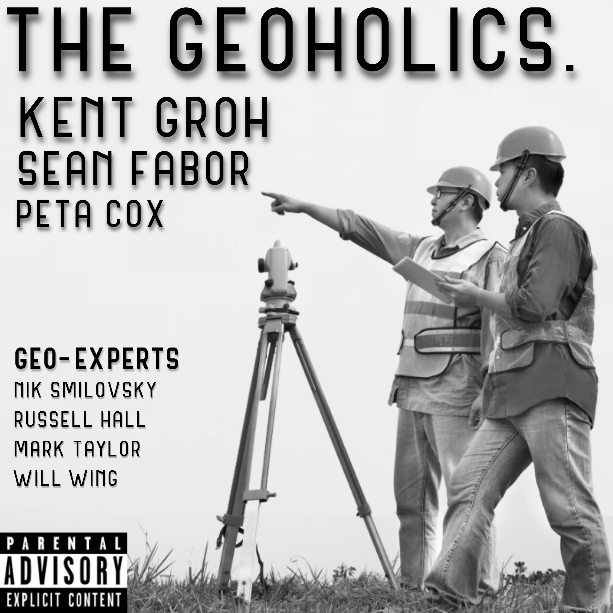
The Geoholics
by thegeoholics
This is a podcast for geospatial professionals. The group discusses a variety of topics including surveying, geospatial, geomatics, GIS, civil engineering and much much more.
-
250
2026 12D Tech Forum - Day 1
Recorded live from the 2026 12d Tech Forum in Brisbane, these rapid-fire conversations feature Andrej Mocicka, David Mares, Andrew Fenwick, Meghan Bowman, Gary Dunn, Marisa Dittmann, and Alex Badaoui. We’re talking massive infrastructure projects, smarter data management, industry innovation, AI and the evolving role of today’s geospatial professional—all with the candid insights and controlled chaos you expect from The GEOHOLICS! 00:04:53 Andrej Mocicka, Country Manager Australia at 1Spatial 00:21:56 David Mares, Core Spatial and Andrew Fenwick, Senior Survey Manager at John Holland 00:42:18 Meghan Bowman, Senior Surveyor Marissa Dittmann, and Gary Dunn, Surveyor at Sunrise Surveying 00:56:18 Alexander “Alex” Badaoui, Associate Designer Marisa Dittmann, Experienced Designer at SMEC Grab a drink, hit play and join us from the other side of the world! 🍻🌏 #TheGEOHOLICS #12dTechForum2026 #Geospatial #LandSurveying #Surveying #DigitalEngineering #Infrastructure #DataManagement #Innovation #Brisbane #Australia
-
249
Episode 292 - Steve Willard, PLS & 9/11
Today marks 25 years since the September 11 attacks—a day that forever changed our nation and countless lives. Episode 292 of The Geoholics is dedicated to remembering those we lost, honoring those who responded, and sharing an important chapter of surveying history that deserves to be preserved. Our guest, Steve Willard, PLS, takes us back to the aftermath of 9/11 and the critical role land surveyors played at Ground Zero and throughout Lower Manhattan. When streets, buildings, monuments, control points, and familiar reference systems had been damaged, buried, or destroyed, surveyors helped restore spatial certainty amid unimaginable devastation—providing trusted information to first responders, engineers, contractors, utility providers, public agencies, and recovery teams. Steve shares the technical challenges, dangerous working conditions, emotional toll, and acts of service that defined the response. We also explore what has changed since 2001—and why, despite tremendous advances in GNSS, laser scanning, drones, and real-time mapping, professional judgment and boots-on-the-ground verification remain irreplaceable during a crisis. This is more than an episode about surveying. It is a conversation about service, courage, responsibility, and the quiet professionals who stepped forward when their expertise was needed most. We remember. We honor. We will never forget. Episode 292 featuring Steve Willard, PLS, is available today wherever you listen to The Geoholics. #NeverForget #September11 #September11th #911Remembrance #LandSurveying #Surveyors #Geospatial #EmergencyResponse #DisasterRecovery #NYSAPLS #TheGeoholics #AddingValueAndMakingFriends
-
248
Episode 287 - Aaron Michalenko & Willis Long
Episode 287 asks the question every surveyor should be thinking about: Will artificial intelligence replace the land surveyor—or reinvent the profession? The guys are joined by Aaron Michalenko, owner of DBE Surveying, and Willis Long, Head of Survey Operations and Senior Director, for a no-BS conversation about where AI is already creating value and where the hype gets ahead of reality. They explore point-cloud processing, feature extraction, drafting, boundary research, QA/QC, workforce development, data security, and the skills tomorrow’s geospatial professionals will need to remain relevant. The conversation gets especially real when AI meets boundary surveying. An algorithm may calculate where a corner could be, but can it determine where that corner legally is? Can it evaluate monuments, occupation, historical evidence, and intent and then accept responsibility when the answer is wrong? The crew also tackles whether AI will eliminate traditional field crews, replace manual drafting, solve the workforce shortage, or make professional licensure even more important. The takeaway is clear: the tools will change, the workflows will evolve, and the volume of data will explode, but the surveyor’s responsibility to verify the evidence, exercise professional judgment, and protect the public remains firmly intact. Buckle up for another round of “Bullsh*t, Breakthrough, or Too Soon to Tell,” a Leica Geosystems Pro Tip, and Rise Against’s “Savior” as the Song of the Week. The future does not belong to surveyors who blindly reject AI—or blindly trust it. It belongs to the professionals who understand it, question it, verify it, and know when the human surveyor must remain in control.
-
247
ASPRS Gulf South 2026
Check out these interviews from this years awesome event: 00:00:00 - Cold Opening 00:02:25 - Dustin Smith, GIS Specialist at the Louisiana Department of Transportation 00:21:52 - Linda Anderson and Daphne Kent with North Central Texas InterLink 00:46:11 - Samuel Landry, Student and Research Assistant at Nicholls State University 01:08:45 - Timoteo Garza, Vice President of Operations at Gratia Geomatics LLC #TheGeoholics #GeoholicsPodcast #ASPRS #ASPRSGulfSouth #GeospatialConference #Geospatial #Geomatics #Photogrammetry #RemoteSensing #LiDAR #MobileLiDAR #GIS #UASMapping #PointClouds #3DVisualization #GeospatialTechnology #GeospatialStandards #ASPRSCertification #GeospatialEducation #GeospatialProfessionals #Surveying #MappingTheFuture #TopoDOT #NichollsStateUniversity #ThibodauxLA
-
246
TopoDOT Users Conference 2026 #TUC2026
Check out these highlights from this year's awesome event!!! 00:00 - Paul DiGiacobbe, Vice President, LiDAR Solutions and Rob Dannenberg, President at Phoenix LiDAR Systems 00:21:25 - Jonah Colebrook, LiDAR Tech and Ryan Hagler, LiDAR/photogrammetry tech at GPI Geospatial, Inc. 00:31:35 - Mike Graham, LiDAR & Point Cloud Specialist at McElhanney and Zachary Diaz, Applications Consultant at TopoDOT 00:47:49 - Wesley Newman, LSIT and ORD Specialist and Stephania Coots, Design Tech at QK4 01:02:47 - Jason Rhodes, Technical Leader: Survey & Reality Capture at Jacobs 01:19:34 - Noah Bremer and Stephanie Wood, LiDAR Tech at McKim & Creed
-
245
Episode 286 - Liz Babcock
Forty years in Land & Right-of-Way. An Enron survivor. A woman who earned her seat at the table in historically male-dominated industries. And, in her own words, someone who has spent her career “navigating a male-dominated world one martini at a time.” This week, we sit down with Liz Babcock, Vice President of Land & ROW at ALTAEI, for a candid conversation about resilience, trust, relationships and what it really takes to succeed in the people-heavy world of land and right-of-way. Liz shares lessons from four decades spent working with landowners, attorneys, engineers, agencies, utilities and energy companies—and explains why technical knowledge alone is never enough. We also dive into: How the Land and ROW profession has changed—and where progress is still needed What surviving the Enron collapse taught Liz about reputation and resilience How to build trust with skeptical or frustrated landowners The importance of bringing ROW professionals into projects earlier Earning your voice and your seat at the table Why relationships, humor and genuine human connection still move projects forward The stories and experiences that make a 40-year career truly meaningful This episode is a reminder that successful projects are not built through data, documents and processes alone. They are built through trust, communication, judgment and treating people right. Because the best ROW professionals do not just help projects acquire land—they protect relationships, reduce risk and create a path forward. Music by Prince!! #TheGeoholics #LandSurveying #RightOfWay #ROW #LandAcquisition #Geospatial #Surveying #Infrastructure #Leadership #WomenInLeadership #WomenInEnergy #ProfessionalDevelopment #CareerLessons #RelationshipBuilding #ProjectManagement #Prince #WhenDovesCry #Podcast
-
244
Episode 285 - Trent "TK" Keenan & Ryan "Big Shoots" Kelly
The guys are joined by TK and Big Shoots for a full-circle conversation about where The Geoholics started, what it has become, and why this crazy little show continues to resonate with surveyors, mappers, photogrammetrists, tech leaders, mentors, troublemakers, and everyone else trying to move the profession forward. This episode gets into the early days of the show, the raw and scrappy chemistry that made it work, the guests and moments that left a mark, and the bigger mission that has always been at the heart of it all: adding value and making friends. We also dig into the future of surveying, mentorship, recruiting the next generation, technology, AI, drones, scanners, mobile mapping, and the role of professional judgment in a world moving faster than ever. Because the best surveyors are not just button-pushers — they understand the why behind the workflow, the risk behind the data, and the responsibility behind every deliverable. Big Shoots is back behind the mic. TK brings the fire. Kent and Sean keep it moving. Buckle up…this one is a ride you don't want to miss! Huge thanks to this week’s featured partners: EMLID, TopoDOT, AllTerra Central, Leica Geosystems, David Evans & Associates, and DBLS. Music by Lainey Wilson! Until next time…add value, make friends, and most importantly, be safe and healthy! #TheGeoholics #Surveying #LandSurveying #Geomatics #Geospatial #Mentorship #RealityCapture #MobileMapping #Photogrammetry #LiDAR #SurveyLife #ProfessionalSurveyor #FutureOfSurveying #AddingValueMakingFriends
-
243
BLM ID - Boise Meridian Initial Point Celebration
The BLM Idaho, alongside the Idaho State Historical Society and various mapping partners, hosted the Boise Meridian Initial Point Celebration on May 1 and 2, 2026. The signature event commemorated the 1867 founding of Idaho's survey grid and America’s 250th anniversary at the Old Idaho Penitentiary. The community event honored the cadastral surveyors who defined the state's boundaries and set the Public Land Survey System for nearly 54 million acres. The Geoholics were honored to play a small part in this awesome celebration! Here are the folks we were honored to chat with throughout the day: Josh Strege, Land Surveyor @ BLM Taylor Stanton, Director Communications and Marketing @ Foundation for America's Public Lands John Quincio, Amateur Radio Operator Tasha Huhta, Land Surveyor @ BLM HannaLore Hein, Idaho State Historian, Idaho State Historical Society; Vice Chair, America250 in Idaho Task Force Christian Courtial, Land Surveyor @ BLM Stuart Ward, Owner @ Dioptra Music by Johnny Cash!
-
242
Episode 283 - Karen Schuckman
This week on The Geoholics, we sit down with Karen Schuckman, Subject Matter Expert in Remote Sensing and Geospatial Services at RRC Companies—and someone who has had a front-row seat to the evolution of modern lidar and airborne mapping. Karen takes us back to the early days of airborne GPS, before IMUs became standard, and shares how she helped develop groundbreaking data-processing workflows following Hurricane Floyd and supported North Carolina’s pioneering statewide lidar program. We also explore her work supporting major FEMA initiatives, her passion for positional accuracy and data quality, and the continued importance of understanding geodesy, datums, projections and metadata. This conversation goes well beyond lidar. Karen shares valuable lessons about: Turning emerging technology into trusted, defensible deliverables Why industry standards and ASPRS guidance matter The fundamentals professionals still cannot afford to overlook Helping engineers effectively use survey-grade geospatial data What lidar’s evolution can teach us about AI, automation and digital twins The mindset required to adapt, evolve and stay relevant in a rapidly changing profession We also discuss what even experienced professionals still misunderstand about lidar, which technologies never lived up to the hype, and what continues to excite Karen after more than two decades of pushing the geospatial profession forward. Oh—and did we mention Karen was an alternate gymnast for the 1972 Olympics? This episode delivers history, technology, education and one incredible career journey. Buckle up for Episode 283 and join us as we add value, make friends and explore how accurate geospatial data gets to the right place on the ground. Music by Jethro Tull! #TheGeoholics #LiDAR #RemoteSensing #Geospatial #LandSurveying #Geomatics #Photogrammetry #Mapping #GIS #Geodesy #DataQuality #PositionalAccuracy #DigitalTwins #ArtificialIntelligence #SurveyingTechnology #ASPRS #CareerDevelopment #GeospatialLeadership #Podcast
-
241
Episode 282 - Tom Yeshurun & Civ Robotics
On Episode 282 of The Geoholics, we sit down with Tom Yeshurun, CEO of Civ Robotics, to explore how automation is transforming construction layout—and what that evolution means for surveyors, contractors, field crews, and the future of the geospatial profession. Tom shares the real-world frustrations that inspired Civ Robotics, the company’s bold pivot from drones to ground-based robots, and the challenges of earning trust in an industry where accuracy, accountability, and boots-on-the-ground experience still matter. We dig into the line between surveying and construction layout, the productivity and profitability unlocked by robotic point placement, and why automation should elevate field professionals rather than simply replace them. We also look ahead to the fully connected jobsite—where robotics, machine control, digital twins, and human expertise converge—and discuss the skills today’s young surveyors and geomatics professionals will need to remain valuable in an increasingly automated world. Precision gets you started. Automation makes you faster. Verification keeps you out of court. Music by Led Zeppelin #TheGeoholics #CivRobotics #TomYeshurun #ConstructionRobotics #RoboticLayout #ConstructionTechnology #ConTech #LandSurveying #Surveying #Geomatics #Geospatial #ConstructionLayout #Automation #DigitalTwins #MachineControl #FieldTechnology #RealityCapture #FutureOfConstruction #Innovation #Surveyors #AECIndustry #BuiltEnvironment #LeicaGeosystems #Emlid #TopoDOT #AllTerraCentral #AddingValueAndMakingFriends
-
240
Episode 281 - Itzik Malka, CEO and Co-Founder of 4M Analytics
This week on The Geoholics, we’re going underground — literally — with Itzik Malka, CEO and Co-Founder of 4M Analytics, a company helping redefine how surveyors, engineers, designers, and contractors understand the hidden world beneath our feet. If 4M is the “Google Maps of the underground,” then this conversation is all about why that matters. Kent, Peta, and the crew dig into how 4M is using AI, satellite imagery, utility records, and digital intelligence to turn scattered underground utility data into actionable insights before crews ever step foot on site. From avoiding those dreaded “oh sh*t” utility conflict moments to improving safety, reducing risk, saving money, and helping teams make smarter decisions earlier in the project lifecycle, this one hits right at the intersection of technology, field reality, and the future of infrastructure delivery. Itzik brings a global perspective, a founder’s mindset, and a passion for solving one of the industry’s most expensive and dangerous problems: not knowing what’s underground until it’s too late. Born in Israel and now leading 4M as CEO and Co-Founder, Itzik also shares a little about life beyond the platform — soccer, music, family, and the entrepreneurial drive behind building something that could change how the entire industry plans, designs, and builds. We also talk about how tools like 4M can work alongside traditional SUE, survey, CAD, GIS, drones, and scanning workflows — not as a replacement for boots on the ground, but as a way to elevate decision-making, reduce surprises, and help teams show up smarter. Bottom line: The cheapest utility you’ll ever locate is the one you never hit. Dig smart, not sorry. Music by Cooper Alan!
-
239
Episode 280 - Michael Hart & Bradley Dillon
This week on The Geoholics, we’re digging into the roots of the profession with Michael Hart, BLM Chief Cadastral Surveyor for Idaho, and Bradley Dillon, Lead Surveyor in the Field Section for BLM Idaho. From the legacy of the Land Ordinance of 1785 and the Boise Meridian Initial Point to hunting down century-old monuments in rough terrain, this episode is all about the history, grit, problem-solving, and purpose behind cadastral surveying. We talk field stories, conflicting evidence, protecting public lands, modernizing workflows without losing the integrity of the work, and why mentoring the next generation matters now more than ever. Because cadastral surveyors do not just find boundaries—they build the story, defend the evidence, and preserve a legacy that still shapes millions of acres today. Buckle up…Episode 280 is one for every surveyor who believes the past still matters, the field still teaches, and the monument still tells the truth. #TheGeoholics #LandSurveying #CadastralSurveying #BLM #PublicLands #PLSS #Surveyors #Geospatial #Mentorship #America250 #BoiseMeridian #BoundariesMatter
-
238
Episode 284 - Alex Chose, Taylor Shepley & YSN National Mentorship Program
In this episode of The Geoholics, we’re talking mentorship, momentum, and the future of land surveying with Alex Chose and Taylor Shepley from the Young Surveyors Network. With applications open for the 2026 YSN National Mentorship Program, Alex and Taylor dig into why mentorship matters right now, not someday, and how structured mentor/mentee relationships can help young surveyors navigate licensure, leadership, business ownership, work-life balance, confidence, and the kind of hard-earned professional judgment that simply cannot be pulled from a textbook or YouTube video. The 2025 pilot program delivered a powerful result, with 100% of questionnaire respondents saying they would recommend it to their peers, and the 2026 program is expanding to 250 participants, signaling real demand and real momentum across the profession. This one is about more than career advice. It is a call to action for seasoned surveyors to be intentional about passing down knowledge, opening doors, and helping the next generation believe they belong in the room. Alex brings a passion for community, camaraderie, and preservation of wild public lands, while Taylor brings a deep commitment to mentoring the next generation of surveyors through his work in the industry and with YSN. Add in a Leica Geosystems Pro Tip on mentorship, Wanda Jackson’s “Let’s Have a Party” as Song of the Week, and the usual Geoholics energy, and you’ve got an episode focused on adding value, making friends, and reminding all of us that the future of surveying depends on what we are willing to share today.
-
237
Episode 279 - John Russo & Joseph Romano - USIBD
Episode 279 of The Geoholics is a straight-up masterclass in reality capture, Scan to BIM, digital twins, and the future of the built world. Kent and the crew sit down with industry heavy hitters John Russo and Joseph Romano to unpack how Scan to BIM evolved from a niche service into a game-changing force across the AEC industry. From LOA standards and digital twin ecosystems to AI automation and the risks of “push-button” technology, this episode dives deep into the balance between innovation and professional expertise. The conversation also highlights the critical role of organizations like U.S. Institute of Building Documentation in driving standards, education, and credibility throughout the reality capture community. Toss in some classic Geoholics energy, a little John Mellencamp, industry pro tips, and plenty of future-focused insight—and you’ve got an episode built for anyone serious about where geospatial technology is headed next.
-
236
Episode 278 - Shelby Sharpe
This week, we sit down with Shelby Sharpe, an instructional designer and PhD candidate who’s right in the middle of where education meets the real-world geospatial workforce. And let’s just say…she brings some perspective. We dig into the so-called “workforce shortage” and flip the script...it’s not just about talent, it’s about accessibility, awareness, and how we’re actually training people. Schools are teaching tools…industry needs problem-solvers. Big difference. Shelby also drops some serious insight on how adults really learn...especially busy professionals, field crews, and PMs. Hint: it’s not sitting through long trainings. It’s solving real problems, in real time, with context that actually matters. We also get into her journey from practicing geospatial to teaching it, what makes a great technical expert to collaborate with, and how we can better connect education and industry moving forward. If you care about the future of surveying, geospatial, and the next generation coming into it…this one’s worth your time. Music by Tom Petty!
-
235
GeoWeek 2026 - Part 3 LIVE From Denver!
Check out these highlights from this year's awesome event!!! 00:30 - Rhea Garratt, Manager of Geospatial Desktop at Pix4D...apologies for the technical difficulties! 09:40 - Andy Ives, Survey Manager at Langan Engineering 34:45 - Madeleine Janzen, Technical Sales Specialist at Geo-Plus and William Myers, Director of Operations at Global eTraining 47:55 - Charles Schreiner, Senior Project Manager and Scott Graham, VP and Chief Surveyor at ETM Surveying & Mapping, Inc. 1:10:55 - Rami Tamimi, Founder and Lead Instructor at The Survey School and Geomatics Project Manager at WSP 1:25:55 - Mike Liggett, Owner at Aerial Ethos, LLC and Scott Harrigan, President at Harkin Aerial
We're indexing this podcast's transcripts for the first time — this can take a minute or two. We'll show results as soon as they're ready.
No matches for "" in this podcast's transcripts.
No topics indexed yet for this podcast.
Loading reviews...
ABOUT THIS SHOW
This is a podcast for geospatial professionals. The group discusses a variety of topics including surveying, geospatial, geomatics, GIS, civil engineering and much much more.
HOSTED BY
thegeoholics
CATEGORIES
Loading similar podcasts...
Frequently Asked Questions
How many episodes does The Geoholics have?
The Geoholics currently has 16 episodes available on PodParley. New episodes are automatically indexed when they're published to the podcast feed.
What is The Geoholics about?
This is a podcast for geospatial professionals. The group discusses a variety of topics including surveying, geospatial, geomatics, GIS, civil engineering and much much more.
How often does The Geoholics release new episodes?
The Geoholics has 16 episodes. Check the episode list to see recent publication dates and frequency.
Where can I listen to The Geoholics?
You can listen to The Geoholics on PodParley by clicking any episode. We provide an embedded audio player for direct listening, and you can also subscribe via your preferred podcast app using the RSS feed.
Who hosts The Geoholics?
The Geoholics is created and hosted by thegeoholics.
URL copied to clipboard!