EPISODE · Mar 19, 2014 · 19 MIN
Blender-basierte Erstellung von 3D-Modellen von Orten mit Hilfe von OSM-Daten (fossgis2014)
from Chaos Computer Club - recent events feed · host Vladimir Elistratov
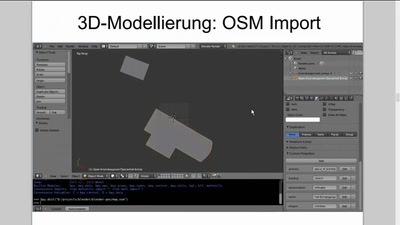
Im Vortrag wird diskutiert, wie man 3D-Modelle von Orten mit Hilfe von OpenStreetMap-Daten und Blender Open Source Software erstellen kann. Als Beispiel wird die Erstellung von 2.5D Karten betrachtet. Es gibt einige Projekte mit dem Ziel Gebäude, Wege und andere Objekte aus dem OpenStreetMap-Datenbank parametrisch in 3D darzustellen. Selbstverständlich solchem Vorgehen fehlt realistisches Aussehen. Ziel dieses Projekts ist nach realistischem Aussehen von Orten zu streben. Dafür werden manuell erstellte 3D-Modelle von Gebäuden und anderen Objekten verwendet. Sowohl für 3D-Modellierung als auch für Rendering wird ein Open Source Programm Blender verwendet. Komplexe Berechnungen in 3D werden auch mit Hilfe von Blender durchgeführt. OpenStreetMap Daten werden ins Blender importiert um Georeferenzierung von jedem manuell erstellten 3D Gebäude durchzuführen. Ein 3D Modell wird durch Ziehen und Drehen über der importierten OSM-Karte an der richtigen Stelle platziert. Die entsprechenden geographischen Koordinaten und das Drehwinkel werden in einer Datenbank gespeichert. Somit entsteht das 3D-Modell des ganzen Ortes, das man in verschiedener Art und Weise anwenden kann. Als Beispiel dieses Ansatzes werden 2.5D Karten betrachtet. Unter der 2.5D Karte versteht man eine ganz herkömmliche Karte in Web Mercator-Projektion mit einer Oberfläche aus einzelnen 3D Gebäuden, die in Schrägprojektion vertikal nach unten dargestellt sind. Eine Diskussionsfrage ist, ob man eine Datenbank von 3D-Gebäudemodellen mit einer offenen Lizenz braucht. about this event: https://fossgis-konferenz.de/2014/programm/events/641.de.html
What this episode covers
Im Vortrag wird diskutiert, wie man 3D-Modelle von Orten mit Hilfe von OpenStreetMap-Daten und Blender Open Source Software erstellen kann. Als Beispiel wird die Erstellung von 2.5D Karten betrachtet. Es gibt einige Projekte mit dem Ziel Gebäude, Wege und andere Objekte aus dem OpenStreetMap-Datenbank parametrisch in 3D darzustellen. Selbstverständlich solchem Vorgehen fehlt realistisches Aussehen. Ziel dieses Projekts ist nach realistischem Aussehen von Orten zu streben. Dafür werden manuell erstellte 3D-Modelle von Gebäuden und anderen Objekten verwendet. Sowohl für 3D-Modellierung als auch für Rendering wird ein Open Source Programm Blender verwendet. Komplexe Berechnungen in 3D werden auch mit Hilfe von Blender durchgeführt. OpenStreetMap Daten werden ins Blender importiert um Georeferenzierung von jedem manuell erstellten 3D Gebäude durchzuführen. Ein 3D Modell wird durch Ziehen und Drehen über der importierten OSM-Karte an der richtigen Stelle platziert. Die entsprechenden geographischen Koordinaten und das Drehwinkel werden in einer Datenbank gespeichert. Somit entsteht das 3D-Modell des ganzen Ortes, das man in verschiedener Art und Weise anwenden kann. Als Beispiel dieses Ansatzes werden 2.5D Karten betrachtet. Unter der 2.5D Karte versteht man eine ganz herkömmliche Karte in Web Mercator-Projektion mit einer Oberfläche aus einzelnen 3D Gebäuden, die in Schrägprojektion vertikal nach unten dargestellt sind. Eine Diskussionsfrage ist, ob man eine Datenbank von 3D-Gebäudemodellen mit einer offenen Lizenz braucht. about this event: https://fossgis-konferenz.de/2014/programm/events/641.de.html
NOW PLAYING
Blender-basierte Erstellung von 3D-Modellen von Orten mit Hilfe von OSM-Daten (fossgis2014)
No transcript for this episode yet
Similar Episodes
Apr 21, 2026 ·73m
Apr 18, 2026 ·95m
Apr 15, 2026 ·55m
Apr 13, 2026 ·68m
Apr 11, 2026 ·59m
Apr 9, 2026 ·66m